AppRank
 ロシア の トップ有料 ナビゲーション アプリ
ロシア のライブ トップ有料 ナビゲーション チャートを閲覧。アプリの評価、説明、スクリーンショット、検索、App Store への直接リンクが含まれます。
各国のiOS App Storeランキングを比較して、トレンドや急成長中のアプリを見つけ、次に何を構築するかのアイデアを得ましょう。
アプリを検索
App Store ランキング
トップ有料 · ナビゲーション
説明
Антирадар HUD Speed PRO – это цифровой спидометр с функцией предупреждения о превышении ограничения скорости и об опасностях на дороге: камеры, Стрелки, Автодории, посты ДПС, засады, лежачие полицейские, опасные пешеходные переходы и прочее. Наша база камер и опасностей, вероятно, самая точная. Мы работаем над ней вместе с пользователями уже больше 10 лет! HeadUp Display (HUD) – это возможность использовать ваш телефон или планшет как проекционный дисплей. Просто положите устройство под лобовое стекло и вы увидите проекцию скорости и предупреждений об опасностях прямо на стекле. Не нужно отвлекаться от дороги - все непосредственно перед вашими глазами! * * * * * Ключевые функции: • HUD Speed предупреждает о стационарных камерах, мобильных засадах и других опасностях на Вашем пути, т.е. выполняет функции антирадара (если точнее, то радар-детектора). • Звуковые предупреждения о превышении скорости перед камерами, чтобы соблюдать ПДД и не получать лишние штрафы. • Цифровой спидометр. Скорость, определенная по GPS, является более точной, чем показывает спидометр в машине. Автопроизводители, как правило, завышают скорость на спидометре на 5-10 км/ч от реальной. • Отображение данных в проекции на лобовом стекле. • Удобный, простой и полностью русифицированный интерфейс. • База опасных объектов и камер покрывает все регионы России, Беларуси, Узбекистана, Украины и Казахстана. В данной PRO версии доступны функции: • Неограниченное обновление базы камер и опасностей; • Голосовое уведомление о типе камеры или опасности; • Возможность настройки предупреждение только для случая, если превышена скорость; • Возможность фоновых предупреждений, для совместного использования с приложениями навигации; • Приложение не содержит рекламы. Наши дальнейшие планы: • Предупреждение об опасных перекрестках; • Предупреждение о знаках "уступи дорогу", "СТОП" и других важных знаках, которые критичны для безопасности водителей. Видео-демонстрация работы приложения: http://youtu.be/KJTJaiORrZ0 * * * * * Внимание! 1. Постоянное использование службы определения местоположения (GPS и ГЛОНАСС) в фоновом режиме может значительно уменьшить длительность заряда и срок службы батареи. 2. В солнечную погоду яркости вашего устройства может не хватить для отображения проекции на стекле. В этом случае используйте обычный режим отображения и поставьте устройство в держатель. Ночью, вечером и пасмурную погоду проекция будет всегда хорошо видна! 3. Во время движения ваш смартфон или планшет должен быть надежно зафиксирован с помощью специального держателя или специального коврика и не должен мешать обзору дороги. Окна в машине должны быть закрыты, во избежание вылета устройства при резких поворотах.
説明
Solocator – The GPS Camera for Fieldwork and Photo Proof evidence. Overlay and stamp photos with location, direction, altitude, date & time taken. With the Industry Pack (in-app purchase), capture field notes including project name, photo description, company or username, and company logo. Solocator is trusted by professionals, government agencies, and industries worldwide for reliable photo documentation. TAILOR OVERLAY INFORMATION TO YOUR NEEDS Capture & stamp on your photos: + GPS position (Latitude & Longitude in various formats) ± accuracy + UTM/MGRS coordinates (Industry Pack) + Street address (Industry Pack) + Direction – bearing + Altitude (MLS / HAE) + Tilt & Roll angles + Local date & time (based on GPS location) + Local time zone + UTC time + Compass display + Cardinal directions + Building facade direction, e.g. "North elevation" + Field Notes (Industry Pack) + Company Logo (Industry Pack) AUTOSAVE PHOTOS TO iCLOUD & CAMERA ROLL Autosave two photos at once: one stamped with the selected overlays and the other as an original high-resolution photo. SORT, SEARCH, SHARE OR EMAIL + Photos are sorted by time, location, distance from current location and project name. + View photo direction and location in map view and navigate there. + Share photos individually or as a zip file via the share sheet. + Search for photos by date, date range or notes and street addresses. + Email photos including the following information: - Exif metadata - Compass direction - GPS position ± accuracy - Altitude - Tilt & Roll - Date & time taken - Street address (Industry Pack) - Cardinal Directions - Elevation of building facade - Links to maps so the receiver can navigate there easily ** INDUSTRY PACK ** (In-App Purchase) "One-off charge" EDITABLE NOTES OVERLAY Stamp photos with "Project name", "Description" & “Watermark”. The Project Name field can be used as a job or ticket number. The Watermark field is typically used for a company or username. You can also edit these fields later. WATERMARK LOGO Add your Company Logo to photos. You can customise the logo’s size, opacity, and position for both portrait and landscape photos. To get you started, a Solocator icon is included, which can be replaced. CUSTOM EXPORT FILENAME Define your photo export filename from a selection of fields: Project Name, Description, Watermark, Street Address, Date/Time, Number#, Custom text field, Photo type (original/stamped), and Coordinates (DD.dddddd, UTM, UTM Bands, MGRS). AUTOSAVE OR EXPORT PHOTOS TO CLOUD STORAGE Autosave original and stamped photos to Google Drive, Dropbox, and OneDrive (Personal & For Business), including SharePoint Sites and Teams. You can also save photos in date or project name subfolders automatically. PHOTO DATA in KML, KMZ & CSV Along with photos, email or export photo data and notes in KML, KMZ or CSV formats. Both email and export buttons are customisable to suit your data requirements. STREET ADDRESS & UTM/MGRS Add street address to your overlay or use UTM/, UTM Bands & MGRS coordinate formats. BATCH EDIT NOTES & OVERLAY FIELDS Select photos from the library and edit Project Name, Description & Watermark fields in one go. TRACK PHOTOS IN MAP VIEW View photos by direction, the distance between photos, area of photos taken and distance to your added markers via imported KML files or dropped pins. REFINE & LOCK GPS LOCATION Ideal for those working in and around buildings; to improve your GPS location. You can also use it to lock the asset position you're photographing. COMPACT VIEW Switch off Compass, Building and Street modes and only show the GPS info bar for a more compact view. VPP Customers: https://solocator.com/enterprise-app-for-mdms/ Terms of Use: https://www.apple.com/legal/internet-services/itunes/dev/stdeula/
説明
ALPINE QUEST PRO — GPS для активного отдыха Alpine Quest — это продвинутое приложение для GPS-навигации и управления полевыми работами, разработанное для военнослужащих, инженеров-геологов и геодезистов, полевого персонала, тактических подразделений, альпинистов, охотников и профессионалов внедорожного дела. Используется по всему миру с поддержкой 32 языков. Using ArcGIS and QGIS project files. ВОЕННОЕ И ТАКТИЧЕСКОЕ ПРИМЕНЕНИЕ MGRS (Military Grid Reference System) — полная поддержка военных координат USNG (United States National Grid) и координатная система UTM Формат времени DTG (Date-Time Group) — время по Зулу (Zulu) и местное время Военная координатная сетка (наложение сетки MGRS) на карте Планирование тактического передвижения и маршрутов Полная офлайн-функциональность — работа без сотовой сети Все данные на устройстве — без передачи на сервер (операционная безопасность) ГЕОЛОГИЯ И ИНЖЕНЕРНАЯ ГЕОДЕЗИЯ Определение и расчёт границ участков с помощью полигонов Импорт/экспорт полевых данных KML/GPX/GeoJSON Преобразование координат MGRS и UTM Топографические и спутниковые слои карты Слои горизонталей (изогипс) и отмывки рельефа (hillshade) Отрисовка границ участков/полей с выбором по нескольким точкам Формат KML, совместимый с земельным кадастром Загрузка собственных геологических карт в формате MBTiles ТАКТИЧЕСКИЕ КООРДИНАТНЫЕ СИСТЕМЫ MGRS (Military Grid Reference System) UTM, USNG, QTH и десятичный формат ШИР/ДОЛ (LAT/LON) Преобразование координат в реальном времени ПРОДВИНУТАЯ КАРТОГРАФИЧЕСКАЯ СИСТЕМА Топографические, спутниковые, дорожные и гибридные слои карты Военная координатная сетка (наложение сетки MGRS) Загрузка офлайн-карт для полевых операций Загрузка собственных карт в формате MBTiles 3D-вид рельефа и профили высот УПРАВЛЕНИЕ ЦЕЛЯМИ И ПУТЕВЫМИ ТОЧКАМИ Неограниченная запись и управление путевыми точками Ручной ввод цели по координатам MGRS Расстояние, азимут и время прибытия (ETA) до активных целей в реальном времени Обмен путевыми точками через специальные диплинки ФОТО-ПУТЕВЫЕ ТОЧКИ Фиксируйте важные точки фотографиями во время операций. ПОДДЕРЖКА МНОЖЕСТВА ФОРМАТОВ ФАЙЛОВ GPX (путевые точки, маршруты, треки) — военная и гражданская совместимость KML (Google Earth) — Point, LineString, Polygon, MultiGeometry KMZ (сжатый KML) — автоматическая распаковка GeoJSON — для современных веб-карт Прямое открытие файлов из WhatsApp, почты и «Файлов» Умное определение формата — автоматически направляет файлы в нужную вкладку ПРОДВИНУТАЯ СИСТЕМА МАРШРУТОВ Отрисовка тактических маршрутов на карте Планирование маршрутов по нескольким точкам Полное редактирование маршрута — перемещение, удаление и добавление точек Редактирование промежуточных точек сегмента — добавление изгибов между двумя точками Оповещения об отклонении от маршрута и коррекция направления Режим движения — интегрированная активная навигация и запись трека Экспорт и обмен маршрутами в формате GPX/KML ПОЛЕВАЯ ЗАПИСЬ ТРЕКОВ Бесперебойная запись трека в фоновом режиме Статистика скорости, расстояния, высоты, подъёма/спуска Просмотр сохранённых треков на карте Навигация по треку — используйте записанные треки как маршруты Обмен треками (формат GPX/KML) Высокоточный цифровой компас Индикатор отклонения от курса РИСОВАНИЕ НА КАРТЕ Используйте инструмент брифинга для рисования от руки. Field Team Mode is offered as an auto-renewable monthly subscription. The subscription renews automatically unless cancelled at least 24 hours before the end of the current period. You can manage or cancel it in the Subscriptions section of your device Settings. Privacy Policy: https://www.cte.militaryapp.net/2026/09/14/alpin-quest-pro-outdoor-gps/ Terms of Use (EULA): https://www.apple.com/legal/internet-services/itunes/dev/stdeula/
説明
Путешествуйте офлайн с Guru Maps Pro — подробные карты, пошаговая навигация и запись GPS-треков работают даже там, где нет связи. Скачайте карты один раз и пользуйтесь ими где угодно (на основе OpenStreetMap). Планируйте маршруты, записывайте приключения, сохраняйте любимые места и синхронизируйте всё между устройствами. ОФЛАЙН-КАРТЫ • Скачивайте карты стран или регионов и пользуйтесь ими полностью офлайн. • Подробные карты и миллионы объектов. Ежемесячные обновления. ОФЛЛАЙН-НАВИГАЦИЯ • Голосовые подсказки и навигация «поворот-за-поворотом» с автоматическим перестроением маршрута. • Подсказки по полосам — проще ориентироваться на сложных развязках. • Режимы: авто, велосипед, грузовик, пешком, а также навигация по прямой (отлично для яхтинга и бездорожья). ПЛАНИРОВАНИЕ МАРШРУТОВ • Собирайте маршруты с несколькими остановками и своими точками. • Выбирайте самый быстрый или самый короткий вариант и сохраняйте планы. • Экспортируйте маршруты в GPX/KML — для обмена или резервной копии. РЕАЛИСТИЧНЫЙ 3D-РЕЛЬЕФ И ТОПОГРАФИЯ • Просматривайте местность в реалистичном 3D: холмы и долины выглядят как вживую. • Топослои высокой детализации: горизонтали, отмывка рельефа и уклон. • Профиль высот и график уклонов — для более точного планирования. ЗАПИСЬ GPS-ТРЕКОВ • Записывайте треки одним касанием (в том числе в фоне). • Показатели в реальном времени: скорость, расстояние, время, высота. • Анализируйте треки на интерактивных графиках и экспортируйте в GPX/KML. БЫСТРЫЙ ОФЛАЙН-ПОИСК • Поиск по названию, адресу, категории или координатам — офлайн. • Мгновенные результаты по мере ввода, с поддержкой разных языков. ЗАКЛАДКИ И ОРГАНИЗАЦИЯ • Сохраняйте места с собственными метками, пинами и иконками. • Организуйте всё по папкам и коллекциям. ЧАСЫ РАБОТЫ • Просматривайте часы работы мест, если они указаны. СИНХРОНИЗАЦИЯ МЕЖДУ УСТРОЙСТВАМИ • Синхронизируйте и делайте резервные копии меток, треков и коллекций в одном аккаунте Guru на разных платформах. CARPLAY • Используйте Guru Maps в Apple CarPlay с офлайн-картами и голосовыми подсказками. БЕЗ РЕКЛАМЫ. ПРИВАТНОСТЬ ПРЕЖДЕ ВСЕГО. • Никакой рекламы. Ваше местоположение остаётся на устройстве. Дополнительные функции: масштабирование одним пальцем, компас и линейка масштаба, координатные сетки (MGRS/UTM), слои GeoJSON, импорт MBTiles/sqlitedb и многое другое. Отличительные возможности Guru Maps Pro: • Неограниченные офлайн-загрузки карт, • Неограниченное количество меток и GPS-треков, • Дополнительные источники карт, включая спутниковые снимки и специализированные слои (велосипедные, outdoor, лыжные и др.) Скачайте и путешествуйте уверенно — где угодно и когда угодно. Условия использования и Политика конфиденциальности: https://gurumaps.app/terms_of_service Длительное использование GPS в фоновом режиме может заметно сократить время работы аккумулятора.
説明
Многофункциональный GPS-спидометр, журнал пробега и монитор расходов с видеорегистратором и экшн-камерой. Следите за скоростью, получайте понятные предупреждения, записывайте подробные маршруты и учитывайте реальные расходы на поездки. Возможности: ■ Ограничения скорости и предупреждения Настройте 4 или 8 кнопок быстрого выбора. При превышении лимита крупные цифры меняют цвет с зелёного на красный и звучит сигнал. Приложение может запомнить место использования лимита и применить его снова автоматически ■ Расходы, топливо и электромобили Расходы ДВС и электромобилей в реальном времени. Топливо: цена и расход (US/UK MPG или л/100 км). EV: цена/кВт·ч, полезная ёмкость, запас хода при полной зарядке и эффективность с учётом потерь. Добавляйте расход на км/милю, делите между пассажирами и контролируйте расчётный запас хода с настраиваемыми предупреждениями. ■ GPS-трекинг Записывайте маршруты и пробег, просматривайте скорость, высоту и статистику или добавляйте прежний трек на карту, чтобы пройти его снова. Импортируйте и экспортируйте GPX, KML и KMZ. ■ GPS-видеорегистратор и экшн-камера Снимайте дорогу или движение с синхронными скоростью, позицией, направлением и картой. Для прямого вида, просмотра или экспорта выберите скорость, карту, Тангаж и крен либо G-Cross. Сохраните чистый оригинал; экспортируйте всё или отрезок. Кадр можно сохранить как фото с геопривязкой и точку. Циклическая запись оставляет только последний интервал. Для конфиденциальности iOS видео требует видимого экрана записи; оно останавливается при выходе или в фоне. Нет парковочного наблюдения и автозапуска от питания автомобиля. ■ Калькулятор пробега и PDF-отчёты Рассчитайте расстояние, топливо и пробег между адресами. Заполняйте пробелы в журнале, разделяйте личные и рабочие поездки и создавайте настраиваемые отчёты для компенсации расходов или налогового учёта. ■ Карты Выбирайте Apple, Google, пустую или офлайн-карту дорог, спутника и рельефа. Импортируйте MBTiles/SQLiteDB или скачивайте в приложении. Создавайте, импортируйте и делитесь слоями KMZ. ■ Режимы и навигация Доступны полноэкранный спидометр, зеркальный HUD, раллийный компьютер, монитор G-Force, таксометр, карта, водный спорт, таймер простоя, приборы для параплана и навигация на земле, в воздухе и на воде. ■ Путевые точки и камеры Создавайте точки с фото/аудио, сигналом приближения или лимитом. Импортируйте/экспортируйте CSV, GPX, KML и KMZ. Используйте импортированные камеры/радары или встроенную библиотеку. ■ Голосовой тренер и команды Siri Слушайте данные о расстоянии, длительности, скорости и высоте с выбранным интервалом. Запускайте и останавливайте трекинг и задавайте лимит скорости через Siri. ■ Барометрические приборы Вертикальная скорость и высота в реальном времени на совместимых устройствах, с QFE/QNH. ■ Автоматический учёт пробега Спидометр и GPS могут работать в фоне после включения. Опциональная автозапись ведёт налоговый/компенсируемый пробег без ручного запуска и остановки. Включено 50 бесплатных треков/месяц; доступно снятие лимита. ■ Скорость и расстояние 0–999 в км/ч, милях/ч или узлах, а также максимум, среднее, расстояние, высота и солнечное время. ■ Конфиденциальность и совместимость Геоданные служат только скорости и поездкам в приложении и не передаются третьим лицам. Нужен iPhone или сотовый iPad с GPS; iPad Wi-Fi и iPod требуют внешний GPS. Постоянное использование ускоряет разряд батареи. Условия использования: https://www.apple.com/legal/internet-services/itunes/dev/stdeula/
説明
«Mapcam Info» - программа, предупреждающая водителя о камерах фиксации нарушений ПДД и потенциально опасных местах на дороге. «Mapcam Info» вовремя напомнит водителю о соблюдении скоростного режима и правил дорожного движения, и поможет избежать штрафа или предотвратить ДТП. «Mapcam Info» может работать как самостоятельно, так и с любой навигационной программой в фоновом режиме. ВНИМАНИЕ! Для корректной работы программы необходимо наличие в устройстве GPS-модуля (iPod Touch и некоторые модели iPad не имеют встроенного модуля GPS). Программа использует базу предупреждений проекта http://mapcam.info. На данный момент, это самая полная и актуальная база по странам СНГ и не только. В программе используются два типа баз предупреждений: "Стандартная" и "Расширенная". В "Стандартную" базу входят следующие предупреждения: 1. Стационарная камера, измеряющая скорость; 2. Камера, встроенная в светофор; 3. Камера, проверяющая проезд на красный свет; 4. Участок контроля средней скорости на отрезке дороги; 5. Мобильная камера (засада); 6. Мобильная засада (контроль скорости). В "Расширенную", кроме перечисленных выше, входят: 7. Мобильная засада (обгон, встречка); 8. Мобильная засада (знак STOP); 9. Мобильная засада (пешеходный переход); 10. Контроль полосы маршрутного транспорта; 11. Камера, измеряющая скорость (в спину); 12. Комплекс контроля ПДД; 13. Контроль полосы маршрутного транспорта (в спину); 14. Стационарный пост ДПС; 15. Железнодорожный переезд; 16. Опасный пешеходный переход или школьная зона; 17. Начало/конец населенного пункта; 18. Знак ограничения скорости; 19. Лежачий полицейский; 20. Плохая дорога; 21. Опасное изменение направления движения; 22. Опасный перекресток; 23. Другая опасность; 24. Обгон запрещен; 25. Возможен затор в левой полосе; 26. Возможен затор; 27. Возможен затор в правой полосе. Данная версия программы комплектуется расширенными базами данных «Россия», «Украина», «Беларусь», «Казахстан», «Армения», информация в которых актуальна на дату размещения программы в App Store. Получить доступ к обновлению базы данных и поддерживать ее ежедневную актуальность можно после регистрации пользователя в проекте. Актуальность информации в базе данных поддерживается самими участниками проекта. В проекте зарегистрировано уже более 1 000 000 участников и, по крайней мере, в крупных городах камеры попадают в базу практически в день их установки. Отсутствие камеры в базе данных может быть вызвано несколькими факторами: 1. Камера не имеет отношения к фиксации нарушений ПДД; 2. Возможно это муляж. Индивидуальный рейтинг ранжирует все объекты базы данных по степени внимания водителя к данному объекту. Данный рейтинг формируется путем голосования участников проекта на сайте http://mapcam.info Проверить наличие конкретного объекта в базе данных проекта можно на странице http://mapcam.info/speedcam/ Если объекта действительно нет в базе, то его можно добавить на этой же странице с помощью удобного визуального интерфейса. Дистанция предупреждения указана в базе индивидуально для каждого объекта. Это позволяет минимизировать количество ложных срабатываний и предупредить водителя именно там, где это действительно необходимо. Получить более подробную информацию о программе, а также задать свои вопросы можно в соответствующем разделе форума проекта: http://mapcam.info/forum/ ОБРАЩАЮ ВАШЕ ВНИМАНИЕ, ЧТО НЕСМОТРЯ НИ НА КАКИЕ ПРЕДУПРЕЖДЕНИЯ ПРОГРАММЫ, В ЛЮБЫХ СИТУАЦИЯХ ВОДИТЕЛЬ В ПЕРВУЮ ОЧЕРЕДЬ ОБЯЗАН РУКОВОДСТВОВАТЬСЯ ПРАВИЛАМИ ДОРОЖНОГО ДВИЖЕНИЯ И ТЕКУЩЕЙ ДОРОЖНОЙ ОБСТАНОВКОЙ!!! ДЛЯ КОРРЕКТНОЙ РАБОТЫ ПРОГРАММЫ В ФОНОВОМ РЕЖИМЕ, ПОСЛЕ ЗАПУСКА ПРОГРАММЫ НЕОБХОДИМО ДОЖДАТЬСЯ СООБЩЕНИЯ О ТОМ, ЧТО «СОЕДИНЕНИЕ СО СПУТНИКАМИ УСТАНОВЛЕНО» И ЛИШЬ ЗАТЕМ ПЕРЕВОДИТЬ ПРОГРАММУ В ФОНОВЫЙ РЕЖИМ РАБОТЫ. ВНИМАНИЕ! Продолжительное использование GPS в фоновом режиме может значительно сократить срок службы батареи. Continued use of GPS running in the background can dramatically decrease battery life.
説明
Расширенная версия приложения Приложение работает оффлайн и в фоновом режиме! Регулярные обновления базы дорожных объектов. Приятный и удобный интерфейс спроектирован так, чтобы им было удобно пользоваться одной рукой. Часто путешествуете на автомобиле? Хотите сэкономить на штрафах и знать когда лучше притормозить? Быстрокам поможет вам! Все функции буквально на кончике пальца! О камерах контроля скорости приятным голосом оповестит профессиональный диктор. Режимы отображения информации: - Цифровой спидометр - Схема расположения камер - Карта дорожных объектов - Проекция на лобовое стекло - Отображение поверх других приложений с функцией “Картинка в картинке” (требуется iOS 15 и выше) - Уведомления о камерах на ваших Apple Watch Есть предложения и пожелания? Мы с радостью к ним прислушаемся! Пишите нам через экран настроек. Преимущества: - Работа оффлайн - Работа в фоновом режиме (приложение свернуто) - Поддержка быстрых действий на экране “Домой”. Коснитесь приложения и удерживайте его, чтобы открыть меню быстрых действий - Быстрые команды Siri и поддержка приложения “Команды”. Можно создавать любые автоматизации, например, запускать приложение в режиме “Проекция” при подключении телефона к CarPlay - Отображение информации поверх других приложений с функцией “Картинка в картинке” (требуется iOS 15 и выше) - Регулярные бесплатные обновления - Приятный и удобный интерфейс - Уведомления озвучены профессиональным диктором - Все камеры на удобной карте - Проекция на лобовое стекло - Уведомления на Apple Watch Приложение работает в странах: - Россия - Беларусь - Казахстан
説明
Приложение CamCarDer применяется для записи видео (видео-регистрации) во время поездки на автомобиле. Для этого телефон требуется установить основной камерой вперед - по ходу движения. Вы даже не можете представить какие интересные моменты могут попасться в объектив (помните Челябинский Метеорит?)! И если вдруг случится авария (мы надеемся что не случится) или возник спор с полицейским по-поводу штрафа - видео материал будет хорошей помощью в работе со страховой компанией или полицией. Приложение включает следующие функции: * Запись видео в трех уровнях качества (низкое, среднее, высокое); можно также включить запись звука * Навигация с голосовым филбеком во время записи видео * Запись автоматически разбивается на клипы фиксированной длины (выбор длины: 1, 5, 10, 15, 30 или 60 минут) * Вместе с видео записываются координаты гео-локации и скорость * Воспроизведение видео параллельно с картой, на которой показан движущийся маркер, а также дата/время и скорость момента * Экспорт видео в альбом для дальнейшей работы; при экспорте в изображение включается информация о дате/времене и скорости, а также полу-прозрачная карта с динамическим маркером текущего местоположения * Возможность хранить записанные клипы * Просмотр истории в виде списка (по датам) и на интерактивной карте (по место-положению) * Показ пройденного пути на карте где скорость отображена различными цветами * Опция начинать запись автоматически при запуске приложения * Опция по автоматическому хранению только последних N клипов с удалением старых * Возможность пометить клип как “защищенный” от удаления * Сенсор ускорения для записи резких торможений и ускорений (G-force) * Возможность показать / скрыть карту на главном интерфейсе если нужна навигация * Возможность "погасить" экран для снижения нагрева устройства и оптимального энергопотребления ВНИМАНИЕ: Продолжительное использование гео-локации (GPS) в фоновом режиме может значительно влиять на время работы батареи. Подробно об этом можно прочитать на нашем веб-сайте: http://oxigenator.com/products/camcarder/ . Мы рекомендуем использовать приложение когда ваш телефон работает не на батареи, а подключен к источнику питания. Если во время работы вам позвонили или вы переключились на другое приложение - текущий клип будет записан и запись нового можно начать как только приложение опять перейдет в активный режим. Приложение имеет настройку для автоматического запуска записи при переходе приложения в активный режим.
説明
Interactive map of Harbin Metro
説明
Не можете купить в России? Посмотрите наше другое приложение еСтрелка... Защитит от штрафов с камер видеофиксации ГИБДД по дорогам России: в т.ч. на Черное море и другие направления. Видео как это работает: https://www.youtube.com/watch?v=obl85KpMmW0 За 10 лет разработки приложений-антирадаров для разных мобильных платформ мы накопили огромный опыт и обеспечили наши программы широчайшим набором настроек и качественной базой! Приложение предупреждает об опасностях на дорогах (объекты видеофиксации, Cтрелки, посты, Автодории, Кречеты, Автоураганы, Кордоны, Платоны, контроль обочин, разметки и стоп-линий, населенные пункты, неровности, повороты, и т.п.) в России и СНГ. Наша программа уже экономит бюджет около полумиллиону владельцев смартфонов! У нас наиболее качественная база, проверяемая кураторами, исключающая мусор в виде погодных камер, охранных, контрольных и т.п. Также, программа позволяет загружать любые базы объектов из текстовых файлов. Вы платите один раз. Никаких дополнительных подписок не требуется. Также не требуется доступ в интернет во время движения. ВАЖНО! Стрелка, Автоураган и ряд других камер могут одновременно контролировать и скорость и полосу и обочину и стоп-линию. Поэтому при уведомлении о таких объектах рекомендуем выполнять все правила! Подробное описание и инструкции на сайте http://ivolk.ru Если Вы не можете разобраться в настройках или что-то работает "не так" - пожалуйста, напишите на электропочту [email protected] - мы обязательно Вам поможем! iStrelka отображает на экране объекты по ходу движения автомобиля, указывает тип, расстояние, вашу скорость и ограничение. Кроме этого выдает до трех звуковых и голосовых предупреждений об объекте по настроенным вами расстояниям. Также предупреждает вибрацией, бипером с изменяющейся частотой и через напоминания. Программа может работать в фоновом режиме (только баннер, звук, бипер и вибрация). Для работы ОЧЕНЬ ВАЖНО (основные жалобы в отзывах именно по этим причинам): 1. Загрузить базу. 2. Разрешить использование GPS. 3. Разрешить обновление контента (см. ниже) 4. Для работы в фоне включить уведомления (звуки, баннеры) 5. Включить обнаружение и начать движение. Первое делается нажатием кнопки "Загрузить базу" и требует наличие интернет (далее, при поездках, интернет не требуется) Второе - диалоговое окно появляется при первом запуске программы. Проверить (и включить) также можно тапнув по ярлыку Настройки на рабочем столе, далее Приватность-Геолокация-strelka. Само-собой должна быть включена Геолокация в целом. Третье - разрешить обновление контента в фоновом режиме - тапнув по ярлыку Настройки на рабочем столе, далее Основные-Обновление контента-разрешить в целом и для программы. Четвертое - тапнуть по ярлыку Настройки на рабочем столе, далее Уведомления, далее выбрать программу Стрелка и разрешить уведомления Запуск основного рабочего режима (режима обнаружения) осуществляется круглой кнопкой внизу (кнопка Старт). Что-либо увидеть вы сможете ТОЛЬКО начав движение. Дома и при скорости меньше минимальной, программа показывает только --. Также доступен режим "Демо" - длинное нажатие на кнопку Старт. Добавлять свои объекты можно при движении в два клика (без движения - через меню). Стрелка и некоторые камеры могут контролировать не только скорость, но и полосу гортранспорта, обочины, стоплинии, поэтому при предупреждении о них рекомендуется не нарушать никакие из ПДД. ВАЖНО: В рабочем режиме программа потребляет большое количество энергии, что может привести к быстрому разряду батареи. Continued use of GPS running in the background can dramatically decrease battery life. - Рекомендуется при использовании программы подключать устройство к источнику питания. - Также не забывайте нажимать кнопку Стоп и принудительно закрывать программу, когда вы ее не используете! Разработчики программы рекомендуют вам выполнять правила дорожного движения, скоростные ограничения и размещать устройтво в автомобиле так, чтобы оно не мешало обзору.
説明
Экономьте на штрафах за превышение, обочину, полосу, парковку, стоп-линию и сберегите свой мобильный трафик. Предупреждает о всех типах камер фиксирующих нарушения ПДД и о других опасностях на дороге (лежачие полицейские, плохая дорога, опасные повороты) Информация по камерам постоянно обновляется и корректируется нашими специалистами. Во время движения в онлайн режиме в приложении мгновенно обновляется информация о постах ДПС и мобильных камерах добавляемых нашим сообществом из более 200 000 участников. Для дальних поездок доступен офлайн режим, перед поездкой нужно всего лишь обновить оффлайн базу опасностей. Включите автоматическое обновление базы – и даже этого делать не придется. Работает в следующих регионах: - Российская федерация - Беларусь - Украина - Азербайджан - Казахстан - Узбекистан - Армения - Грузия - ЕС Основные особенности: - Предупреждение звуками и приятными голосами профессиональных дикторов - Ночной режим (+ ночная тема для iOS 13) - Оффлайн карты Open Street Maps, не требующие интернета (включаются в настройках) - Видеорегистратор с продвинутыми настройками записи видео - Экспорт видеозаписи с наложением даты/времени - Съемка с основной или фронтальной камеры - Предупреждение о нескольких опасных объектах впереди - Предупреждение о скоростном ограничении на дороге - Предупреждение о населённых пунктах - Зеркальная проекция на лобовое стекло - Работа в фоновом режиме совместно с навигаторами - Предупреждение через Bluetooth, AUX, USB Audio - Запись поездок, с фиксацией превышения в зоне действия камеры - Отображение трека поездки на карте - Статистика по поездкам (скорость, время, расстояние) Видеорегистратор, карта с расположением камер, добавление собственных опасностей, автоматическая запись поездок с отображением на карте, фиксация превышений в поездках, зеркальная проекция на лобовое стекло - все это включено в Антирадар М. Не нарушайте ПДД! Мы рекомендуем вам соблюдать ПДД и все ограничения скорости на дороге. Если у вас возникли вопросы, жалобы или предложения по улучшению приложения, напишите нам, пожалуйста, через форму обратной связи https://macsoftex.by/radar_detector_ru и мы обязательно учтем ваше мнение при подготовке новой версии. Спасибо! Внимание! Постоянное использование службы определения местоположения (GPS и ГЛОНАСС) в фоновом режиме может значительно уменьшить длительность заряда и срок службы батареи.
説明
Maps 3D PRO – Explore the outdoors in beautiful 3D Plan, discover, and navigate your next outdoor adventure with maps that reveal the landscape as it really is. Unlike traditional flat maps, Maps 3D PRO lets you explore mountains, valleys, trails, and terrain in immersive 3D, making it easier to understand the landscape before you head out. Whether you're hiking, cycling, trail running, skiing, or simply exploring new places, Maps 3D PRO helps you plan smarter, stay oriented, and—even far from mobile coverage—calculate entirely new routes offline. Professional outdoor maps in 3D Maps 3D PRO combines detailed topographic maps with realistic 3D terrain to give you a better understanding of the world around you. – Beautiful 3D terrain visualization – Detailed outdoor and topographic maps – Smooth map navigation and intuitive controls – Search for towns, streets, mountain peaks, lakes, and more – Worldwide map coverage Plan your adventures Everything you need to prepare for your next trip. – Create and edit routes directly on the map – View elevation profiles before you go – Measure distance and elevation gain – Record your GPS tracks with precise elevation data – Review and analyze completed tours Explore offline Go beyond offline maps. Maps 3D PRO doesn't just let you view maps without a connection—it also lets you calculate entirely new routes offline. Even in remote mountains, forests, or national parks, you can continue planning your adventure without mobile coverage. – Worldwide offline maps – Full offline route calculation – GPS recording with precise elevation data – Offline map search – Reliable navigation anywhere – Save battery by using pre-downloaded maps Import and share Take your adventures with you wherever you go. – Import GPX tracks from many sources – Export recorded routes – Share your adventures with friends and family Trusted by millions of outdoor enthusiasts For more than a decade, Maps 3D PRO has helped more than 2.5 million outdoor enthusiasts explore the world in realistic 3D. Whether you're planning your next hiking trip, cycling tour, or weekend adventure, Maps 3D PRO gives you the tools to explore with confidence. Why Maps 3D PRO? – Realistic 3D terrain for a better understanding of the landscape – Worldwide offline maps for reliable adventures anywhere – Unique offline route calculation—even without mobile coverage – Powerful route planning and GPS recording – GPX import and export – Fast, intuitive, and built specifically for outdoor adventures Award-winning app – Featured by Apple with a main banner in the US App Store Navigation category – 3rd Place – Best App Ever Awards (148Apps), Best Outdoor App – Reached #1 in the Navigation category in more than 75 countries For over a decade, Maps 3D PRO has been one of the world's leading 3D outdoor navigation apps, trusted by millions of hikers, cyclists, runners, skiers, and outdoor enthusiasts. Notes – Continued use of GPS running in the background can reduce battery life. – Download maps before your trip to use all offline features. Thank you for using Maps 3D PRO. We are continuously improving the app and always appreciate your feedback.
説明
Наш Видеорегистратор предоставляет весь функционал автономного устройства на Вашем iPhone и iPod Touch по минимальной цене. Видеорегистратор – неприхотливый компаньон, куда бы вы не поехали: на работу, в путешествие или на гонки. Вы получите видеозапись в HD качестве с полнейшей информацией о времени, месторасположении и вашей скорости. Видеорегистратор позволяет Вам экспортировать записанное видео и использовать его в качестве доказательств в случае штрафа, аварии или просто чтобы показать друзьям какое-нибудь интересное происшествие , свидетелем которого вы стали. Наш видеорегистратор – единственное приложение в магазине, записывающее HD-видео вместе с информацией. Характеристики: Запись видео с разрешением 640х480, 1280х720, 1920х1080 и до 30 кадров в секунду Возможность добавить в видео данные: текущее время, скорость, координаты, направление Запись аудио Метрические и английские единицы Непрерывная циклическая запись. Новое видео пишется на старое, чтоб не съедать всю Вашу память Возможность сохранять записанные видео в приложении Воспроизведение видео в приложении или на устройствах с поддержкой AirPlay Экспорт видео в галерею Политика Конфидециальности: http://appannex.com/privacy-policy/ Условия использования: Terms of Use: https://www.apple.com/legal/internet-services/itunes/dev/stdeula/
説明
Браузер местоположения в вашем iPhone Localscope – окно в мир, которое позволяет исследовать пункт вашего нахождения так, как никогда прежде. Узнайте подробности о людях и местах в непосредственной близости от вас, используя данные геотегинга, поступающие от множества местных поисковых систем, социальных сетей, служб обмена медиа и других приложений. • Named the best iPhone Navigation app in the App Store Rewind 2011 • Featured by Apple as Editors' Choice, App of the Week, Staff Favorites, What's Hot Основные функции • Просматривайте информацию и медиа с геотегами, относящиеся к вашему местоположению, полученную из разных служб • Интуитивно понятная «Панель инструментов» позволяет просматривать все, что находится в непосредственной близости от вас, благодаря информации из всех источников данных Localscope • Ищите что есть рядом с вами и просматривайте результаты из всех источников данных одновременно • Просматривайте результаты поиска, представленные в виде интуитивно понятного списка, дополняемого в реальном времени указателями направления и счетчиками расстояния • Перенесите результаты на карту или воспользуйтесь современным просмотром в режиме расширенной реальности, чтобы спроецировать найденные данные на окружающую местность • Бегло просматривайте результаты, полученные от различных служб, и располагайте их параллельно друг другу с помощью удобного ползунка ресурсов • Получайте подробную информацию о различных местах, в том числе информативные бирки о рейтингах, посещениях, пометках «мне нравится» и так далее • Одним касанием находите на карте и узнавайте маршрут до нужного пункта, звоните туда или сохраняйте данные о нем в адресной книге. • Добавление напоминаний с геотегами к любому пункту, а также push-уведомления о прибытии и отправлении от местных служб • Сообщите друзьям о своих находках с помощью текстовых сообщений, электронной почты, Facebook, Twitter, WhatsApp или Sina Weibo. • Просматривайте подробные сведения о найденном результате с помощью встроенного браузера или открывайте его в связанном родном приложении • Исследуйте любую точку мира, сделав ее своим виртуальным местоположением • Просмотр достопримечательностей на карте при подключении к индикатору на лобовом стекле через приемник автомобиля или другие вспомогательные устройства вывода изображения. Работает даже с AppleTV и Airplay Mirroring. • Работает по всему миру: где бы вы ни были, всегда можно узнать подробности о том месте, где вы находитесь. • Поддерживает 21 язык Интегрированные ресурсы В настоящее время Localscope получает информацию от следующих служб: • Google • Facebook • Foursquare • Twitter • iOS Reminders • Instagram • Panoramio • Flickr • Wikimapia • Wikipedia • Factual • Citysearch • Yelp • 2GIS • Zomato • Baidu • Dianping • Yellow Pages Australia Интеграция навигационных приложений Localscope позволяет одним касанием выводить маршрут до найденных адресов с точностью от поворота к повороту, благодаря интеграции со следующими навигационными приложениями: • Apple Maps App • Google Maps • TomTom • Navigon • Garmin • MotionX GPS Drive • Magellan RoadMate • Navfree / Navmii GPS navigation • MetroView Australia and NewZealand • Sygic GPS Navigation • iGo Primo • Waze • MotionX GPS & HD • VZ Navigator • Telenav • Geobyte GPS Navigation UK and Ireland • Denso Navibridge • Gokivo GPS Navigator • Яндекс.Навигатор • Skobbler • AMap by AutoNavi • The Transit App • Baidu Maps App • Yandex Maps • City Mapper • Maps+ • iWayGPS • Streets - The Street View App • Tube Tracker (London) • TopoMaps Мнения • The first location app I've ever used that I think I'll use every day. - ReadWriteWeb • Jaw-Dropping Update for iPhone Navigation App of The Year Localscope - Cult of Mac • Localscope is easy to use and sophisticated … I continue to recommend Localscope. - TUAW • Localscope puts local services at your fingertips - Macworld
説明
GPS-спидометр и бортовой компьютер, Speed Tracker определяет скорость, время поездки, расстояние, направление, высоту и др. Speed Tracker универсален. Вы можете использовать его на iPhone и на iPad. HUD Позволяет отображать значения скорости прямо на лобовом стекле. КАРТА Проверяйте текущее МЕСТОНАХОЖДЕНИЕ на карте, а также свой маршрут. ИСТОРИЯ ПОЕЗДОК TRIP LOG сохраняет статистику внутри приложения. Вы можете называть поездки по-разному, экспортировать данные в форматах: CSV, KML, GPX или на Facebook, Twitter, по электронной почте. БОРТОВОЙ КОМПЬЮТЕР позволяет в реальном времени отслеживать значения средней и максимальной скорости, пройденного расстояния, времени движения и остановок. ПРИБОРНАЯ ДОСКА Специальный iPad интерфейс Speed Tracker отображает всю важную информацию о поездке на одном экране и поддерживает как горизонтальную, так и вертикальную ориентацию, отображает карту. АЛЬБОМНЫЙ РЕЖИМ Для тех, кто предпочитает видеть вещи широко. МАСШТАБИРУЕМЫЙ СПИДОМЕТР Выберите максимально возможную скорость для Вашего транспорта и следите за ней с большей точностью, на чем бы Вы не перемещались. АВТОМАТИЧЕСКОЕ ОПРЕДЕЛЕНИЕ ОСТАНОВОК Приложение автоматически определяет, движетесь вы или нет и пересчитывает информацию о маршруте. Поддержка Apple Watch. Управляйте записью трэков непосредственно с часов. ПРИМЕЧАНИЕ: Не загружать на iPod Touch и iPad без GPS! Использование GPS сокращает время работы аккумулятора. Для отображения карты необходимо подключение к интернету. Убедитесь, что опция "Геолокация" включена. Включить Геолокацию - Настройки> Основные> Геолокация Политика Конфидециальности: http://appannex.com/privacy-policy/ Terms of Use: https://www.apple.com/legal/internet-services/itunes/dev/stdeula/
説明
Спидометр GPS - это необходимое приложение для водителей: • Точное определение скорости с использованием GPS • Измерение в километрах или милях • Круиз-контроль - предупреждение о превышении скорости • Разгон до 100 км - узнайте насколько быстр ваш автомобиль • Режим проекции - передвигаться на автомобиле ночью одно удовольствие ВАЖНО: • В рабочем режиме программа потребляет большое количество энергии, что может привести к быстрому разряду батареи: • Рекомендуется при использовании программы подключать устройство к источнику питания • Также не забывайте принудительно закрывать программу, когда вы ее не используете • GPS не всегда показывает точные данные из-за ограничений датчика iPhone Убедитесь, что настройки геопозиции включены для приложения. Чтобы включить перейдите в Настройки-> Спидометр -> Геопозиция
説明
Если у вас есть машина, то скачайте это приложение – рано или поздно, но оно вам сильно пригодится! Простое и удобное приложение «Где машина» поможет найти вашу машину на парковке большого супермаркета, в незнакомом городе или районе, и даже поможет выйти из леса и не заблудиться. Все гениальное просто. Одна кнопка «Запомнить это место» - нажмите её, когда покидаете машину, и приложение запомнит это место. Когда вам потребуется помощь в поиске автомобиля – просто откройте «Где машина», и приложение покажет вам куда идти. Важная особенность нашего приложения – ему не обязательно соединение с Интернетом, и оно не расходует заряд аккумулятора, когда закрыто. Вот примеры ситуаций, которые поможет решить «Где машина»: 1. Парковка гипермаркета. Вы приехали и запарковались на огромной парковке, где тысячи других машин. Когда покупки завершены «Где машина» сэкономит вам время на поиске нужного ряда и места парковки. Оно просто покажет куда нужно идти. 2. Вы приехали в новый город, припарковали машину и пошли смотреть достопримечательности. А как найти дорогу назад? «Где машина» запомнила адрес парковки и покажет его вам. Также вы увидите расстояние до машины, чтобы решить добраться до неё пешком или воспользоваться общественным транспортом. 3. Вы поехали за грибами. Оставили машину и пошли в лес. А если стемнеет раньше, чем вы вышли из леса? Приложению «Где машина» не нужно соединение с интернетом, и оно покажет вам направление выхода из леса. 4. Думаем, что таких ситуаций может быть гораздо больше :)
説明
Good Maps — Your Global Exploration & Professional Outdoor Map Whether you're exploring world-famous landmarks from home or trekking through off-the-grid wilderness trails, Good Maps is your reliable partner for discovering the Earth. Combining professional hiking trails, 3D satellite topography, immersive Street View, and an intelligent routing engine, we offer a clear and intuitive geographical exploration experience. [Core Features] - Immersive Global Street View — Your window to explore the world. From the winding bricks of the Great Wall to the sands of the Pyramids, view every detail as if you were there. Ideal for pre-trip preparation or everyday virtual travel. - Global Hiking Trails — A vast collection of outdoor trails worldwide. From local city greenways to high-altitude wilderness treks, easily discover your next adventure with our growing route library. - Multi-Engine Maps — Switch freely between professional map data. Use Google High-Res Satellite to inspect surface details and Mapbox 3D Terrain to visualize mountain ridges and valley depths, easily mastering complex landscapes. - Smart Route Planner — Intuitive drag-and-drop planning. Tap and sketch your path; the engine instantly snaps to real-world roads and trails, generating accurate routes without the hassle. - Pro-Grade Data & Search — Access real-time elevation profiles, accurate distance estimates, and key waypoints. Find exactly what you need with comprehensive POI data, from wilderness refuge camps to city supply stops. - Offline Maps for Extremes — Built for off-the-grid environments. Download custom regions worldwide to ensure you always have a reliable guide, even deep in the wilderness without a signal. - Your Exploration Archive — Build a personalized wishlist. Save favorite trails, memorable street views, and key locations with one tap, effortlessly managing your past and future journeys.
説明
Погрузитесь в инновационный опыт навигации с MiniMap Radar. Превратите свои Apple Watch в динамическую мини‑карту, обновляющуюся в реальном времени. Добавляйте собственные маркеры прямо с iPhone и смотрите их на часах или в режиме дополненной реальности. Используйте режим AR, чтобы видеть ориентиры в реальном мире, делая исследование интуитивным. Приложение интегрируется с данными здоровья и фитнеса для отслеживания вашей активности во время исследования. Совместимо с Apple Watch и iPhone.
説明
- TIME Magazine’s 15 Fantastic Gadgets “Perfect for hiking or mountain biking.” - TUAW.com “The GPS Kit app... has a number of excellent outdoor uses, especially [for] hiking, biking or geocaching.” - NBC’s ‘The Browser’ Radio Show “Most beneficial for adventure-type guys.” _________________________________________________________ Top-of-the-line GPS system for adventurers and professionals in the great outdoors. Designed for outdoor activities such as: hiking, hunting, camping, skiing, cycling, geocaching, mountain biking, motorcycling, off-roading, fishing, and other romping in or out of the backcountry—ANYWHERE IN THE WORLD. GPS Kit is a full-featured GPS system for the iPhone that combines all the functionality of expensive handheld units with the power of wireless technology. Using advanced technology optimized for the iPhone, GPS Kit offers a superbly easy-to-use system that puts data from a wide range of sensors at your fingertips. Highest Quality Mapping - Fastest maps in the App Store - Smooth, elegant interaction - Offline Mode enables use out of cell range - No data connection required if map is cached - Use your own map sources Simple, Powerful Data Handling - Mail links for Google Earth & map viewing - Full-color thumbnails of data sets - Group tracks and waypoints together - Most options for export and import of data - Open KML, KMZ, & GPX from Mail & Safari - Attach KML & GPX files to email - Export GPX & KML through iTunes - Share your adventures on Facebook and Twitter Powerful Waypoints - Add photos and notes to waypoints - Drag map to reposition as coordinates update - UTM, USNG, MGRS - Long-press to quickly drop a waypoint - Navigate to waypoints using compass - Magnetic compass (3GS, 4, iPad) - Option to use current travel direction on compass - See distance to waypoint update in real-time Weather Stations (U.S. Only) - Create "weather stations" to get point forecasts - Get data specific to your fishing hole, ski tour, etc. - Data provided by the National Weather Service - Unlimited stations Intelligent Data Collection - Uses maximum GPS accuracy - Real satellite positioning even without cell signal - Auto-segmentation of tracks for clean tracks Fully Customizable Dashboard - Gorgeous high contrast display - Huge variety of parameters and units - Time, Trip Time, Track Time - Elevation Change - Formatted Position (Lat/Lng, UTM, MGRS, USNG) - Accuracy, Speed, Odometer, Avg Speed - Max Speed, Pace, Avg. Pace - Moving Time, Stopped Time, Direction - 3-Axis Inclinometer and Glide Ratio - Customizable cell on map Loaded with Related Utilities - Elevation and speed graphs - On-map tracking controls and timer - On-map ruler - Multi-touch area measurements * Use of "Squawk!" requires an Internet connection and extended use may adversely impact battery life Continued use of GPS running in the background can dramatically decrease battery life
説明
Sun Seeker is a comprehensive solar tracking & compass app. It shows the sun’s hourly direction intervals, its equinoxes, winter & summer solstice paths, sunrise & sunset times, twilight times, shadowed periods, UV Index, solar irradiance, golden and blue hours, eclipses & more. The app allows you to add sun-event notifications & has a widget and watch app showing the day’s solar data & position on an arc. The 3D View shows the solar direction for each sunlight hour. Sun Seeker has both a flat compass view & a 3D Augmented Reality (AR) view to show the solar position & path. The app is useful for - ▶ Photographers- to plan shoots according to the golden hour or blue hour & optimal sunlight conditions, sunrise & sunset times & directions. ▶ Cinematographers- enables you to find the solar exposure, directions, shadow, sunrise & sunset times for any location. ▶ Real Estate Buyers- can use the app before buying a property to check the sun's path & to find the solar exposure of properties. ▶ Drivers - Sun Seeker lets you track the sun path & movement during the days & helps drivers know the sun position to find how long the car will remain in the shade at any given parking spot. ▶ Campers & Picnickers- for anyone planning a day out, this app will help in finding where to camp, sit or pitch an umbrella depending on the sunlight & sun direction. ▶ Gardeners- Sun Seeker can also help with finding optimal planting locations & seasonal sunlight hours as a sunrise calendar ▶ Architects & Surveyors- for visualising the spatial variability of the solar angle throughout the year & using the compass app as a sun surveyor & calendar to determine the sunlight directions. Main Features * Sun Seeker is a sun locator which uses GPS, magnetometer & gyroscope to find the correct solar position & sun path for your current location. * Flat compass view shows current solar position, diurnal solar angle & elevation (separated into day & night segments), sun shadow length ratio, atmospheric path thickness. * 3D augmented reality (AR) camera overlay view shows the sun's current position, and it's path with hour points marked. You can scroll through time to preview changes throughout the year or day, and an optional pointer to guide you towards the current location of the sun & help you find the sun's direction. * Map view shows solar direction arrows, sun path & elevations for each hour of the day. * Choose any date to view sun position & path on that day. You can view sunset & sunrise times for each day as well. * Choose any location on earth (includes 40,000+ cities or custom locations available offline, as well as a comprehensive online map search capability). * Get additional details including sunrise, sunset & culmination times, maximum elevation, civil, nautical & astronomical twilight periods of the sun. * Optional device notifications for all manner of sun-related periods & events, such as golden hour or blue hour, various twilight periods, or sun crossing a given compass heading or elevation. The Sun Seeker app has been featured in numerous high-profile blogs, websites & publications, including Wall Street Journal, Washington Post, Sydney Morning Herald etc. "Truly amazing", "Incredible", "Brilliant - the most genuinely useful application of augmented reality - ever!" Check out our YouTube video here: https://bit.ly/2Rf0CkO Simply search YouTube for "Sun Seeker app" to find many videos, websites & blogs created by our enthusiastic users FAQs * See https://bit.ly/2FIPJq2 - also easily accessible from the app's info screen Note * The compass accuracy depends on having an undistorted magnetic field around your device. If you use it close to metallic objects or electrical equipment, directional accuracy may be impaired. The device’s compass accuracy can be optimised by calibrating it prior to use. See app’s FAQs for more help.
説明
SmartDriver – незаменимое приложение для водителей, которое объединяет в себе видеорегистратор и антирадар - предупреждения об опасностях на дороге (камеры контроля скорости - Стрелки, стационарные радары, посты ДПС и другие опасные места). Это полная версия приложения, которое работает без ограничений. Если при приближении к опасному участку Ваша скорость будет выше разрешенной более чем на 19 км/ч, то приложение будет подавать предупреждающие сигналы. Это важно, т.к. теперь штраф за превышение на >20 км/ч уже начинается с 500 рублей. Скачайте приложение сейчас и экономьте на штрафах уже сегодня! Приложение работает в нескольких странах на русском, английском и немецком языке: – Россия – Германия – Украина – Белоруссия – Казахстан – Узбекистан – Туркменистан – Азербайджан – Армения – Грузия - Австрии - Нидерландов - Испании - Бельгии - Швейцарии - Соединенные Штаты - Бразилия - Франция - Италия - Финляндия - Болгария - Дания - Эстония - Польша - Румыния Вам больше не нужен отдельный видеорегистратор для снижения риска неправомерных действий со стороны других водителей или сотрудников ГИБДД. Вам больше не нужен радар-детектор. Все записи удобно хранятся вместе с другими вашими фотографиями в приложении Фото в отдельном альбоме. С приложением SmartDriver все это у вас в телефоне или планшете. SmartDriver может работать в фоне - Вы можете использовать его совместно с навигатором. Предупреждения об опасностях будут выводиться с помощью голосовых уведомлений. Обратите внимание: в фоновом режиме работа видеорегистратора недоступна. Условия обслуживания приложения http://ru-pdd.ru/terms/ По всем вопросам вы можете связаться с нами [email protected] В настоящий момент приложение содержит карту опасностей для России. Наша группа ВКонтакте - http://vk.com/public59336195 Официальная страница Facebook - http://bit.ly/2d3MKZx Здесь вы можете оставить свои пожелания, комментарии, информацию о недостающих камерах и т.д. --- Внимание! - Использование работы в фоне может сократить время заряда вашего аккумулятора. Не забывайте выключать приложение, когда в нем нет необходимости. - SmartDriver – это ваш помощник, но не гарант отсутствия штрафов, т.к. новые камеры и опасности могут не сразу попадать в базу данных. Пожалуйста, соблюдайте правила дорожного движения.
説明
Ship Finder shows live moving ships on a worldwide map. The intuitive design combined with incredible performance puts you in control. Watch in full screen, view in AR, search, add filters and so much more! Ship Finder has been top rated and top ranking since 2009 and covers most of the world, tracking 30,000+ ships simultaneously. Our incredible app performance means that you can see all tracked vessels at once. Simply tap a ship to see its name, type, photos, speed, dimensions and much more. Powerful features such as filters, search, night mode and the ability to save favourite ships are included. (You can choose Apple or Google maps too!). Add and browse bookmarks to saved locations around the globe to quickly navigate to areas or ports of interest. You can even use Augmented Reality (AR) view to identify ships out at sea using your device camera. Ship Finder works by picking up AIS ship feeds used by all passenger vessels, vessels over 300 tons and increasingly by smaller pleasure craft and yachts. This technology is actually faster than radar and is used by vessels for safety and navigation. Ship Finder provides near real time “virtual radar” AIS maps. It’s easy to use and is an amazing app for anyone interested in shipping, cruising and sailing in ports and locations across the world. It’s also great if you simply want to know what boats are out there or want to see where your friends and family are. Ship Finder is also used extensively by maritime professionals and mariners. Our global AIS coverage is impressive and expanding all of the time as we add new AIS feeds and receivers. Please check www.shipfinder.co regularly to see the latest coverage. Pinkfroot are committed to customer service and continually improve our Ship Finder apps based on feedback. Why not join our online community at www.pinkfroot.com or if you have any questions please email us via [email protected] and we’ll be happy to help. Disclaimer: Ship Finder should not be used for navigational purposes. Under no circumstances will the developer of this application be held responsible for incidents resulting from the use of the data or its interpretation.
説明
Заблудиться с Pocket Earth - это весело! • Подробные карты и путеводители по всему миру • Работает полностью в автономном режиме даже при GPS • Большая экономия на счетах за роуминг, когда за границей • Все данные бесплатно после покупки приложения • Интернет маршрутизации и многое другое! « Отзывы » Выбор редакторов как Лучшее оффлайновское картографическое приложение - thedigitaltrekker.com «Лучшая туристическое приложение в мире ... Не выходите из дома без него!" - Bonvoyageurs.com "Впечатляющее приложение с уникальными возможностями." - Toptenreviews.com « Карты » • Красивые качественные карты Retina! Самые быстрые и самые красивые карты на App Store, работающие в автономном режиме! • Подробные и интерактивные карты по всему миру ! Более 100000 мест совершенно бесплатно! • Доступ к картам онлайн и оффлайн! Не надо тратиться в роуминге! • Персонализируйте карты, чтобы они показали информацию, которую нужно Вам! • Интернет маршрутизация с подробными указаниями. Сохраните мульти-стоп маршруты для использования оффлайн! • Онлайн поиск уличных адресов! • Мы упомянули о том, что все это работает оффлайн? Работает в прямом смысле везде на планете Земля - городах, деревнях, посереди леса. И не нужно платить за роуминг. Попробуйте - Вам понравиться! « Для путешественников » • Узнавайте о тысячах интересных мест - отели, рестораны, бары, достопримечательности и туристические объекты, плюс информация по линиям метро и маршрутам общественного транспорта! • Наш супер-быстрый поисковик "Поблизости" работает на большой радиус и найдет все нужные Вам объекты за долю секунды! • В Вашем кармане - вся информация о путешествиях - а это более 50000 детальных путеводителей Wikivoyage и более 1 млн. статей Википедии на 7 языках! • Настраиваемые Маркеры и группы Избранное! Добавляйте заметки, отмечайте Ваши любимые места и делитесь ими с друзьями! • Делитесь ссылками и Вашим текущим местоположением! « Для любителей приключений » • Пешеходные и велосипедные карты! Отлично подходит для геокэшинга и для любителей забраться поглубже! • Запись GPS трека всегда даст Вам увидеть весь Ваш пройденный путь! Отлично подходит для походов, езды на велосипеде и плутаний по бездорожью! Никогда не заблудитесь! • Поддержка Импорта/Экспорта для GPX и CSV файлов! Поделитесь с друзьями используя Архивы PE. • Отображает и позволяет искать координаты во всех распространенных форматах (в том числе DD, DM, DMS, MGRS, UTM/UPS, GeoHash)! • Настройки GPS для Вашей любимой конфигурации, включая компас, вид стрелки и вращение, режим "смотреть вперед", настройки точности и функции записи. ... и многое другое, что стоит попробовать! Не забывайте о следующем: 1. Используя функции GPS этого приложения, Вы существенно снижаете срок службы батареи. 2. Это приложение использует данные из уникального сообщества openstreetmap.org! Покрытие разных районов может варьироваться, пожалуйста, посетите наш сайт, чтобы проверить детализацию карты для нужных Вам регионов. 3. В настоящее время мы не поддерживаем азиатские тексты на карте (китайский, японский и т.д.).
説明
Это супер приложение! Майя календарь "Дримспелл" теперь в вашем кармане! "13:20:Sync поможет вам гораздо проще понять систему календаря Майя и синхронизировать её с вашей повседневной жизнью. Рекомендуем для гармонизации." Народ майя точно описали циклы времени как Вселенной, так и природы вокруг нас. Они создали гармонический календарь, который синхронизируется со всеми этими циклами. После изучения и познания этих циклов, Вы сможете более сильно ощущать связь с природой вокруг вас и осознавать вашу сущность. Это приложение является простым инструментом, который помогает нам повысить нашу частоту и дает нам новый объектив для просмотра и осознания планетарных событий повседневно. -> Все это и многое другое, подробно объясняется в этом приложении. (Более 15 000 слов на 37 страницах! Обратите внимание, что этот текст только на английском языке.) ////////////////////////////////////////////////// /////////////// 5-звездный рейтинг по всему миру! ////////////////////////////////////////////////// /////////////// "Увлекательно и познавательно" ////////////////////////////////////////////////// /////////////// Для новичка это приложение является средством обучения, содержит подробное объяснение о тональных и синхронизациях Kin порядка космических майя. Вы можете подумать, что это сначала трубно, но скоро вы будете чувствовать себя как все это синхронизируется в вашем сознании. "Это гениальное приложение позволяет легко перемещаться в датах. Мы провели несколько лет исследований в книгах о майя, часами перечитывая и вникая в многоуровневую систему календарей, сейчас это можно сделать в считанные секунды!" Для тех, кто уже знаком с календарем майя это приложение представляет собой удобный инструмент для навигации по дням, вычислить Kin (печать) можно для любой комбинации. Кроме того, это приложение может быть большим прорывом для обучения других людей циклу 13:20 используя в обучении по всему миру. === ОСОБЕННОСТИ === + Календарь Это основная панель календаря Dreamspell для майя со всеми деталями, необходимыми для синхронизации. Показывает Кин сегодня по умолчанию. Рассчитать Кин на любую другую дату. + Личные заметки На этой новой странице вы можете хранить свои личные заметки для 2 основных циклов времени: цикл Цолькина 260 дней и цикл 13 Лун 365 дней. А с мощной функцией поиска текста вы быстро найдете свои заметки. + Оракул Выберите любую комбинацию из 13 тонов и 20 печатей. Верхняя секция может прокручивать до 4 страниц с информацией. + Кин калькулятор Рассчитайте Комбинированный Кин из любой комбинации Кин. Вы можете добавить столько Кинов, сколько вы хотите, чтобы вычислить Комбинированный Kin для группы людей. + Цолькин с указанием дня ПГА (Портал Галактической Активации) и Волнового Модуля. + Контакты Все контакты в списке ваших контактов, приложение будет автоматически импортировать и назначать верный Кин. Изучайте все ваши контакты с их значением по календарю майя и ваше отношение к ним. + Календарь 13 лун Полная интеграция календаря 13 Лун. (Дублируется с вашей датой рождения!) + Информация Достаточно информации о теории синхронизации, чтобы помочь вам ориентироваться в календаре Майя "Дримспелл". Тексты взяты с веб-сайта www.lawoftime.org где четко объясняется понятие пульса времени. (Более 15.000 слов на 37 страницах) + Обмен На всех 3 основных вкладках, вы можете поделиться текущим выбранным значением используя данное приложение. БОЛЬШЕ ИНФОРМАЦИИ: www.1320sync.com # На основе работы Хосе Аргуэльеса. # Это приложение было создано с разрешения и в сотрудничестве с Фондом Закона Времени - www.lawoftime.org, # Ариэль Спилсбери.
説明
КЛЮЧЕВАЯ ОСОБЕННОСТЬ: - Необходимый инструмент для вашего iPhone и iPad. - Проверьте модуль GPS. - Быстрое время блокировки GPS. - Точные параметры навигации. - Дополняет работу ваших навигационных приложений. - GPS технология «JumpStart». - Если местоположение не может быть определено, тогда это диагностирует почему. - Помогает вам в изменяющихся условиях, чтобы получить надежное местоположение. - GPS, Galileo, ГЛОНАСС, QZSS полная поддержка. - Широта и долгота, а WGS84 включен по умолчанию. - Бесплатная техническая поддержка по электронной почте. ------------------------------------- ОБЗОР: - Спутниковая гистограмма: Инновационная разработка, которая отображает всю необходимую информацию со спутника с помощью диаграммы из 4 шкал (Copyright © 2015 David Ryall, все права защищены). - Технология GPS «JumpStart» может решить проблемы GPS с навигационными приложениями, которые имеют замороженное местоположение, реагируют медленно или работают неточно. - Использует встроенный GPS в iPhon или IPad. - Место и высота над уровнем моря (лучшие в своем классе точность и надежность). - Скорость (SOG) и курс (COG). - Heading (т.е. компас) с возможностью включения и выключения ручной калибровки компаса. ----------------------------------------------------- Встроенные покупки = "Координаты Про" (Только английский). Эта функция добавляет в систему дополнительные системы координат и датумы, чтобы вы могли точно работать со многими бумажными картами и диаграммами, используемыми гражданскими лицами, американскими военными и силами НАТО для ходьбы, плавания и полетов. Системы координат и датумы включены: - США National Grid (USNG) - Military Grid Reference System (MGRS) - старая и новая - Ordnance Survey National Grid (OSNG) для Великобритании, - Universal Transverse Mercator (UTM) - World Geographic Reference System (GEOREF) - Global Area Reference System (GARS). - 174 датума (например, WGS84, NAD83, NAD27, WGS72, ED50, ED79, OSGB36 и т. Д.) ----------------------------------------------------- - Информация об оборудовании - Точность измерений, показанных для профессиональных пользователей. - Империал, метрической и морских единиц. Это наиболее часто используемые и наиболее полезные навигационные блоки. Все легко заменяемый с экрана при использовании. - Не требует доступа в Интернет и не использует сотовые данные. - Необходимый инструмент для профессиональных пользователей (например: штурманов, яхтсменов, разработчиков приложений) - Скопируйте местоположение в формате Lodestone Location для более точного определения местоположения. (например: 37.334560 N, 122.035833 W, +/-5 metres, WGS84, Decimal Degrees). - Работает на Lodestone Wireless algorithms © 2015.
説明
▷ iLocation+ – это средство для простого и быстрого поиска местоположения, с возможностью поделиться. iLocation+ может показывать текущее или выбранное местоположение при нескольких нажатиях на экран. И, если нужно узнать координаты или адрес текущего местоположения, просто используйте iLocation+. Если вы хотите объяснить о месте, в котором у вас встреча или нужно быстро сообщить о своём местонахождении, просто отметьте нужное место флашком на карте, и выбрав способ отправки вы сможете легко поделиться своим местоположением. ◉ Функции • При использовании приложения, ваша текущая локация становится видно автоматически • Обозначение координатов и высоты текущего или выбранного местоположения • Обозначение адреса местоположения • Обозначение азимута компаса • Изменение типа карты при просмотре(обычный вид, вид со спутника) • Укажите центр карты и проверьте координаты и адреса • При вводе координат задаётся любое местоположение • При вводе адреса задаётся любое местоположение (Pro) • Сохранение карт в Camera Roll или в буфер обмена • Местоположение сохраняется в избранном и используется повторно • Сохраните указанную информацию о местоположении и карту или поделитесь ею через SNS • Местоположение отправляется через URL, поэтому человек, который получает информацию о местоположении, может сразу же присоединиться к карте Если у вас есть iLocation+, вы можете объяснить местоположение без разговора. ◉ Обратите внимание • В зависимости от местоположения пользователя и окружающей среды прием сигнала GPS может быть неравномерным или могут быть различия в точности. • Это приложение не может изменить системную информацию GPS вашего устройства.
説明
תוכנת iGO החדשה מהווה עדכון לתכנת ה-NEXTGEN המצליחה. התכנה מאפשרת ניווט מקצועי ללא תלות בחיבור אינטרנט וחבילות גלישה. ניווט מקצועי בכל תנאי השטח. ובנוסף : - שירות דיווחי תנועה בזמן אמת , פקקים , עומסי תנועה , מחסומים ותאונות. *שירות זה מחייב תקשורת אינטרנט - מפות שטח של ישראל - כולל סימון שבילי ישראל מבית החברה להגנת הטבע. - מנוע הנחייה קולית חכמה TTS , הכרזה של שמות רחובות וכבישים בעברית. - שירות מזג אוויר ביעד ולאורך המסלול , כולל תחזית שבועית. *שירות זה מחייב תקשורת אינטרנט - מנוע חיפוש חדש הכולל שורת חיפוש חופשי , לחיפוש קל ונוח של כל כתובת או נקודת עניין. - ממשק משתמש חדש וקל לשימוש (מעל 30 שפות). - מדריך למשתמש מלא בעברית מתוך התכנה. - תצוגה מציאותית של המפה בעזרת שלטי חוצות, מידע נתיבים , תצוגת צומת ומנהרה. - חבילת מצלמות מהירות , רמזור , דמה (דחלילים) בדרך. - מנוע חיפוש קולי מתקדם. *שירות זה מחייב תקשורת אינטרנט ועוד .... The new iGO version comes with the same tried-and-trusted iGO Engine used in millions of GPS navigation devices around the world: faster & more reliable than ever before. Easy to learn - this app is ideal even for people who have never tried GPS navigation before. The maps are part of the application, so you're not restricted by cellular network coverage. NO ROAMING FEES, no surprises. It simply works everywhere. **** HIGHLIGHTS **** - no need internet connection or 3g fees - one line free search: find businesses or anything else you need around your position - Fast, short, easy-to-follow, and GREEN (new!) routes - Automatic route recalculation - Multipoint-route support - Smart keyboard - smart Hebrew voice guidance , TTS (announce street names and roads) - Smart history - Petrolstation Landmarks - new Voice Recognition engine in Hebrew Lang - off-road navigation with detailed israel maps on the field. - onliin traffic service ( traffic jams , road blocks ). * needs internet connection to work. - online Weather service at location and destination. with week forcast. - Amazing 3D map with buildings and landmark. - real signposts , lane information , junction view , tunnle view. ---- GETTING THERE IS NOW EASIER AND FASTER ---- - New green routing for the lowest fuel consumption and CO2 emission - POI search along the route - Avoidances let you bypass any road section of the itinerary - Country specific lane guidance & signposts - Multiple route variants calculated simultaneously - Navigate to o iPhone contacts o GPS-coordinates o pictures ---- PERSONALISED & INTERACTIVE NAVIGATION---- - Customizable vehicle profile - Trip Monitor ---- ENHANCED VISUALIZATION ---- - 3D junctions - Digital terrain - Free camera movements - Route progress bar ---- IN-APP SHOP ---- -Satellite view (raster maps) The advanced visualization: get photorealistic terrain on your screen! -Safety Cameras A must-have addition to your navigation app: the safety camera database will assist you in driving more safely and being aware of your speed and the surrounding speed limits. -Live Traffic for Israel Receive notifications for accidents, road works and traffic jams. Save time by using the alternative routes generated automatically by your navigation software using up-to-date traffic information available for your actual route (service requires mobile internet connection). FOLLOW AND JOIN US: facebook.com/igomyway twitter.com/NNGglobal HOW IT WORKS a full hebrew manual can be opend from inside the app. go to menu - about - user manual INSTALLATION AND SETUP Please note that since iPod touch and iPad do not have built-in GPS-receivers, an external GPS-receiver is required. .
説明
найти туалет поможет Вам быстро и просто отыскать туалет в любой точке мира в более чем 3 500 000 местоположениях в Вашей непосредственной близости. К ним относятся как общественные туалеты, так и туалеты в ресторанах, на автозаправочных станциях или в других учреждениях. Пожалуйста учтите, что при необходимости Вам придётся воспользоваться сервисными услугами соответствующего учреждения, чтобы воспользоваться туалетом. Функции: * Уведомление о близлежащих туалетах на карте * Навигация к туалету пешком или на машине '''(using Apple Maps)''' * Возможность рассмотреть окрестность вблизи туалета с помощью Street View (при наличии иллюстраций) * Добавить/оценить туалет * Звук водопада * Вид со спутника * Никакой рекламы! * GPX-загрузка Мы будем рады любому отзыву с Вашей стороны: как замечаниям, так и положительным оценкам посещенного Вами туалета, которые Вы можете отправить нам по E-Mail или при помощи кнопки «Feedback».
説明
Import and view GPS eXchange format (GPX) files. GPX-Viewer offers a customizable display of GPX files exported from many GPS devices and other apps that create GPX files. Import GPX files from the Cloud (includes iCloud, Dropbox, Google Drive, etc), your local device, or by using iTunes file sharing, email, a URL, or your pasteboard. - Customize your map: Apple Maps, Google Maps, OpenStreetMaps, or use a custom map tile source URL - Color customization for waypoints, track points, routes and tracks - Hide or show the waypoints, track points, routes or tracks on the map - Choose units: Metric, imperial, or nautical - Organize and quick-view files: Create folders to better organize your GPX files, and preview the tracks of all files within a folder - Import GPX files to the current GPX file - Send the waypoints to Apple Maps - Keep device from sleeping: Option to disable screen auto-lock Create and share charts: - Y axis: Elevation or speed - X axis: Track points, distance, or time A sample GPX file is included. Download free GPX files from many web sites, such as http://www.poi-factory.com and https://www.hikingproject.com. We also have GPX Viewer and GPX Editor apps for Mac computers. Visit the Mac App Store or our website for more info.
説明
Easily and quickly identify and locate stars, planets, comets, constellations, galaxies and more by simply pointing to the sky. Your personal telescope to the wonders in the night sky. Go outside and explore with GoSkyWatch Planetarium. ***** As seen in Apple's iPad 2 event ***** Featured on ABC's "The View" ***** Featured in "Wired" magazine No in-app purchases! One download for your iPhone, iPad and iPod touch. We don't think you should pay twice for the same app on a bigger screen. --- What People Are Saying "Powerful and easy to use, with excellent animation and the widest zoom range." — D.Schroeder, University professor "GoSkyWatch Planetarium should not be missed regardless of whether you are a casual or hard-core fan of astronomy." — AppAdvice "I have more than 10 astronomy apps on my iPhone and this is by far the best. Everything I need and easy to use." — Pat, iTunes reviewer --- What makes GoSkyWatch different to other apps? • Easy to use — No buttons to press or modes to select, just point to the sky to start exploring. • Designed specially for efficient outdoor use. • Touch free identification — Information pops up on screen as you move. Great for those cold nights with gloves on! • Popup images — No need to keep zooming in and out just to see what is out there. • Full 180 degree display — See at a glance what is in the sky and where without having to pan around. • Don't need to hold level — Displays the sky view and information at the correct orientation when held at any angle not just landscape or portrait. • Gyroscope compass auto calibration — No need to calibrate the gyroscope. Advanced adaptive algorithms for smooth and accurate positioning. • Planets shown with relative brightness to stars — No oversized graphics that prevent you from distinguishing a planet from surrounding stars. • Unique target identification — Touch drag scheme for greatest accuracy since your finger doesn't hide what you are trying to identify. • Minimal on screen text — Stars and planets easier to identify since they are not covered by text. Features: Identify • On screen object name, brightness and distance • Contains all stars visible to the naked eye • Light adjustment for viewing conditions • Red light mode for night vision • Touchless navigation even for the iPod touch without a compass. Find • Looking for a planet, star, comet, constellation or galaxy? Just use the finder and let the arrow guide the way • Search stars and DSOs sorted by name, distance or magnitude • Moon phase calendar • Sun rise/set times Explore • Day, sidereal and time lapse animation • Over 200 images of planets and deep sky objects • Messier and Caldwell catalogs with images • Actual image taken of the Milky Way • Below horizon display • Look back in time with the birthday star search. Find out how old you were for the star light seen. Learn • Constellation images, boundaries and patterns • Solar system, star, comet, DSO, constellation Wikipedia • Ian Ridpath's constellation StarTales • Interactive graphical ephemeris • Planet, star, constellation and DSO ephemeris data More • High performance graphics • Easy setup using auto location or built in city list • Location favorites * No internet connection required. Internet optionally used for auto location, viewing Wikipedia information and StarTales. Many more enhancements to come as free updates. Free International Space Station real time tracking and viewing opportunities available with the companion GoISSWatch app.
説明
Это приложение позволяет просматривать карту мира на вашем iPhone. Увеличить, перемещения, места достопримечательностей, и GPS к вашему текущему местоположению. Просмотр улиц или мир и наслаждайтесь! ОСОБЕННОСТИ: * Поиск адресов * Найти бизнес-и места вокруг вас * Добавить булавку, чтобы ваше местоположение * Просмотр карты по странам * Полный экран непрерывного просмотра * Улица и навигации атлас режимов * Спутниковое и гибридные * Мягкий * Multi зум сенсорный * Портрет и Пейзаж Просмотры * Offline карта кэширования * Физическая карта, * Политическая карта * Часовые пояса
説明
Deck Officer's Tools: - Compass Error Calculation - Celestial Navigation - E.T.A Calculation - Port UN LOCODE - Units Converter - True Wind Calculation The app runs offline and all calculations are done within the app using precise and sophisticated algorithms. Compass Error Calculation 64 Celestial Objects. Precise bearing and altitude. Automatic calculation of magnetic variation. Complete calculation according to all requirements. Suitable for all types of ship logs. Hiding celestial objects below the horizon is available. Celestial Navigation Three position lines for calculating the ship's position. A function is available for mapping the lines of position and the calculated position of the vessel. The sunrise and sunset function is available as well as Twilight Nautical and Twilight Civil. E.T.A Calculation High precision Great user interface Vessel speed adjustment function Port UN LOCODE 18,000 seaports Brief information on the seaport Units Converter 15 Dimensions Volume Length Angle Mass Temperature Speed Duration Area Power Pressure Frequency Energy Electric Resistance El. Potential Difference Electric Current This app will save you a lot of time and allow you to steer your boat even more safely. If you have questions or suggestions, please email [email protected] or on the Instagram page conav_.
説明
Theodolite is a multi-function viewfinder that combines a compass, two-axis inclinometer, rangefinder, GPS, map, nav calculator, and geo-overlay photo/movie camera into one indispensable app. Theodolite was one of the very first augmented reality (AR) apps when it was released in 2009, and it’s been downloaded and used by millions of customers since then. Uses are endless, and the app is great for land measurements, outdoor sports, sightseeing, navigation, and finding your way around. Theodolite is a pro grade app and is used extensively by surveyors, geologists, architects, engineers, competitive sportsmen, first responders, military personnel, and search and rescue workers around the world. Theodolite lets you take data-overlay photos and movies with 2X-8X zoom. Overlay geographical data, angle markings, date/time, author/company info, and project notes directly on photos and movies for later reference. The same data is written into the metadata record of images, making image files self-contained data records. Third-party apps can tap into Theodolite's advanced camera functions with a camera sharing feature. View current position on the built-in map with optional offline Outdoors maps that include topo contours, roads, trails, landmarks, campgrounds, ski lifts, and more. Live map markers continually update distance/heading relative to the current location and also show wayfinding info in the main viewfinder. Draw polygons on the map to mark things like property boundaries and trails, and import/export polygon data via KML. Share map markers and nav calculator points with other users of Theodolite via text messages or e-mail. This powerful capability opens up a wide range of collaborative uses including team land surveying, accident investigations, spotting wild fires, triangulation of landmarks, and advanced tactical observation and targeting. With an optional in-app purchase to enable team tracking, you can share location with up to 20 people on Theodolite's map. Theodolite includes features for serious users like a reference angle mode, nav calculator, map marker import/export, manual and automatic data logging with CSV and KML export, clipboard integration, %grade display, mil compass readout, optical rangefinders (including a mil-based reticle, sniper-style stadiametric graphs, and a variable 4X-24X scope), and night filters to improve use in dark conditions. Theodolite can provide location in military grid reference system (MGRS) coordinates, Universal Transverse Mercator (UTM) coordinates, British/Irish National Grids, US National Grid, Maidenhead locator system, Map Grid of Australia, and six latitude/longitude formats. Optional US State Plane coordinates include SPCS27 and SPCS83 zones covering all US States. The optional Datum Pack adds over 230 geodetic datums to the app to improve position computation from GPS data, covering regions and countries on all continents around the world. AR Layers include navigational aids like the sun, moon, planets, and Polaris (North star), and the optional US Mountain Summits layer that shows over 70,000 US mountain summits in the viewfinder. Theodolite has been shown in Apple Keynotes, featured on the App Store, and has been a #1 selling Navigation app in App Stores around the world. Since its introduction in 2009, Theodolite has defined augmented reality navigation. The app continually introduces new technologies, pushing the limits of iOS app development and taking advantage of new hardware capabilities. Find out why Apple named Theodolite one of the most amazing apps available and showed it being used to explore the Great Wall of China. Where will you take it on your next adventure? Note: Theodolite is an iPhone app -- see “Theodolite HD” for use on an iPad. And be sure to check out the all-new "Theodolite for Watch" and put Theodolite on your wrist!
説明
“Awesome!!! The best speed app on iphone” 5 Stars by kurtonic Speed Box is a Speedometer and GPS app for both your iPhone and iPad. It displays your current speed, distance, direction and altitude along with your top speed and average speed. The app also keeps a record of the speed and altitude for the last few hours. Now including trip logging to log location, speed and more data for individual trips! MAIN FEATURES ======================== * MPH, KM/H and KNOTS * Show decimal speed (e.g. "45.7 mph") * One app for both the iPhone and iPad * "Speak speed" - Tap screen to have the speed spoken to you * 11 Analog and digital speedometers * Map view * Maximum and average speed * Altitude * Digital compass * HUD display to see speed in windshield * Odometer to measure distance traveled * Chart of the traveled speed and altitude * Warning signal when driving too fast * Export last 3 hours of data * Change maximum displayed speed on speedometer * Swipe finger over chart to display historic data * Display GPS accuracy by tapping the indicator in the top left corner USER REVIEWS ======================== 5 Stars by Darekakuta "Just what I needed. My '58 chev's speedo doesn't work. This did the trick." 5 Stars by Rawd "Great My 79 Firebird speedo only goes to 140 kmh. ;). This worked perfectly." 5 Stars "Within 1 mile per hour +/- Great Job!" SpeedBox was one of the very early Speedometer Apps for the iPhone. Take advantage of my experience and the refined algorithms that can get a much greater accuracy from the iPhone then a lot of other apps. I regularly update my application to make it even more accurate and usable. Users have already used our application to verify the accuracy of their car's speedometer or they tried measuring the speed they achieved while skiing. Can you come up with more ideas? How about measuring the speed of the airplane you travel with? USAGE NOTES ======================== The "GPS strength" indicator in the top left corner should display a green dot. You can tap this indicator to display the current GPS accuracy. Please allow the application up to a minute to find enough satellites to work correctly. If you get a message to enable GSP, please go to ”Settings > General > Location Services“ on your iPhone and check if the little switch is set to "On" for Speed Box as well as for "Location Services" in general. ATTENTION iPod touch users! Unfortunately this app doesn't work very well on the iPod touch and the iPad WiFI (without 3G) since these devices are missing a GPS! FEEDBACK ======================== If you've got any wishes or suggestions for new features, please let me know with the contact form on this application's website (see link below). I am already working on the next update!
説明
Сохраняйте важные ориентиры в поле зрения, где бы вы ни находились. Orientation позволяет выбрать до шести мест и сразу увидеть, где они находятся относительно вашего текущего местоположения. Сравнивайте направление и расстояние до каждого места, просматривайте координаты и сохраняйте нужные ориентиры в путешествии, на прогулке, в походе или в повседневной жизни. Следите за направлением к отелю, припаркованному автомобилю, точке старта, месту встречи, достопримечательности или любой точке, выбранной на карте. ОСНОВНЫЕ ВОЗМОЖНОСТИ • Одновременное отображение до шести мест • Направление и расстояние до каждого места на визуальном компасе • Координаты широты и долготы • Все выбранные места на одной карте • Поиск места или адреса, а также установка и перемещение цели касанием карты • Возврат карты к текущему местоположению и смена типа карты • Отправка выбранного местоположения или открытие цели в Картах Apple • Поддержка iPhone и iPad Приложение Orientation создано для быстрой ориентации и наглядно показывает каждое выбранное место относительно вас. Сравнивайте места и выбирайте направление. Для работы приложения требуются доступ к геопозиции и подключение к интернету. Магнитные и электромагнитные помехи могут влиять на точность компаса.
説明
ПРЕВРАТИТЕ СВОЙ СМАРТФОН В МОЩНУЮ НАВИГАЦИОННУЮ СИСТЕМУ Исследуйте окружающую среду с помощью лучших карт, путешествуйте по самым захватывающим маршрутам, улучшайте свои показатели и, прежде всего, тренируйтесь на свежем воздухе в полной безопасности. Поднимите свои прогулки на новый уровень. АДАПТИРУЙТЕ ПРИЛОЖЕНИЕ К СВОЕМУ ВИДУ СПОРТА TwoNav адаптируется к различным видам спорта, таким как пешие прогулки, езда на велосипеде, автогонки, полеты, водные виды спорта... Создайте свой профиль, и приложение адаптирует его настройки для этого вида спорта. Вы занимаетесь другими видами спорта? Создавайте разные профили, чтобы приложение адаптировалось к потребностям каждого момента. ИССЛЕДУЙТЕ СВОЕ ОКРУЖЕНИЕ МАКСИМАЛЬНО ПОДРОБНО Загрузите несколько карт одновременно и просматривайте их одновременно или поочередно. Перемещайте карту свободно и плавно, чтобы найти лучшую перспективу. Открывайте новые достопримечательности рядом с вашим текущим положением. БЕЗОПАСНЫЙ ПРОСМОТР Следуйте своему маршруту, контролируя расстояние, время и подъем, чтобы достичь своей цели. Просматривайте маршруты, созданные вами, загруженные или рассчитанные автоматически. Приложение уведомит вас, если вы отклонитесь или столкнетесь с чем-то непредвиденным. ПРОСТАЯ И ИНТУИТИВНО ПОНЯТНАЯ GPS-НАВИГАЦИЯ Забудьте о старых бумажных заметках. Ваш дорожный справочник теперь цифровой, все, что вам нужно знать, находится на экране вашего смартфона. Приложение по очереди подскажет, куда идти. ИНСТРУМЕНТЫ ОБУЧЕНИЯ Вы сами решаете, тренироваться ли по времени, по расстоянию... или соревноваться сами с собой с TrackAttack™. Повысьте результативность предыдущей тренировки, приложение сообщит вам, превзошли ли вы себя или вам нужно улучшить. СОЗДАВАЙТЕ СВОИ СОБСТВЕННЫЕ МАРШРУТЫ И ПУТЕВЫЕ ТОЧКИ Создавайте маршруты и путевые точки, нажимая прямо на экране, систематизируйте их по папкам и коллекциям. Вы также можете обогатить свои ссылки, добавив фотографии и видео. 3D-ВИД ДЛЯ БОЛЬШЕЙ РЕАЛИСТИЧНОСТИ Перед выходом из дома преобразуйте свои 2D-карты в трехмерный вид. Войдите и предвидите сложность местности, по которой вы собираетесь ступить, с очень реальной симуляцией. ОПТИМИЗИРУЙТЕ СВОЮ ПРОИЗВОДИТЕЛЬНОСТЬ Всегда контролируйте ключевые данные о своей деятельности, такие как расстояния, скорость, время и высоту, как то, что вы путешествовали, так и то, что ждет впереди. ВИЗУАЛЬНЫЕ И ЗВУКОВЫЕ СИГНАЛЫ ТРЕВОГИ Установите, как далеко вы хотите пройти, установите будильник, чтобы приложение предупреждало вас, когда вы превышаете установленные вами пределы (частота пульса, скорость, высота, отклонение от маршрута...). ТРАНСЛИРУЙТЕ СВОЮ ПОЗИЦИЮ В ПРЯМОМ ЭФИРЕ С эксклюзивной функцией Amigos™ вы можете в реальном времени делиться своим местоположением, где бы вы ни находились. Таким образом, вы гарантируете свою безопасность и спокойствие. ДЕТАЛЬНЫЙ АНАЛИЗ ВАШИХ МАРШРУТОВ Вернувшись домой, проанализируйте свои маршруты с максимальной детализацией и точностью. Переживите заново каждый этап своих приключений с графиками, этапами, +120 полями данных... СВЯЗЬ С МИРОМ Подключение к GO Cloud (30 МБ бесплатно) позволит вам выполнять все ваши действия в безопасном и доступном месте из любого места. Также подключайтесь к другим сервисам, таким как Strava, TrainingPeaks, Komoot, UtagawaVTT или OpenRunner, синхронизируйте свои действия или загружайте свои лучшие маршруты. ВАЖНО Приобретение этого приложения через iTunes не позволяет устанавливать его на другие устройства, отличные от операционных систем iOS.
説明
תוכנת iGO החדשה מהווה עדכון לתכנת ה-NEXTGEN המצליחה. התכנה מאפשרת ניווט מקצועי ללא תלות בחיבור אינטרנט וחבילות גלישה. ניווט מקצועי בכל תנאי השטח. ובנוסף : - שירות דיווחי תנועה בזמן אמת , פקקים , עומסי תנועה , מחסומים ותאונות. *שירות זה מחייב תקשורת אינטרנט - מפות שטח של ישראל - כולל סימון שבילי ישראל מבית החברה להגנת הטבע. - מנוע הנחייה קולית חכמה TTS , הכרזה של שמות רחובות וכבישים בעברית. - שירות מזג אוויר ביעד ולאורך המסלול , כולל תחזית שבועית. *שירות זה מחייב תקשורת אינטרנט - מנוע חיפוש חדש הכולל שורת חיפוש חופשי , לחיפוש קל ונוח של כל כתובת או נקודת עניין. - ממשק משתמש חדש וקל לשימוש (מעל 30 שפות). - מדריך למשתמש מלא בעברית מתוך התכנה. - תצוגה מציאותית של המפה בעזרת שלטי חוצות, מידע נתיבים , תצוגת צומת ומנהרה. - חבילת מצלמות מהירות , רמזור , דמה (דחלילים) בדרך. - מנוע חיפוש קולי מתקדם. *שירות זה מחייב תקשורת אינטרנט ועוד .... The new iGO version comes with the same tried-and-trusted iGO Engine used in millions of GPS navigation devices around the world: faster & more reliable than ever before. Easy to learn - this app is ideal even for people who have never tried GPS navigation before. The maps are part of the application, so you're not restricted by cellular network coverage. NO ROAMING FEES, no surprises. It simply works everywhere. **** HIGHLIGHTS **** - no need internet connection or 3g fees - one line free search: find businesses or anything else you need around your position - Fast, short, easy-to-follow, and GREEN (new!) routes - Automatic route recalculation - Multipoint-route support - Smart keyboard - smart Hebrew voice guidance , TTS (announce street names and roads) - Smart history - Petrolstation Landmarks - new Voice Recognition engine in Hebrew Lang - off-road navigation with detailed israel maps on the field. - online traffic service ( traffic jams , road blocks ). * needs internet connection to work. - online Weather service at location and destination. with week forecast. - Amazing 3D map with buildings and landmark. - real signposts , lane information , junction view , tunnel view. ---- GETTING THERE IS NOW EASIER AND FASTER ---- - New green routing for the lowest fuel consumption and CO2 emission - POI search along the route - Avoidances let you bypass any road section of the itinerary - Country specific lane guidance & signposts - Multiple route variants calculated simultaneously - Navigate to o iPhone contacts o GPS-coordinates o pictures ---- PERSONALISED & INTERACTIVE NAVIGATION---- - Customizable vehicle profile ---- ENHANCED VISUALIZATION ---- - 3D junctions - Digital terrain - Free speedcams database - Route progress bar ---- IN-APP SHOP ---- -Satellite view (raster maps) The advanced visualization: get photorealistic terrain on your screen! -Safety Cameras A must-have addition to your navigation app: the safety camera database will assist you in driving more safely and being aware of your speed and the surrounding speed limits. -Live Traffic for Israel Receive notifications for accidents, road works and traffic jams. Save time by using the alternative routes generated automatically by your navigation software using up-to-date traffic information available for your actual route (service requires mobile internet connection). FOLLOW AND JOIN US: facebook.com/igomyway twitter.com/NNGglobal HOW IT WORKS a full hebrew manual can be opend from inside the app. go to menu - about - user manual INSTALLATION AND SETUP Please note that since iPod touch and iPad do not have built-in GPS-receivers, an external GPS-receiver is required. .
説明
The reference guide to rules and signals at sea. Part of a series of Marine Navigation apps, Rules & Signals is a useful tool for sailors, fishermen, surfers and people involved in sea water sports. The Imray Marine Navigation reference products are intended for quick reference and learning. Beautifully illustrated with diagrams and short, clear text. Remind yourself quickly about a rule or light, or learn at home, traveling or in the winter while planning your trips. INCLUDES RULES OF THE ROAD: - Steering and sailing rules. - Lights and shapes: day and night time marking of boats. - Sound signals in restricted visibility. Actual sounds. - Distress signals. - Full Colregs text. SIGNALS & COMMUNICATION: - Buoys: worldwide buoyage systems A & B and animated harbour approaches. - Buoy lights, animated. - Sample harbour charts from around the world, with animated lights. - Flags: flag translator, phonetic alphabet, morse code and message builder. - Dual flag messages. - Racing flags. - Semaphore flags. - Radio calls including Mayday/PanPan and radio channels. - Life saving communication including air rescue: Solas V. - Communication with air rescue. LEARNING SYSTEM: - Learning cards for all content, by section or for all Rules together. Content can be scrolled, viewed individually or in sequence. Large images (charts and at a glance images) can be zoomed and panned. Based on the International Regulations for Preventing Collisions and Sea, 1972, with amendments in force from November 1995, SOLAS Chapter V Regulation 29 and the general guidelines for buoys and signals. LANGUAGES English, French, German, Italian, Spanish, Japanese ABOUT US Imray are a leading chart and marine book publishers, based in England and with a catalogue of charts that covers Europe, the Mediterranean and the Caribbean. Imray's pilot books cover the whole world in extensive detail. In partnership with Imray, software developers and sailors. Follow us on Twitter - http://twitter.com/imray_charts Facebook - imraynautical Look out for other applications in the Marine Navigation Series from Imray: TIDES PLANNER - tide predictions any date MARINE CHARTS - Europe Atlantic, Mediterranean, Caribbean, Australia BOAT INSTRUMENTS & AIS (requires WiFI NMEA bridge) CHART SYMBOLS
説明
Hai sempre sognato di vistare l'Italia? Stai pianificando un viaggio nella campagna toscana o un weekend per conoscere le meraviglie di Roma? Sei il benvenuto. Prima di partire, però, devi sapere che in molte città italiane, a differenza di quelle europee, esistono delle zone urbane in cui è impossibile accedere con l'automobile. Le Zone a Traffico Limitato (ZTL) sono sorvegliate dai vigili urbani e protette da telecamere che controllano gli accessi. Alcune di esse sono in funzione 24 ore su 24, altre vengono aperte agli automobilisti solo per alcune ore al giorno. Se per caso dovessi accedere in una di queste zone, saresti costretto a pagare una multa che va dagli 80,00 euro ai 335,00 euro. Lo sappiamo, ti sembrano cifre assurde ma in Italia le regole sono queste. Non preoccuparti più del dovuto, però! Scarica ZTL Italia e parti sicuro e informato. Quest'app è l'unica che contiene una mappa aggiornata con tutte le ZTL d'Italia. Facilissima ed attendibile, funziona come un navigatore. Grazie ad un sistema di allarme personalizzato, ogni volta che ti avvicinerai ad una ZTL una voce ti avvertirà in tempo e ti dirà se la zona è aperta o chiusa. Puoi avere ZTL Italia anche nel centro notifica del tuo smartphone o Tablet perché include il widget. Visita l'Italia senza brutte sorprese, scarica ZTL Italia e buon viaggio! *** Ultimo aggiornamento varchi: 29 Marzo 2017 ***
説明
"GPS" gives you access to your iPhone's GPS functionality and more. The simple display shows your current: - Heading (where a compass is available). - Course - Speed or Speed Average - Coordinates - Altitude Street and Topographic maps are available along with aerial or satellite photos. Once viewed maps will also be held cached for a day. And trace statistics including: - Time and Distance - Minimum and Maximum Altitude - Average and Maximum speed. Via the settings you can: - Choose between Latitude & Longitude formats and UTM coordinates. - Choose between meters or feet and formats. - Choosing Speed or Average Speed. - Keep your iPhone awake. - Trace while GPS is in the background. - Automatically pause when you stop. - Shutdown when the battery started getting low. more features are on the way... www.onwhat.net/gps
説明
MAPS n TRAX is a VERSATILE and HIGHLY CUSTOMIZABLE offline map viewer, GPS track recording and WAYPOINT detail recorder. * IMPORT AND VIEW YOUR OWN MAPS and GPS tracks on your device, and record tracks and detailed WAYPOINT notes. MAPS n TRAX excels in rugged "off the grid" professional, academic, and recreational activity on land, sea or air! * GREAT SUPPORT! MAPS n TRAX is well-supported with a detailed online User Guide (http://rallyto.com/maps-n-trax/maps-n-trax-user-guide/) and responsive, personal email support. With MAPS n TRAX you can: • Import and view your favorite maps (see supported file formats below*). • View your current GPS location on your imported map. • Record GPS tracks. • Record waypoint details including photographs and field notes. • View maps and tracks superimposed on familiar online background maps. • Import GPS tracks from other sources or export your track records. • Easily store, organize and access multiple maps and track files. Use MAPS n TRAX to view specialized map files, topographic maps, or digital map image files and gps tracks on your iOS device. You can even import scanned paper maps or photos of maps! Even when far beyond the reach of cellular data or WIFI networks, with MAPS n TRAX you can view your own downloaded maps and use the GPS navigational features of your iOS device. MAPS n TRAX has numerous professional applications. Our customers use the app to support forest fire fighting operations; environmental and biological field research; search and rescue; petroleum and mining; real estate; geo-truthing; flying; sailing; and, academic research. The off-the-grid functionality and waypoint recording features provide a powerful mobile toolset. MAPS n TRAX is also ideal for a wide range of outdoor recreational including: bushwalking, hiking, trekking, bird watching, treasure hunting, prospecting, camping, bicycle touring, hunting, fishing, snowmobiling, dogsledding, 4-wheel drive off-road motoring, geocaching, orienteering, randonneuring, mountain biking, skiing (downhill, backcountry, Nordic), and squatching, among others. Many publicly available maps can be imported into MAPS n TRAX. In addition the app is well suited for applications that require specialist maps with details that are customized or are not widely available, such as highly detailed topographic maps obtained from your government mapping authority or specialized maps produced with GIS tools. Details: • Converts and displays a wide range of map and image file types including * PNG, JPEG, TIFF, GIFF, ESRI Shapefiles, ESRI File Geodatabase and Open Street Map (PBF & XML) and geo-referenced image formats such as GeoTIFF. (Note: .ozf2 & .ozfx3 files are NOT supported). See the User Guide for more information about working with these files. • Imports and exports tracks in GPX and KML formats. • Compatible with raster and vector map file types and projections used in commercial and open source Geographic Information Systems (GIS) software tools including ARCGIS and OpenStreetMaps. • Automatically align geo-referenced image files or manually calibrate non-geo-referenced ones. • Can display large maps and can join several consecutive large maps into a single huge map. The map size is limited only by the iPhone or iPad's storage capacity. • Imported maps of different scales can be viewed simultaneously, adjacent to or overlapping each other. • Multiple tracks can be displayed on maps simultaneously and tracks with named waypoints can be searched like a directory or gazetteer. We recommend that you review our website www.rocketsplashgames.com/mapsntrax/support/ and the online User Guide to be sure that MAPS n TRAX suits your requirements. The User Guide section on Preparing Maps describes the process to prepare a plain image file for use as a location-calibrated and mobile-optimized map image. Continued use of the GPS running in the background can dramatically reduce battery life on the iPhone or iPad.
説明
ИССЛЕДУЙТЕ ПОДРОБНЕЕ. ОРИЕНТИРУЙТЕСЬ УВЕРЕННЕЕ. АНАЛИЗИРУЙТЕ КАЖДОЕ ПРИКЛЮЧЕНИЕ. У вас есть маршруты GPX или KML, которые вы хотите изучить в деталях? Или вы собираетесь отправиться в горы и записать своё новое приключение? GPX Viewer PRO превращает ваш iPhone и iPad в идеального спутника для активного отдыха — будь то походы, велопрогулки или исследование новых мест. От планирования маршрутов до детального анализа ваших активностей — всё необходимое всегда у вас под рукой. ОЖИВИТЕ СВОИ МАРШРУТЫ Импортируйте файлы GPX и KML за считанные секунды и просматривайте их на детализированных картах. • Отображайте несколько треков, маршрутов и путевых точек одновременно • Анализируйте прошлые приключения или открывайте новые • Настраивайте цвета и стили отображения АНАЛИЗИРУЙТЕ КАЖДЫЙ ШАГ Это больше, чем просто трекинг. Улучшайте свои результаты. • Измеряйте дистанцию, скорость, высоту и многое другое • Просматривайте подробные графики (профиль высоты, скорости и т.д.) • Сравнивайте активности и отслеживайте прогресс • Поддержка данных: пульс, каденс и мощность НАДЕЖНАЯ НАВИГАЦИЯ Всегда оставайтесь на правильном пути. • GPS-трекинг в реальном времени с поворотом карты • Следите за своим положением на карте в режиме реального времени • Контролируйте скорость, высоту и направление ОНЛАЙН И ОФЛАЙН КАРТЫ В ЛЮБОМ МЕСТЕ Вы готовы к маршруту даже без интернета. • Большой выбор карт (Apple Maps, OpenStreetMap, OpenTopoMap и другие) • Подробные офлайн-карты всего мира • Различные стили карт для города и активного отдыха • Регулярные обновления с улучшенными данными ОТСЛЕЖИВАЙТЕ, ЗАПИСЫВАЙТЕ И СОХРАНЯЙТЕ ПРИКЛЮЧЕНИЯ Сохраните каждый маршрут. • Записывайте треки со скоростью и высотой • Сохраняйте маршруты и путевые точки прямо на устройстве • Экспортируйте в GPX или KML в любое время ПУТЕВЫЕ ТОЧКИ БЕЗ ЛИШНИХ УСИЛИЙ Отмечайте важные места легко и быстро. • Добавляйте путевые точки одним нажатием • Настраивайте иконки и цвета • Просматривайте подробную информацию ПЛАНИРУЙТЕ С TRACKBOOK Синхронизация с нашим бесплатным сервисом - https://trackbook.com • Планируйте маршруты на компьютере • Автоматическая синхронизация с приложением ПРОСТО И УДОБНО Интерфейс, который понятен с первого запуска. • Лёгкое и интуитивное управление • Поддержка светлой и тёмной темы ВАШ ИДЕАЛЬНЫЙ СПУТНИК ДЛЯ АКТИВНОГО ОТДЫХА Будь то походы, велопрогулки или исследование новых мест, GPX Viewer PRO поможет вам планировать, ориентироваться и анализировать каждое приключение.
説明
This app the second in the "pilot helper" series is aimed at helping you out with all those pesky acronyms and contractions. This application is for professional and private Pilots. It is a compact search tool used to help with NOTAM / Weather Contractions (Acronyms) either inflight or on the ground. On the Ground this app helps you interpret complex NOTAMs and un-decoded METARs/ TAF’s / Area Forecasts, etc.. As a pilot you often review your NOTAMS again in the air when close to your destination as a reminder, it is impractical to go looking up contracts at this stage of the flight but this app makes that simple. Simply type in the first few characters of the contraction and the list will narrow down showing you the definition you need to understand the information you have. E.G. if looking for the meaning of "PAEW" you just type in part of the contraction "pa" and you will see the list narrow down to similar contractions with the definition adjacent to it in this case “Personnel and Equipment Working”.
説明
This application adds the a compass to your device. It either uses the built in magnetic compass (if available) or provides a sun compass (You just have to see the sun and know the time to determine the north direction). Use it for all your outdoor activities whether it's hiking, biking or for a boy scout camp. The sun compass is not affected by magnetic anomalies.
説明
ETA — это ваш водительский GPS-ассистент, обеспечивающий вас быстрым доступом к времени поездки и направлениям по всем вашим обычным маршрутам. Все время поездок по вашим обычным маршрутам собрано на одном экране. Одним касанием вы получаете на экране указания, привязанные к улицам и шоссе и детализованные по поворотам в любом нужном вам навигационном приложении (Apple Maps, Google Maps или Waze). ETA просто использовать, оно обеспечит вас всей нужной информацией для передвижения по городу. Также оно отлично взаимодействует с вашим любимым навигационным приложением. Если мы вас еще не убедили, прочтите оценки нашего приложения в прессе: # Обзоры # “[ETA offers] a simpler, faster and generally less cumbersome experience [than maps apps]” - TechCrunch “The app features a beautifully minimal, elegant design that is top notch.” - AppAdvice “This app may be simple, but it is invaluable for people like me who regularly travel across highly trafficked areas.” - iDownloadBlog “It's simple, but it's a really nice way to just glance at travel times without messing around with a maps app.” - Life Hacker “ETA is an extremely useful app that I will use all the time. It's the kind of thing Apple should build into Maps.” - TUAW "While many map apps can give you estimates for a current route, none of them let you save locations as conveniently as ETA does." - iMore == Our Apple Watch app allows you to start cycling and walking workouts to your locations. ETA for Apple Watch works with Apple Health to sync workouts and activity data.
説明
This application is primary used to measure coordinates of WGS84. It provided two different format of coordinates - decimal degrees and degrees-minutes-seconds. All measure data could be exported as a csv file for post process. In addition, users could also add photos, videos and voice records to the measure data, and the photos, videos and voice records could be downloaded through iTunes.
説明
Congratulations, you have found one of the finest E6B aviation flight calculators available for the Apple iPad, iPhone, and iPod touch. With more than 75 aviation calculations, unit conversions and aviation weather reports, we are sure you will find myE6B beneficial in helping to solve the planning and navigating problems associated with flying. In addition to a comprehensive set of flight planning calculations, myE6B includes convenient access to global METAR, TAF, AIR/SIGMET and PIREP reports, and a handy search utility for finding unknown ICAO weather station codes. CALCULATIONS ———————————————— Quickly perform more than 75 aviation related calculations, including many that typically require pilots to download separate apps, such as fuel calculations and converters. myE6B accommodates every pilot's calculation and flight-planning needs in a convenient package for your iPhone, iPad or iPod touch. • Time, speed & distance calculations • Advanced fuel calculations • Wind calculations • Altitude calculations • Add & subtract time • GPS coordinate converter AVIATION WEATHER ———————————————— myE6B offers in-app access to pilot weather reports, so pilots don't have to leave the app to check the latest conditions. Search by ICAO code or browse a database of worldwide reporting stations. • METARs • TAFs • AIRMET • SIGMET • PIREPs • Cloud base • MOTNE / SNOWTAM decoder • ICAO Code database UNIT CONVERSIONS ———————————————— myE6B includes more than 65 conversions and features in-calc unit converters for all metric and U.S. units, so pilots can quickly adjust results to the preferred unit of measurement. • Temperature • Distance • Speed • Pressure • Weight/mass • Latitude & longitude • Fuel and more myE6B is built and maintained by pilots for pilots and includes the real calculations, not "rule of thumb" estimates like others. Try myE6B today, you will not be disappointed, as it is tried, tested, and proven by thousands of professional pilots across the globe every day. Visit our website for more details: http://myE6B.com
説明
Создавайте, импортируйте, экспортируйте треки с путевыми точками. Поддержка офлайн-карт, без ограничений по времени, без рекламы, без покупок в приложении. Основные функции приложения: - приложение полностью переведено на русский язык. - загрузка и неограниченное хранение карт района путешествия. - встроенный барометр и шагомер работающий в фоне, при закрытом приложении. - поддерживает все доступные для вашего устройства способы импорта и экспорта с сервисами, друзьями и приложениями в формате .gpx. - цветовой градиент для скорости и высоты, если эта информация есть в импортируемом треке. - цветовой градиент для скорости и высоты для записанных треков. - запись скорости и высоты в трек. - расширенная информация о треке: средняя и максимальная скорость, продолжительность трека по времени и расстоянию, количество путевых точек . - линии рельефа в режиме оутдор. - разные единицы измерения: мили, километры, футы, метры. - бесплатный поиск мест по адресу или названию места - бесплатное построение маршрутов для разных режимов движения ( не более 300 в месяц). - хранение и экспорт маршрутов. - построение маршрутов от текущего положения к точке или от точки к точке. - возможность записи треков в фоне. - не содержит встроенных покупок, дополнительной оплаты за карты, рекламы и не имеет ограничений по времени пользования. - просмотр одного или нескольких треков в любом режиме приложения, в том числе и режиме записи другого трека. - установка, редактирование, удаление путевых точек в любом режиме приложения и в любом месте. - возможность настройки качества трека, фильтры дистанции, режима энергосбережения. - экспорт и импорт треков и путевых точек на различные сервисы - Open Street Map и другие. - вывод на экран дополнительной информации - масштаб, координаты, высота, скорость. - показывает текущую пройденную дистанцию трека и время в пути или прогулки. - имеет несколько стилей карт - спутник, улицы, комбинированный и дарк. - поддерживает дарк тему для iOS 13-14. - легкий запуск и остановка трекинга несколькими способами. - возможность продолжить любой ранее записанный или импортированный трек. - несколько режимов ориентирования карты - по заголовку телефона, по направлению движения, центрирование и на север. - возможность наклона карты двойным пинч. - быстрый и легкий выбор и просмотр сохраненных треков, путевых точек и карт. - графики скорости и высоты можно масштабировать и прокручивать. - Условия обслуживания: https://appsupport.store/terms/ - Политика конфиденциальности: https://appsupport.store/privacy
説明
Существуют сотни GPS приложений. Действительно ли нам нужно еще одно? Ariadne GPS - это больше, чем просто GPS приложение. Программа дает вам возможность узнать ваше местоположение: название улицы, номер дома и т.д. Вы также можете изучить карту окружающего района. Что мы имеем ввиду, говоря "изучить"? Вы будете работать с говорящей картой. Если на вашем устройстве включена функция VoiceOvwer, вы сможете услышать названия городов, улиц и номера домов, касаясь их на экране. Во время просмотра карты просто каснитесь пальцем экрана вашего устройства и двигайте палец по экрану. Ваше текущее местоположение находится в центре экрана. Местность, расположенная перед вами, отображается в верхней части экрана, а территория, расположенная позади вас, - в нижней. Аналогичным образом, вы можете изучить любую часть карты, а не только территорию вокруг себя. Вы можете узнать свое местоположение в любое время. Кроме того, можно включить функцию "Монитор", и программа автоматически будет сообщать вам ваше местоположение по мере его изменения. В программе, также, предусмотрены и другие функции, которые могут пригодиться во время поездки на автобусе или поезде. Это приложение полностью доступно для пользователей VoiceOver. С его помощью можно получить информацию, которая, обычно, недоступна в других GPS приложениях. Поэтому Ариадна GPS может быть особенно полезно для слепых и слабовидящих пользователей. Примечание: все возможности программы Ариадна GPS основаны на функции геолокации вашего устройства и на использовании сервера Карт Google. Точность информации, которую вы получаете из программы, зависит от точности определения географических координат вашего местоположения. Обычно она составляет 15 метров, но иногда может достигать нескольких десятков метров. Кроме того, сервер Карт Google, в силу различных причин, иногда может быть не доступен. Задача программы Ариадна GPS заключается в том, чтобы дать вам представление о вашем местоположении и о том, что находится вокруг вас. Пожалуйста, не полагайтесь полностью на программу. Для получения дополнительной информации, пожалуйста, посетите сайт http://www.ariadnegps.eu Please note that the use of GPS running in the background can dramatically decrease battery life.
説明
iOS/GPS altitude Altitude estimated by the device's location service. It works reasonably well in most situations but can't track small changes and can be unreliable indoor. Barometric altitude (iPhone 6 minimum) Altitude based on the device's barometer. This is how most hardware altimeters work. It can track very small relative variations but must be calibrated with weather data or GPS. Calibration with weather data grabs current sea-level pressure and temperature at your location from a nearby weather station. GPS calibration takes the current iOS/GPS altitude as a starting point then uses the barometer to track changes. Elevation database This method displays earth surface elevation at your location by polling an elevation database. It works even with very imprecise location data but requires network access. Surface elevation usually includes buildings and trees.
説明
Данное приложения - это ваш путеводитель по городу, который позволяет вам самим определять свой маршрут. С этим приложением куда бы вы не отправились, вы всегда найдете дорогу. Приложение позволяет: -Быстро найти ближайшую станцию метро или место проката велосипедов. -Запомнить текущее местоположение, чтобы познее к нему вернуться. -Найти поблизости ресторан, бар или музей. -С легкостью ориентироваться на местности: всегда знайте, в каком направлении вы движетесь. Приложение работает без подключения к сети: не беспокойтесь о зонах покрытия вашей мобильной сети или о покупке мобильного плана. База данных содержит названия более 22 тысячи мест: наберите название в строке поиска, и вы найдете практически любое место. Увеличение и уменьшение масштаба для определения, в каком квартале или округе вы находитесь. Приложение совместимо с Iphone 3GS, Iphone 4 и 4S, а также с iphone 5 с версией IOS 5.0 или более поздней версией. Данная версия приложения не требует подключения к Интернету или сети Wifi. Никаких расходов на роуминг!
説明
БлаиндСквер (BlindSquare) помогает Вам получить представление, что находится вокруг Вас. Вам необходимо только слушать. БлаиндСквер (BlindSquare) – это новое решение, которое объединяет новейшие технологии, помогая людям с ограниченными возможностями по зрению в повседневной жизни. Оно было разработано при помощи незрячих людей и прошло тщательное практическое тестирование. Чтобы воспользоваться приложением, Вам необходимо иметь iPhone или iPad. Приложение поддерживает некоторые дополнительные аксессуары для удобства пользования. Как работает приложение? БлаиндСквер (BlindSquare) использует GPS и компас для определения Вашего местоположения и получает информацию от ФорСквер (FourSquare) о близлежащих местах, которые могут представлять интерес. БлаиндСквер (BlindSquare) использует ряд уникальных алгоритмов для определения релевантности информации, озвучивая ее с помощью высококачественного синтезатора речи. «Какое из кафе самое популярное в радиусе 200 метров?» «Где находится почта или библиотека?» Использование БлаиндСквер для GPS навигации: Когда Вы запустите приложение, оно укажет Вам на интересные места, а также перекрестки вокруг Вас. Изменив радиус, Вы можете ограничить территорию сбора и выдачи информации. Вы также можете осуществлять поиск по категории или поисковому слову. Вы можете выбрать интересное место из результатов поиска и проделать с ним следующие операции: 1) Получить контактную информацию (адрес, номер телефона) 2) Открыть твиттер или меню ресторана (если доступно) 3) Позвонить 4) Отслеживать объект (БлаиндСквер (BlindSquare) будет помогать Вам, указывая и повторяя расстояние до и направление к объекту. 5) Использовать Ваше имеющееся навигационное приложение для пошаговой навигации (ТомТом, Навигон, Аппл Мапс) БлаиндСквер (BlindSquare) понимает, когда Вы передвигаетесь на машине, автобусе, поезде и сообщает о приближающихся интересных объектах (например, следующей остановке), а также сообщает о проезжаемых перекрестках. Вы можете также сохранять Ваши места в айКлауд (iCloud) и использовать их на любом из Ваших устройств. Использование БлаиндСквер (BlindSquare) в качестве клиента ФорСквер (FourSquare): Если Вы хотите играть в ФорСквер, то Вы можете проделать следующие операции с БлаиндСквер: 1) Получить список ближайших мест ФорСквер 2) Когда Вы находитесь в месте ФорСквер, вы можете зарегистрироваться, встряхнув Ваше устройство. 3) Сделать регистрацию с комментарием и поделиться в твиттере/фейсбуке. 4) Исправить расположение объекта на карте. БлаиндСквер поддерживает следующие языки: английский, испанский, французский, Японский, немецкий, итальянский, голландский, финский, шведский, норвежский, датский, чешский, русский, эстонский, польский, арабский и венгерский. Поддерживается использование ВойсОвер (VoiceOver), а также в приложение включен высококачественный дополнительный синтезатор речи от Акапела групп. Подробные инструкции на английском: http://help.blindsquare.com и http://blindsquare.com/faq Внимание! Приложение использует подкачку данных из ФорСквер и Оупен Стрит Мап в реальном времени. Мы настоятельно рекомендуем использовать безлимитный тариф мобильных операторов для трафика. Выйдя только в мае 2012 г., приложение БлайндСквер уже получило ряд призов и наград: - GSMA: Global Mobile Awards 2013, в номинации «Лучший продукт или услуга в сфере здоровья» - Apps4Finland 2012 - OpenCities App Challenge 2012 - The Finnish Information Processing Association. В номинации «Лучший продукт 2012» Continued use of GPS running in the background can dramatically decrease battery life.
説明
“MapOut saves the day with its intuitive interface for drawing routes and viewing elevation profiles. I’m genuinely impressed by its powerful features!” – Alee, cyclingabout.com Offline maps covering the entire globe, optimized for iPhone and iPad. As beautiful as a traditional paper map—but far more versatile. Perfectly tailored for: - Hikers: Clear, detailed terrain maps accessible even in the most remote locations, without an internet connection. - Cyclists: Extensive cycling route network with real-time speed and distance tracking. - City Travelers: Detailed city maps complete with essential tourist information. - Map Enthusiasts: Simply elegant maps that are a pleasure to view. Innovative 3D Tilt View - Tilt your device in any direction to vividly explore terrain details. Learn more at [mapout.app](https://mapout.app). Powerful Offline Search - Easily find places, streets, mountains, and more—no internet needed. High-Quality Map Data - Built upon the OpenStreetMap project, the "Wikipedia of Maps". Contribute your own corrections and additions at OpenStreetMap.org. - Regularly updated offline maps available for your selected regions. Effortless Tour Planning - Draw: Easily create custom routes and waypoints directly on your map. Adjust existing tours or imported GPX files effortlessly. - Import: Transfer routes to your device via email using a free "MapOut.me" account. Discover countless GPX and KML route files online, ideal for hiking or biking (e.g., gpsies.com). - Record: Capture your adventures and easily share them with friends. - Insights: Quickly see vital information for every tour—distance, elevation changes, route profile, and map details. Superior Map Viewing Experience - Rapid, hardware-accelerated rendering for smooth navigation. - Continuous zoom with impeccable clarity at every level. - Detailed topographical views featuring contour lines and shading. - Versatile overlays include biking, hiking, skiing routes, sightseeing locations, and public transport networks. Find comprehensive support and answers in our user manual: https://mapout.app/manual Map data © OpenStreetMap contributors https://www.openstreetmap.org/copyright
説明
Пробег + представляет собой красиво оформленный одометра. Хотите знать, как далеко вы прошли? Вы любите заниматься физическими упражнениями и хотите знать, как далеко вы работать или ехал на велосипеде? Необходимо отслеживать пробег на работу? После пробега + является то, что вам нужно! После завершения деятельности вы можете легко просмотреть его в поездке истории, а также все ваши прошлые мероприятия! Отлично подходит для автомобильных поездок, велосипедные прогулки, ходьба, бег, бег, и любой другой двигательной активности! ОСОБЕННОСТИ - Пробег - Ведите аккуратный учет расстояние, на которое вы прошли с помощью телефона GPS. - История - Теперь вы можете увидеть подробную историю поездки. Просмотр каждой записи, как долго это продолжалось, расстояние, и то, что дата его совершения. Хотите, чтобы удалить некоторые элементы? Просто проведите удалить. - Сохранить название и описание каждого записанного поездки. - Многозадачность - Работает в фоновом режиме! Оставьте приложения и пусть пробега + продолжает отслеживать, как далеко вы находитесь, даже если вы не используете приложение! - Измерение параметров - Необходимость использования метрики? Необходимость использования имперской? У нас обоих! - Значок знак - Забудьте, если вы работаете одометра +, когда вы находитесь за пределами приложения? Ярко-красный индикатор знак будет напоминать вам! - Ландшафтный режим - - Карта - Смотрите, где вы находитесь - - Экспорт истории как CSV-файла - ** Нужна оповещения, чтобы напомнить вам о том, когда вы достигли определенного расстояния? Проверьте наш обратный одометр приложение "Retemodo» в App Store.
説明
AirTrack integrates with multiple data sources in order to report flight and navigation data wirelessly and in real time. Designed to be used with a Flight Simulator, with the aid of a plugin this application allows you to track your virtual flights in real-time in the palm of your hand, as well as to remotely control your simulated flights. You no longer need to stay glued to the computer in order to know if you're still flying at 39,000 feet, if you're still heading to the right waypoint, how long you've got left or what the weather is going to be like at your destination airport; you can now relax and do it in the garden or anywhere within WiFi reach really and control your flight with your thumb. But if this isn't enough, AirTrack can also use your device's built-in GPS, Accelerometer and Gyro to determine your current movements and attitude and the Internet to download real weather to simulate an aircraft's sensors. Turn your car trip into a flight experience by getting information about your instant position, heading and surrounding waypoints. See yourself in an EFIS style navigation display / primary flight display or plan your multi-leg trip with the built in route planner FMC which gives you real-time information about your waypoints, how far they are and how long it will take you to reach them. With its built-in database of FIX, VOR, NDB and Airports, AirTrack can also be used as a flight simulator companion allowing you to plan and monitor your trip, target a VOR or even perform a full IFR approach without ever needing to look at the screen. The AirTrack features include: - A full Primary Flight Display with speed, altitude, vertical speed, barometric pressure - Also in the PFD, compass, AI with roll/pitch, auto-pilot status and settings. - Instant GS, IAS, MACH, TAS and VS when available. - An MFD with APP, VOR, MAP and PLN mode with centered and expanded views. - The whole world as a map of geo contours in the MFD. - NAV / ADF and ILS / Approach guidance in the PFD and MFD. - An MCP panel to control the Aircraft's Auto-Pilot. - Wind speed and direction indicators. - Next waypoint reporting on the MFD. - Electronic Flight Bag style interface for iPad, - An advanced multimode navigation display. - A multi-leg FMC style route planner. - Enroute Airways decoder. - SID, STAR and Approach procedures decoder. - Bi-directional radio stack. - AutoTransponder Mode. - Customizable waypoints. - Saved waypoints and Nearby waypoints. - Real-Time weather information for airports. - Detailed airport information including runways. - A database of localities worldwide. - Built-in database of intersections, VORs and NDBs. - Support for NAVIGRAPH FMS AIRAC cycles. - Tracking of VATSIM / IVAO/ PilotEdge surrounding air traffic on the MFD. - Tracking of which controllers are online in VATSIM/IVAO. - Auto-tuning of ATC frequencies to COM1/COM2. - Automatic position report generation for oceanic. - Enhanced graphics with high-res Retina Display. - Remote Yoke/Joystick/Rudder for flight simulator. - Support for X-Plane - Support for Flight Simulator 2020 - Support for FS9 and FSX(*) - Cloud Services flight plan and waypoint sync. - Cloud based auto-sync advanced flight planner - Cloud based Approach plate / charts viewer with user charts. - And much more ... (*) Support for the old FS9 and FSX simulators is limited and provided by a third party plugin which is no longer actively maintained.
説明
Ski Tracker Premium & Ski Tracks - это приложение для всех, кто любит снег и зимние виды спорта. Полезно для лыжников и сноубордистов. Измерьте максимальную скорость катания, трассы, расстояние, отметьте склоны на карте и предоставьте полную статистику своей зимней спортивной деятельности Это Премиум версия Ski Tracker. Он неограничен, содержит некоторые дополнительные функции премиум-класса и не имеет рекламы Ski Tracker включает в себя следующие функции: - измерять и записывать максимальную скорость катания - измерение расстояния до лыжных трасс, разделенных на горные лыжи и подъемники - измерение времени, катание на лыжах, подъемники и отдых - маркировка лыжных трасс на карте - мониторинг высоты над уровнем моря, с записью мин. и макс. ценности - специальная функция «Быстрая поездка» для отдельного измерения максимальной скорости, времени и расстояния до любого отрезка и времени - все данные и статистику вы можете записывать весь день и позже просматривать историю - с помощью этого приложения вы можете делать снимки с данными и делиться ими с друзьями, - наша идея - любая лыжная статистика, карты, графики и другие данные в одном приложении Для использования этого приложения не нужны данные мобильного роуминга, достаточно только GPS. Помните, что GPS плохо работает внутри зданий и может генерировать неверные данные. Иногда GPS на улице может потребоваться больше времени, чтобы поймать хороший сигнал, особенно в плохих погодных условиях. Приложение Snow tracker может также использоваться для тренировок на беговых лыжах, лыжных прогулок, катания на коньках, сноуборде, горных лыжах или других видах спорта, которые практикуются на открытом воздухе. Это приложение пригодится как опытным профессионалам, так и начинающим лыжникам, которые будут испытывать удовольствие от его использования. С Ski Tracker Premium вы можете сравнивать результаты лыжного спорта с друзьями, организовывать спортивные соревнования и другие виды соревновательных зимних видов спорта. Ski Tracker Premium также может помочь вам сориентироваться на лыжных склонах, найти маршруты или связаться с друзьями. Вы собираетесь кататься на лыжах в Церматте или Шамони? Или, может быть, Аспен? Проверьте погоду и установите приложение Ski Tracker. Неважно, где вы будете, это приложение, безусловно, подарит вам массу удовольствия и впечатлений! Более 30 миллионов довольных пользователей по всему миру установили наши приложения - присоединяйтесь к ним и получайте удовольствие! Информация Это приложение постоянно развивается и совершенствуется. Мы все еще работаем над его развитием и улучшением. Если вы видите что-то, что может быть улучшено, мы будем благодарны за электронную почту [email protected]. Мы хотим сделать наши приложения лучшими в Apple Store - спасибо вам.
説明
aSmart HUD + is simple and clear vehicle digital dashboard featured by - HUD mode - SHORT TIME WEATHER FORECAST - IPOD PLAYLIST REMOTE CONTROL - ADJUSTABLE TRANSPARENCY APPLE MAPS SCREEN - EDITABLE FIXED SPEED CAMERAS DATABASE - EDITABLE RED LIGHT CAMERAS DATABASE for USA, Australia and Canada - PHOTO CAMERA WITH IMAGE MARKING SUPPORT It visualizes your - current speed - average speed, - time, - heading, - altitude, - trip elapsed time, - distance/time/direction to stored Home location, - weather forecast for nearest 48 hours the with 3-hour time interval, - maximum reached speed (during the current trip or all your trips), maximum altitude and maximum distance to the starting point of your trip. Also it shows - color coded distance to the nearest known fixed speed camera; - it's speed limit (if known); - it's position, relatively to your moving direction, what gives you an idea is the camera in front or behind you; The fixed cameras database includes an information about speed cameras in - Europe (whole EU) - USA - Canada - Australia - New Zealand - Brazil - South Africa - Singapore - United Arab Emirates - Taiwan - HongKong, - Kuwait, - Russia, - Thailand. You can edit the database by adding or removing the speed cameras. Also you can change the camera speed limit. On approach aSmartHUD will give you sound and visual warning. NOTE: It's not guaranteed all speed cameras in your area are included into the database. However, we will release database updates right after the new information will become available. - Tapping the "HUD" icon mirrors all the text, so if you position the iPhone horizontally under your car's windscreen you can see perfectly readable half-transparent reflection of the picture displayed. Note: this mode works pretty well at night time and twilight, but on direct sunlight the screen brightness can be insufficient. - aSmartHUD can keep track on 4 speed limits, giving a warning (sound and visual) each time you crossing it. Normally, it's legal speed limits within cities, local roads and high-speed motorways. "Never exceed speed" is the speed you should not exceed under any conditions. Like technical limit of your vehicle or the point where government can arrest your driving license. - You can quickly take a photo of what's going on the road. Photo will be automatically saved into the Photos Album. The speedometer image, map and a some of other useful information will be placed over your photo. - 6 functionally different screen themes. - Apple maps screen with adjustable transparency. Street, Satellite and Hybrid modes with all standard gestures (zoom, pan, etc.) support. - Landscape and portrait screen modes. - 5 different compass styles, 6 color themes, 3 sound themes, etc. - Speed fullscreen mode (tap the speed indicator to switch into). - Weather forecast time intervals and temperature units (C, F) are selectable in Preferences. - Speed history log chart is placed on the bottom of the screen. - "Records" screen (left upper button on the Location Info screen), with maximum reached speed (during the current trip or all of your trips), maximum altitude and distance from start. - Different measurement units (km/h, mph, knots and meters per second), display color scheme, log type, sounds and more. - You can pause, play, skip or rewind the music item in your current iPod playlist. - Location Info (longitude and latitude, GPS measurement precision) and some more data. IMPORTANT: this features list in not complete. Please visit the product page for more info! Limitations: On iPad 3G application runs only in "double pixel" mode. No iPod Touch or 1st-generation iPhones supported. Thanks to everyone for your suggestions about additional functionality! THE BEST AND FASTEST WAY TO CONTACT US IS SENDING YOUR REQUESTS AND BUG REPORTS to [email protected].
説明
Самые полные движения камеры приложение содержит до 32,000 камер по всему миру. Проверьте дорожного движения и состояние погоды с этим приложением, прежде чем вы начнете свое путешествие. Теперь вы можете планировать свой вождения маршрут и время своего путешествия в соответствии с в режиме реального времени состояние дорожного движения. Это поможет вам избежать дорог с интенсивным потоком движения или пробке. Это приложение также позволяет сообщать своим друзьям последним условия дорожного движения или поделиться им через Facebook, Twitter, Evernote, Dropbox и другие. Особенности: ◉ Доступ до 32,000 трафика камер по всему миру ◉ Динамическое отображение камер движения на экране устройства ◉ Легкий просмотр и управление камерой трафика ◉ Пролистайте изображений с камер, проводя на экране ◉ Нажмите на картинку для увеличения трафика в полноэкранном режиме ◉ Одновременное изображение Обновить, чтобы показать живой вид, частоту обновления могут отличаться в зависимости от поставщиков камер ◉ Поддержка как портретном и ландшафтном режиме ◉ Позволяет снимок условия дорожного движения и сохраняется в фотоальбоме ◉ Поделиться условия дорожного движения с друзьями через Facebook, электронная почта, Twitter, Evernote или Dropbox и т.д. Добавил трафика камеры и регулярно обновляется. _____________________ Эта камера приложение трафика охватывает до 33 стран: Австралия, Австрия, Бельгия, Бразилия, Канада, Чехия, Дания, Эстония, Финляндия, Германия, Греция, Гонконг, Индонезия, Ирландия, Израиль, Италия, Кения, Корея, Люксембург, Малайзия, Мексика, Нидерланды, Новая Зеландия, Норвегия , Польша, Пуэрто-Рико, Россия, Сингапур, Словения, ЮАР, Испания, Швеция, Швейцария, Тайвань, Таиланд, Украина, Великобритания, США. _____________________ Поддержка: У Вас есть вопрос или отзыв? Пожалуйста, свяжитесь с нашей технической поддержкой на [email protected]
説明
Loadstone GPS позволяет незрячим пользователям свободно передвигаться в пространстве. Приложение разрабатывается незрячими для незрячих с акцентом на функциональность и простоту использования. Основные возможности * Пошаговая навигация от текущего местоположения или любой другой точки к выбранной цели. * Доступ к базам данных картографического ресурса OpenStreetMap по всему миру, а также к данным, полученным от других пользователей Loadstone. * Возможность создавать, хранить и делиться своими собственными точками. * Фильтр поисковых запросов по категориям и тегам. * Просмотр точек вокруг вашего местоположения с помощью функций 'Осмотреться вокруг', 'Режим исследования' и 'Найти точку'. * Возможность отмечать интересующие вас точки и получать оповещения при приближении к ним. * Индивидуальная настройка под предпочтения пользователя. * Информация об астрономических данных: восход и закат солнца и луны и т.д. * Возможность измерить пройденное расстояние с помощью встроенного одометра. * Возможность импортировать текстовые базы и маршруты из предыдущих версий Loadstone. * Для использования основных функций не требуется подключения к Интернету. * Поддержка нескольких языков. Подробная информация на сайте: https://www.loadstone-gps.com.
説明
The Cartograph app views Mapsforge offline vector maps, offline raster maps, and online/WMS maps. It supports tracking, route search, overlays, hillshading, reliefs, track drawing, and has many other features. Cartograph Maps 3 is available here: https://www.cartograph.eu/v3/ ### Features ### - User interface languages: Dutch, English, French, German, Italian, Russian, Spanish, Traditional Chinese. - View Mapsforge offline vector maps (including v5 format). - Full support for Mapsforge styling/render themes (including hillshading) and layers. - Offline raster maps: Locus SQLite maps, MBTiles, TwoWays/CompeGPS RMAP*, Oruxmaps SQLite*. - Online map support (including WMS - Web Map Service maps), e.g. OpenStreetMap, OpenCycleMap, OpenSeaMap, WikiMedia hillshading, etc. - Import online maps easily from files: "http://www.cartograph.eu/help_onlinemapimport". - Offline hillshading (from HGT elevation data). - Offline relief shading. - Offline slope maps (experimental). - Contour lines (Mapsforge maps). - Worldwide, free offline maps. - Support for Mapsforge multi-maps (multiple .map files stitched into a single map). - Night/day mode. - GPS Track recording. - Manual track drawing and editing. - GPX import and export (basic KML/KMZ import support). - Import of photos with EXIF tags as waypoints. - Import of KMZ photo series. - Import Google Maps POIs/Places using Google Takeout data export function. - Upload tracks to Strava.com. - Route altitude profile and elevation/slope visualization. - Online route search. - Live tracking and polling (using custom server, GPSies.com, or Cartograph server). - Support for Mapsforge POIs, offline POI search, and dynamic POI loading. - Scalable interface (e.g. to increase button sizes). - Compass. - Units: Celsius, Kelvin, Fahrenheit, metric, imperial, nautic. - Decimal and degree coordinate modes. - Supports Mapsforge multi-language maps and POIs. - Map import: iOS 11 File Browser, Wifi upload, iTunes file sharing, internal download manager, and import using "Open in" from 3rd party apps like Safari, Chrome, DropBox, etc. - Voice/sound alerts along routes and waypoints. *EXPERIMENTAL* - WaterSupply.at drinking water sources. - Customizable user interface color (dark, light, and colors) and size. - 3D map snapshot view for an overview over the current map region. * RMAP and Oruxmaps use various map projections and support is experimental. Please contact us if a map does not work so that we can add support for your projection. Further information: http://www.cartograph.eu Getting started: https://www.cartograph.eu/gettingstarted Help&Tutorial: https://www.cartograph.eu/docs Facebook: https://www.facebook.com/Cartograph.eu/ User manual: http://www.cartograph.eu/downloads/usermanual_en.pdf YouTube how-to videos: https://www.youtube.com/watch?v=dn9EOg5h3yY&list=PLP8X6xYv-qCz46hplsfGLW1LNgywBZrTk Please drop us a line if you have questions or feature requests: http://www.cartograph.eu/contact ### Maps ### - Offline Map Downloader (https://www.tequnique.com/offlinemapdownloader) - OpenAndroMaps.org: very good maps for outdoor activities.
説明
Offline maps for iPhone, Apple Watch, Fitbit, Garmin or Amazfit smartwatch: topographic maps, satellite images, GRIB weather forecast maps and road maps with cycle and hiking trails. Nautical charts are currently only for USA and Canada available. Please watch the video and read the FAQ: http://www.MapChartMosaic.com/ Switch seamlessly between maps from different sources to get detailed information about a location. Map views are automatically stored in an offline cache on your phone, so that you can view them later without an internet connection. Download offline maps to Apple Watch or Fitbit smart watch and view them without connection to your phone. Add map markers and travel routes to the offline maps (e.g. your current car parking location). Create map travel routes. Record your GPS Track. Share map marker, route and track data as GPX files. Get GPS travel info: speed, course, odometer, route ETA (estimated time of arrival)... Get GRIB weather forecast maps via Internet download, Email or Iridium Go satellite connection. You can display the maps also on the Fitbit smart watch. But please don't expect the same maps app performance on the Fitbit as on a phone. The Fitbit is very slow and has very limited space. The Fitbit phone app "Sync" step, shown in the video, is very important. Don't skip it and make sure that the watch app Map Chart is closed during the Sync. DISCLAIMER Do NOT use the app for navigation or any other purpose that may result in personal injury or property damage. Use it at your own risk.
説明
Превратите iPhone в простой и удобный видеорегистратор. TripREC создан для ежедневных поездок и путешествий на автомобиле. Записывайте дорогу, а вместе с ней сохраняйте маршрут, расстояние и скорость. Возможности · Стабилизация видео: более плавная запись во время поездки · Сверхширокоугольная камера: больше пространства в кадре · Качество видео: по умолчанию 1080p; доступны 720p, 4K и 1080p при 60 кадр/с · Циклическая запись: старые ролики заменяются по истечении выбранного срока хранения, экономя место · Обнаружение удара: автоматическое сохранение видео при обнаружении удара · Настраиваемые отметки на видео: время, скорость и местоположение на выбор · Предупреждение о перегреве: уведомление, если iPhone становится слишком горячим · Автоматическое возобновление: попытка продолжить запись после неожиданного прерывания · Запись с затемнённым экраном: статус, длительность и время остаются видимыми · Управление звуком: включайте и выключайте звук во время записи · Фиксация фокуса и фонарик: настройте съёмку под свои нужды · История поездок: воспроизведение видео и просмотр маршрута, расстояния, длительности и средней скорости · Экспорт видео: сохранение в «Фото» или передача в другое приложение · Локальное хранение: видео, звук и данные поездок остаются на устройстве
説明
Данное приложения - это ваш путеводитель по городу, который позволяет вам самим определять свой маршрут. С этим приложением куда бы вы не отправились, вы всегда найдете дорогу. Приложение позволяет: -Быстро найти ближайшую станцию метро или место проката велосипедов. -Запомнить текущее местоположение, чтобы познее к нему вернуться. -Найти поблизости ресторан, бар или музей. -С легкостью ориентироваться на местности: всегда знайте, в каком направлении вы движетесь. Приложение работает без подключения к сети: не беспокойтесь о зонах покрытия вашей мобильной сети или о покупке мобильного плана. База данных содержит названия более 22 тысячи мест: наберите название в строке поиска, и вы найдете практически любое место. Увеличение и уменьшение масштаба для определения, в каком квартале или округе вы находитесь. Приложение совместимо с Iphone 3GS, Iphone 4 и 4S, а также с iphone 5 с версией IOS 5.0 или более поздней версией. Данная версия приложения не требует подключения к Интернету или сети Wifi. Никаких расходов на роуминг!
説明
The map displays VIIRS/World Atlas/Clouds/Aurora/IAU observatories and the user SQM measurements. The primary use is to show VIIRS/DMSP data in a friendly manner, but over time it also included some other interesting overlays that concern light pollution like SQM/SQC, World Atlas 2015 zenith brightness, clouds, aurora and IAU observatories. If you have a permanent SQM reader installed you can add it to the map by sending me an e-mail. Please send comments and requests for new features via email (look under help) Functionalities: - VIIRS, Sky Brightness, World Atlas 2015, Cloud coverage and Aurora forecast layers - VIIRS and Sky Brightness layers can be displayed in color blind friendly colors - Road & Satellite base maps - Cloud animation for the last 12 hours - Get detail radiance and SQM values from layers at a click. For Sky brightness/World Atlas 2015, you also get Bortle class estimation. - SQM, SQM-L, SQC, SQM-LE, SQM readings submitted by users - International dark sky parks overlay - Submit your own SQM (L) readings - Observatories layer - Save your favorite locations - Distance measurement tool with azimuth angle report - All-sky view of light pollution with real horizon - Offline mode (Sky brightness map and a base map are saved to your device, so it will be displayed when you are offline)
説明
The first and only Vector Magnetometer on the iPhone - Visualize the hidden world of magnetism around you in 3 dimensions (3GS or later!)! It can be perfectly used to explore and measure the direction and strength of the magnetic field of random objects around you (which can be quite fascinating!). With limitations (see docs) it can be used as a metal detector to find electric lines or pipes in walls (always good to check a wall before drilling in, at least better with this than not to check at all). Another application is to use this tool as a rough estimate of your north-south position on earth without using the GPS(!) - just by measuring the local earth magnetic declination (it works fine even while flying in a plane to check how the declination changes). Or simply explore your next Christmas present before opening it! Send us your results! The application has four different displays modes to visualize the magnetic field: - Absolute Mode: Displays the absolute magnetic field in microtesla (μT) measured by the magnetometer. - North Mode: A compass head-up displays the geographic north along with the pointer that directs to the magnetic north (thus display difference magnetic to geographic north). - Declination Mode: Two arrows will be displayed to indicate the declination of the earth magnetic field (0° just on equator, increasing to north with blue pointer direction up or south with blue pointer direction down). - Relative Mode: This mode shows the relative strength (absolute minus compensation vector) of the magnetic field in μT. … and five different display modes for acceleration visualization: - Absolute Mode: Displays the reverse acceleration of the iPhone (1g up when hold steady). - X-Rotation - Y-Rotation - Z-Rotation: The arrow will display the rotation around the X-, Y- and Z-Axis of the iPhone. The digital indicator shows the angle numerically (-180° - +180°). A way to calibrate will be added with one of the next updates, so you could use this as a level. - Relative Mode: This mode shows the relative strength (absolute minus compensation vector) of the acceleration. For a detailed documentation, please visit our product homepage. For recreational use only. However it CAN (!) be very accurate. The measurement is performed as good as possible (we try our best) by using the inbuilt accelerometer and magnetometer to their limits. The range of the accelerometer typically has a max of ±3g (~4.2g displayed here if combined) and each magnetometer usually recalibrates internally when over ±120μT in one axis. However, tell us your experience!
説明
A must have toolkit for every outdoor enthusiast: climber, hiker, off-road driver. All the essential tools for navigation are integrated seamlessly in one app. MapTool combines full screen map, GPS, compass, altitude, UTM, Magnetic declination, precision grid and more. GPS with COMPASS Both GPS and Compass are displayed on the map with a high precision grid. Accuracy (±) is indicated to check signal quality or magnetic interference. ALTITUDE Current altitude is displayed with accuracy (±) in GPS mode. UTM Coordinates WGS84/NAD83 UTM coordinates are displayed in real time and in map browsing mode (click Location button). MGRS and Compass Mils (click Location button) MAGNETIC Declination Current magnetic declination (∆) for the entire world using World Magnetic Model (WMM). A must have feature for those that use a physical compass as well. MAP Browsing Map browsing with Latitude/Longitude or UTM coordinates for the entire world. MAP Grid High precision grid combined with predefined scale values for both metric and feet/miles (click Scale button) BATTERY Friendly Turns off GPS in compass only and browsing modes to improve battery savings
説明
Advanced car digital dashboard combining map, routing, tracking, photo and speed cameras functionality wrapped into nicely polished 3D user interface. Key features: - HUD MODE - EDITABLE FIXED AND REDLIGHT SPEED CAMERAS DATABASE - UNIQUE COMBINED SPEED, LOCATION and ALTITUDE 3D LOG GRAPH - SHORT-TIME WEATHER FORECAST - IPOD PLAYLIST REMOTE CONTROL - PHOTO CAMERA WITH IMAGE MARKING aSmartHUD visualizes your - current and average speed - time - elapsed trip time - heading - altitude - distance/time to stored Home location - distance to the trip starting point - maximum reached speed, altitude and distance to starting point for the current trip and all the trips your ever did, - current playing music track - weather forecast for nearest 48 hours the with 3-hour time interval. Also it shows - positions of the nearest known speed cameras - color coded distance to the nearest known speed camera and it's speed limit, if known; The fixed cameras database includes an information about speed cameras in - Europe (whole EU) - USA - Canada - Australia - New Zealand - Brazil - South Africa - Singapore - United Arab Emirates - Taiwan - HongKong - Kuwait - Russia - Thailand You can edit the database by adding or removing the speed cameras and set cameras speed limit. NOTE: It's not guaranteed all speed cameras in your area are included into the database. However, we will release database updates right after the new information will become available. - Tapping the "HUD" icon mirrors all the text, so if you position the iPhone horizontally under your car's windscreen you can see perfectly readable half-transparent reflection of the picture displayed. Note: this mode works pretty well at night time and twilight, but on direct sunlight the screen brightness can be insufficient. - aSmartHUD can keep track on 4 speed limits, giving a warning each time you crossing it. Normally, it's legal speed limits within cities, local roads and high-speed motorways. "Never exceed speed" is the speed you should not exceed under any conditions. Like technical limit of your vehicle or the point where government can arrest your driving license. - 3D Trip Log Graph - unique way to represent the speed, location and altitude data in a single 3D graph. Color coded speed and altitude chart is constantly adjusted according to your moving trajectory. In Track Preferences, you can set the transparency of all the components of the chart or switch them off completely. - Apple and OpenStreet maps in several flavors and color modes. - Landscape and portrait screen modes. - "Records" screen, with maximum reached speed, altitude and distance from start. - Different measurement units, display color schemes (6 available), log type, sounds and more. - Select the music iPod Playlist, pause, play, skip or rewind it's items, set the player in Shuffle or Repeat mode. - Advanced location Info (longitude and latitude, GPS measurement precision) and more. - Local weather forecast;
説明
Получите аккуратные значения широты и долготы по вашей позиции. Это приложение использует GPS вашего phone, чтобы установить ваши координаты аккуратно и быстро. Это навигационное приложение невероятно просто, быстро и легко в использовании. Никакой сложной информации и ненужных вкладок. Просто четкие результаты. Идеально, чтобы быстро и просто найти ваши координаты в пути. Чистый и минималистический дизайн и оформление позволяет вам прочесть информацию о вашей широте и долготе быстро и ясно.
説明
Complete reference for symbols, abbreviations and terms used in marine charts. Useful as an aid for teaching and learning, or as reminder for experienced sailors and sea cartography users. INCLUDES - Comprehensive coverage: more than 800 symbols and abbreviations. - Full content tree, organised for ease of use. - Index and grouped index for all entries. - Search facility. - Sample chart with visual popups for commonly used symbols. - Favourites: archive your best symbols. - Multi-language within the app (English/French). Full international standard from the IHO.All topics from the IHO, UKHO, SHOM, NOAA, CHS and other hydrographic offices: position, distance, direction, compass, features, landmarks, ports, tides, currents, seabed, rocks, wrecks, obstructions, offshore, tracks, routes, areas, limits, lights, buoys, beacons, fog, radar, radio, services, small craft. LANGUAGES English, French, German, Italian, Spanish ABOUT US Imray are a leading chart and marine book publishers, based in England and with a catalogue of charts for Europe, the Mediterranean and the Caribbean. Imray's pilot books cover the whole world in extensive detail. In partnership with Imray, software developers and sailors. Follow us on Twitter - http://twitter.com/imray_charts Facebook - imraynautical Look out for other applications in the Marine Navigation Series from Imray: TIDES PLANNER - tide predictions any date RULES & SIGNALS- Rule of the Road, signals at sea. RACING RULES - RYA Handy Guide to rules for sailing races
説明
GPS Stone trip tracker is a GPX file generator. Display current GPS information, speed (max and average), position, distance, elevation, and shows on the map but also record all the trip information to review it in Google Earth. GPS Stone records and exports all your trips to your main computer for geo-tagging/photo-tagging or trip management. Follow your trip on the map in real time, or use the detailed view with the current speed, average speed, altitude, traveled distance, position accuracy, direction, and more! Once back home, review where you have been at a given time, and for how long. It also works for sport activities, cycling, car, trekking… of course, it can be useful for any photo tour walk. Additionally, GPS Stone can export the trip you’ve recorded in the standard GPX format. See your trip on Google Earth, or compatible software such as Atom GPS and GeoSetter for PC or HoudaGeo for Mac. ----------------------------------------------- GPS Stone Trip Recorder can: • Record and date your trip • Show live path on the map • Auto-restart recording after a phone call • Check your instant, max, and average speed • View the distance, altitude, GPS accuracy • GPS coordonnates • Compass to see your current direction • Delete and rename any trip • Units: mph or km/h • Fine tuning of log details and file size • Send GPX by mail This application use background mode, continued use of GPS can dramatically decrease battery life.
説明
Высотомер превращает ваше устройство в надежный инструмент для измерения текущей высоты. Элегантный дизайн, вдохновленный авиационными высотомерами, интуитивно понятный интерфейс и практичные функции для туристов, путешественников и просто любопытных. Основные функции: • Измерение высоты в режиме реального времени Получайте точную высоту вашего текущего местоположения в метрах или футах с динамическим обновлением. • Сигнал GPS Приложение работает без подключения к Интернету, достаточно сигнала GPS. • Гибкие единицы измерения Легко переключайтесь между метрами и футами в зависимости от ваших предпочтений. • Автоматическое определение местоположения Приложение определяет ваше местоположение и отображает его на карте, показывая высоту, название местоположения, адрес, широту и долготу. • Сохранение местоположений Сохраняйте неограниченное количество избранных мест или объектов интереса (требуется покупка внутри приложения). • Дизайн, вдохновленный авиационными приборами Интерфейс напоминает высотомер в кабине самолета, что делает работу с ним приятной и привычной. Инструкция по применению: Для точных измерений расположитесь на открытой местности, чтобы принимать сигнал GPS. Когда приложение получает сигнал GPS, на дисплее отображается текущая высота. Вы можете выбрать метры или футы непосредственно в настройках. Почему стоит выбрать высотомер? • Чёткое и мгновенное отображение высоты • Возможность сохранения и вызова избранных местоположений • Простое и понятное управление • Элегантный интерфейс, соответствующий реальным приборам • Расширенная языковая поддержка Поддержка и отзывы: Есть предложения или вы хотите сообщить об ошибке? Напишите по адресу [email protected] или посетите сайт www.lionsapp.com. Если вам понравилось приложение, пожалуйста, оставьте отзыв в App Store.
説明
Tube Map Pro uses the official Tube Map from Transport for London (TfL) with live travel information and a journey planner – all free from adverts. This app is the Pro version of Mapway's award-winning Tube Map which has over 22 million downloads worldwide. Key features: Uses the official TfL iconic Harry Beck London Underground map design. Includes additional map views for the TfL Night Tube and Rail Network. Plus a bonus map that we have created that is more geographical. An easy to use journey planner that works with and without an internet connection. Check line status for delays, closures and service changes. See what time the next Tube is due with live departures from TfL. National Rail arrivals and departures. Journey planning made easy with real-time routing around closures and delays. Use step-by-step directions in the journey planner to find your way around London. Save your favourite routes for quick selection when on the go. Save your Home and Work stations for up to date station, line and route information. Find your closest Tube station wherever you are in London. Tube Map Pro Apple Watch app available. Travel Guide First & Last Tube Times, Tube Exits Line status widgets With over 55 million downloads worldwide, there's a Mapway app for many of the busiest transport systems in the world including New York Subway, Paris Metro, Bus Times London and Berlin Subway. Plan. Route. Relax. Please note: whilst we endeavour to ensure that Line Status notifications are delivered in a timely manner we can’t guarantee this 100% of the time. There may be occasions when the functionality isn’t available due to technical reasons outside of our control.
説明
Premium Fully Featured Version With No Ads and Multiple Map Views --------------------------------------------------------------------------------------------- Looking for new places to go on your Motorcycle? New to an area or on a trip and want to find great motorcycling roads near to you? Look no further. The BestBikingRoads.com iOS app is the latest extension of the webs largest motorcycle touring resource (Established and running for over 8 years). Benefit from the experience of over 25,000 motorcyclists and over 7500 routes from all over the world. Community added and peer reviewed favourite roads. Add your favourite roads and contribute to the community, search for a road, look up roads and routes in new areas for trip planning or weekend rides. App tested and recommended by some of the worlds most renowned motorcycle publications -------------------------------- Main Features: Show motorcycle routes near to your or another selected location Show routes by region, text search, or location clicked on map. Overview Map of routes or list view including proximity to your current location and direction of route. Navigate to start or end of route using native navigation. Add great new roads easily as you discover them, re-review existing routes and add your own comments, contribute routes you find to the largest routes community anywhere. Routes added by other users from other interfaces are immediately available to you in the app Switch between miles and kilometres.. Each route now contains a web link to the web version of the route, allowing the following: -GPX format files of each route can be downloaded directly -Access to over 4000 route photos of motorcycle routes, added by the community. -Share your routes with biker friends who have different devices. -On Bike Film Footage of the route (where available) -Incorrect routes can be deleted --------------------------------------- App Recommended by: BMW Motorrad MotorcycleNews (UK) RoadBike (USA) Moto Et Motards (FR) Magacin.dk (DK) BMF (UK) Touring (BE) Motorrad Abenteuer (DE) SoloMoto (ES) BackRoads (USA) ANWB (NL) MotoMaania (EE) Mototurismo (IT) Motorcycle Monthly (UK) Pro Motor (NL) AllMotorcycleStuff.com (UK) VisorDown (UK) DailyAppShow.com (USA) FreshApps.com (USA) Motorcycle Sport & Leisure (UK) Ride Magazine (UK) BMW Magazine (BE) Moto.it (IT) More info: http://www.bestbikingroads.com/apps/iphone/motorcycle-apps/must-have-iphone-motorcycle-app Facebook: http://www.facebook.com/#!/pages/BestBikingRoadscom/113943655337259 Twitter: BestBikingRoads Available Language Versions: EN,FR,DE,ES,PT,IT,PL,SE,NL
説明
Save time and money on your instrument flight training by mastering IFR holding pattern entries at the comfort of your own mobile device. Make IFR flight training easier! Is the following scenario familiar? You receive a holding clearance from ATC, and only have a couple of minutes, sometimes only a few seconds, to choose the correct entry. By the time you've figured out what's going on, you've already passed the holding fix and don't know what to do next. If this sounds familiar, then you need not to worry. Confusion during holding entries happens to practically almost every new instrument student. Even instrument-rated pilots occasionally have the same problem — when they don't get enough practice. Holding Trainer solves this problem and as a result, cuts the time you have to spend on expensive flight and ground lessons. With Holding Trainer, you can practice on your own time and convenience, so that choosing the best holding entry in the air becomes a breeze. Features: -Entry Trainer - Drills you on choosing the best holding entry. Practice until choosing holding entries becomes second nature and impress your flight instructor with your skills. -Holding calculator. Solve and visualize any holding scenario by entering your current bearing to the fix and a outbound or inbound holding radial. -Holding tutorial - learn how to choose the best holding entry quickly and easily. Holding Trainer for iOS is a complete rewrite based on my popular Flash-based desktop Holding Trainer app available on pilotscafe.com. ***Don't get "stuck" next time you receive a holding pattern clearance!*** ---------------------------------- For only a fraction of the cost of one ground lesson with your flight instructor, you can practice this important instrument skill at your own pace and save hundreds of Dollars on figuring out holding entries in the air. This is a great tool for anyone training towards their instrument checkride, CFII, proficiency check, or simply trying to improve their holding patterns. ----------------------------------
説明
TrafficCamNZ displays internet accessible pictures of Traffic Cameras all over the world. Use it for any image with a fixed URL (web address). Images you choose as "Featured" are downloaded and setup side by side so that you can swipe across the screen to view multiple images quickly. TrafficCamNZ works over the cellular network though it works best with WiFi because, usually, it's faster! TrafficCamNZ can also use the GPS features in your device to show cameras around you. Try the predictive mode that predicts where you are travelling to display the next cameras (with known GPS coordinates) on your journey. TrafficCamNZ now contains details of more than 7000 cameras from around the world. You choose which cameras are the "featured" ones. Featured cameras are easily identified in the Library; they have a Green dot next to them. Managing your own personal list of cameras is easy too. This can be done in two ways: 1. Enter a new camera directly on the iPhone and key in the entire URL (http://mywebsite/image.jpg) or 2. Create your own XML file for importing into the application. Instructions on how to do this are available at the support web site or by contacting the developer. Usage Notes: * Pictures are displayed in the order they are received unless you set the image sequence number, you can then order the images how you want them * Check your network usage when downloading over the cellular network * Images are not cached, if you receive an image that isn't right (i.e. daylight when you know it is night time, that camera may not be functioning) * Sometimes the traffic camera pictures are not up-to-date. You may see night pictures when it is supposed to be daylight or perhaps pictures don't change. TrafficCamNZ has no control over that * You receive updates to the camera list automatically; a check is performed every 7 days when the application starts * Tap the image on the main window to display it full screen Features: * Easily flick through the loaded images with your finger - this was the original idea behind the application * Load your own web images * Free version available, loads up to 3 images * Full version available, loads up to 19 images on iPhone and 32 images on iPad * Allows XML import of camera list * Camera list (XML Import file) can be updated from a web site - doesn't require the release of a new application * No advertising Many great comments from around the world have been made about TrafficCamNZ: * Great little app, what a time saver. I would often leave work to find the traffic all congested, now I can check before I leave and even if it gets busy I can check on the road and take a different route. I have set my own cameras and can quickly check what's what. A real must for driving commuters, couriers or even taxi's. * This app works very well and is awesome if you travel a lot. Going on a road trip for work or vacation? Google the cameras for your cities, insert the URL into the app, and cameras appear * I set it up for all the traffic cameras from Douglas County down through El Paso County (Colorado) and it works great! So well in fact, that I sprung for the paid version * Make sure you enter in the URL's correctly - that's where some people mess up. What you see is basically what the traffic/weather cam sees wherever they are. They have to be viewable on the Internet first. Awesome app! * App is very easy to use and I use it for going to work every day * I put 2 of the most important traffic cams on the way to work and it works perfect
説明
Based on Sporty’s popular handheld E6B Electronic Flight Computer, the E6B app has been designed from the ground up to make the most of iOS on the iPhone, iPad and Apple Watch, and MacOS on Apple Computers. The software is based on the tried and true formulas and algorithms developed over the years by Sporty’s team of over 50 pilots. Its pilot-friendly design makes quick work of any navigational, conversion or fuel problem and it also performs conventional arithmetic calculations. The advanced timer/clock feature simultaneously tracks Zulu, Local and Home time zones. The timer counts either up or down, and will display an alert when reaching zero. 27 AVIATION FUNCTIONS -Pressure & Density Altitude -Planned True Airspeed -Heading and Groundspeed -Compass Heading -Leg Time -Fuel Required -Crosswind, Headwind and Tailwind -Cloud Base and Freezing Level -Actual True Airspeed -Actual True Altitude -Wind Speed and Direction -Groundspeed -Planned Mach Number -Required True Airspeed -Required Calibrated Airspeed -Distance Flown -Endurance -Fuel per Hour -Actual Mach Number -Percent Mean Aerodynamic Chord (MAC) -Hydroplane Speed -Required Rate of Climb -Specific Range -Pivotal Altitude -Top of Descent -Required Rate of Descent -Glide Distance 22 AVIATION CONVERSIONS -Celsius :: Fahrenheit -Nautical Miles :: Statute Miles -Nautical Miles :: Kilometers -Feet :: Meters -Pounds :: Kilograms -Avgas Gallons :: Pounds -Jet A Gallons :: Pounds -Gallons :: Liters -Hours/Minutes/Seconds :: Hours -Climb FT/NM :: Climb Percent -Climb FT/NM :: Climb Degrees CALCULATOR -Perform basic math without having to exit the application CLOCK/TIMER -Simultaneous tracking of Zulu, Home and Local time zones -Advanced timer counts up or down and operates independently so you can perform other calculations while the timer is running -Upon reaching zero in the countdown mode, a message will display no matter what app is active – a useful feature for missed approaches, switching fuel tanks, etc.
説明
Unofficial app for BlackVue Dashcam's - Unlimited cloud storage for BlackVue Dashcam users. Key features * Upload your own driving videos to Dride cloud. * The app will allow you to share your videos easily with a link. * Supports all native functions such as changing settings and live view. **NEW** * Add GPS to your BlackVue Dashcam. Supported models: 50, 110, 130, 200, 230, 520 Join our community of drivers who are driving safe and protecting themselves on the road with Dride. Heads up! Continued use of GPS running in the background can dramatically decrease battery life.
説明
Boat Beacon is an internet AIS receiver and transmitter for your iPhone and iPad. It is the only AIS ship tracking app to provide Collision Warnings, share your boat’s position & use real-time AIS data. Connected to the largest network of AIS shore receivers world-wide covering most major ports, harbours and popular coastal areas. “An outstanding app, with great potential. Both interesting to use and very user friendly. This could be a life saver and especially of interest to small boat users. Everyone who goes on the water should have this on and use it!” ***** Sun Dream, App Store Review Boat Beacon is designed for boaters & provides continuous Bearing, Range & Closest Point of Approach (CPA) calculations and alarms in addition to standard AIS information even when in the background. Boat Beacon does not require any external AIS transponder or receiver equipment. Key Features ------------ Over-the-horizon collision avoidance (30 miles radius) using continuous CPA calculations - highlights boats that are on a potential collision course and alerts you with an alarm. Continually transmits and receives position information via the internet and calculates and alarms CPA even when the app is in the background. Shares your position with Internet AIS Systems & apps & other Boat Beacon users in real time. Real time ship map view with North up & Heading up modes so you can look in the direction of the ships on the map to locate them. Nav display showing own boat's speed, course, heading and position. SART Alarm Man Overboard tracking, Anchor watch & Theft alarms (IAP). Apple Watch App included Siri voice commands Apple Critical Alerts support Export tracks Boat-to-Boat & Group Messaging. Local AIS & GPS via Wifi. Boat Beacon InApp Add-ons (IAP):- - LiveView - Augmented Reality view with ships, compass & horizon overlaid. Works with FLIROne IR cameras as well to see ships & people in the dark & fog - "AIS Sharing" to other apps like Navionics & iNavX - US, UK and IE Marine raster charts. - MOB and Anchor Watch. Let Friends and Family see where you are and where you're headed to with our free Boat Watch app or on web-based AIS systems like MarineTraffic which have free web viewers available. Arm all the crews in a race with Boat Beacon and have real time updates on the race positions on the water and back in the club house. Keep a watch and in touch with other boats in your flotilla when sailing in a group. Boat Beacon requires internet access to work. Most popular coastal areas have cellular data access extending 12 or more miles out to sea. Subscriptions The "AIS Sharing " subscription is monthly ($5.99) or yearly ($16.49), and will automatically renew at the end of the subscription period unless auto-renew is turned off at least 24-hours before the end of the current period. Payment will be charged to your iTunes Account at confirmation of purchase, and will be charged for renewal within 24-hours prior to the end of the current period. Subscriptions may be managed by the iTunes account holder and auto-renewal may be turned off by going to Account Settings after purchase. No cancellation of the current subscription is allowed during active subscription period. Terms of Use: http://seanav.net/termsofuse.php Privacy Policy: http://seanav.net/privacy.php Support: [email protected] Your position can be shared and seen on all our apps without using an MMSI number. To be seen on Global AIS systems like MarineTraffic you need an MMSI number. In the US you can obtain one by visiting http://www.boatus.com/mmsi or email us for a free internet MMSI number. Please note that continued use of GPS running in the background can dramatically decrease battery life. NOT FOR NAVIGATION Boat Beacon should only be used for basic navigation reference and should not be solely relied upon to determine precise locations, proximity, distance, or direction. You will not be visible to other ships on VHF only AIS systems.
説明
Превратите iPhone или iPad в удобный полевой набор инструментов для измерений с помощью камеры, работы с картами и путевыми точками, компасом и планирования астрономических наблюдений. RangeFinder объединяет все необходимые инструменты в одном приложении. Оцените расстояние, проверьте угол, сохраните точку, измерьте фигуру на карте или спланируйте съёмку с учётом солнечного света, не прерывая работу. ИНСТРУМЕНТЫ КАМЕРЫ • Оценивайте расстояние или высоту по объекту известного размера. • Измеряйте расстояние с помощью LiDAR на совместимых устройствах. • Определяйте курс, наклон и крен, а затем измеряйте угол A–B. • Используйте режим угловой съёмки с чёткими калиброванными векторными сетками. • Сохраняйте кадр с сеткой, результатом измерения или весь экран. КАРТЫ, КОТОРЫЕ ВСЕГДА С ВАМИ • Используйте растровые карты и подробные векторные карты OSM с масштабированием до уровня 19. • Загружайте поддерживаемые области для работы без подключения к интернету. • Начните с 512 МБ для офлайн-карт; сохраните первую офлайн-карту и получите ещё 512 МБ. • Ищите и просматривайте координаты в форматах Decimal Degrees, DMS, UTM, MGRS, Plus Codes и GeoHash. ПУТЕВЫЕ ТОЧКИ С ПОЛЕЗНЫМИ ДАННЫМИ • Создавайте точки на карте или по GPS-данным фотографии. • Выбирайте из 175 значков, чтобы быстро находить нужные места. • Добавляйте заметки, фотографии и голосовые сообщения. • Отслеживайте выбранные точки на карте, компасе и изображении с камеры — с названием и расстоянием. ИЗМЕРЯЙТЕ И ПЛАНИРУЙТЕ • Рисуйте на карте расстояния, ломаные линии, углы, прямоугольники, многоугольники, площади и окружности. • Используйте магнитный или истинный север, азимут на точку, вращение карты и калибровку компаса. • Планируйте по восходу и закату, гражданским, навигационным и астрономическим сумеркам, золотому и синему часу, фазе Луны и положению планет — расчёты выполняются на устройстве. СОХРАНЯЙТЕ РЕЗУЛЬТАТЫ Храните наблюдения, снимки, путевые точки, вложения и измерения на карте. Безопасный помощник по переносу может импортировать совместимые точки, медиафайлы и настройки из предыдущего приложения. Кадры камеры и геоданные фотографий обрабатываются на вашем устройстве. Доступность и качество зависят от датчиков, разрешений, освещения, поверхности и точности геопозиции. Результаты являются оценочными и не предназначены для геодезии или навигации, от которых зависит безопасность.
説明
Provides a list of LUNAR PHASES, a CALENDAR view, a FLAT VIEW COMPASS, a MAP VIEW and an AUGMENTED REALITY CAMERA 3-D VIEW showing the lunar path and its hour intervals. Also includes detailed description of event timing for solar and lunar ECLIPSES, such as local visibility, exact start and end times and maximum magnitude. * Ideal for photographers and anyone involved in outdoor nighttime activities. * Great for planning optimal light conditions. Note - if you are interested in daytime light conditions, please look at the "Sun Seeker" app, which provides related functionality for the sun. Main Features * Uses GPS and magnetometer to find the correct lunar position and path for your current location, or for any location on earth * Flat compass view showing current lunar position, diurnal lunar angle and elevation (separated into above and bow horizon segments) * 3D augmented reality camera overlay view showing the moon's current position, its path with hour points marked * Map view showing lunar light direction and elevation at all hours, for any location, scrollable for any date and time * Ability to choose any date and view lunar path for that day Notes * The compass accuracy depends on having an undistorted magnetic field around your device. If you use it close to metallic objects or electrical equipment, directional accuracy may be impaired.
説明
BACKGROUND: Built from the ground up in the rugged mountains of eastern Afghanistan, Tactical NAV (also known as TACNAV-X) was developed by a U.S. Army Field Artillery officer with the vision of crafting a low-cost and highly accurate mobile navigation platform tailored for the U.S. military. Tactical NAV’s journey began in the Pech and Korengal Valleys of Kunar Province, Afghanistan. U.S. Army Capt. Jonathan J. Springer, a Field Artilleryman serving as a Fire Support Officer with the 101st Airborne Division (Air Assault), embarked on the development of this tactical navigation platform immediately following the memorial services for Spc. Blair D. Thompson and Spc. Jared C. Plunk, who were killed in action on June 25, 2010. Despite initial rejections by the Department of Defense, Captain Springer remained steadfast in his mission to continue developing Tactical NAV — even to this day. His ultimate goals were (and still are) to make a positive difference for other soldiers and service members and to honor the men and women killed and wounded in battle. He used his life savings to fund and develop TACNAV-X, all with the ultimate hope of saving military lives, and helping his fellow service members in accomplishing their missions at home and abroad. Tactical NAV officially launched on the App Store on February 14, 2011. BUILT FOR ACCURACY: TACNAV-X’s performance accurately matches that of the AN/PSN-13 Defense Advanced GPS Receiver (DAGR). MISSION: Empower military service members with a highly accurate and powerful mobile navigation platform. VISION: Assist and support our nation’s service members with their mobile navigational needs and enable them to operate and win in both training and combat environments. BOTTOM LINE: Tactical NAV has successfully undergone evaluation against Nett Warrior, ATAK, BFT, and other military targeting and navigation systems. Its accuracy is within 1mm of officially approved DoD equipment. IAPs & SUBSCRIPTIONS: Currently, offline mapping mode is available as a monthly or yearly subscription, or as a one-time purchase. Drawing mode, previously an in-app purchase, is now included free for all users. All revenue generated from these features contributes to further development and updates, and a portion of the proceeds are donated to charities that specifically benefit disabled veterans. KEY FEATURES: • A military-quality precision targeting platform • Purpose-built for the individual Soldier • Offline mapping capabilities (complete usage of the app with no emission of a cellular signal) • WGS-84 standard (MGRS, UTM, BNG, and USNG coordinates) • Tactical drawing mode (useful for mission planning, building overlays, targeting, etc.) • Waypoint plotting functionality with military graphics (per FM 1-02.2) • Compass “FastLock” function for capturing quick and precise azimuths • Snap and save photographs onto the main map to increase situational awareness • Location, waypoint, and photo-sharing capabilities (via email and text) • One-button night mode function for low-light situations • Apple Watch support included for free • ‘Go to Grid’ feature for precision planning, drawing of overlays, and dropping waypoints • iOS/iPadOS native code built for austere and contested environments IMPORTANT NOTES: The Department of Defense does not endorse Tactical NAV and TACNAV-X. The app should not replace a government-issued device during life-threatening or combat operations. SUPPORT: If you have any questions about the app, please contact Jonathan Springer directly at [email protected].
説明
This offline application enables pilots to determine their night flight time. All you need to do is just to set the place and time of departure and arrival. The app uses algorithm to determine orthogonal distance and algorithm to determine sunrise or sunset. The definition of night can be modified in Settings according to user's national regulations. The Vincenty formula is used for calculation of distance. To calculate sunrise/sunset the Sunrise equation is used. The app contains the default database. The source of data for it is openflights.org database. If the airport you need is missing you can create it in user's database.
説明
NEW FEATURE: Now includes GLOBAL DATABASE! *ALSO OPTIMIZED FOR iPAD* Airports-4-Pilots is the most comprehensive database of public and private airports, heliports, gliderports, balloonports, STOLports, ultralights and seaplane bases, covering over 26,000 facilities in all 218 countries and regions of the world, from Afganistan to Zimbabwe. "Tremendous app: very useful and helpful, with lots of important information at the touch of a finger" - WRoberts, Chicago "Lots of info an[d] nice map integration. Good to have offline at some remote airport or location … AOPA should use th[is] instead …" - FRG Pilot "Well Done! Very nice App! Pulls up information on the airport in just a couple of seconds. Could really save the day in a real emergency…" - KD "Well done. Especially like the satellite view of the runway and surrounding area. The amount of data and information is impressive…" -CT "What an extremely imformative app… The developer did their homework on this one, put so much information in, that you can almost do your flight planning from this app. I have to say it is now one of my favorite avaition apps. I really believe all pilots should invest in this app, you won't go wrong." -MD "All the information you need for airports in a simple but extremely informative format especially when you need it the most…" -RP Having aircraft engine trouble? Running low on fuel? No more crash-landing in the parking lot! Airports-4-Pilots will dynamically provide you with a list of the closest landing facilities, public and private, sorted by distance to your present location, and will give also you directions to each located facility, as well as provide a map and comprehensive information on your chosen landing spot. Airports 4 Pilots provides extra great detail for all public, private and military facilities across the United States, Puerto Rico, Virgin Islands, and Pacific Territories. It includes detailed information on each facilities' runways, operations, contacts, services, supplies, frequencies, FSS and more. It also includes current FAA remarks for each facility, as well as satellite imagery and maps. Airports-4-Pilots sources current data from a range of sources including the FAA and covers the entire WORLD, from Afganistan to Zimbabwe! Extra detail coverage is included for ALL US regions areas - Northwest, Southwest, North Central, South Central, East Central, Northeast, Southeast, Alaska, Pacific / Hawaii. Airports-4-Pilots is fully self contained and does not require an internet connection to operate (with the exception of maps and satellite imagery). Updated data, when releasedA, will be made available via the AppStore. NOTE: Global Database is available by regional in-app purchases, with the entire USA and territories included free. Airports-4-Pilots was designed and developed by Ndili Technologies, Inc. Notes Regarding In-App Purchase of Online Storage Space: • Title of service: Airports 4 Pilots Data Subscription • Length of subscription: 1,3, 6 or 12 month options • Price of subscription: $4.99,$13.99,$24.99,$35.99/year. • Payment will be charged to iTunes Account at confirmation of purchase • Subscription automatically renews unless auto-renew is turned off at least 24-hours before the end of the current period • Account will be charged for renewal within 24-hours prior to the end of the current period, and identify the cost of the renewal • Subscriptions may be managed by the user and auto-renewal may be turned off by going to the user’s Account Settings after purchase • No cancellation of the current subscription is allowed during active subscription period • Our Privacy Policy and Terms of Use can be found here: http://corp.ndili.com/privacy • Any unused portion of a free trial period, if offered, will be forfeited when the user purchases a subscription to that publication. End User License Agreement: https://www.apple.com/legal/internet-services/itunes/dev/stdeula/
説明
Данное приложения - это ваш путеводитель по городу, который позволяет вам самим определять свой маршрут. С этим приложением куда бы вы не отправились, вы всегда найдете дорогу. Приложение позволяет: -Быстро найти ближайшую станцию метро или место проката велосипедов. -Запомнить текущее местоположение, чтобы познее к нему вернуться. -Найти поблизости ресторан, бар или музей. -С легкостью ориентироваться на местности: всегда знайте, в каком направлении вы движетесь. Приложение работает без подключения к сети: не беспокойтесь о зонах покрытия вашей мобильной сети или о покупке мобильного плана. База данных содержит названия более 22 тысячи мест: наберите название в строке поиска, и вы найдете практически любое место. Увеличение и уменьшение масштаба для определения, в каком квартале или округе вы находитесь. Приложение совместимо с Iphone 3GS, Iphone 4 и 4S, а также с iphone 5 с версией IOS 5.0 или более поздней версией. Данная версия приложения не требует подключения к Интернету или сети Wifi. Никаких расходов на роуминг!
説明
TrackPal is the indispensable companion for road-book navigation adventures. It features two odometers, one for total distance (Total Section Distance) and another one for partial distance (Point To Point). PROMOTION SALE until the Oct 1, 2019 ! Feature highlights: • BIG FONT Odometers • Total Section Distance Odometer • Point to Point Distance Odometer • Landscape and Portrait mode with auto scaling • Large CLEAR buttons with configurable delay protection • Global Odometer ± counting direction • Course direction and GPS signal indicators • Delayed EDIT button for manual correction of each Odometer This application uses the GPS on your device in high accuracy background mode, the use of high accuracy background GPS mode will dramatically decrease iPhone's battery life thus it's highly recommended the usage of a charging cable with an external power source for continued use (i.e. automotive lighter-plug-12V USB adapter).
説明
aSmartHUD is simple and clear vehicle digital dashboard featured by - HUD mode - SHORT-TERM WEATHER FORECAST - IPOD MUSIC PLAYLIST CONTROL - PHOTO CAMERA WITH IMAGE MARKING - ADJUSTABLE TRANSPARENCY APPLE MAPS SCREEN It visualizes your - current speed, - average speed, - current time, - elapsed trip time, - heading, - altitude, - trip elapsed time, - distance/time/direction to home location, - weather forecast for nearest 48 hours the with 3-hour time interval, - direct distance (kilometers, miles, nautical miles supported) to the starting point of your trip. - maximum reached speed, altitude and distance to start point, for the current trip and all the trips your ever did. Comparing with others HUD displays on the market - better look and more features for no price. Tapping the "HUD" icon mirrors all the text, so if you position the iPhone horizontally under your car's windscreen you can see perfectly readable half-transparent reflection of the picture displayed. We love this mode! We found it much more convenient compared to traditional car dashboards (especially on the roads of Western Europe, which are full of speed cameras and where you need to watch your speedometer all the time). And last but not the least - it just looks cool. Note: this mode works pretty well at night time and twilight, but on direct sunlight the screen brightness can be insufficient. - "aSmart HUD" can keep track on 4 speed limits, giving a warning (sound and visual) each time you crossing it. Normally, it's legal speed limits within cities, local roads and high-speed motorways. "Never exceed speed" is the speed you should not exceed under any conditions. For example, it can be a technical limit of your vehicle or the point where government can arrest your driving license. - You can skip/rewind/play/pause your current iPod music track, select the playlist or set the Shuffle or Repeat iPod mode. - Weather forecast time intervals and temperature units (C, F) are selectable in Preferences. - You can quickly take a photo of what's going on the road. Photo will be automatically saved into the Photos Album. The speedometer image, map and a some of other useful information will be placed over your photo. - Landscape and Portrait screen layouts support. - Three different compass styles, sound themes, colors, etc. - 4 functionally different display themes. - Speed history log chart. - "Location Info" - longitude and latitude, GPS measurement precision and some more data. - "Records" screen (left upper button on the "Location Info" screen), where you can see your maximum reached speed (during the current trip or all of your trips), maximum altitude and maximum distance from start. - Tap the speed indicator to switch into speed fullscreen mode. IMPORTANT: for more screenshots and details visit the http://atoll-ordenadores.com website Limitations - The precision is affected by the satellite signal quality. If unsure, use the program only for reference, don't rely on it for 100%. Application requires real A-GPS chip - so, no iPod and not-3G iPad supported. On iPad 3G application function only in "double pixel" mode. Thanks to everyone for your suggestions about additional functionality! THE BEST AND FASTEST WAY TO CONTACT US IS SENDING YOUR REQUESTS AND BUG REPORTS to [email protected]. WE ARE REALLY INTERESTED IN DIALOG, what is not possible when you leaving the bug-report as AppStore review.
- 88
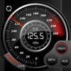 Спидометр GPS Учет скорости, автомобилей Спидометр, Цикл компьютер, Бортовой компьютер, Отслеживание маршрута, HUD99,00 ₽
Kevin Siml
Навигация説明
Спидометр GPS является причудливым и уникальное сочетание GPS Спидометр и бортового компьютера в одном приложении. Что вы получаете при покупке Speedo GPS Много замечательных возможностей встроенных. Speedo GPS собрать все необходимые статистические данные поездка / маршрута. Просто запустите приложение и спидометр GPS будет автоматически записывать ваши данные гео (долгота широта), скорость, средняя скорость, время начала, прошло время, дистанция, altidute и многое другое. Используйте Спидометр приложения в вашем автомобиле, на велосипеде, в поезде или самолете или когда вы идете или бродить. Приложение поможет вам войти все nessecary данные ваших поездок. Никакой рекламы никакой рекламы в приложении, что я гарантировано! Универсальное приложение Купить один раз и использовать его на свой мобильный и IPad. Графики с высоким разрешением для Retina Display (iPhone4, iPhone 5 (ы) и новых IPADS. HUD Дисплей на лобовом - это полезная функция также доступна. Просто включите HUD и поставить IPhone или IPad под лобовое стекло. Устройство проецирует текущую скорость на лобовое стекло. Посему ты уже не отвлекаться от и есть все подряд. Ориентация Вид адаптируется к ориентации мобильный. Навигация GPS с картой дисплей Вы когда-нибудь иметь возможность перейти на карте (спутниковой или гибридные вид), так что вы видите, где вы находитесь или где вы будете ехать. В режиме реального времени Статистика Получить графическую статистику о скорости, средней скорости, высоты, средняя высота. Экспорт данных Экспорт всех записанных данных по электронной почте или ITunes общего доступа к файлам. (CSV, XML, KML, GPX) и анализировать данные на вашем компьютере или ноутбуке. Обратите внимание: Использование GPS позволит резко сократить срок службы аккумулятора устройства. Его рекомендуется использовать зарядное устройство. GPS не всегда точно из-за ограничений датчиков аппаратного устройства. Чтобы увидеть карту требуется подключение для передачи данных. Убедитесь, что у вас есть местоположение услуги включены для приложения. Включите его в - Параметры> Общие> Location Services Видео: iPhone: http://youtu.be/YdOuA482SyQ Ipad: http://youtu.be/It5axbiohTs HUD: http://youtu.be/xniJyVQFmSQ
説明
Во время путешествия на автомобиле (автомобиле, велосипеде и т. Д.), Во время пеших прогулок или восхождения вы можете мгновенно определить свое местоположение и высоту, направление, географические координаты, адрес и атмосферное давление на карте. Следуя своему направлению на подробном экране компаса, вы также можете отслеживать изменение своей высоты. Вы можете поделиться сделанными фотографиями со своими близкими, включая информацию о вашей высоте, географических координатах и адресе. В зависимости от угла съемки на фотографиях указано направление компаса. СОХРАНИТЕ НА КАРТЕ ВЫСОТЫ РАЗЛИЧНЫХ МЕСТОПОЛОЖЕНИЙ (режим маркера) Вы можете исследовать и сохранять информацию о высоте выбранных мест на карте - Вы можете узнать высоту и координаты, отметив места на карте - Вы можете сохранить данные для этих мест УЗНАЙТЕ СВОЮ ВЫСОТУ НА КАРТЕ (нормальный режим) Вы можете мгновенно узнать информацию о своем местонахождении на карте. - высота - Давление на открытом воздухе (атмосферное) - координаты широты и долготы и адрес - Скорость в движении - Направление с подробным компасом СЛЕДУЙТЕ ЗА ВЫСОТОЙ НА КАРТЕ В ДВИЖЕНИИ (режим отслеживания на карте) На карте при путешествии в транспортном средстве (машине, велосипеде и т. Д.), Походе или восхождении Вы можете мгновенно отслеживать свое местоположение и изменение информации. - высота - Давление на открытом воздухе (атмосферное) - координаты широты и долготы и адрес - Скорость в движении - Направление с подробным компасом ОТСЛЕЖИВАЙТЕ ВЫСОТУ ПО КОМПАСУ (режим компаса) Во время путешествия на автомобиле (автомобиле, велосипеде и т. Д.), Во время пеших прогулок или восхождения вы можете мгновенно отслеживать свое направление и высоту вашего текущего местоположения. ПОДЕЛИТЬСЯ ФОТОГРАФИЕЙ С ЛЮБИМЫМИ С ВЫСОТОЙ И НАПРАВЛЕННОЙ ИНФОРМАЦИЕЙ (режим обмена) Во время путешествий на автомобиле (автомобиле, велосипеде и т. Д.), Пеших прогулок или восхождений вы можете поделиться сделанными фотографиями с этой информацией. - Информация о высоте, давлении, координатах и адресе будет на фото - В зависимости от угла съемки к фотографии будет добавлено направление по компасу. ВЫ МОЖЕТЕ ДОСТУПИТЬ К ИНФОРМАЦИИ О ВЫСОТЕ И МЕСТОПОЛОЖЕНИИ С APPLE WATCH ВАЖНОЕ НАПОМИНАНИЕ О МЕТОДЕ РАСЧЕТА И ТОЧНОСТИ - Координаты высоты и местоположения рассчитываются с использованием сигналов GPS используемого устройства. - Значения измерений могут отличаться в зависимости от качества сигнала GPS в местоположении устройства. - Чуть ниже значения высоты мгновенно отображается точность измерения в метрах. - На точность компаса могут влиять магнитные поля или помехи окружающей среды.
説明
Exit Strategy literally shaves minutes off every subway trip. Imagine the subway train pulls into your destination and you're DIRECTLY in front of the exit...every time! This app eliminates the guesswork from your ride, making your life easier and faster...and all for less than the cost of a roundtrip subway ride! Plan where to stand and shave minutes off your trip! Exit Strategy NYC has been praised by NYTimes, NY Post, NY Mag, Gizmodo, Wired and more. Try it and you'll quickly see why it's a MUST-HAVE for New Yorkers & savvy visitors too. (Works offline in the subway, no internet required) ___________________________________________________ Summary of Features: - Official MTA subway map (zoomable, scrollable and interactive!) - Official MTA Bus Maps for all five boroughs - Comprehensive MAP OF MANHATTAN showing address ranges and popular destinations created from the official MTA Neighborhood Maps. (Works offline when other map apps don't!) - Exit Strategy diagrams help you plan where to stand ("Should I be at the front or back of train?"). Literally shaves minutes off every trip! - Diagrams include locations of exits, transfer spots, and elevators, in most cases down to the optimal DOOR! - Diagrams show the hours for exits that close. - NO PHONE SERVICE OR INTERNET CONNECTION REQUIRED; use it on the subway! ======================================= All subway, bus, and street maps are property of the MTA.
説明
KickMap NYC. It’s an all-in-one app for stress-free rides to your destinations. Our user-friendly design and clear maps take the guesswork out of your commute, helping you get anywhere in the city quickly and confidently. Here's what makes KickMap NYC your go-to subway app: Effortless trip planning: Calculate routes between any two locations, including stations and street addresses. Know before you go: Get real-time service advisories with push notifications for delays and disruptions, to help plan your travel schedule. Day or night, no problem: Unlike most subway apps, the 24-hour KickMap NYC switches automatically to show which lines run during night hours, ensuring a confident journey at any time. Real-time station information : Tap and hold any station on the map to see live train arrival times and a detailed street map showing exits and entrances. Simple and clear: Our intuitive interface makes planning your trip a breeze, so you can spend less time navigating and more time exploring NYC! Download KickMap NYC today and experience the easiest way to ride the NYC subway! Features: NYC subway map and directions work underground without an internet connection. Directions without an internet connection displayed right on the map. Very easy to use - All lines and connections shown clearly. 24-hour Day/Night maps - Automatically switches maps at 11pm and 6 am. Pop-up street map - Press any station for 3 seconds to see station entrances and the local area. Built-in Compass - Keeps you oriented at street level. GPS Locator - Shows subway stations closest to you. Official MTA Transit Alerts - Customize push notifications of delays for the lines you choose. Identifies stations with no free cross-over to go in opposite direction. Shows over 350 NYC Neighborhoods and Parks and over 1000 points of interest. “One of the top ten New York City-based apps" - Huffington Post “Easier to read" - The New York Times “One of the best apps for navigating NYC’s subway lines" - CNET “Easy, detailed, and clear" - Apple Gazette “Navigating the NY subway has never been easier" - Appolicious.com “Easier to see all the lines" - Treehugger.com “You’ll know how to get where you’re going whether it’s 3PM or 3AM" - SmarterTravel.com “Encourages people to take advantage of the subway" - Transitmy.org
説明
Air travelers of any kind can use this app to easily find the distance between two airports throughout the world. - Contains 23,483 airports from around the world. - All airports available offline (no network connection required). - View elevation of each airport. - Displays distance in nautical miles, statute miles, or kilometers. For app updates, follow us on Twitter: @airdistance Check out our other aviation apps: -- pilotpro.com -- flightplanapp.com Disclaimer: Keep in mind that your iPhone isn't a Garmin 1000. The GPS is only so precise. Don't rely on this as a primary means of navigation. This is for informational and entertainment purposes only. Have a safe flight!
説明
AeroAltitude calculates pressure altitude (PA) and density altitude (DA) either from user data inputs or automatically by using built-in GPS, built-in barometer*, and METAR** of airports. Overview of features: - PA/DA/QNH calculation for current position using GPS and barometer (enter temperature manually) - PA/DA calculation based on user inputs for altitude, QNH, and temperature - PA/DA calculation of any airports from the built-in airport database. Including METAR display and chart of DA (on 4'' screens and higher) - List of user defined airports showing PA/DA calculation - List of nearby airports showing PA/DA calculation - Includes watch app to display DA at current position, user, and nearby airports - User definable warning threshold factor - Sharing data via mail, message, etc. - All units are customizable - Pre iOS 14 today widget with PA/DA for maximum five nearby airports (not available in iOS 18 or later) AeroAltitude uses the freely available Aviation Digital Data Service from US NOAA to get METAR data and can not be guaranteed. Internet connection required
説明
Nav Camera uses the proven navigation, augmented reality, and image processing engines from the well known Theodolite app to create a new app that focuses on photogaphy and video recording with data overlays. The app has been crafted with attention to detail by a top iOS developer, and benefits from over 20 years of development and testing heritage, along with real world usage by surveyors, geologists, architects, engineers, competitive sportsmen, first responders, military personnel, and search and rescue workers around the world. Nav Camera supports portrait and landscape photo capture, and gives you the option to overlay date/time, geo data, street address, and four lines of custom notes on photos and videos. Nav Camera lets you take photographs and record movies in landscape and portrait orientations with geo-location overlays and custom notes. Geo-location overlays include date, time, position, altitude, GPS datum, and compass bearing. Overlay data is updated in every frame when recording movies, which is great for documenting dynamic scenes or scanning an area. You can enter up to four lines of custom notes to be rendered into the overlay, which is perfect for job descriptions, project names, company/staff information, invoice numbers, or additional comments/documentation. Various parts of the overlay can be turned on or off, and multiple overlay colors are available. Nav Camera includes features for serious users including multiple reticles (three types of crosshairs and an SLR-style focus/exposure indicator), colored lens filters to improve use in dark conditions and preserve night vision, and multiple position formats including military grid reference system (MGRS), universal transverse Mercator (UTM), British/Irish National Grids, and six latitude/longitude variations. The optional "Datum Pack" adds over 220 geodetic datums to the app for more accurate position and altitude computation from GPS data. Optional datums include NAD-27, NAD-83, OSGB-36, ED-50, and hundreds of others, covering regions and countries on all continents around the world. Find out why apps like Nav Camera and Theodolite, and their field-proven results, are featured in Apple Keynotes, written up in magazine articles and professional journals, and used by everyday explorers and pro users around the world. Where will you take Nav Camera on your next adventure? Nav Camera works on any iPhone or iPod Touch with camera, running iOS 11.4 or later. If you like Nav Camera, please leave a review/rating on the iTunes App Store. It only takes a moment, and helps us a lot. Thanks!
説明
# Introduction Simply and fast information assistant application for Shanghai Disney. # Features - Display waiting time list for every attractions and performances; - Add favorite for attractions and performances; - Add schedule for performance to calendar with alarms; - Display waiting time icon on map with its location for attractions and performances; - Navigate to destination attractions and performances from your current location with route; - Display the local weather and Air Quality Index (AQI); - Widget display favorite items Information. # Feedback If you like this application please kindly give 5 stars. Any feedback and recommendation please click Email icon in about page.
説明
Pocket Flight Management Assistant (PFMA) is a flight computer designed for the professional pilot, with a familiar look resembling the computers onboard most modern automated cockpits. The E6B Edition emulates the functions present on the traditional "Wizz Wheel" providing the pilot with a complete and powerful solution for flight planning and inflight aviation calculations. Features: - Real life avionics look & feel - Customizable quick access buttons - Configurable units - Block and airtime chronographs - Comfortable keypad for inflight use - Basic math calculator functionality - Selectable themes Formulas included: - Airspeed and altitude - Wind triangle - Runway crosswind - Fuel usage - Great circle navigation (point to point) - Vertical profile (descent/climb) - Unit conversions - Holding Patterns - Sunrise-Sunset - Rate of turn
説明
Enhance Your Driving Experience with Speed Tracker Speed Tracker is the ultimate app for car enthusiasts and performance drivers who want to monitor and analyze their driving with precision. Whether you're on a road trip, testing your car's limits, or simply commuting, Speed Tracker provides the insights you need to optimize your driving experience. All core features work out of the box - no account or subscription required. Key Features: Real-Time Driving Metrics: Track your current speed, average speed, and maximum speed in real-time. Monitor your journey with precise GPS location updates, even when the app is running in the background. Follow your trip from the Lock Screen and Dynamic Island with Live Activities, including distance, duration, average speed, and ETA status. Optionally auto-start trips when you begin driving and end them when you park - even if the app was closed. Shortcuts & Automation: Set up CarPlay automations to automatically track trips when you connect or disconnect from your car. Control tracking with Siri voice commands and Apple Shortcuts. In-Depth Trip Analysis: Access detailed summaries of each trip, including start and end times, total distance, and duration. Analyze your route with comprehensive speed data and GPS coordinates. Calculate estimated travel times and compare them with actual durations to gain insights into your travel efficiency and identify areas for improvement. Create share cards from any trip - polished route, compact, or overlay graphics ready to send to friends or post online. Interactive Map Visualizations: Visualize your routes on a dynamic map with speed-based coloring to identify high-speed segments. Customize speed ranges for map coloring, or use Autobahn-optimized presets. Comprehensive Driving Statistics: View detailed statistics on total distance, duration, average speed, and top speed. Explore highlights, ETA comparison, cruising insights, streaks, and tag breakdowns. Identify high-speed segments with customizable speed thresholds, perfect for performance analysis. Trip History & Management: Browse through your trip history with advanced sorting and filtering options. Tag trips for better organization and quick access. Sync and back up your trips with iCloud for seamless access across all your devices. Speed Tracker Social (subscription required): Share your trips with friends or drivers worldwide and see how you compare. Watch friends - and drivers sharing worldwide - live on the map with real-time speed, route, and ETA. Auto-share completed drives with friends and get alerts when someone is driving live. React to shared trips, build your driver profile, connect with friends, and explore their drives. Add cars to your Garage and attach them when you share. Compare on global and country leaderboards in categories like total distance, peak speed, drive time, average speed, ETA comparison, and longest trip. Social features require a monthly or yearly subscription. All core tracking, analysis, and statistics features remain fully available without a subscription. Why Choose Speed Tracker? Speed Tracker is specifically designed for car drivers who demand precision and detail in their driving data. Whether you're aiming to improve your driving performance, track your road trips, or simply keep a log of your daily commutes, Speed Tracker provides the tools you need to gain valuable insights and make informed decisions. With Live Activities, smarter statistics, share cards, and optional auto-start tracking, every drive is easier to follow and revisit. And with Speed Tracker Social - including Live Drives, auto-share, and leaderboards - you can join a community of drivers, share your trips, and see how others drive. Download Speed Tracker today and take your driving experience to the next level! — Privacy Policy: https://moonshotapps.de/privacy-policy-speed-tracker/ Terms of Use: https://moonshotapps.de/terms-of-use-speed-tracker/
説明
This application is a photo-realistic aircraft Artificial Horizon indicator, also known as an Attitude Indicator, for your iPhone. Has a resettable zero and the movement is super smooth and realistic. NEW VERSION includes these new features: 1. improved Graphics 2. Landscape mode 3. Native iPad app 4. Bug Fixes 5. Supports Latest iOS version This application is modeled after the instrument found in many general aviation aircraft. It looks just like the real thing because photos of the real thing were used to create the graphics. Pitch and roll angles are represented both with the analog instrument as well a digital display. The instrument can be zeroed and the pitch reference "wings" can be adjusted, just like the real instrument. Of course, the iPhone doesn't have the same type of Gyro as an aircraft, so the instrument function is simulated using the iPhones built in accelerometer, This program has been tested on an iPhone 3g, 3Gs, 4 and iPod touch running firmware version 4.0 on up
説明
Nautical Calculator Pro is the most complete application that solves the navigation calculations The main features are : - Calculate Route (solves 2nd navigation problem) - Calculate point on Rhumb Line (solves 1st navigation problem) - Calculate point on Great Circle (solves 1st navigation problem) - Calculate point on WGS84 (solves 1st navigation problem) - Calculate Average speed - E.T.A. calculation - Route plan, for manual waypoints planning - Waypoint route - Compisite sailing with parallel limit - Rhumb Line Parallel/Meridian intersection - Follow on same Rhumb Line route - Opposite course rendez vous - Route correction - Calculate Amplitude at sunset and sunrise and magnetic compass deviation - Compass detections - Solves Drift problem - Solves Tides problem - Solves Tidal current problem - Wind calculation with Beaufort classification - ABC Tables (azimuth, initial course, right ascension with unknow star) - Nautical almanac - Celestial Navigation with position line - Meridian transit - Celestial observation - Coastal navigation - Wheel Over - Draft survey - Converter - Anchorage - Interpolation In routes feature there is a world map: it isn't a nautical chart and is not for use as a saling chart, but as a simple general means of showing the courses through the water on earth, this map isn't for navigational purposes. No need connection for show the map; the map will be downloaded only one time. The map, for size limit, will be show for scale over 60-70 Nm. follow on facebook https://www.facebook.com/NauticalCalculator