AppRank
 App Meteo di Top a Pagamento (Mac) in Svizzera
Sfoglia la classifica live Top a Pagamento (Mac) Meteo in Svizzera, con valutazioni delle app, descrizioni, screenshot, ricerca e collegamenti diretti all'App Store.
Confronta le classifiche dell'App Store iOS tra diversi paesi per individuare le app di tendenza e di successo, e ottieni idee su cosa sviluppare successivamente.
Cerca app
Classifiche dell'App Store
Paese / Regione
Top a Pagamento (Mac) · Meteo
Descrizione
Weather Pro provides users with accurate and authoritative weather forecasts, helping you to plan future trips and search weather infor you need. The Pro version contains no ads and provides a better experience. 【weather function】 · Provide you with 15-day weather forecasts, 24-hour weather forecasts · Real-time weather radar map , global weather changes at a glance · Outdoor data such as air pressure, humidity, rainfall probability, visibility, wind power, etc. · Daily dynamic information, such as,sunrise, sunset and moon phase changes · Life index such as UV, sports, dressing, fishing, car washing, and susceptibility to colds 【special function】 · Weather background: With Light mode, it offers massive excellent pics, which can changes aucomitaclly with day&night. · Global weather forecasts: Authorized multi-source data, covering the global main cities. privacy policy: https://sites.google.com/view/darkweatherapp/privacy-policy
Descrizione
Behalte dein Raumklima immer im Blick – diskret, präzise und blitzschnell. Netmo bringt die Daten deiner Netatmo-Wetterstationen direkt in die macOS-Menüleiste. Kein Browser-Tab, kein Smartphone-Check: Ein Klick genügt, um detaillierte Einblicke in dein Zuhause oder deinen Garten zu erhalten. Highlights: - Alles auf einen Blick: Unterstützung für bis zu 6 Stationen inklusive aller Zusatzmodule (Regenmesser, Windmesser & bis zu drei zusätzliche Innenmodule). - Visualisierte Trends: Analysiere Temperatur, Luftdruck, CO2, Regenmenge oder Windgeschwindigkeit in eleganten, interaktiven Diagrammen. - Nahtloses Design: Ein minimalistisches Interface, das sich perfekt in macOS einfügt – inklusive vollem Support für den Dark Mode. - Maximale Kontrolle: Exportiere deine Daten bequem als CSV zur weiteren Analyse. Die Funktionen im Detail: - Anzeige von Temperatur, Luftfeuchtigkeit, Luftdruck, CO2 und Lautstärke. - Präzise Daten zu Regenmenge, Windstärke und Windrichtung. - Batterie-Status: Verpasse nie wieder den Zeitpunkt für einen Batteriewechsel deiner Module. - Individualisierbar: Wähle selbst, welche Werte direkt in der Menüleiste sichtbar sein sollen. - Lokalisiert in Deutsch, Englisch und Französisch. WICHTIG: Netmo ist eine Menüleisten-App. Nach dem Öffnen erscheint kein herkömmliches Programmfenster, sondern ein kleines Icon oben rechts in deiner macOS-Menüleiste (neben Uhrzeit und WLAN). Klicke auf das Icon, um deine Daten anzuzeigen! Falls das Icon NICHT aufscheinen sollte, dann bitte in den Einstellungen von macOS unter dem Punkt "Menüleiste" prüfen, ob es Netmo erlaubt ist, die Menüleiste zu nutzen. Bitte beachten: - Der Zugang zu einer Wetterstation von Netatmo ist Voraussetzung für die ordnungsgemäße Funktion der App
Descrizione
Wir möchten Ihnen Wetter HD vorstellen, eine bildschöne, einzigartige App, die das Wetter direkt auf Ihrem Desktop lebendig macht. Die App präsentiert Ihnen die Wettervorhersage und verwandelt Ihren Desktop je nach Wetterbedingung in eine schöne, lebendige Landschaft. Sie können Living Weather HD auch als Bildschirmschoner verwenden. WESENTLICHE FUNKTIONEN: ● Aktuelle Wetterbedingungen und Wettervorhersagen für weltweite Orte auf Ihrem Desktop ● Animierte Wetterhintergründe, die an das aktuelle Wetter oder die Wettervorhersage des aktuellen Tags oder die Wettervorhersage des nächsten Tags angepasst sind. Sie können auch Ihren Lieblingshintergund festlegen oder ein zufälliges Bild auswählen lassen. ● Animierter Wetterhintergrund: ・Die Hintergründe passen sich an die aktuelle Wetterlage, die Wettervorhersage des aktuellen Tags oder die Wettervorhersage für den nächsten Tag an. ・Sie können auch Ihr Lieblingswetterbild als Hintergrund festlegen. ・Sie können Hintergrundbilder per Zufallsauswahl ändern. ● Fenster mit ausführlicher Wettervorhersage, das sich über einen Klick auf das Dock-Symbol öffnen lässt. ● Dock-Symbol mit Wetteranzeige: ・Symbol-Badge mit aktueller Temperatur, Windgeschwindigkeit oder gefühlter Temperatur ・Symbol mit Wetterlage ・Texte zur Wetterlage ● Anpassbares Wetter-Widget für den Desktop: ・Stil: 5 verschiedene Widget-Stile ・Position: Schieben Sie das Widget an eine beliebige Stelle auf dem Bildschirm ・Größe: Passen Sie die Größe des Widgets bei Bedarf an ・Transparenz: Erkennen Sie den Hintergrund des Widgets ● Suchen Sie nach Orten für Vorhersagen über die Adresse, den Flughafencode oder die automatische Standortermittlung. ● Speichern Sie beliebig viele Orte ● Bildschirmschoner-Option (Die Funktion „Desktop anzeigen“ p” minimiert alle Fenster) ● Daten zur Vorhersage und aktuellen Wetterlage werden alle 60 Minuten aktualisiert FUNKTIONEN: ● Präzise Wettervorhersagen und Ortszeit für jeden Ort auf der Welt ● Ihr erster Ort wird automatisch ermittelt. Neue Orte lassen sich über Eingabe der ersten Buchstaben des Ortsnamen, der Postleitzahl oder des Flughafencodes hinzufügen. ● Aktuelle Temperatur als Symbol-Badge direkt auf dem Desktop AUSFÜHRLICHE WETTERVORHERSAGE: ● Ausführliche 7-Tage-Vorhersage ● 2-stündliche Wettervorhersage für 3 Tage ・Temperatur ・Windgeschwindigkeit & -richtung ・Luftfeuchtigkeit ● Überblick über die Wettervorhersage in Textform ● Niedrigst- und Höchsttemperaturen ● Aktuelle gefühlte Temperatur ● Windgeschwindigkeit und -richtung ● Taupunkt ● Luftfeuchtigkeit ● Regeninformation ● Örtlicher Sonnenauf- und -untergang ● Maßeinheiten: Fahrenheit oder Celsius & mph oder km/h ● Zeitformat: Systemstandard, 12 Stunden oder 24 Stunden ● Präzise Premium-Wetterdaten von Weather Underground® Wetter HD jetzt herunterladen!
Descrizione
Mit ClassicWeather kann man Wettervorhersagen von verschiedenen Orten vergleichen. Es zeigt die Wettervorhersagen bei Bedarf auch im Dock-Menü und im Menü-Leisten-Menü an. Funktionalität: • Aktuelle Wetterlage • Vorhersage für 14 Tage • Vorhersage stundenweise • Vorhersage für die nächsten 24(+) Stunden (scrollbar) • Wind-Geschwindigkeit und -Richtung • UV-Index • Luftqualität (5 Tage) • Luftfeuchtigkeit • Temperatur in Fahrenheit oder Celsius • Wahrscheinlichkeit von Niederschlägen • Regen/Schnee in mm/cm • Gefühlte Temperatur • Sonnen-Aufgang/-Untergang (Zeit) • Mond-Phase • Mehrere Städte • Aktueller Standort • optional Apple Weather für aktuellen Standort (ab macOS 13) • Vorhersage in Dock-Menü und Menü-Leiste • Aktuelles Wetter auf Dock-Icon und in Menü-Leiste • App in Dock und/oder in Menü-Leiste • Verschiedene Widget-Designs und -Grössen • 2 Modi (einzelnes Fenster oder Widgets) • Und mehr Bezahlen einmal - installieren auf mehreren Mac mit selbem App Store Konto. Der Kauf dieser App berechtigt nicht zum kostenlosen Download der kostenpflichtigen iOS-Version. Dies sind unterschiedliche Produkte. -------------------------------------------------------------- ClassicWeather HD (V7.0.1) hat von Softpedia die Auszeichnung "100% CLEAN" erhalten.
Descrizione
**4K version also available! Please search the Mac App Store for "Mach Desktop 4K" for the 4K version** Introducing Mach Desktop version 3.0: The most advanced and beautiful wallpaper application ever conceived for a personal computer! Mach Desktop features 50 stunning dynamic Themes; allows you to load your own Videos, GIFs, or Quartz Compositions as Wallpaper, and allows you to add over 30 different Widgets to your Desktop. Choose from a huge variety of meticulously crafted dynamic Themes from categories including: Space, Fantasy, Architecture, Fields, Nature, Holiday, Aquariums, Fireplaces, Abstract Themes, and much more! Mach Desktop also features GPU-acceleration support so Themes use little-to-no CPU — freeing up your computer for other tasks. If that still wasn’t enough, with the Widget Manager you can add Widgets to your Desktop with a single click! Select a Widget and set its size, font, foreground color, and background color — and easily position a Widget anywhere you want. Choose from over 30 different Widgets including Time, Date, Current Weather, 12 hour Weather forecast, 5 day Weather forecast, a variety of Clocks, and much much more. You can even add Web pages to your Desktop with the Web Page Widget, or add your own Custom Text Widgets (including Emojis) to your Desktop super easily. Don’t feel like adding and customizing Widgets on your own? No problem! Mach Desktop can automatically add Widgets positioned, colored, and tailored for each individual Theme. With all these features, Mach Desktop has no equal and is the only application of its kind! New in version 3.0: - All new completely redesigned Themes - All Themes are now pre-rendered Videos using no more than 5% CPU per display (no more included Quartz compositions that rely on heavily CPU/GPU usage, however you can still load your own Quartz Compositions if you would like) - New Widgets, including Custom Text Widget - Improved dynamics: Closing/opening Laptop lid, better wake/sleep support, improved awareness when you’re switching Display resolution, etc. - Preserve original Aspect Ratio in Themes - Widgets up to 75% faster than previous Widgets Super cool features! - Includes 50 Dynamic Video Themes as Wallpaper - Load your own Videos, GIFs, or Quartz Compositions as Wallpaper - Includes over 30 different Widgets to add to your Desktop; Widgets include: Date, Time, Weather, Clocks, and more - Choose from a huge variety of Themes including: Space, Fantasy, Architecture, Fields, Nature, Holiday, Aquariums, Fireplaces, Abstract Themes, and more - Unlimited Display/Monitor support, with each Display being independently customizable - Choose Themes graphically with a single click - Video and GIF as Wallpaper feature GPU-acceleration support; consuming little-to-no CPU for Wallpaper animations (Quartz compositions vary depending on Quartz composition) - Not only includes a huge variety of Date/Time/Weather/Clock Widgets; but also includes Web Page Widgets and Custom Text Widgets - All Widgets support custom position, size, font, foreground color, and background color - Super advanced, yet super easy to use *If you like Mach Desktop please leave us a positive review in the Mac App Store as it really does help us out a lot!*
Descrizione
Jeder Blick zum Mond kann eine Entdeckung sein. Deluxe Moon HD verwandelt deinen Mac in eine persönliche Mondsternwarte: mit stimmungsvollen Mondbildern, ausführlichen Himmelsdaten und einem illustrierten Kalender, der zum Erkunden einlädt. DEM MOND AUF DER SPUR Erfasse die aktuelle Phase, Beleuchtung, das Mondalter und die Entfernung auf einen Blick. Entdecke die nächsten Neu- und Vollmonde mit Zeiten für deinen gewählten Standort und deine Zeitzone. DEIN MONAT IM MONDKALENDER Betrachte Mondphasen, Tierkreiszeichen und illustrierte Mondtage einzeln oder gemeinsam. Entdecke Beschreibungen der Mondtage, Zeichenwechsel und Mondpausen. Zeige Termine aus Apple Kalender neben den Monddaten an und füge ausgewählte Ereignisse mit optionalen Erinnerungen hinzu. DEN HIMMEL VERSTEHEN Sieh nach, wann Sonne und Mond auf- und untergehen. Erkunde ihre Positionen, astronomische Koordinaten, Tagundnachtgleichen und Sonnenwenden. Entdecke Sonnen- und Mondfinsternisse mit Angaben zur Sichtbarkeit an deinem Standort. MONDTRADITIONEN ENTDECKEN Lies Deutungen zu Mondtagen und Tierkreiszeichen, wähle zwischen tropischem und siderischem Tierkreis und entdecke Gartentipps passend zu deinen Pflanzen und Anbaubedingungen. Die Monddeutungen und Gartentipps beruhen auf traditionellen Praktiken. DEIN ORT, DEINE ZEIT Nutze deinen aktuellen Standort oder wähle einen anderen Ort, ein Datum und eine Uhrzeit. Plane einen Abend im Mondschein, begleite den Wechsel der Jahreszeiten oder folge einfach deiner Neugier. Erfordert macOS 26 oder neuer. Die Kalenderintegration benötigt deine Erlaubnis.
Descrizione
Mit der Schreibtisch Uhr App erhalten Sie eine schöne und praktische Uhr für Ihren Mac-Desktop und Dock. Die App bietet Ihnen 23 schöne Designs zur Auswahl. Da ist für jeden Geschmack etwas dabei. Uhr-Designs: + Analoge Uhren + Flip-Clock-Design + Animierte Quartz-Bewegung für analoge Uhren App-Funktionen: + Die Position und Größe der Uhr lässt sich anpassen + Die Transparenz der Uhr lässt sich anpassen + Option „Zuoberst anzeigen“ + „Heiße Ecken“, um die Uhr über allen anderen Fenstern anzuzeigen + Die Uhren werden auf ALLEN Desktops angezeigt + Die App verbraucht sehr wenige Systemressourcen
Descrizione
NOTE: this a is menu bar app. Once you open the app an AeroWeather icon will appear in the menu bar (as shown on screenshots). A simple and clean METAR/TAF viewer as known from AeroWeather for iOS. For a full version of AeroWeather, consider AeroWeather Pro (available on Apple M1 or higher computers only). Features: - Menu bar application for quick access (Menulet) - Customizable menu bar (airport with flightrule, temperature, or wind) - Menu bar display optionally rotates through list - Notification center widgets for raw format; requires macOS Ventura (13.0) - Sortable list (by user-defined, name, ICAO, IATA, country) of airports in well known AeroWeather layout (with raw or decoded METAR) - Detail view with METAR, TAF (raw or decoded) and station information - Read out of METAR similar to ATIS by swiping a station in list to the right (English voice only) - Calculates presssure altitude, density altitude, and windchill or heatindex - AWOS data for US airports (where available) with phone support (either via Skype or connected iPhone) - Customizable formats and units - Sharing of METAR/TAF via E-Mail, Messages etc. - Printing of station detail - Import/export of user data from/to AeroWeather for iOS - Support for dark mode - Available in Chinese (Simplified), Danish, Dutch, English, Finnish, French, German, Italian, Japanese, Norwegian, Polish, Portuguese (Brazilian), Spanish, Swedish AeroWeather uses weather data from freely available sources like US NOAA, which cannot be guaranteed. The cost for AeroWeather is for development of the app and not to pay for any weather data.
Descrizione
Wetter Dock bringt die Wettervorhersage direkt auf Ihren Desktop. Ein kurzer Blick auf das Dock-Icon verrät Ihnen bereits die aktuelle Wetterlage sowie die Vorhersage für heute und morgen. Sie brauchen das Symbol nur einmal anklicken und schon erhalten Sie ausführliche Informationen zum aktuellen Wetter mitsamt einer 10-Tages-Wettervorhersage. Ausführliche Wettervorhersage: • Zugriff auf ausführliche Informationen zur aktuellen Wetterlage und eine 10-Tages-Vorhersage • 10-Tages-Wettervorhersage mit zweistündlichem Ausblick • Wettervorhersage für mehrere Orte • Vorhersagefenster mit animierten Symbolen • Metrische oder angloamerikanische Maßeinheiten • Wetter-Aktualisierungen alle 60 Minuten • Automatische Wetter-Aktualisierungen, falls sich das Handy im Ruhemodus oder ohne Internetverbindung befand Animiertes anpassbares Dock-Icon: • Anpassbare Anzeige auf dem Symbol-Badge: Wählen Sie zwischen der aktuellen Temperatur, den Windverhältnissen, der gefühlten Temperatur oder der Höchst-/Tiefsttemperatur von heute/morgen • Anpassbare Wetteranzeige: Wählen Sie zwischen der aktuellen Wetterlage, der Wettervorhersage für heute oder der Vorhersage für morgen • Anpassbare Textfarbe für Wetterbedingungen: Wählen Sie zwischen schwarz, weiß oder weiß mit grauem Hintergrund • Anpassbare Animationsgeschwindigkeit (lässt sich ausschalten) Sehr präzise Wetterdaten von The Weather Company. Sollten Probleme mit der App auftreten, kontaktieren Sie uns bitte direkt über den Button/Menüpunkt „Kontakt“ und geben Sie den Ort der betroffenen Wettervorhersage an.
Descrizione
Well Live Dock Weather just set a new standard in making users feel right at home with their weather needs. iLifeTouch is listening! If we missed something tell us . We well try our best to add features. The app has no set-up instructions. The idea behind this was if we need instructions the app is already way too complicated to use. Please feel free to click and try all the features the app provides. Weather on your dock ! How cool is that ! Live Dock Weather is the simplest way to be in constant contact with live weather 24/7 without even opening up an application. You can also load your desktop with two different types of sizeable and movable weather displays that are simply a blue colored plus button click away, enabling you to access up to date 24 hour accurate weather. This will be your quick source for live weather making Live Dock Weather one of your most used apps. Features Include + 151 000 world cities including 44 000 US Zip codes + Current weather conditions and temperatures + Weather is just a click away + Two desktop choices of weather displays + Multiple cities displayed at the same time + Weather is updated every 15 minutes + Status Bar displays current weather conditions + Quick reference of live local weather on the dock + 24 hour forecast + Dramatic organized graphics showing current weather + Current time, date, humidity, temperature + Live updates on the 15 + Voice forecast + +++++ this app is loaded with features In the tradition of iLifeTouch we make apps that make your life easier one day at a time! LifeTouch is listening! If we missed something tell us . We well try our best to add features. Enjoy
Descrizione
CARROT Weather is a crazy-powerful (and privacy-conscious) weather app that delivers hilariously twisted forecasts. ** Winner of Apple’s Editor’s Choice award and featured by The New York Times, Good Morning America, CNN, Wired, & more! ** Accurate and Detailed Dark Sky’s super accurate weather data gives you quick access to your current, hourly, and daily forecasts. Plus, you can upgrade to use other providers like AccuWeather, Tomorrow.io, and MeteoGroup as your data source! Overflowing with Personality From spooky fog to torrential downpours, CARROT’s dialogue, characters, and scenery change in… “unexpected” ways. You’ll actually be looking forward to a blizzard just to see what CARROT has in store for you! Notifications Sign up for precipitation, weather alert, and daily forecast notifications. And Premium Club members can sign up for lightning strike and storm cell notifications - and even create completely custom notifications. (Precipitation notifications are available in the US, UK, & parts of Canada. Weather alert and storm cell notifications are only available in the US. Lightning notifications are available in the US and Canada.) Weather Maps Watch in awe as the next big storm bears down on your house with CARROT’s trusty radar. Plus, Premium Club Tier 2 members get access to future radar (in the US), lightning strikes, and 12 additional map layers! Customization Want to disable CARROT's personality? You can turn her into a 100% professional weather app! And you can customize every last data point that CARROT displays to show the weather data that you care about. Time Machine View the weather for any location up to 70 years in the past. DeLorean not required! Secret Locations Follow clues to hunt down 60+ secret locations - like the Moon, the Pyramids, and Chernobyl. Achievements Unlock 30+ achievements by experiencing weather events, traveling around the world, and using different features in the app. Features: • Beautifully minimalist weather app • Dark Sky’s super accurate weather data • AccuWeather, Tomorrow.io, Foreca, MeteoGroup, Aeris Weather, Environment Canada, and WillyWeather data sources available as an upgrade • Precipitation, weather alert, lightning strike, storm cell, daily summary, and astronomy notifications (where available) • Radar and satellite maps • 6,500+ lines of hilarious spoken dialogue • 62 secret locations • 36 achievements • Will never sell your location data to third parties Don’t make CARROT angry. Download her now! --- CARROT Weather uses auto-renewing subscriptions. Tier 2 provides additional features like more frequent background updates, additional map layers, custom notifications, and additional data source access for Apple Watch users. Tier 3 includes all the features of Tier 2, plus rain, lightning, and storm cell notifications (where available) and even more frequent background updates. Payment will be charged to your Apple ID account at the confirmation of purchase. The subscription automatically renews unless it is canceled at least 24 hours before the end of the current period. Your account will be charged for renewal within 24 hours prior to the end of the current period. You can manage and cancel your subscriptions by going to your App Store account settings after purchase. Cancellation of the current active subscription period is not allowed. Terms of Use: http://support.meetcarrot.com/weather/terms.html Privacy Policy: http://support.meetcarrot.com/weather/privacypolicy.html
Descrizione
Regenradar für Deutschland und Europa mit 45 Minuten Vorhersage, amtliche Unwetterwarnungen und 10-Tage-Prognose auf Ihrem Mac. In der Menüleiste, im Dock oder im großen Radarfenster – einen Klick entfernt. AUF IHREM MAC • Menüleiste: aktuelle Temperatur und Wetterlage neben der Uhr; ein Klick zeigt die komplette Vorhersage • Dock-Symbol: das aktuelle Radarbild und die Temperatur, automatisch aktualisiert; ein Klick öffnet das Radarfenster • Drei Fensterstile, vom kompakten Panel bis zu zwei Radarkarten nebeneinander RADAR • Niederschlagsradar für Deutschland, Österreich, die Schweiz und ganz Europa aus dem Verbund der nationalen Wetterdienste (OPERA), alle paar Minuten aktualisiert • Die Schleife läuft bis zu 45 Minuten voraus – Sie sehen, wohin der Regen zieht, bevor er ankommt • Zwei Stunden Radarverlauf; Zeitregler ziehen oder abspielen lassen • Die zweite Radarkarte läuft Bild für Bild synchron zur ersten WARNUNGEN • Amtliche Unwetterwarnungen der europäischen Wetterdienste (MeteoAlarm) direkt auf der Karte, DWD inklusive • Ein Klick auf ein Gebiet zeigt den vollständigen Warntext VORHERSAGE • Aktuelles Wetter, Stundenvorhersage und 10-Tage-Prognose für jeden Ort der Welt • Temperatur und gefühlte Temperatur, Windgeschwindigkeit und -richtung, Luftfeuchtigkeit, Taupunkt, Niederschlag, Sonnenauf- und -untergang • Beliebig viele Orte speichern; °C oder °F, km/h oder mph Einmal kaufen. Kein Abo, keine Werbung, kein Konto. Fragen? Über das Hilfe-Menü in der App erreichen Sie uns direkt.
Descrizione
Präzise Stunden- und 15-Tage-Vorhersagen von zwei unabhängigen Wetteranbietern — mit Unwetterwarnungen, Echtzeit-Barometer, Gezeitenvorhersagen, Luftqualität, Sturm- und Hurrikanverläufen, Erdbebenberichten, Meerestemperaturen und der einzigartigen animierten Wetteruhr. eWeather HD bündelt alles Wichtige an einem schönen Ort: Temperatur, Regen, Schnee, Wind, UV-Index, Luftdruck, NOAA-Bojendaten und Apple-Watch-Komplikationen — damit Sie Ihren Tag mit Zuversicht planen können. Funktionen: • Präzise Stunden- und 15-Tage-Vorhersagen weltweit • Zwei unabhängige Wetteranbieter (USA und EU) — wählen Sie die beste Quelle für Ihren Standort • Unwetterwarnungen (USA und Europa) per Push-Benachrichtigung • Globale Sturm-, Hurrikan- und Taifunverläufe mit prognostizierten Zugbahnen • Live-Temperatur-Badge und vier Widgets, darunter die animierte Wetteruhr und das Barometer • Echtzeit-Barometer über den Drucksensor Ihres iPhone/iPad • Benachrichtigungen bei Luftdruckänderungen, die mit Migräne in Verbindung stehen können • Push-Benachrichtigungen mit aktuellen Wetterbedingungen • Gezeitenvorhersagen und Daten von über 700 NOAA-Bojen • Meeresoberflächentemperaturen weltweit • Luftqualitätsindex, Details und Vorhersagen • UV-Index, Luftfeuchtigkeit, Taupunkt, gefühlte Temperatur und geomagnetische Aktivität • Animierte Satelliten-Wolkenbilder (USA, Europa, Asien) • Interaktive Wetter- und Windkarten mit acht Ebenen • Erdbebenberichte • 10 Jahre historische Wetterdaten inklusive Meerestemperaturen • Sonnen- und Mondzeiten, Mondphasen und astronomische Ereignisse (Finsternisse, Tagundnachtgleichen, Sonnenwenden) • Temperatur- und Luftdruckdiagramme — Vergangenheit und Vorhersage • Vier Designs mit Nachtmodus • Siri-Kurzbefehle, Spotlight und iMessage-App • Apple-Watch-App mit acht Komplikationen WARUM EWEATHER HD? Die Wetteruhr zeigt auf einen Blick, wann Regen oder Schnee beginnt. Zwei unabhängige Quellen ermöglichen den direkten Vergleich — und das Barometer warnt Sie vor Druckänderungen, die Migräne auslösen können. Für Outdoor-Aktivitäten kombiniert eWeather HD Vorhersagen, Windkarten, Gezeiten, Bojendaten, Luftqualität und UV-Informationen in einer App. Ob schneller Wettercheck, 15-Tage-Ausblick oder Unwetterwarnung — Sie bleiben dem Wetter immer einen Schritt voraus.
Descrizione
Bleiben Sie mit einem stilvollen Wetter-Widget auf Ihrem Desktop in punkto Wetter auf dem Laufenden! Freuen Sie sich auf eine attraktive Auswahl an Widget-Designs. Verwenden Sie das Widget, um sich einen Überblick über die Wetterlage zu verschaffen. Wenn Sie genauere Vorhersagen benötigen, können Sie das detaillierte Wetterfenster öffnen. Das App-Symbol des Wetter-Widgets stellt Ihnen eine kurze Vorhersage oder einen Überblick über die aktuelle Wetterlage im Dock sowie der Menüleiste bereit. Wettervorhersage - Vorhersage für Standorte weltweit - Unterstützung für mehrere Standorte - Imperiale und metrische Einheiten (°F / mph oder °C / km/h) - Option für Start bei Anmeldung Widget - Auswahl verschiedener Widget-Designs - Beliebige Position des Widgets auf Ihrem Desktop mit der Funktion „Klicken und Ziehen“ in den App-Einstellungen - Option zur Anpassung der Größe Ihres Widgets - Option zur Anpassung der Intransparenz Ihres Widgets (bis zur Durchsichtigkeit) - Funktion „Aktive Ecke“: Festlegung einer aktiven Ecke, um sofort Desktop und Widget zu öffnen, wenn Maus zu dieser Ecke bewegt wird. - Funktion „Desktop anzeigen“: Blendet alle Fenster nach einer bestimmten Zeit der Inaktivität aus, um das Desktop und Widget anzuzeigen Wetter in der Menüleiste - Symbol der Menüleiste kann die aktuelle Temperatur, Vorhersage oder Wind anzeigen - Einfacher Zugriff auf das App-Menü, um das detaillierte Wetterfenster und die App-Einstellungen aufzurufen Wetter im Dock - Design des Dock-Symbols kann angepasst werden - Dock-Symbol kann die aktuelle Temperatur, Vorhersage oder Wind anzeigen - Wetter ist ebenfalls in Menüleiste sichtbar Detailliertes Wetter - Detailliertes Wetter kann mit einem Klick auf das Dock-Symbol aufgerufen werden - Das detaillierte Wetterfenster stellt auch eine alle 2 Stunden aktualisierte 3-Tage-Vorschau bereit - Bequemer Wechsel zwischen Ihren Standorten über das Auswahlmenü
Descrizione
Stellen Sie sicher, dass Sie eine WLAN-Verbindung zum Internet haben. An diesem Punkt wird die App Ihren Standort zu ermitteln. Das Display zeigt den Namen des Ortes und dem Atmosphärendruck anzeigen, auch , die die klimatischen Bedingungen. Die Daten werden durch eine zuverlässige Wetter apixu.com Dienstleistungen [ BEWERTUNGEN ] Einfach und elegant ***** Diese App ist im Sinne aller ist, die am besten mit dem Mac. Einfach, aber elegant und bietet alles was Sie über Atmosphärendruck wissen müssen. Ich hoffe, dass es in der Zukunft bieten eine Trend-Bar, um die Druckänderungen über einen Zeitraum von Stunden und Tagen zeigen, wie die Änderungsrate ist sehr wichtig, das Konzept der Wetterfronten vorherzusagen. Dank. [ FEATURES ] • Echtzeit- Messung von Luftdruck • Die unterstützten Geräte sind hPa, mbar, mmHg, torr, zoll • Zuverlässigkeit in der Anwendung • Verfolgen Sie die letzten Luftdruckanzeige • Intuitive Grafiken für Retina Display optimiert • Benutzerfreundlichkeit [ KOMPATIBILITÄT ] macOS 11.0 und höher. Luftdruck ist auch für iOS (iPhone , iPad und iPod touch) erhältlich. [ UNTERSTÜTZTE SPRACHEN ] • Deutsch, Englisch, Italienisch, Spanisch, Französisch, Portugiesisch, Niederländisch, Russisch, Chinesisch, Japanisch, Dänisch, Finnisch, Norwegisch und Schwedisch. [ HILFE ] Wenn Sie Hilfe benötigen, kontaktieren Sie uns unter [email protected] , oder besuchen Sie unsere offizielle Website www.lionsapp.com Wenn Sie die App zu genießen, vergessen Sie nicht, uns eine Bewertung im App Store.
Descrizione
Probieren Sie die Erfahrung eines starken, aber zugleich einfaches Werkzeug, eine echte Windmesser direkt auf Ihrem Mac. Mit einem innovativen Design, inspiriert von den Instrumenten des Flugzeugs Diese App verbindet das Konzept des Windes mit dem Kompass was Geschwindigkeit und Windrichtung im Kompass integriert. Windmesser gibt die in Echtzeit Richtung und Windgeschwindigkeit. Achten Sie darauf, mit dem Internet verbunden sind. An dieser Stelle wird die Anwendung Ihren Standort zu ermitteln. Das Display zeigt den Namen des Ortes, die Richtung und Stärke des Windes zeigen. Sie können zwischen 5 Einheiten (Knoten, mph, km/h, m/s oder Beaufort) wählen. [ EIGENSCHAFTEN ] • Gust • Windrichtung • Kompass • Wählen Sie aus 5 Einheiten: Knoten, mph, km/h, m/s oder Beaufort • Intuitive Grafik • Einfache Bedienung [ KOMPATIBILITÄT ] macOS 11.0 und höher. Anemometer - Windgeschwindigkeit ist auch für iOS (iPhone, iPad und iPod touch) zur Verfügung. [ SPRACHUNTERSTÜTZUNG ] • Deutsch, Englisch, Italienisch, Spanisch, Französisch, Portugiesisch, Niederländisch, Russisch, Chinesisch und Japanisch. [ HILFE ] Wenn Sie die App gefällt, vergessen Sie nicht, uns im App Store hinterlassen Sie eine Bewertung. Für Anregungen kontaktieren Sie uns bitte [email protected], oder besuchen Sie unsere Website www.lionsapp.com
Descrizione
MWetter ist eine Wetter App die dir das stündliche Wetter für die nächsten 10 Tage auf eine schöne und klare Weise zeigt. Mit der Stündlichen und Täglichen Vorhersage in Diagramm Form siehst du den Verlauf des Wetters auf einen Blick. Das Hintergrund Bild der App zeigt die aktuelle Wetter Lage. App Funktionen: - Aktuelles Wetter - Stündliche Vorhersage für bis zu 10 Tage - Tägliche Vorhersage für bis zu 10 Tage - Übersichtliche Präsentation im Diagramm Stil - Hintergrundbild passend zum aktuellen Wetter - iCloud Synchronisierung für die Einstellungen und Orte - Heller / Dunkler Modus - Vollbildmodus - Mehrere Vorhersage Fenster - Widgets - Lokale oder System Zeit - Speichern von bis zu 8 Orten - tvOS App (extra erhältlich) - iOS & visionOS App (extra erhältlich) Wetter Funktionen: - Aktuelle Temperatur - Aktuelle Wetterbedingung - Min / Max Temperatur - Regen Wahrscheinlichkeit - Sonnenaufgangs / Sonnenuntergangs Zeit - Aktuelle gefühlte Temperatur - Luftfeuchtigkeit - Windgeschwindigkeit und Richtung - Regenmenge - UV Index - Mondphase - Tageszusammenfassung Die Wetterdaten werden von Apple Wetter bereitgestellt.
Descrizione
**Universal binary ready for Apple Silicon processors!** Introducing Radar Extreme, a powerful and easy to use Radar, Weather, Satellite, Lightning, Earthquake, and Hurricane Tracker. Radar Extreme features hundreds of NEXRAD Local Radars, dozens of Regional Radars, 14 World Radars, Local Weather Conditions for over 200,000 locations around the globe, 7 Lightning Intensity Radars, a National U.S. Radar, even interactive Solar System, 3D Earth, and an Interactive Map that shows Precipitation, Temperature, Clouds, Rain, Snow, Wind, and Sea Level Pressure individually. If that wasn't enough, Radar Extreme also offers extremely descriptive textual local weather Forecasts for Day and Night; letting you know exactly what conditions will be like for a given period of the day — and whether or not you should bring an umbrella. Local Weather features photorealistic Day and Night time graphics, Ten Day Weather Forecasts, Wind Speed/Direction, Humidity, Highs/Lows, and much more. Local Weather Conditions are shown in the Menu Bar (Dark Theme compatible!) and a live animated NEXRAD Local Radar in the Dock. All three panes can be resized independently, with full Multi-touch gestures included. With all these features, Radar Extreme offers more Radars than any other application in the world, and best of all, Radar Extreme offers incredibly advanced features at a ridiculously affordable price of only U.S. $4.99! Advanced and Easy to Use Features! - Hundreds of "NEXRAD Next Generation" Local Radars all over the U.S.; with each Radar featuring independent layers, with 6 Radars per location: Base Reflectivity, Storm Relative Motion, Base Velocity, One-Hour Precipitation, Composite Reflectivity, and Storm Total Precipitation - Dozens of Regional Radars give you a glimpse of what's going on in the immediate surrounding vicinity - 18 World Radars (Full Color GOES-16 Satellite) with 17 Radars per location - Local Weather features Photorealistic Day/Night Graphics, with over 200,000 locations around the globe supported; updates every 15 minutes - Innovative 7 Lightning Radars around the world show Lightning Intensity for a given region - National U.S. Radar, with a high resolution option - Textual Forecast gives detailed descriptions for different periods throughout the day (Provided by U.S. National Weather Service) - Interactive 3D Solar System shows Sun, Planets, and Asteroid Belt - Interactive 3D Earth shows latest Earthquakes, Tropical Storms, and Live Clouds - Interactive Map shows the latest Precipitation, Temperature, Clouds, Rain, Snow, Wind, and Sea Level Pressure - Each Radar can be switched between locations on the fly - Each Radar features Reload button to make sure you always have the latest data - Dock Icon shows Animated NEXRAD Local Radar - Local Weather supports Unlimited Multiple Locations, Imperial/Metric systems,F°/C°; 24 Hour Clock Option - Local Weather Conditions in menubar (Dark Theme compatible, must be enabled in Preferences) - Multi-Touch gesture and Retina Display support included - Super advanced, yet super easy to use *Please note Local Radar, Regional Radar, and Textual Forecast features are for the United States only*
Descrizione
Moon Phase Gadget is a set of stylish Moon and Sun gadgets for your desktop. Moon Phase Gadget is a great addition to the magnificent Deluxe Moon HD application. Features: - Large Moon gadget with precise moon phase times. - Sun gadget with sunrise and sunset times. - Small, stylish moon gadget with main Moon information. Moon Parameters - Precise Moon phase times. - Full names of all Moon phases. - Moonrise and moonset times for your location on large gadget. - Moon countdown timers: amount of time since moonrise and until moonset. - Percent of the illuminated Moon area. - Current moon age: how far along the moon is in its full cycle. - Zodiac sign the Moon is in. Sun Parameters - Sunrise, sunset and zenith times. - Number of days since beginning of the year. - Zodiac sign the Sun is in. - Solar time We appreciate your input. Please help us make this application better with your feedback – if you like Deluxe Moon, write us a review on iTunes. Your support would greatly help us make the application even better!
Descrizione
AtmoBar 3 wurde komplett überarbeitet, um noch komfortabler zu sein. Jetzt können Sie jede Art von Messung Ihrer Netatmo-Wetterstation direkt in der Menüleiste Ihres Mac verfolgen. Wir haben ein Sidebar-Widget hinzugefügt AtmoBar zeigt die Diagramme aller Messungen Ihrer Netatmo-Wetterstation an AtmoBar ist eine inoffizielle Menüleisten-App für Netatmo. Es ist eine Netatmo-Wetterstation erforderlich. Sie müssen Ihre Neatmo-Zugangsdaten verwenden. Eigenschaften: - Multi-Stationen -Wir unterstützen den Wind- und Regenmesser -Wir unterstützen zusätzliche Netatmo-Module. Die Daten werden alle 10 Minuten von Ihrer Netatmo-Station aus aktualisiert Die Netatmo Station misst die Innentemperatur, die CO2-Konzentration, die Lärmbelastung und die Luftfeuchtigkeit im Haus. Mit der Atmo-Leiste können Sie direkt von der Menüleiste Ihres Mac aus auf Folgendes zugreifen: Außen- / Innentemperatur Außen- / Innenluftfeuchtigkeit Höhe CO2-Gehalt in Innenräumen Innendruck Lautstärke Zusätzlich zeigt Atmo Bar tägliche Grafiken für: Außen- / Innentemperatur Außen- / Innenluftfeuchtigkeit Höhe CO2-Gehalt in Innenräumen Innendruck Lautstärke Sensoren und Messungen: Temperatur (innen): Bereich: 0 ° C bis 50 ° C Genauigkeit: + - 0,3 ° C / + - 0,54 ° F Temperatur (außen): Bereich: -40 ° C bis 65 ° C Genauigkeit: + - 0,3 ° C / + - 0,54 ° F Luftfeuchtigkeit (innen und außen): Bereich von: 0 bis 100% Genauigkeit: + - 3% Barometer: Bereich: 260 bis 1160 mbar / 7,7 bis 37,2 inHg Genauigkeit: + -1 mbar / + - 0,03 inHg CO2-Meter (innen): Bereich von: 0 bis 5000 ppm Genauigkeit: + - 50 ppm oder + -5% Schallmesser: Bereich von: 35 dB bis 110 dB Einheiten US-System: ° F und inHg. Metrisches System: ° C und mbar. Entdecken Sie Wettermuster und -zyklen. Ein umfassendes und leistungsstarkes Tool zum Verstehen Ihres Lebensumfelds. Die App benötigt eine Netatmo Wetterstation. Bei Problemen senden Sie uns bitte eine E-Mail an [email protected]
Descrizione
Mit Mondphasen haben Sie immer den unterschiedlichen Aspekt zur Hand, den der Mond während seiner Bewegung der Erde zeigt. Konsultieren Sie den integrierten Kalender, um die vergangenen und zukünftigen Mondzyklen zu sehen. Überprüfen Sie Sonnenaufgang und Sonnenuntergang in Echtzeit. Der Tag- und Nachtmodus wird automatisch bei Sonnenaufgang und Sonnenuntergang aktiviert. All dies mit spektakulären Grafiken, die es einzigartig und angenehm machen. [ Eigenschaften ] • Mondphasen • Prozentsatz der Beleuchtung des Mondes • Kalender zu den Mondzyklen • Sonnenaufgang und Sonnenuntergang • Automatischer Tag- und Nachtgrafikmodus • Platzieren Sie die Erkennung • WiFi-Funktion [Kompatibilität] Mac OS X 10.14 und höher. Moon Phase ist auch für iOS (iPhone, iPad, iPod touch und Watch) verfügbar. [Unterstützte Sprachen] • Englisch, Italienisch, Spanisch, Französisch, Deutsch, Portugiesisch, Niederländisch, Russisch, Chinesisch und Japanisch. [ UNTERSTÜTZUNG ] Wenn Sie Hilfe benötigen, wenden Sie sich bitte an [email protected] oder besuchen Sie unsere offizielle Website www.lionsapp.com Wenn Sie die App mögen, vergessen Sie nicht, uns eine Bewertung im App Store zu geben.
Descrizione
Fast. Simple. Predictive high-resolution Weather Radar. Severe weather warnings. Storm tracks and future projections. Satellite cloud animation. Use Radar HD to see what weather is coming your way! Radar shows areas of current precipitation or future simulated radar prediction!. A weather radar is used to locate precipitation, calculate its motion, estimate its type (rain, snow, hail, etc.), and forecast its future position and intensity. Precipitation type is indicated by the color. Green color indicates lesser precipitation while the yellow color code indicates intense precipitations. The color code red is indicative of the most intense precipitations. Blue color indicates snow. Using the data from Storm Prediction Center and Global Disaster Alert and Coordination System (SPC & GDAC) Radar HD provides information about tropical storms and hurricanes for locations worldwide, areas affected by storms and severe weather, coordinates and wind speed, storm tracks & path projections. Satellite images provide an excellent view on the clouds in the sky and an indication of the weather over the United states, Europe, Japan, Australia and Indonesia. Satellite images come from satellites which remain above a fixed point on the Earth (i.e. they are “geostationary”). Lighter areas of cloud show where the cloud tops are cooler and therefore where weather features like fronts and shower clouds are. The app also allows you to check the weather on your favorite places on maps. Interactive map includes live international weather conditions, local weather and time, ten-day forecasts and sunrise/sunset times for multiple places. You can add placemarks on the map to represent your favorite places or the places you’d like to visit. At a glance you can see the time and weather for all of your favorites. Key features: * [NEW] Predictive weather radar * [NEW] Simulated radar prediction for the next 60 minutes using five-minute intervals * The real time radar images provided by NEXRAD an accurate view of the weather situation in the U.S. * Storm / hurricane / typhoon tracker and projected paths (International and Global) * All severe weather alerts on interactive map, 126 weather alert types (U.S.) * High resolution weather radar. Stunning and sharp images. (U.S.) * Animated satellite images of cloud cover (U.S., E.U., Japan, Australia) * Current weather conditions directly on the map. 130,000 locations worldwide. * Current weather details and ten-day forecast in pop-up window. Features include: * three different layers to get the weather: ground stations, radar and satellite. * zoom in and out, drag and scroll * play, pause animations at any zoom level * displays current position on the map * saves and restores your last position * adjustable radar image quality for Wi-Fi and cellular connections
Descrizione
Mach Wallpaper is the true dynamic Wallpaper application for macOS! Mach Wallpaper features 20+ stunning themes, with each theme featuring advanced 3D effects, and the most cutting-edge and beautiful Widgets ever to grace a Desktop! 3D effects include but are not limited to: Light, Water, Fog, Smoke, Clouds, Fire, Snow, Stars, Galaxies, Quasars, even Black Holes, and more! With the Widget Manager, quickly customize a Widget's position, size, font, and colors (and Add Widgets) with a single click! Unlike other Wallpaper apps, every single one of our themes are beautifully 3D rendered dynamic wallpapers, guaranteed! And our advanced Desklets not only feature weather, date, forecasts, and other detailed information; but detailed charts of projected temperature, humidity, wind speed, and more! Quickly download more Quartz Compositions and customize your own Widgets to customize your Wallpaper any way you see fit! Innovative Features! - 20+ Themes, with the option to automatically add customized Desklets or add no Desklets at all; the choice is yours! - Unlimited Display support, with each display being independently customizable - 20+ 3D (Quartz) Compositions with stunning rendered effects such as Light, Water, Fog, Smoke, Clouds, Fire, Snow, Stars, Galaxies, Quasars, Black Holes, and more - Choose Themes graphically with a single click - Add nearly 30 different Widgets with a single click; with each Widget supporting customized position, size, font, foreground color, and background color - Forecast Widgets show conditions for the next 12 hours - Retina Display support - Advanced, yet super easy to use
Descrizione
**Universal binary ready for Apple Silicon processors!** Hurricane Track 3.0 is the most advanced, modern, and easiest to use Hurricane Tracking, Radar, and Local Weather application. Hurricane Track 3.0 features incredible new features such as 14 World Radars, a new customizable dynamic Local Radar using NEXRAD "next-generation radar" technology, descriptive Textual Forecasts, future Projected Tropical Cyclone Paths, Historic Hurricane Paths, Regional Radars, National Radars, Lightning Intensity Radars, Sea Temperatures, Cloud Formations that can potentially turn into tropical cyclones, Maps, an Interactive 3D Earth and Solar System, detailed tropical storm information and discussion, and much much more! Local Weather features photorealistic Day and Night time graphics, Ten Day Weather Forecasts, Wind Speed/Direction, Humidity, Highs/Lows, and much more. Local Weather Conditions are shown in the Menu Bar (Dark Theme compatible!) and a live animated NEXRAD Local Radar in the Dock. All three panes can be resized independently, with full Multi-touch gestures included. With all these features, Hurricane Track brings comprehensive Hurricane tracking and Radar technology to your Mac, at a very affordable price. Hurricane Tracking Features: - Projected Tropical Storm Paths: Future tropical storm paths for the next five days - Graphical outlines of cloud formations that can turn into potential Tropical Storms - Historical Hurricane Tracks going all the way back to 1949 - Sea Surface Temperatures for the past two months - Interactive Map shows the latest Precipitation, Temperature, Clouds, Rain, Snow, Wind, and Sea Level Pressure - Interactive 3D Solar System shows Sun, Planets, and Asteroid Belt - Interactive 3D Earth with Live Clouds, Tropical Storms, and Earthquakes - Tropical Storm and Weather Information, Summaries, Discussions, and Outlooks - Multi-Touch gesture and Retina Display support included! Radar Features: - 18 World Radars (Full Color GOES-16 Satellite) with 17 Radars per location - Customizable Advanced Local Radar using NEXRAD technology - Innovative Lightning Intensity Radars - Each Radar can be switched between locations on the fly - Each Radar features Reload button to make sure you always have the latest data - Dock Icon shows Animated NEXRAD Local Radar Local Weather Features: - Local Weather features Photorealistic Day/Night Graphics, with over 200,000 locations around the globe supported; updates every 15 minutes - Local Weather supports Unlimited Multiple Locations, Imperial/Metric systems,F°/C°; 24 Hour Clock Option - Local Weather Conditions in menubar (Dark Theme compatible, must be enabled in Preferences) - 10 Day Forecast on main window - 5 Day Forecast in menubar - Textual Forecast gives detailed descriptions for different periods throughout the day (Provided by U.S. National Weather Service) - Wind Speed, Direction, Humidity, Conditions and more - Advanced, yet super easy to use *Please note Local Radar, Regional Radar, and Textual Forecast features are for the United States only*
Descrizione
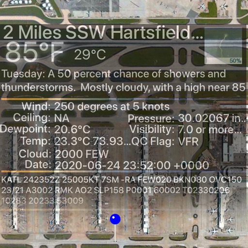
RadarScope is an AMS-award-winning weather visualization tool that empowers meteorologists, public safety officials, storm spotters, and weather enthusiasts to view a full suite of single-site radar data and related severe weather products. Your initial purchase provides professional radar visualization in a fully native app, free from distracting and invasive practices, with optional subscription packages to add even more capabilities. Whether you’re scanning for a mesocyclone’s tell-tale hook echo, pinpointing the landfall of a hurricane’s eye wall, or identifying velocity couplet, hail spike, or debris ball signatures, RadarScope displays native radar data in its original radial format. You see what the radar sees almost as soon as the radar sees it, with automatic updates every two to ten minutes depending on the radar’s scanning strategy. Your initial app purchase includes the following: • Full suite of single-site radar products for the US, Canada, Guam, Denmark, Finland, and Germany • 10-frame radar loops • Two built-in providers for radar data • Tornado, thunderstorm, flash flood, marine, snow squall, extreme wind, tropical, and other warnings in the US • Selected severe weather warnings in Canada and Australia • Severe weather watches in the US and Canada • NWS-generated storm tracks with hail, TVS, and mesocyclone attributes • Inspector and distance tools • Color palette options for radar data • Weather Pulse data plan integration • Spotter Network integration for storm and location reporting • mPING integration for submitting weather reports to NSSL • Bundled maps with political borders, water bodies, and highways, optimized for low-bandwidth use • Support for widgets and complications • Universal app for Apple platforms, including Apple Watch, and Apple TV • CarPlay support • Family Sharing support RadarScope Pro Tier One is an optional annual subscription that adds more features for tracking severe weather: • 30-frame radar loops • Cloud-to-ground lightning strikes • Special weather statements in the US and Canada • Mesoscale convective and precipitation discussions • SPC convective, tornado, hail, wind, and fire outlooks • WPC excessive rainfall outlooks in the US • Local storm reports in the US • Custom color palette support • Multi-pane display (2 on phones; 4 on larger devices) • Family Sharing support RadarScope Pro Tier Two is an optional annual or monthly subscription that transforms RadarScope into a more complete visualization tool for a larger suite of weather products, including: • Everything in Pro Tier One • 50-frame radar loops • A third provider for US radar data • 30-year archive of NEXRAD Level II radar data • 6-year archive of NEXRAD Level III data • 30-day archive of super-res and non-US radar data • 20-year archive of NWS bulletins • GOES satellite data • Multi-Radar Multi-Sensor (MRMS) data • Real-Time Mesoscale Assimilation (RTMA) data • GFS, ECMWF, HRRR, HRW, NAM, and RRFS model data • Surface observations • ProbSevere layer • Atmospheric soundings in the US • Hail size, hail probability, and azimuthal shear contours with a 30-day archive • More detailed transportation and satellite imagery maps • Custom color palette support for GOES, MRMS, RTMA, and forecast products • Server-sent events for radar and warning updates • Cross-platform subscription sharing on up to 5 devices If you choose to buy a RadarScope Pro subscription, it will be charged to your App Store account. The subscription will be auto-renewed within 24 hours prior to the end of the current period at the same price you originally paid. Subscriptions may be managed and auto-renewal disabled via your App Store account settings after the purchase. Once purchased, the subscription cannot be canceled during the active subscription period. DTN is committed to safeguarding your privacy online. Our privacy policy is available for review at https://www.dtn.com/privacy-policy/ Please visit our web site for more information.
Descrizione
Tides PRO is a beautiful tide prediction app for iPhone, iPad and Apple Watch that helps you know up-to-the-minute facts about the predicted tide height in the United States, Canada, Japan, Portugal, France, Germany, United Kingdom, Australia, New Zealand, China and other countries. Get high and low tide times, tide charts, tide tables for over 17000 of ports, harbors and coastal locations around the World. Designed with lots of passion & love: * The application includes 4 modes: Tide graphs, Tide tables, Tide maps and unique "Tide watch" interface that provides all tide information at a glance. * Tides PRO optimized for modern devices to provide HD graphics, animations and video effects Tide graph: * Interactive graph shows tide predictions, current time, Sunrise, Sunset, Moonrise, Moonset times * Swipe left and right to get tide predictions with up to the minute accuracy for the next few days * Tap on "Calendar" to open calendar and get tidal predictions up to the next 365 days * Tap on "Now" button to show current time on the graph Tide tables: * Tide calendar for the next 365 days * Highest tides & lowest tides * Swipe up and down to see water levels * Tap on specific day to show it in Tide graph mode “Tide watch” display: * Live tidal clock * Count down the number of hours, minutes and seconds to the next High tide or Low tide Apple Watch: * Apple Watch complications: Modular Large & Small, Graphic Rectangular, Corner & Circular, Circular Small, Extra Large, Utilitarian Small & Large * Current water level * Today's high tide and low tide times * Sunrise/Sunset, Moonrise/Moonset times Map: * Provides fast and convenient access to local or international tide stations * View Tide stations near you * Tap on Tide station to get current water level, high and low tide times * Tap on "Star" to add tide station to the list of favorites Specifications: -High and Low tide times for the next 365 days -Sunrise, Sunset, Moonrise, Moonset times -Solunar charts -Current water level -Up to minute predictions -"Tide watch" interface that provides all tide information at a glance -Min & max water levels displayed in a special designed interactive table -Interactive map of tide sites (local and worldwide) that provides information about current level, high tide and low tide times -Location can be added by name, by the map or using user's current location Tide stations in all regions: 183 Africa 1155 Asia 171 Atlantic Islands 815 Austral-Asia 205 Caribbean Islands 34 Cen.America Caribbean 508 Europe 127 Indian Ocean 57 Mediterranean 43 Middle East 4292 North America,Atlantic 727 North America,Gulf 2777 North America,Pacific 196 Northern seas 341 Pacific Islands 155 S.America,Atlantic 52 S.America,Caribbean 142 S.America,Pacific 520 South East Asia in 150 countries: >7000 USA 1716 Canada 802 Japan 422 Australia 245 New Zealand 277 Philippines 108 Brazil 153 Russia 58 Kuril Islands 177 Indonesia 128 China 116 Chile 112 United Kingdom 80 Mexico 69 Greenland 98 France 74 Germany 54 Bahamas 47 India 47 Vietnam 52 Netherlands 34 Italy 33 Korea 22 Portugal ... the list includes almost all coastal countries around the world Knowledge of tides is an important element of boating safety. Tidal information is essential for navigating a shallow waterway or placing your boat at anchor. The success or failure of a voyage can depend on the height or depth of a tide, while knowledge of current information can save fuel and make passage into a river or channel safer. Tides PRO goes further than the tables provided by the NOAA. The app automatically accounts for correction factors and provides instant information without requesting that you account for time lags, daylight savings conventions, or height differences between the reference stations and the locations you are seeking. Since the tidal information that is published in this app is not subjected to the use of the voyage, please do not use for navigation
Descrizione
***** 70% OFF, Hurry now !!! “The Very First of Its Kind” 3DWeather is an impressive weather app for your macOS and unlike any other weather app available, 3DWeather brings you weather information in an amazing 3D style, so that what matters most to you, all the important weather updates are delivered to you through widget which sits looking attractive on your desktop displaying the weather of a place . It lets you keep a 3D animating widget on the desktop that generates the scenic representation of the current weather condition of the place you set. STUNNING THEMES: 3DWeather never gets monotonous and will never look old to you, because, as weather condition changes so does the app, representing the accurate information of the weather of that time. 3DWeather comes packed with themes featuring different scenes, places and atmosphere. It has several themes to select from, containing different natural elements and atmosphere. We've been constantly updating 3DWeather with new themes and features to make it an ideal weather app for you. CUSTOMIZATION: 3DWeather lets you customise it to such extent that it will become your very own personal weather assistant. DETAILED WEATHER STATISTICS from WEATHER UNDERGROUND: 3DWeather fetches weather stats from Weather Underground which is the most accurate and detailed weather forecast provider available world wide till date. Weather Informations - Humidity - Dew Point - UV index - Wind chill - Heat index - Visibility - WNW - Precipitation in percentage - Precipitation in mm - Sunset and Sunrise timing with last update time - Hourly weather forecast for the next 24 hours - Daily weather forecast for the next 4 days ALERT IN NOTIFICATION CENTRE: You will get timely weather alert directly sent to the Notification Centre about recent updates and developments on weather throughout the day. So, download 3DWeather today and embrace a new approach of displaying weather forecast which is both informative and delightful to look at.
Descrizione
Weather Dock Express is the most modern, innovative, and beautiful Weather application. Weather Dock Express features stunning photorealistic animations, super accurate weather forecasts, gorgeous interactive 3D Graphics, and even Live Tropical Storm, Earthquake, Clouds, and Sunlight data. View photorealistic animations with animated Rain, Snow, Clouds, the Sun, Moon, even Lightning, and more! Or view an Interactive 3D Solar System or view Planets (with Planetary data) individually right from the Menu Bar! Weather Dock Express combines sophisticated technology with stunning design -- all while being super easy to use! Ridiculously Advanced Features! - Left-click the Dock Icon to bring up the main Weather window (only if Weather Dock Express is in the background, if in the foreground choose File > Main Window) - Left-click on the Menu Bar Item to bring up the Current conditions and Five Day forecast Menu -- anywhere system-wide - Right-Click the Menu Bar Item to bring up a 12-Hour Forecast and Live Interactive 3D Earth; also system-wide - Resize the main Weather window to automatically turn the 5-Day Forecast into a 10-Day forecast - Click on Current Conditions or Five-Day Icon (on the main window) to view detailed Forecast information for that time period (currently only U.S. only) - Choose a Forecast in the Menu Bar Item to view detailed Forecast information for that time period (currently U.S. only) - Works for over 200,000 Locations worldwide - Unlimited Multiple Locations - Weather data updates every 15 minutes - Switch Locations instantly from the Locations Menu - Retina Display support - Incredibly advanced, yet super easy to use Innovative Live 3D Earth Our Interactive 3D Earth features a plethora of real-time data sources unseen in applications today; The Live 3D Earth features: - All Earthquakes that have happened in the past 24 hours - Names of current Tropical Disturbances, Depressions, Storms, and Hurricanes; including Live Wind Speed - Live Clouds shows storms as they form - Live Sunlight direction that shows shadowed and lit portions of the Earth *If you like Weather Dock Express, please show your support by leaving us a good review -- good reviews keep the updates coming!*
Descrizione
Wo immer Sie sind Thermo gibt Ihnen die lokale Außentemperatur, direkt auf Ihrem Mac. Nie das Haus verlassen unvorbereitet. Thermox sagt Ihnen, wie viel Grad sind draußen und die klimatischen Bedingungen. Temperatur in Grad Celsius (°C) Grad Fahrenheit (°F) und Kelvin (K). Mit einem spektakulären Design und intuitive diese Anwendung bietet eine angenehme Erfahrung und Zuverlässigkeit in der Anwendung. Stellen Sie sicher, dass Sie eine WLAN Verbindung zum Internet haben. An diesem Punkt der Anwendung wird Ihre geografische Lage zu erkennen. Es zeigt Ihnen den Namen der Lage, die klimatischen Bedingungen und die aktuelle Außentemperatur, auch die früheren Tagestemperatur in derselben Stunde anzeigt. Die Daten werden durch apixu.com bereitgestellt [ FEATURES ] • Echtzeit- Temperaturmessung außerhalb • Die Temperatur in Grad Celsius (°C) , Fahrenheit (°F) und Kelvin (K) • Zuverlässigkeit in der Anwendung (Daten aus apixu.com) • Grafik intuitive • Benutzerfreundlichkeit [ KOMPATIBILITÄT ] macOS 10.14 und höher. Thermox ist auch für iOS (iPhone , iPad und iPod touch) erhältlich. [ UNTERSTÜTZTE SPRACHEN ] • Deutsch, Italienisch, Spanisch, Französisch, Portugiesisch, Niederländisch, Russisch, Chinesisch und Japanisch. [ HILFE ] Wenn Sie Hilfe benötigen, kontaktieren Sie uns unter [email protected] , oder besuchen Sie unsere Website www.lionsapp.com. Wenn Sie die App zu genießen, vergessen Sie nicht, uns eine Bewertung zu dem Mac App Store.
Descrizione
Introducing Motion Weather 4K: The most insanely beautiful and innovative weather application ever conceived. Motion Weather 4K turns your Wallpaper into breathtaking Cinema quality 4K video based on the Weather conditions outside — and is an excellent weather application in it’s own right. Motion Weather 4K also “knows” when it’s day time and night time and automatically switches to night time 4K videos when it’s night outside! We’ve spent countless hours shooting and licensing some of the highest quality 4K videos in the world to deliver an experience like no other; and then spent even more time developing the app itself. This application is so crazy, that is has *three* different Preferences Windows: Weather Preferences (Set Weather Options and Locations), Display Preferences (Customize Wallpaper for each display), and the Desklet Manager which lets you add over 30 Desklets to your Desktop that are completely customizable. In addition to adding Desklets to your Desktop individually, you can also set Motion Weather 4K so it automatically adds customized Desklets for each Theme — giving you relative information right on your Desktop when you need it and ensuring your Wallpaper and Desklets will always match. Motion Weather 4K also features the ability to choose a custom 4K video (with Graphical Theme chooser), includes Unlimited Display support that lets you customize each Display individually, and also has a super efficient video player foundation that can play full 4K videos while consuming less than 5% CPU per display. If that *still* wasn’t enough, we went ahead and built in a 3D Solar System and 3D Planets with live data that can be interacted with manually. With all these features, Motion Weather 4K delivers a breathtaking and soothing experience like no other! Main features: - Automatically changes your Wallpaper based on conditions outside in stunning 4K Ultra HD Video - Knows when it’s Day or Night time and changes 4K Videos accordingly - Add up to 30 Desklets to your Desktop allowing full customizability over position, size, font, foreground color, and background color - Optionally set Desklets to be automatically added and customized for each Theme as the Wallpaper changes - Choose a Custom 4K Video with Graphical Theme Chooser, turning off automatic Wallpaper updates - Super efficient Video Player foundation can play full 4K videos while averaging 5% CPU per display - Main Weather window matches with Wallpaper background - Works for hundreds of thousands of locations worldwide - Unlimited Display support - Unlimited Multiple Locations - Weather data updates every 15 minutes - Switch Locations instantly from the Locations Menu - Incredibly advanced, yet super easy to use Basic Usage: - Left-click the Dock Icon to bring up the main Weather window (only if Motion Weather 4K is in the background, if in the foreground choose File > Main Window) - Left-click on the Menu Bar Item to bring up the Current conditions and Five Day forecast Menu — anywhere system-wide - Right-Click the Menu Bar Item to bring up a 12-Hour Forecast and Live Interactive 3D Earth; also system-wide - Click on Five-Day Icon (on the main window) to view detailed Forecast information for that time period (U.S. only) - Choose a Forecast in the Menu Bar Item to view detailed Forecast information for that time period (U.S. only) Motion Weather 4K features 4K Videos for the following weather conditions for both day and night (Over 20 4K Videos total!): - Clear/Sunny - Partly Cloudy - Mostly Cloudy - Very Cloudy - Light Clouds - Medium Clouds - Heavy Clouds - Rain - Lightning - Snow
Descrizione
WEATHERTRACK Fantastische, genaue Wetterinformationen auf Knopfdruck. Weltweit. "An incredibly comprehensive weather app - it accesses many data models from different agencies and provides worldwide coverage. The GRIB layers include wind, precipitation, wave height/direction/period, ocean and tidal currents, air and sea temps, relative humidity and more. WeatherTrack works offline, and GRIB files can be downloaded through an SSB connection, an Iridium AxcessPoint or as an email attachment and opened in the app." (App of the month! in Cruisingworld) http://goo.gl/PLzpI0 (auf einen Blick) Offizieller Partner im AMERICA's CUP TEAM ARTEMIS (2013). Vorhersagen für Profis und Amateure "Nutze die App seit 4 Jahren und bin absolut zufrieden!!! Sehr individuell, zuverlässige Vorhersage und kleines Datenvolumen beim Download...(Mittelmeer)" Alles, was man sich von einer App nur wünschen kann: +++ GRIB ANZEIGER - Funktionen im Detail: Interessengebiet auswählen und GRIB Dateien laden. Sehen Sie sich die Vorhersagen online/offline an,als Ortsvorhersagen oder im Meteogramm. GRIB Ebenen: + Windgeschw./-Richtung (10 m msl) + Böen + CAPE: Indikator für mögliches Unwetter + Niederschlag (Regen/Schnee) + Taupunkt + Bewölkung + Wellenhöhe/-Richtung/Periode + Strom (RTOFS) + Luftdruck (Hochs (H)/Tiefs (T)) + Wasser-/Lufttemp. + Lufttemp. bei 500 mb + Geopot. Höhe bei 500 mb + Rel. Luftfeuchtigkeit Vorhersagen: + Weltweite Abdeckung + Vorhersagen bis 16 Tagen + Wettermodelle: GFS, COAMPS, NAVGEM; Strom: RTOFS; Wellen:WW3,WAM85,FNMOC-WW3/FNMOC-MED/FNMOC-EQAM + Auflösung:0.05°, 0.5°, 1°, 2°, 2.5° (je nach Wettermodell) + Vorhersageintervall: 3h, 6h, 12h, 24h + Aktualis. alle 6 Stunden (GFS) Karte: + Offline, hoch aufgelöste Vektorkarte. + Vergrößern bis zu 0.001° (111 m /121 yd) - (für sehr hoch aufgelöste GRIB Dateien) + Konfigurierbar + Online (Satellit/Hybrid/Kartenanzeige) Speziell: + Funktioniert leicht bei niedriger Bandbreite + Benutzerfreundlich + Meteogramm dynamisch, zeigt jede Ebene an + Öffnet GRIB Dateien von Email/Browser/Dritten + Teilen + City/Airport Suche + Lupe + In-app Hilfe (offline) + Animation jeder GRIB Ebene - ansehen & teilen + Import/Export von GRIB Dateien zu/vom PC (via iTunes) + GRIB via Iridium access point +++ Streckenwetter nützlich für eine gute Reisevorbereitung (In-App Kauf). http://goo.gl/PXFCIj + Erstellen eigener Routen/aus anderen Apps importieren/exportieren. (z.B. Dropbox). + Wegpunkt bearbeiten: Name, Lat/Long, Dauer, (geschätzte) Geschwindigkeit, Kraftstoff. + Windmodus: wahr, relativ, scheinbar + Streckenmeteogram + Komplette Strecken Dateien per email teilen/in anderen Apps öffnen. (z.B. Dropbox). + Online Karte (Satellit/Hybrid/Kartenanzeige) +++ GRIB Robot (engl.) (subscription**) Makes the retrieval of GRIB files over satellite connections easy. +++ Tidetech (subscription**) + Hoch aufgelöste Daten für Meeres-/Gezeitenstrom weltweit +++ GLOBAL-LOKAL Satellitenansicht + Faszinierender Blick aus dem Weltraum + Alle 3 Stunden Aktualisierung von weltweiter Wolkenbildung + Daten für jeden Ort per Fingertip - nicht nur für 2 Millionen Orte + Weltzeituhr, analog/digital +++ WEATHER ONLINE (engl.) Selected online resources **SUBSCRIPTIONS AUTOMATICALLY RENEW unless auto-renew is turned off at least 24-hours before end of current period. Tidetech Price: USD $7.99/mo, $34.99/6 mo, $46.99/12 mo GRIB Robot Price: USD $2.99/7d, $5.99/mo, $15.99/3 mo, $28.99/6mo Your iTunes account will automatically be charged at the same price for renewal within 24-hours prior to end of current period unless you change your subscription preferences in your account settings. More: http://goo.gl/CQHG5H WeatherTrack, das Schweizer Messer für Wetterenthusiasten! All das in einer einzigen App.
Descrizione
Tide Graph uses the harmonic predictions from thousands of US coastal stations and presents them in a fun and interactive graph. It also includes water currents and sun/moon information. NOT FOR NAVIGATIONAL PURPOSES. USE AT YOUR OWN RISK. Tides have a great influence on the lives of boaters, fishermen, surfers, coastal communities, marine life, and vacationers just to name a few. Directly or indirectly, the great flow of our massive ocean bodies of water impact the daily lives of everyone on this planet. The cyclical movement of the Earth's tides are caused by a combination of the gravitational forces of the sun and moon as well as the shape of the costal region. Unlike simple tide clocks that you can buy in novelty stores, more accurate tide predictions use special data gathered by instruments located at each tide station. The data from these measurements are used to determine the harmonic components which then feed into the mathematical algorithms which predict tides for the future. The end results are tested for accuracy and adjustments are made as necessary. Tide Graph has US owned Tide Stations Only. An internet connection is required to get the latest tide graph. - See TideGraph.com for a complete list of stations.
Descrizione
A minimalistic and beautiful visualization of the weather conditions and day and night cycle at your current location and thousands of global locations from Aarhus to Ushuaia. Now with beautiful Widgets for Big Sur. The current weather is shown at the center while the weather for the next 48 hours is displayed around the solar wheel in a very natural and intuitive fashion. In addition to the solar wheel, the sunrise and sunset times along with information about civil, nautical and astronomical twilight times are displayed as well. All this information valuable for all outdoor activities and navigation is presented in a beautiful and easy to read user interface. - Accurate weather forecasts both locally and globally - Support for Celsius and Fahrenheit units and 12/24h time display - Display local golden hour start and end times for great photography - Alarms and notifications based on various solar events such as golden hour, sunrise, sunset, noon, midnight and twilight (astronomical, nautical, civil) - Alarms can optionally be recurring and be set to notify you 5 minutes before the desired solar event - Beautiful and accurate display of sunrise/sunset times along with civil, nautical and astronomical twilight times for your outdoor activities. - Customize with your favorite locations from all-around the globe Terms of Service: http://solarwat.ch/terms.html Privacy Policy: http://solarwat.ch/privacy.html
Descrizione
Haben Sie sich jemals gefragt, wie viel Zeit vor Sonnenaufgang oder Sonnenuntergang bleibt? Lux ist in der Lage, diese und mehr zu bieten. Stellen Sie sicher, dass Sie eine WiFi-Verbindung zum Internet haben. An diesem Punkt wird die Anwendung Ihre geografische Lage erkennen. Das Display zeigt den Namen des Ortes und die Uhrzeit und Stunden bis Sonnenuntergang / Sonnenaufgang an. Der Tag- und Nachtmodus wird automatisch basierend auf Sonnenaufgang und Sonnenuntergang aktiviert. [ Eigenschaften ] • Erkennung Sonnenaufgang, Sonnenuntergang und Ihren Standort • Automatischer Hintergrundwechsel • 6 verschiedene Hintergründe zwischen Tag und Nacht • Zeitformat 12 oder 24 Stunden • Wifi benötigt [ Kompatibilität ] macOS 10.14 und höher. Lux ist auch für iOS ( iPhone, iPad und iPod ) [ Unterstützte Sprachen ] • Deutsch, Englisch, Italienisch, Spanisch, Französisch, Portugiesisch, Niederländisch, Russisch, Chinesisch und Japanisch. [ Unterstützung ] Wenn Sie Hilfe benötigen, kontaktieren Sie uns bitte unter [email protected] oder besuchen Sie unsere offizielle Website www.lionsapp.com Wenn Sie die App genießen, vergessen Sie nicht, uns einen Bericht über den App Store zu geben.
Descrizione
Willkommen bei Real-time Weather & Radar, Ihrer zuverlässigen Wetterradar- und Vorhersage-App, die Ihnen die genauesten und aktuellsten Wetterinformationen liefert, egal ob Sie einen Hurrikan verfolgen, den Niederschlag überwachen oder die lokale Wettervorhersage prüfen – die App bietet Ihnen die Tools, die Sie brauchen, um informiert und vorbereitet zu bleiben. Real-time Weather & Radar ist mehr als nur ein Radar, es bietet einzigartige Datenlösungen für alle Arten von Wetterdaten, die auf Ihre Bedürfnisse zugeschnitten sind, egal ob vor, während oder nach einem Sturm.
Descrizione
Weather4D Routing & Navigation integrates weather forecasting, routing calculations, navigation with digitized raster charts, instruments and data sharing to maximize your boating experience. Navigation See SOG, COG, VMC, HDG, TWS, AWS, ETAs, ETWs, AIS data and more in real time along with weather and routing information with a wifi connection to a transponder. Store your charts on your device for offshore/offline navigations. Set the screen to night mode after sunset to better see what’s happening outside during your watch. Set alarms to alert about excessive XTE, course deviations, surrounding boats, excessive wind speed and low depth. Take advantage of the iPad/iPhone built in compass, pressure and acceleration sensors. Connect bluetooth devices like wireless anemometers and wind vanes. Share AIS and boat sensors data like wind, current, pressure, air and sea temperature within the Weather4D users community. Activate Man Overboard safety feature to estimate drift and thus rescue location based on current and wind. Weather View combined weather data displayed in 3D HD layers animated automatically or manually by sliding a finger on the screen. Use GFS model to get started. In addition, over 35 weather and oceanographic models are available with a yearly subscription (in-app purchase). Create your own geographical zones, select the models you need and download only the characteristics that matter to you: data type, resolution, periodicity, file size, etc. GRIB files can be downloaded anywhere through a regular or satellite internet connection. Split the screen (iPad only) to combine and/or compare: navigation and weather, weather and waves or currents, two weather models… Routing Routing calculation optimizes for safety, comfort and performance when sailing, motoring, or mixing the two. Create a route and calculate its associated routings in function of departure dates/times, forecasts (weather, wave and current), minimum sailing speed, motoring speed, boat polar, maximum wind and minimum distance to the coast. Visualize sail configurations based on your routings and your own set of sails. Save waypoints, locations, simulate routes, combine them with GRIB forecast models. Restart a routing calculation at anytime from the actual boat position. Default Models and Charts ———————————— GFS global forecast model at 0.25 °, 0.5 °, 1 ° and 2 ° resolutions BING global chart OSM (Opens Street Map) global chart Optional Models (GRIBs) and Nautical Charts (additional fees apply) ——————————————————————————————- ECMWF IFS & AIFS NAM USA HRR CONUS GDPS ICON-EU Europe ICON D2 UKV ARPEGE Global, Europe AROME France, Antilles, Guyane, Polynésie, Calédonie, Indien AROME HD France Waves: GFS Wave MFWAM Global, Europe, France IFREMER Currents: Copernicus Global SMOC, IBI, NWS, Baltic, Med NCOM AMSEAS, USEAST, ALASKA, SOCAL, HAWAII HYCOM IFREMER MSC Saint Laurent Nautical Charts: GeoGarage is Weather4D supplier and offers by subscription access to more than 10,000 nautical charts derived from International Hydrographic Services. Pricing and chart selection is set per publisher. Updates are released regularly under chart publishers authority. Once the subscription is purchased, charts are instantly accessible within the application. Available publishers: NOAA RNCs (USA) CHS (Canada) WAVEYLINE (Bahamas) DHNV (Venezuela) DHN (Brazil) SHN (Argentina) LINZ (New Zealand) SHOM (France / DOM-TOM / Polynesia + international) UKHO (UK and dependencies + international) BSH (Germany) NLHO (Netherlands) VLAAMSE (Belgium) DGA (Denmark) NHS (Norway) ICG-HD (Iceland) NAVIMAP / IIM (Italy) ENC_ES (Spain) ENC_HR (Croatia) ENC_PL (Poland) ENC_PT (Portugal) ENC_AU (Australia) BLP (West Mexico) IMRAY (North Sea, English Channel, West Britain & Ireland, Atlantic France, Iberia & Atlantic Islands, Western Mediterranean, Central Mediterranean, East Mediterranean, Netherlands) GeoCuba (Cuba)
Descrizione
DockMeteo zeigt im Dock das Wetter an. Anhand des Standorts wird das Wetter ermittelt und grafisch dargestellt. Die Temperatur und der Standort werden ebenfalls angezeigt. Das Design ist modern auf das aktuelle macOS System ausgelegt, so dass sich das Symbol wunderschön in die anderen Dock-Symbole einreiht.
Descrizione
Software to work with a range of electronic personal weather stations, either directly (USB) or via API data or via WIFI. Graphs, logs, displays your data and can send your data to weather wunderground , CWOP , Wunderground.com or similar cloud services and even FTP (SFTP,FTP, FTPS) images and files to your web site, as well as send emails , push alerts, update twitter , mastodon, weathercloud, NOAA Forecast download, METAR download, Slack API messenger, etc. It's very powerful and comprehensive and very configurable. Your data, your way!
Descrizione
*** AeroWeather: for pilots, aviation enthusiasts, and everyone who is serious about the weather! *** Current and precise weather conditions (METAR) and forecasts (TAF). AeroWeather Pro provides quick and intuitive access to METAR and TAF for airports worldwide. Data can be shown in its original (raw) format or as fully decoded and easy understandable texts. AeroWeather Pro is helpful for weather preflight-briefings, but also to just get very precise weather. All weather data is cached for offline access. In addition to weather data, AeroWeather Pro integrates also airport NOTAMs (provided by US FAA), webcam images around airports (provided by windy.com), FlightService access (US only), and US ATC delay information (provided by US FAA). AeroWeather Pro also offers built-in groups for earthquakes, nearby stations, and today widget (pre iOS14), which can be individually enabled on the top level view. Besides creating user groups it’s also possible to put stations on the same level user groups (e.g. home base). Depending on your needs, groups can be shown or hidden in the main list view. User groups can also be synchronized via Cloud Kit*. The app features a built-in airport database, which includes airport data like runways, sunrise/sunset, twilight times, moon times, timezones etc. METAR alert notifications** is another new and helpful feature to stay up-to-date. Define multiple alerts for each station with criteria like: flight rule (US NOAA), wind speed, temperature, pressure, present weather, visibility etc. Notifications will be sent to your device if the criteria is met (e.g., when flight rule becomes IFR). Dedicated METAR/TAF** access is optionally available. METAR/TAF data will come primarily from a certified ANSP (air navigation service provider) and is provided reliably and fast from our dedicated, redundant servers (indicated by blue checkmark underneath METAR/TAF). The AeroPix feature offers users the possibility to take quickly picture(s) of the weather at their current location. AeroWeather Pro comes with an Apple Watch app, which shows either a list of stations as defined in the Apple Watch group or all nearby stations based on the current location. METAR and TAF are displayed for each station. In addition, you can put AeroWeather as a complication in your watch face to stay up-to-date. Please consult our web-site for a full description of all features. * Additional functionality which needs to be unlocked (one-time purchase). These purchases are not transferable between Lite, Pro, and Mac. ** SUBSCRIPTIONS Additional features which generate recurring operation costs for us will be offered within a subscription. The following features are enabled while 'First' subscription is active: - Dedicated METAR/TAF data source - Meteograms - Alert push notifications - D-ATIS (bigger US airports only) - Area Forecast Discussions (currently US only) - RVR data (US and Germany only) - Home Screen Widgets for METAR, Plot, Meteogram - Imagery and Charts (requires 'Captain' subscription) - SIGMETs (requires 'Captain' subscription) Additional features are also enabled when using AeroWeather Lite. The subscription varies in time periods (1 month, 12 months). The subscription is valid in both AeroWeather Lite and Pro. Cross app subscription support is only available if iCloud (with the same Apple ID) is enabled. Previously purchased unlock features are not affected and will work with or without subscription. Auto-renewal may be turned off at any time by going to your account settings. A payment will be charged to your iTunes account at the end of the free trial period. Your iTunes account will be charged for renewal within 24 hours prior to the end of the current period. No commitment - you can cancel any time. Pleas read the full “Subscription Terms of Use” at: https://www.lakehorn.com/subscription-terms-of-use/
Descrizione
Our birthday-special 50% discount during the whole week! Absolut genaue Windvorhersage! WINDY PRO - Ist eine praktische Anwendung für windsüchtige Menschen, die genaue und klare weltweite Windprognose benötigen. Ein Muss für jeden Kiteboarder, Windsurfer, Segler, Skydiver, Gleitschirmflieger, Radfahrer und Fischer. FEATURES: • Interaktive Windkarte - Du kannst auf der Karte erkennen wie der Wind bläst • Weltweite Windvorhersage für die nächsten 10 Tage in 3 Stundenschritten (wie windguru GFS27 ) • Gezeiten, Wellen • Bewölkung, Temperatur, Niederschlag • 40.000 Spots in der Datenbank • Einfache Suche nach Spots über die Karte oder Suchfeld • Speichere deine beliebten Spots als Favorit • Erstelle neue Spots Nutzungsbedingungen: https://windyapp.co/CustomMenuItems/34/en
Descrizione
MOON is your personal lunar portal. Never be caught off-guard by moon-related craziness again. View the current moon phase, see what the moon will be like on a certain date, see countdowns to moon events, receive notifications with enough time to avoid unpleasantness, and share the moon phase with your friends. MOON is the most thoughtful moon phase calendar available. It becomes increasingly useful the more you use it. Enjoy. Features * Works offline, never be stranded without lunar positioning * Notification Center widget * Moon predictor * Share today's moon on Facebook, Twitter, etc * Share how the moon looks on any date * Countdown to upcoming New and Full Moons * Built for OS X MOON is also available on iOS!
Descrizione
Visualisierte METAR- und TAF-Wetterinformationen für alle Flughäfen der Welt. Prägnante Zusammenfassung von allem, was du über das aktuelle Flugwetter wissen musst. METAR-Funktionen: - Visualisiert in leicht verständlichen und farbenfrohen Metriken - Wettersymbole für signifikantes Wetter und Wolken, wie in einem Nicht-Flugwetterbericht - Seitenwindberechnungen durch Kombination von METAR- und Landebahninformationen - Kategorie Flugregeln: VFR, MVFR, IFR, LIFR - Vorlesen durch Text-to-Speech möglich, höre dir einen dekodierten METAR an, während du andere Dinge tust TAF-Funktionen: - TAF aufgeschlüsselt und pro Stunde in einer Tabelle angezeigt - Anzeige von Sonnenaufgang/Sonnenuntergang, Mindest- und Höchsttemperatur Den Überblick behalten: - Füge deine Lieblingsstationen zur Liste hinzu und sieh ihr Wetter auf einen Blick - Erhalte Beobachtungen in der Nähe deines Standorts - Finde Stationen auf der interaktiven Karte mit Wettercodes - Suche nach Flughäfen nach ICAO-Code oder Name Historie: - Diagramme mit Wettertrends von heute und gestern: Temperatur, Sichtweite, Windgeschwindigkeit, QNH - METAR-Historie für die letzten Stunden und Link zu weiteren auf der Website Flughafeninformationen: - Informationen über die Flughäfen, wie z.B. die Richtung der Start- und Landebahn, Höhe und Lage - Wenn der Flughafen keinen METAR meldet, wird die nächstgelegene Station für die Berechnungen verwendet Berechnungen: - Alle Einheiten sind anpassbar: Geschwindigkeit (Knoten, km/h, m/s, mph), Höhe (Meter/Fuß), Sichtweite (Kilometer/Meilen), Temperatur (Celcius/Fahrenheit) und Luftdruck (Hectopascal, Inch Hg) - Die Zeiten werden für jeden Flughafen in die Ortszeit umgerechnet. - Sonnenaufgang und Sonnenuntergang werden anhand des Breitengrads/Längengrads des Flughafens berechnet. Allgemeines: - METAR, TAF und Flughafendaten werden automatisch für die Offline-Nutzung gespeichert - Verfügbar in 6 Sprachen: Englisch, Niederländisch, Spanisch, Portugiesisch, Deutsch und Französisch
Descrizione
This app solves a wind triangle by allowing you entering four values out of six (three speeds and three angles) and calculating the remaining two. It then explains step by step how you get a solution using an animated flight computer showing how to perform each step: the animation rotates the disk, slides it and add marks. It also shows which of the given values to use for each step towards the solution. It also contains an example generator for the 15 different cases of 4 given values with 2 to calculate. Occasionally it also produces "impossible" values, such as triangles degenerated to a single line or data for which it is not possible to construct a wind triangle. This is deliberate to let a (student) pilot think about the data entered and find good data starting from there. For each set of good data, it draws a wind triangle, giving you an insight in how to navigate. It illustrates this by showing a little plane flying along a course while compensating for the wind using a correct heading. The conversions show you different units in SI and Imperial dimensions, while the calculators help you find cross wind components or help you preparing your flight. Features - Solves any kind of wind triangle problem and explains how to find those results on a flight computer. - Contains an accurate visualization of a flight computer and animates the different steps towards a solution. - Generates examples for 15 different cases of four given values and two results to obtain. Draws the wind triangle complying with the given data. - Enter data using the keyboard or by pressing buttons to increase of decrease values. - Contains a small animation showing why you need a wind triangle to navigate. - Offers conversions for fuel, speed, climb rate, altitude, distance, mass and temperature. - A small calculator helps you determining e.g. EET and another calculates the cross wind, head wind and tail wind. - An explain tab gives you a short explanation of this app. - Select one of the possible languages: English (Default), French, German, Spanish and Dutch. - Switches to light or dark theme, depending on the system settings.
Descrizione
Mooncast ist eine wunderschön gestaltete App, die die aktuelle Phase des Mondes mit Präzision und Klarheit zeigt. Diese App ist sowohl für ungezwungene Neugierde als auch für ernsthafte Himmelsbeobachter konzipiert. Erforschen Sie den Mondzyklus mit reichen visuellen Details, wischen Sie durch die Tage, um vergangene und zukünftige Phasen zu sehen, und finden Sie sofort den nächsten Vollmond oder Neumond. Mooncast gibt Ihnen genaue Monddaten für jedes Datum zwischen 2011 und 2035, einschließlich des genauen Moments, in dem der Mond perfekt voll wird. Eigenschaften: - Atemberaubende, hochtreue Mondphasen-Visuals - Interaktive Zeitleiste - wischen Sie, um jeden Tag zu erkunden - Genaue Vorhersagen für Vollmonde, Neumonde und alle Mondphasen - Eingebauter Almanach für langfristiges Surfen und Planen - Präzise Zeitstempel für Peak-Vollmond und Neumond - Intelligente Erinnerungen für Vollmond- und Neumondveranstaltungen - Anpassbarer Look - wählen Sie Ihren Lieblingshimmel und Ihre Lieblingswolken - Verschiedene Arten von Widgets und Zubehör sind verfügbar Umfangreiche Berichterstattung: - Verfügbar auf iPhone, iPad, Mac, Apple Watch und Apple TV Internationale Unterstützung: - Vollständig lokalisiert in Englisch, Französisch, Spanisch, Italienisch, Deutsch, Russisch - Funktioniert nahtlos mit allen Gebietsschemata und Kalendersystemen Mooncast ist einfach zu bedienen, wissenschaftlich genau und visuell verfeinert - der Mondkalender, den Sie jeden Tag gerne überprüfen werden.
Descrizione
WeatherMenu - Your Weather at a glance! Stay ahead of the weather without leaving your workflow. WeatherMenu puts comprehensive weather data exactly where you need it in your Mac's menu bar. Whether you're planning your day scheduling outdoor activities, or tracking weather for multiple cities, everything is just one click away. INSTANT ACCESS IN YOUR MENU BAR See current temperature and conditions in your menu bar at all times. One click reveals detailed forecasts, interactive charts, and hourly predictions all in a beautifully designed popover that won't disrupt your work. INTERACTIVE WEATHER VISUALIZATION Understand weather patterns at a glance with stunning interactive charts: - Temperature trends - Visualize how temperatures change throughout the day - Wind speed and gusts - Track wind conditions with directional indicators - Humidity levels - Monitor moisture levels hour by hour - UV Index - Plan sun protection based on UV forecasts - Precipitation probability - Know exactly when rain is coming Tap any point on the chart to see detailed metrics for that specific hour. TRACK WEATHER ANYWHERE - Current Location - Automatic weather updates based on your GPS location - Multiple Locations - Add unlimited cities worldwide with a comprehensive database - Smart Search - Lightning-fast city search across thousands of cities worldwide - Timezone-Aware - Weather data automatically adjusts to each location's timezone PERSONALIZATION Customize WeatherMenu to match your preferences: - 5 Beautiful Themes - Temperature Units - Switch between Fahrenheit and Celsius instantly - Wind Speed Units - Display in mph, km/h, m/s, or knots - Menu Bar Display - Show or hide weather in your menu bar based on your preference PRIVACY-FIRST DESIGN - Your location data never leaves your device - No tracking, no analytics, no third-party data sharing - Weather data fetched directly from Apple's secure servers - All settings synced privately via iCloud SMART FEATURES - Intelligent Caching - Reduces network requests while keeping data fresh - Launch on Login - Start automatically with your Mac - Keyboard Accessible - Full support for keyboard navigation and VoiceOver - Multi-Language Support - Available in English, Spanish, French, German, Japanese, Russian, Chinese, Arabic, and Korean - Weather Alerts - Get notified of severe weather conditions when available PERFECT FOR - Remote Workers - Quick weather checks without context switching - Travelers - Monitor weather in multiple cities simultaneously - Outdoor Enthusiasts - Detailed wind, UV, and precipitation data for planning activities - Productivity Focused Users - Minimal, distraction-free weather access - Anyone who wants beautiful, accessible weather data at their fingertips WHY WEATHERMENU STANDS OUT Unlike other weather apps: - No cluttered interfaces with ads - No subscription fees or in-app purchases - No data harvesting or privacy concerns - No need to open a separate app window With WeatherMenu: - Lightweight, clean, focused design that respects your workflow - One-time purchase, yours forever - Privacy-first approach with Apple's secure weather data - Instant access from anywhere on your Mac That's it. No accounts to create. No complicated setup. Just beautiful weather data when you need it.
Descrizione
Die völlig andere Uhrzeit- und Wetter-App. Living Earth präsentiert eine atemberaubende 3D-Simulation unseres Planeten in Echtzeit mit einem Überblick über das Wetter, Wettervorhersagen und Zeitanzeigen für Städte auf der ganzen Welt. Sieh dir Bilder von Wolkenformationen, Hurrikanen und tropischen Stürmen an. Entdecke und erlebe beeindruckende Wetterdynamiken auf unserem Planeten in Echtzeit mit Wetterkarten und der Verfolgung tropischer Wirbelstürme. Betrachte unseren Planeten, wie er inmitten eines Universums von Tausenden von präzise dargestellten Sternen seine Bahn zieht, und lass dich von einer völlig neuen Perspektive zu Zeit und Wetter faszinieren. „In einem Meer von komplizierten und ambitiösen Apps hebt sich Living Earth durch bildschöne Schlichtheit hervor.“ -New York Times „Eine beeindruckende App, mit der die Erde basierend auf weltweiten Wetterberichten in Echtzeit gezeigt wird. “ -WIRED Insider 'Must Have Apps' UNIVERSAL-ANWENDUNG Ein Kauf für alle Geräte – iPhone und iPad FUNKTIONEN • Wolken werden mit Satelliten-Wolkendaten nahezu in Echtzeit wiedergegeben (alle 3 Stunden). Sieh dir Bilder von Wolkenformationen, Hurrikanen und tropischen Stürmen an. • Live-Wetterkarten mit Temperatur-, Luftfeuchtigkeits- und Windanzeigen sowie Wettervorhersagen. • Weltzeituhr, Wetteranzeige und langfristige Wettervorhersagen für Millionen von Städten weltweit mit 10-Tage- und 2-Stunden-Vorhersagen. • Benachrichtigungen über tropische Wirbelstürme. Erhalte Push-Benachrichtigungen über neue tropische Wirbelstürme und aktuelle Entwicklungen von Sturmsystemen. • Das Heute-Widget bietet schnellen Zugriff auf wesentliche Wetterdaten, Sonnenauf- und Sonnenuntergangszeiten, Weltzeituhr und aktive tropische Wirbelstürme. • Sterne, Konstellationen und die Milchstraße werden allesamt präzise in Raum und Zeit angezeigt. • Verfolge Finsternisse in Echtzeit: Bei einer Sonnenfinsternis wandert der Mondschatten über die Erde; bei einer Mondfinsternis leuchtet der Mond rot. • Sonnenauf- und Sonnenuntergangszeiten. • Beobachte den Wechsel der Jahreszeiten während des ganzen Jahres. Sieh dir Schnee- und Eisdecken und andere jahreszeitlich bedingte Veränderungen auf unserer Erde an. • Weckfunktion mit einer Auswahl sanfter Wecktöne. Lass dich zu einem faszinierenden Blick auf unseren Planeten wecken. • iCloud Stadt-Synchronisierung mit Living Earth App für Mac. SENDE UNS EINE E-MAIL: [email protected] FOLGE UNS: x.com/livingearthapp
Descrizione
Vielen Dank an alle, dass MyRadar so erfolgreich geworden ist. Wir konnten bisher über 35 Millionen Downloads verzeichnen! MyRadar Pro ist eine schnelle, benutzerfreundliche Wetter-App, die animierte Daten von Wetterstationen von Ihrem aktuellen Standort anzeigt. So sehen Sie schnell, welche Wetterlage auf Sie zukommt. Unsere hochauflösenden Radardaten stammen von Wetter-Rohdaten der NOAA (National Oceanic and Atmospheric Administration). Wir verarbeiten diese über unser eigenes System und unsere eigene Software und bieten Ihnen die deutlichste, schärfste, präziseste und aktuellste Darstellung des voraussichtlichen Niederschlags an. Diese Darstellung können Sie bequem mit einer Berührung Ihres Handys abrufen. Öffnen Sie einfach die App und Ihr Standort wird mit einer animierten Wetterdarstellung angezeigt. So können Sie leicht herausfinden, ob Regen zu erwarten ist. Mithilfe unserer hochauflösenden Radardaten sehen Sie ausführliche Wetterdaten selbst bei einer starker Zoomeinstellung. Der Vorteil von MyRadar ist, dass Sie die Karte leicht mit einer Fingerbewegung zoomen und bewegen können. So können Sie das Wetter in anderen Gegenden schnell einsehen (einschl. Hawaii & Puerto Rico). Neben den wichtigsten Wetterdaten erhalten Sie einen schnellen Überblick über die landesweiten Temperaturen sowie eine Überlagerung von einem aktuellen Satellitenbild zur Wolkenbedeckung. Für alle Vielflieger bieten wir auch eine Schicht mit Airmets & Sigmets und sogar die Fähigkeit, den Flugplan eines bestimmten Flugzeugs auf die Karte zu projizieren. Sie können interessante Wetterfotos von Ihrer Umgebung teilen und Fotos anderer Nutzer in schöner Darstellung auf der Karte sehen. Zu weiteren Optionen zählen Unwetterwarnungen und Wettermeldungen sowie Push-Benachrichtigungen, um Sie bei Unwetterlagen in Ihrer Gegend zu benachrichtigen. Die App eignet sich hervorragend für die Gewitter- und Tornadozeit! Es ist außerdem ein optionaler Hurrikan-Tracker enthalten, der hervorragende Informationen und Darstellungen der einzelnen Sturmwege aufzeigt. MyRadar zeigt derzeit nur Wetterdaten von den USA (einschl. Alaska, Hawaii und Puerto Rico wenn HD Radar aktiviert ist). Laden Sie MyRadar jetzt herunter und testen Sie die App!
Descrizione
Space Pulse is a location-aware Solar System dashboard which keeps celestial bodies on your Home Screen. Track the Moon, Sun, and all seven planets from your location - in the app and in widgets for iPhone, iPad, and Mac. FOR EVERY BODY - Rise, set, and next-pass times for your location - Live sky position (azimuth and elevation) and horizon status - Distance, apparent magnitude, angular size, and elongation - Positions computed on-device from JPL orbital elements THE MOON - Current phase with accurate rendered imagery - Illumination percentage, cycle day, and next phase countdown THE SUN - Live solar imagery - Solar activity: current Kp index and geomagnetic storm forecast - know when aurora may be visible - recent NASA SDO imagery, current NOAA SWPC Kp activity and a 48-hour peak forecast WIDGETS, YOUR WAY Add as many widgets as you like - one per body if you want. Each widget is individually configurable: pick the body, then choose exactly which readings it shows (phase, rise/set, position, distance, solar activity, and more). Small, medium, and large sizes, light and dark. PRIVATE BY DESIGN Your location never leaves your device. It is used only to compute sky positions and daily events.
Descrizione
FlyCheck is a native macOS utility designed for pilots who monitor METAR and TAF weather conditions during the 40 hours a week they spend at their desks. Born in a Berlin hotel room during a weather-induced grounding, FlyCheck replaces clunky browser tabs and "napkin math" with a high-contrast, professional-grade dashboard directly in your menu bar. WHY FLYCHECK? Native Excellence: Built with pure SwiftUI for Apple Silicon (M1/M2/M3), launching in 0.1s with zero impact on system performance. Airport Signage Aesthetic: We use high-contrast Helvetica Neue Condensed Bold, mimicking physical runway signage for instant, peripheral-vision legibility. Safety First: Don't just read the weather — let your Mac handle the Density Altitude and Crosswind calculations for you. Pilot-Grade Privacy: No accounts. No tracking. No subscriptions. Your data stays on your Mac.
Descrizione
Bring your personal weather station data directly to your Mac's menu bar! "Weather Menu Bar for Ecowitt PWS" is the essential app for anyone who owns an Ecowitt Personal Weather Station and wants instant, at-a-glance access to their real-time weather data. This lightweight and powerful menu bar application seamlessly integrates with the Ecowitt API to display key weather metrics, always just a click away. No more opening a browser or an app to check the conditions right outside your window. Key Features: Real-Time Data at a Glance: See the current temperature from your PWS displayed right in your macOS menu bar. A quick click reveals a full dropdown menu with a wealth of additional data. Comprehensive Weather Metrics: The menu provides a detailed view of your personal weather conditions, including: Temperature: Current outdoor temperature with an emoji that reflects the conditions. Rainfall: Daily rainfall amount. Wind Speed & Direction: Current wind speed and gust, along with a compass direction. Barometric Pressure: The relative pressure reading from your station. Dew Point & Humidity: See the moisture levels with both dew point and humidity percentage. Monitor Up to Two Locations: Do you have more than one Ecowitt PWS? The app supports monitoring two separate weather stations simultaneously. Each location has its own customizable settings. Customizable Location Labels: Easily label each weather station (e.g., "Home," "Cabin," "Office") to quickly identify which data you're viewing. Configurable Refresh Interval: You're in control of how often the app fetches new data. Set the refresh interval to a minimum of 60 seconds to ensure your data is always up-to-date. Metric and Imperial Units: Seamlessly switch between imperial (ºF, in, mph) and metric (ºC, mm, km/h, hPa) units to suit your preference. Last Updated Timestamp: Each location's data includes a timestamp to let you know exactly when the last successful update occurred. How It Works: To get started, you will need to create an API Key and an Application Key from your personal Ecowitt Personal Weather Station under your profile on the Ecowitt website. Simply enter these keys, along with your PWS's MAC Address, into the app's settings. Once configured, your weather data will automatically appear in your menu bar.
Descrizione
GlobalAlert helps you monitor natural disasters and major natural events around the world. Track earthquakes, wildfires, volcanoes, storms, floods, ice events, dust and haze events, landslides, and other active events from one app. View live activity on an interactive Apple Maps experience with earthquake markers, natural disaster icons, grouped event markers, tectonic plate boundaries, and a globe-style map view. Zoom out for a global overview or zoom in for more detail. GlobalAlert also includes local notifications, Home Screen widgets, Apple Watch support, detailed event pages, search, filters, and useful stats. Features: • Live earthquake tracking • Natural disaster monitoring • Wildfire, volcano, storm, flood, ice, dust, haze, and landslide events • Interactive global map • Apple Maps globe-style view • Tectonic plate boundaries • Grouped map markers for crowded areas • Built-in map legend • Earthquake magnitude, depth, time, location, and tsunami-related details • Search and filters • Event stats and category breakdowns • Local notifications • Home Screen widgets • Apple Watch app • iPhone, iPad, and Mac support GlobalAlert is designed for awareness and visualization. For emergency decisions, always follow official alerts, emergency services, local authorities, and government guidance. Powered by USGS All data is provided by the United States Geological Survey (USGS) for maximum accuracy and reliability.
Descrizione
Welcome to Emoji Weather, the simplest and most discreet way to stay updated with the current weather conditions, right in your macOS menu bar! Elegant Simplicity: Our app transforms complex weather data into an easily understandable emoji. Whether it's sunny, cloudy, raining, or windy, you’ll get an instant visual representation without any fuss. Temperature Updates: Stay informed with the current temperature, subtly displayed in your menu bar. It's always there, yet never in the way, providing you with the essential info at a mere glance. Compact and Discreet: We understand the value of screen space. Emoji Weather is designed to be minimally intrusive, occupying only a tiny fraction of your menu bar. It's the perfect weather companion for your daily computing, offering information without the clutter. Effortless Functionality: With Emoji Weather, there's no need to open a separate app or browser tab. The current weather is always visible, so you can stay focused on your work or play. Privacy-Friendly: Your privacy matters. Our app doesn't collect personal data, ensuring your information stays secure. Emoji Weather is more than just a utility; it's a subtle enhancement to your daily routine. Experience the weather in a way that's as delightful as it is straightforward. Download Emoji Weather today and add a touch of clarity to your menu bar!
Descrizione
Ich wollte eine einfache App, dass mir das Wetter in der Menuleiste anzeigt! Zudem sollte es viele Möglichkeiten geben um mir das Wetter anzuzeigen. Bei dieser kleinen Wetter App geht es einfach um das Wetter mit Vorhersagen (stündlich & täglich). Was braucht man mehr! Das Wetter aktualierst sich alle 30 Minuten automatisch oder manuell, wenn man sich die Details anschaut!
Descrizione
Zeitplan, Höhen und Koeffizienten der Gezeiten in mehr als 150 französischen Häfen und einigen Häfen in Großbritannien. Anwendung aus den von PreviMer bereitgestellten harmonischen Konstanten. Es ist völlig autonom: Die Internetverbindung wird nur für Updates und zur Anzeige von Karten verwendet. Keine Werbung. Keine Verwendung von Geolokalisierungsdaten außerhalb der Anwendung und nur zum Auffinden des nächstgelegenen Hafens. Alle angezeigten Ortszeiten sind Sommer- und Winterzeiten. Das Menü ermöglicht es Ihnen, die Gezeiten zu berechnen und die Einzelheiten für einen Tag oder einen Monat Ihrer Wahl anzugeben. Legen Sie Ihre eigene Schwelle fest (Mindesthöhe zum Üben der Navigation oder Höchsthöhe zum Angeln zu Fuß). Listen Sie die Hochwasser eines ausgewählten Zeitraums auf und speichern Sie möglicherweise die Niedrigwasserzeiten in Ihrem Tagebuch Geben Sie einen Wasserstand ein und definieren Sie für welche Zeiten dieser erreicht wird bzw. geben Sie für welche Zeit welcher Wasserstand ein. Sie können Tabellen und Gezeitenkarten auf Ihrem Drucker bearbeiten Fragen Sie nach anderen Ports. Vielen Dank, dass Sie Ihre Kommentare teilen, um die Anwendung weiter zu verbessern.
Descrizione
Top Weather ist eine elegante und schöne, genaue Wetter -App, die Ihnen meteorologische Informationen wie Wettervorhersage, Niederschlagsvolumen in den nächsten 10 und die Bereitstellung von MacOS -Versionen bietet. Funktion: 1. Wir behandeln detaillierte Wetterdaten in mehr als 3.000 Städten und Regionen im ganzen Land. Sorge -frei, der echte Wetterassistent. 2. Präzise Positionierung, teilen Sie Ihnen die Wettervorhersage des aktuellen Standorts mit. 3. Das Wetter in den nächsten 24 Stunden anzeigen 4. City Editoren und Suche, leicht löschen, hinzufügen, mobile Stadt, Städte, die besondere Sorge für Ihren Standort benötigen, bieten Wetter für die Anzeige. 5. Fügen Sie die Komponente zum Mobiltelefondesktop hinzu. Sie können das Wetter an diesem Tag ohne Öffnen der Anwendung anzeigen, und es gibt eine Vielzahl von intimen Funktionen wie Niederschlagsaufforderungen Kontaktieren Sie uns: [email protected]
Descrizione
The Next Generation of Aviation Weather app is here (This app is part of the Universal Purchase. With one purchase, you will be able to see the latest forecast for the US airports on your iOS and Apple TV devices.). This app is built upon both the latest METAR information and weather forecast. METAR is a format for reporting weather information. A METAR weather report is predominantly used by aircraft pilots, and by meteorologists, who use aggregated METAR information to assist in weather forecasting. Raw METAR is the most common format in the world for the transmission of observational weather data Built upon our expertise based upon our existing apps. This app provides the instant way to access weather stations with the following distinct features: - Major US airports on the map (select any station to use the latest forecast) - Major airports per state - Airports table view (select any station to see the forecast on the map) - METAR weather forecast and 7 Days forecast
Descrizione
The Next Generation of Marine Forecast app is here (This app is part of the Universal Purchase. With one purchase, you will be able to see the latest forecast for the Marine zones on your iOS and Apple TV devices.). - Great Lakes - Atlanta - Pacific - Gulf of Mexico - Alaska - Hawaii - Puerto Rico Built upon our expertise based upon our existing apps. This app provides the instant way to access weather stations with the following distinct features: - Marine zones on the map (select any station to use the latest forecast) - Marine zones per region (select a region from the right side menu) - Marine zones table view (select any station to see the forecast on the map) - 7 Days forecast
Descrizione
Northern Lights Forecast - a powerful app for catching Aurora! It will determine your location and, based on magnetic latitude, set the necessary notification settings. And as a result, in an efficient way, you will get alerts exactly at the right moment, when northern lights filled the sky! Alerts and Push Notifications: Receive real-time alerts when the aurora is visible at your location or Kp index reaches chosen value. You can customize alert level. Live Northern Lights Webcams: Watch live Aurora webcams from around the world. This is a great tool to see if the northern lights are visible near you. In the app, you can sort these webcams by distance from you or "aurora pixels", this is unique feature that detects the northern lights on webcams! Live Aurora Map: See where the best viewing of the northern lights now on the live aurora map. KP Index Forecast: Forecasts for next 3 days and next 27 days helps you to plan your aurora trip. Good luck in hunting Northern Lights and never miss it again!
Descrizione
On average, Earth is visited by a small asteroid (5-20 meters in diameter) every month! Explore the Near-Earth Objects (NEOs), Potentially Hazardous Asteroids (PHAs), and fireball events on worldwide map. - Interactive Fireball Map displaying reported meteor and bolide impact events with energy visualization - Detailed information about asteroids and their orbits - Impact Risk data section featuring Earth Impact Monitoring collision assessment data - Search through NASA's extensive asteroid database - Track close approaches to Earth and other celestial bodies - Visual distance indicators with dynamic color coding - Hazard percentage calculation based on the Palermo technical impact hazard scale - iPad optimization for a seamless experience across all devices Perfect for: - Astronomy enthusiasts - Space science students - Anyone curious about near-Earth objects and meteor events #AsteroidTracker #NearEarthObjects #SpaceScience #FireballTracking
Descrizione
Meteored - Pro Version Ihnen stehen alle Funktionen der kostenfreien Version zur Verfügung, plus: - Keine Werbung. - Stand-Alone-App. Einmalige Zahlung, erfreuen Sie sich für immer am Service. - Wählen Sie die gewünschten Informationen für Ihr Hauptdisplay. - Speichern Sie bis zu doppelt so viele Standorte wie bisher. Es handelt sich um die offizielle app von Meteored. Wetterinteressierte erfreuen sich an eigens erstellten Vorhersagen, die auf dem besten Wettermodell weltweit basieren. Verfügbar für iPhone, iPad und Apple Watch, und für iOS 26, iPadOS 26 und watchOS 26 optimiert. - WETTERWARNUNGEN UND BENACHRICHTIGUNGEN - Erhalten Sie offizielle Wetterwarnungen des DWD (Deutscher Wetterdienst) und von MeteoAlarm für Ihren Standort in Echtzeit dank unserer täglichen Warnmeldungen. Wir senden Informationen über jedes Wetterphänomen: Regen, Stürme, Temperatur, Wind, Hurrikane und tropische Stürme, Regenradar sowie andere Informationen zu spannenden Wetterberichten und Wetternachrichten. - WETTERKARTEN, NIEDERSCHLAGSRADAR UND SATELITEN - Jetzt neu! Eine neue animierte Weltkarte, die ebenfalls auf dem Europäischen Wettermodell ( ECMWF ) basiert und die Wettervorhersage für die kommenden Tage liefert. Greifen Sie auf die Radaranimation des DWDs zu und schauen Sie sich die verschiedenen Satellitenbilder an: Sichtbar, Infrarot und Wasserdampf. - AKTUELLE WETTER-NACHRICHTEN - Lies unsere täglichen Nachrichten und Artikel, um über das Wetter und die neuesten meteorologischen Phänomene wie Regen auf dem Laufenden zu bleiben. - WETTERVIDEOS - Entdecken Sie Videos von beeindruckenden Wetterphänomenen sowie exklusive wissenschaftliche Inhalte zum Verständnis der Atmosphäre und des Wetters. - WETTERVORHERSAGE - Mit einem simplen Fingerstrich liefert Ihnen die tägliche Wettervorhersage Informationen über das aktuelle Wetter und die wichtigsten Wetterdaten für die nächsten 14 Tage. Wählen Sie einen Tag aus, um detaillierte Informationen über das Wetter im Stundentakt zu erfahren, so wie den Luftdruck, die Temperatur, Windrichtung und -geschwindigkeit, Regen, gefühlte Temperatur, Feuchtigkeit, Sonnenaufgang und -untergang oder auch die Mondphasen. Wenn Sie Ihr Handy horizontal positionieren, können Sie unseren Grafiken die Klimaentwicklung entnehmen. - WETTER WIDGET - Auf einen Blick: das Wetter für die gesamte Woche in Ihrer Ortschaft mit unserem Widget, ohne die App aufrufen zu müssen. - TEILEN - Teilen Sie die Vorhersagen für Ihre Ortschaft jederzeit über jegliche Netzwerke die Sie auf Ihrem Smartphone nutzen, sei es WhatsApp, Twitter oder Facebook, mit Ihren Freunden. - VERFÜGBARKEIT - Machen Sie die nächste Ortschaft ausfindig oder suchen Sie nach Ihren Lieblingsstädten: Wetter Köln, Berlin, Hannover, München, Düsseldorf… oder auch internationale Städte wie Paris, London oder Rom. Wir stellen Ihnen über 14.000 Ortschaften in Deutschland zur Verfügung (einschließlich Skistationen) und mehr als 6.000.000 Ortschaften weltweit, um sich ausführlich über das Wetter zu informieren! - Wenn Sie die Beta-Versionen unserer App mit TestFlight testen möchten, dann folgen Sie nachstehendem Link von Ihrem iPhone oder iPad aus: https://testflight.apple.com/join/ZlUMBitu Durch die Nutzung dieser App stimmen Sie den Datenschutzrichtlinien, sowie den allgemeinen Geschäftsbestimmungen zu von Meteored. - Datenschutzrichtlinien: https://www.daswetter.com/privacy.html - Rechtlicher Hinweis: https://www.daswetter.com/impressum.html Helfen Sie uns, uns zu verbessern, indem Sie Ihre Fragen und Anregungen an [email protected] senden.
Descrizione
The Next Generation of NOAA Tides and NOAA Radar app is here (This app is part of the Universal Purchase. With one purchase, you will be able to know the NOAA Tide information on your iOS, Watch OS and Apple TV devices.). Are you going to ride a boat, going to beach or live near by the ocean? This app will give you the latest Tide information. iOS App Quick Started: > Tide stations around the globe are listed. Zoom in/out and select any city to see the Sunrise/Sunset information. > US NOAA Radar images will be loaded when the app is launched and will be refreshed every 10 minutes. And you are ready to see the latest real time radar images on the map. Zoom in and out to see the whether across multiple states. Click on the "Radar" button to enable/disable radar images. Slide the slider to change the transparency of radar images. > To see the Tide station in 3D View and view the High/Low Tide information, follow the steps below: 1. Select "Flyover" on the top to enable 3D View and you should be able to see the city in 3D View. 2. You can use two-fingers gesture to change viewing angles: zoom in/out, rotate, swipe up/down for 3D View 4. Click on any city to see the Sunrise/Sunset information Watch App Quick Started: > Launch the Watch App and the app will communicate with the iOS App to get the nearest Tide station information and also notify the iOS App to select the Tide stations and view the Tide information. Click on the "Nearest" button if you would like to search the nearest Tide station again. Introduction: This app is the Next Generation of NOAA Tides and NOAA Radar app by integrating the following technologies and data together: - The latest Apple MapKit features such as Traffic, Buildings, POI and 3D Model - Apple Watch Integration with iPhone. - Apple TV integration (Universal Purchase: one purchase to get the app on iOS, Apple Watch and Apple TV) - Real Time NOAA Radar - Databases with built in information. This app provides the following features: - The first app to integrate both Sunrise/Sunset and the latest national Radar images together. - The first app to provide Tide information and Radar images in 3D view. - One click Tide station selection by selecting the right sidebar and click on a Tide station. - One click feature switch by selecting the left sidebar and click on a feature - One click theme switch by selecting the left sidebar and click on a theme. - This app provides the Apple Watch Integration - This app will provide Apple TV integration.
Descrizione
The Next Generation of NOAA Radios and NOAA Radar app is here (This app is part of the Universal Purchase. With one purchase, you will be able to listen the NOAA Radios on your iOS and Apple TV devices.). NOAA Radios are a great extension to the NOAA Radar to listen to the latest weather information. List of the radio stations are available on the home screen. Each station has the name, city and state. Scroll down to see a list of available workstations. Click on any station and ready to list to the latest NOAA Radio.
Descrizione
The Next Generation of NOAA Alerts and NOAA Radar app is here (This app is part of the Universal Purchase. With one purchase, you will be able to see the NOAA Alerts on your iOS, Watch OS and Apple TV devices.). NOAA Alerts provide you the latest active weather alerts. Thanks for your feedback. The following features are added to the Pro version: - Landscape support is not added. - Different alert colors are added. iOS App Quick Started: > By default, alerts are loading once the app is launched. Alerts are listed based upon "Date". Once alerts are loaded, you can select "Importance" on the top to list the alerts based upon the severity. Select any alert to see the alert details. > Click on the Map tab and Alerts around the globe are listed. Zoom in/out and select any alert to see the latest weather information. Please notice alerts are being loaded dynamically, you can use "Refresh" button to refresh the latest alerts on the map. If you prefer to view alerts in different map type (Normal, Satellite, Hybrid and Flyover). Click on the "Map Type" to start to switch to different map type. > Click on the Alert Categories/Filters to select all categories or one specific category, then only alerts for the selected category will be listed. Click on "Refresh" button on the Map view and only selected category will appear on the map. > US NOAA Radar images will be loaded when the app is launched and will be refreshed every 10 minutes. And you are ready to see the latest real time radar images on the map. Zoom in and out to see the whether across multiple states. Click on the "Radar" button to enable/disable radar images. Slide the slider to change the transparency of radar images. > To see the Alerts in 3D View, follow the steps below: 1. By default, Select the Map tab and 3D View is enabled and you should be able to see the Alerts in 3D View. 2. You can use two-fingers gesture to change viewing angles: zoom in/out, rotate, swipe up/down for 3D View 3. Click on any Alert and the app will automatically zoom into the alert area. Click on the information button to see the alert details. Watch App Quick Started: > Launch the Watch App and the app will communicate with the iOS App to get the nearest Alert information and also notify the iOS App to select and view the Alert. Click on the "Nearest Alert" button if you would like to search the nearest Alert again. Introduction: This app is the Next Generation of NOAA Alerts and NOAA Radar app by integrating the following technologies and data together: - The latest Apple MapKit features such as Traffic, Buildings, POI and 3D Model - Apple Watch Integration with iPhone. - Apple TV integration (Universal Purchase: one purchase to get the app on iOS, Apple Watch and Apple TV) - NOAA Alerts - Real Time NOAA Radar - Databases with built in information. This app provides the following features: - The first app to integrate both NOAA Alerts and the latest national Radar images together. - The first app to provide NOAA Alerts and Radar images in 3D view. - This app provides the Apple Watch Integration - This app will provide Apple TV integration.
Descrizione
Ihr persönlicher Assistent für Ihre Outdoor-Fotografie. Von Apple bei "Apps that we love" vorgestellt, erhielt von FStooper das "Gütesiegel", von NoFilmSchool.com als "CoolestFilmmaking Gadget of 2016" ausgezeichnet wurde. GoldenHour.One hilft Ihnen, die beste Zeit, den besten Ort und das beste Wetter für Ihre Außenaufnahmen zu finden. Es kennt im Voraus Ihre Chance auf ein gutes Foto. Es kann die Licht-, Himmels- und Mondindexe aus der lokalen Wettervorhersage überall auf der Welt vorhersagen. =Außergewöhnliche Merkmale = Sky Index - zeigt Ihnen eine Chance auf einen dramatischen Himmel, Light Index - zeigt eine Chance für Porträts von Landschaft und Architektur. Mondindex - zeigt eine Chance für ein Mondfoto. Ein kurzer Blick und Sie wissen, ob Sie fotografieren gehen oder nicht. Wählen Sie einen beliebigen Ort auf der Karte und GoldenHour. Man wird Ihnen den Sonnenstand während der goldenen Stunde zeigen. Wenn die Sonne nicht da ist, wo Sie es sich vorgestellt haben, können Sie entweder den Stift an eine neue Position bewegen oder mit dem Schieberegler ein anderes Datum wählen, wenn die Sonne sich in der gewünschten Position befindet. GHO wird Ihnen keine Gelegenheit entgehen lassen. Wählen Sie eine Veranstaltung, an die Sie sich erinnern möchten und GoldenHour.One wird Sie voraus daran erinnern. = Eigenschaften = • Saubere und einfach zu bedienende Oberfläche • Goldene und blaue Stunde • Mondstunde - beste Zeit für Mondfoto • Sky Index - Vorhersage der Chance auf ein dramatisches Foto von Sonnenaufgang oder -untergang. • Light Index - Vorhersage der Bedingungen für Porträts, Panoramen und Architektur. • Mondindex - Vorhersage der Bedingungen für das Mondfoto. • 5-Tage-Fotografie spezifische Wettervorhersage. • Einzigartige Wetterbeschreibungen aus der Sicht eines Fotografen - Sie wissen, was Sie beim Fotografieren erwartet. • Visuelle Suche auf der Karte: Verschieben Sie die Nadel nach Bedarf. • Finden Sie den besten Platz für Ihr Foto auf der Karte. • Überprüfen Sie die Sichtlinie von Sonne und Mond auf Datum und Uhrzeit. • Liste der bevorzugten Orte und Veranstaltungen für die zukünftige Nutzung. • Zeit/Richtung von Sonne und Mondaufgang/-untergang. • Ansicht von Azimut und Höhe von Sonne/Mond zu jeder Tages-/Nachtzeit • Mondphase, Alter und Beleuchtung. • Himmelsereignisse einschließlich Mondphasen, Mondfinsternis und Sonnenfinsternis • Keine Netzwerkverbindung für Anstiegszeit, Azimut und Sonnen-/Mondposition erforderlich • Abstand, Peilung und Elevationswinkel zwischen zwei beliebigen Punkten Hier wurde über uns berichtet: FStooper, LifeHacker.com, DigitalTrends.com, DigiFotoPro.nl, Snapmunk.com, techjo.jp ... ".... GoldenHour.One erhielt von FStooper das "Gütesiegel" - FStoppers.com ---- Informationen über Abonnements: • Das Abonnement verwendet genauere meteorologische Daten von Apple Weather • Mehr detaillierte Wetterangaben führen zu präziseren Indexen • Aktualisiert Daten jede Stunde (anstatt drei oder sechs • Es ist hyperlokal (Indexe sind akkurat für einen bestimmetn Ort, nicht für eine grosse Region) • Abonnements für 1, 3, 6 und 12 Monate. Wenn Sie sich für ein Abonnement entscheiden wird Ihr iTunes-Konto innerhalb von 24 Stunden vor Ende des gratis Probeabo belastet. Das gratis Probeabo wird nach Ablauf der Probezeit automatisch in ein gebührenpflichtiges Abonnement umgewandelt. Nicht verwendete Anteile des gratis Probeabos (falls zutreffend) verfallen automatisch, wenn Sie sich für ein kostenpflichtiges Abonnement noch während der Probezeit entscheiden. Sie können die automatische Erneuerung jederzeit stornieren, indem Sie in die Einstellung des iTunes Stores nach dem Einkauf gehen. Die Kündigung wird am Tag nach dem letzten Tag des aktuellen Abonnementzeitraums wirksam und du wirst auf den kostenlosen Dienst heruntergestuft. Datenschutz: https://blackbird.one/GHO/GHO_TOS.html Nutzungsbedingungen: https://www.iubenda.com/privacy-policy/59630854
Descrizione
Meine Polarlicht-Vorhersage Pro ist die beste App, um Nordlichter zu beobachten. Ausgestattet mit einem glatten, dunklen Design spricht es sowohl Touristen wie auch ernsthafte Polarlicht-Beobachter an, indem sie ihnen sagt, was sie wissen wollen - ob das die genaue Wahrscheinlichkeit ist, eine Aurora Borealis zu sehen oder Details über Sonnenwinde zu erfahren und hochauflösende Sonnenbilder zu betrachten. Mit dieser App werden Sie in kürzester Zeit ein Nordlicht zu Gesicht bekommen. - Hier finden Sie den aktuellen KP-Index und wie wahrscheinlich es ist, dass Sie ein Nordlichtsehen werden. - Eine Liste der besten Standorte, von denen es jetzt beabachtet werden kann. - Eine Karte, die zeigt, wie stark das Polarlicht auf der Grundlage der OVATION Polarlicht-Vorhersage des Weltraumwetterprognosezentrum (SWPC, Space Weather Prediction Center) ausfallen wird. - Push-Benachrichtigungen, wenn die Polarlich-Aktivität voraussichtlich stark sein wird. - Die Prognosen für die nächste Stunde, mehrere Stunden und mehreren Wochen, so können Sie lange im Voraus (je nach Witterung) planen, Polarlichter zu beobachten. - Solarwindstatistiken und Sonnenbilder. - Reise-Informationen, so dass, wenn Sie erwägen, an Orte zu reisen wie Island, Schweden, Finnland oder sogar Alaska oder Kanada können Sie Touren zu finden, die wir Ihnen empfehlen können. Wenn Sie die neuesten Updates über geomagnetische Aktivität wünschen und den Anblick einer Aurora Borealis genießen wollen, ist diese App ist Sie richtig. Diese Version ist anderen Anwendungen wie Aurora Forecast, AuroraWatch UK und hello aurora ähnlich.
Descrizione
Avalon Offshore is a complete weather routing and navigation application . It works on iPads and iPhones. It also works on the new generation of Macbook Air and Pro,equipped with an ARM 64 chipset. Avalon Offshore integrated the whole set of functions that are useful to cruisers and offshore racers; weather routing, weather, navigation with NMEA 0183 and AIS collision alarm, anchoring alert, regatta start management wit laylines, etc… Avalon includes automatic loading of 65 weather models: NOAA GFS, Metro France Arpege,and Arome, DVD Icon, OpenWRF Skiron, etc Avalon also includes advanced functions such as: - Bathymetric weather routing, allowing calculation of routes taking into consideration the draft of the boat. - Simultaneous comparaison of routes across different weather models, different routes options, etc… - Free use of Avalon VPP to calculate customised VPP polars for single hull boats (main sail + genoa, code 0, gennaker, spinnaker, staysail and mizzen sail. - High compression of weather data on several models (GFS, Arpege, Icon, NAM Caraïbes et USA East) enabling to reduce by up to 95% volume of data, very efficient for satellite transmission (Iridium Go, Iridium Inmarsat, etc) - Easy weather routing module (from harbor to harbor) for a quick start of the app. - Compatible with ©Navionics Boating maps without additional cost. - Interfaced with ©Navily for a quick selection of the best moorings and harbors. - On time arrival : Calculate departure time to arrive on a given time - Compatible with ActiveLook® Augmented Reality glasses VPP Polars - Free use of Avalon VPP to customize your boat velocity preduction and adapt them to the exact caracteristics of your boat - Polar captation at sea Nautical Maps - Free raster nautical maps: NOAA, Linz, Brasil, New Zealand - In-app pack of maps derived from UKHO or SHOM covering France, UK Belgium, Portugal, Spain Carribean, Eastern and Western Mediterranean, Transatlantic, ... - Personal maps support: mbtiles, tif, kap, geotiff - Navionics maps: You can use your Navionics Boating maps with Avalon free of charge. Weather Sources - 65 automatic weather sources (wind, gust, current, wave and general weather) included in the Premium Option (in-app purchase) - Capability to load external grib files (as an alternative to the Premium option) - Capability to load external current grib from Tidetech® Includes one month free use of Premium options (see below) IN-APP PURCHASE: PREMIUM OPTION Includes: - Iridium data compression (reduce by 6 transmitted volumes) - additional weather sources: Arome, Arpege, NAM, CEP, Skiron .... - Weather data up to 394 hours including Wind, Gust, Waves, Precipitation, Storms, Cloud Coverage, Pressure, Temperature - Integration of currents in route calculation in covered areas (worldwide, Iberia Biscay and Ireland and Mediterranean sea) - Waves (Swell and wind waves) Privacy Policy and Terms of Use at: http://www.avalon-routing.com/new/privacy/ Warning: Continued use of GPS running in the background can dramatically decrease battery life. Policy and Terms of Use at: http://www.avalon-routing.com/new/privacy/
Descrizione
Lassen Sie sich nie wieder vom Regen überraschen. Wird's morgen regnen? Lassen Sie sich benachrichtigen. - Sie werden die App lieben.
Descrizione
My Tide Times Pro is the only tide times application you'll ever need. Whether you're surfing, fishing or just going to the beach you'll be able to use it to get quick and easy access to the times. We think it's the most beautiful tide times application on the market to date. FEATURES - Supports over 9,000 tidal stations across over 40 countries (including the US, Canada, UK, Ireland, The Netherlands, Australia and New Zealand)! - Find the nearest tide tables to you when the app opens, so you can get tide predictions no matter where you are! - View sunrise & sunset times for all locations alongside the tides in the application! - Moonrise, moonset and moon phase information! - View currents information for selected locations around the US & Canada! (Simply tap on a tide station, if there's currents information you'll see an extra tab). - Never have to worry about ensuring the data is up-to-date because the app takes care of that for you! - Most locations outside of the UK have up to 30 day charts! - When information has been downloaded it is stored on the phone so you can view it without an internet connection! - It offers a clean interface that you just won't get from other apps! - Optimized for the latest iPhone and iPad models. - Pro version offers the same great functionality of My Tide Times but is ad-free, includes widgets and also includes support for Apple Watch to check the tides on the go (including an Apple Watch complication)! If you're in need of tide tables, charts, forecasts or times, don't go elsewhere - install My Tide Times today. It's similar to apps like Tides Near Me Free, Hi Tide and Windy.
Descrizione
Mit Wetter HD wird das Wetter lebendig – direkt auf Ihrem iPhone oder iPad! Diese Wetter-App präsentiert Ihnen aktuelle Wetterlagen, Temperaturen und Vorhersagen für Deutschland & die Welt mit herrlichen animierten Wetterszenen, die mit der Wetterlage auf Ihrem Bildschirm abgestimmt sind. Beruhigende Meeresblicke, rhythmischer Regentrommel, heftige Gewitter und vieles mehr verdeutlichen das Wetter in Ihrer Gegend auf Ihrem Bildschirm. Sie können auch Wetterlagen auswählen, die zu Ihrer Stimmung passen oder die zufällig gewählt wurden. Die entspannenden Wetterszenen eigenen sich hervorragend, um Stress abzubauen, während Sie die Wettervorhersage ansehen. Ideal für Ihren Bürotisch, auf Ihrem Nachttisch oder im Wohnzimmer. Haben Sie die Wettervorhersage immer griffbereit! Wetter HD ist die iPad/iPhone-Version der beliebten Wetter-App für Mac. Funktionen: + Aktuelle Wetterlagen, Temperaturen und Vorhersagen für Deutschland & die Welt + Animierte Hintergrundszenen, die auf die aktuelle Wetterlage oder die Vorhersage für den aktuellen Tag abgestimmt sind oder per Zufall bestimmt wurden + Ausführliche Wettervorhersage, die über eine Berührung geöffnet werden kann + Der Standort kann anhand der Adresse oder des Flughafencodes ausgewählt oder über die Ortungsdienste ermittelt werden + Sleep-Timer + Entspannen Sie sich bei herrlichen animierten Wetterszenen + Kleine, große oder ausgeblendete Widgets + Deutsche oder amerikanische Temperaturen und Windgeschwindigkeiten (Cº/kmh oder Fº/mph) + Animierte Symbole auf dem Wetter-Widget + Die Taschenlampe schaltet sich ein, wenn Sie Ihr Gerät schütteln
Descrizione
CloudWatcher is a utility designed to enable Mac-based astronomers to interface with a hardware device called AAG CloudWatcher, available from Lunático Astronomia. This device measures a host of parameters vital for astronomers, such as cloudiness, rainfall and sky brightness. CloudWatcher can control a hardware switch in the hardware device which can trigger user-defined safety measures, such as closing an observatory roof. The AAG CloudWatcher hardware ships with Windows software: CloudWatcher reproduces the main elements of its interface, and can interoperate with it in a Master/Remote architecture. But it also provides additional features. It can interface to an external Sky Quality Meter: these SQM devices are made by Unihedron and are the standard for measuring sky darkness. CloudWatcher can interface directly to the model SQM-LE (ethernet-connected) or, via a new GerSpatial app in development (SQM Toolbox), to other models as well. The latest version of the AAG CloudWatcher hardware also includes a light meter with very similar performance to the standard SQM system. CloudWatcher can display this or an external SQM, or both together on a two-trace plot for comparison. In fact many of the standard plots have two traces, where the second trace provides related information (such as standard deviation of the sky temperature, which is useful for detecting thin, high level cloud, wind gust in addition to windspeed and dew point on the humidity graph). CloudWatcher’s graphs are labelled with the axis variables and units and the horizontal time axis always uses natural round units. An important feature of CloudWatcher is that it can interoperate with the Windows software provided with the AAG CloudWatcher device. The Transfer file allowing Master or Remote operation is compatible in both directions. It also generates a ClarityII (Boltwood) file CloudWatcher is compatible with all existing versions of the AAG CloudWatcher firmware.
Descrizione
Mit PocketGrib können Sie globale Wetterdaten von unterwegs herunterladen, ansehen und analysieren. Wind, Niederschlag, Luftdruck, Temperatur, Wellengang und andere von GRIB-Dateien herausgezogene Daten werden über unsere leistungsstarke GRIB-Viewer-Schnittstelle angezeigt. Die perfekte Lösung für Seeleute (sowohl beim Segeln als auch in der Kneipe), Windsurfer, Sturmjäger, Liebhaber von Freiluftaktivitäten sowie Amateur- und Profi-Meteorologen. Funktionen - Kartenstandort wählen und mit Wetterinformationen überlagern - Animation der Wetterkarten - Das Wetter kann als Meteogramm (Schaubild) oder Rohdaten angezeigt werden - Konfigurierbarer Download zur Minimierung der Dateigrößen (großartig für Roaming) - Download der GRIB-Dateien auf Ihren PC via iTunes möglich - Online- und Offline-Anzeigen - Unterstützung fremder GRIB-Dateien PocketGrib Downloads und zeigt die folgende Wetter-Typen: - Windgeschwindigkeit und Windrichtung - Niederschlag (regen, Schnee usw.) - Druck - Lufttemperatur - Wellen (einschließlich Mittelmeer und Schwarzes Meer) - Bewölkung - Relative Luftfeuchtigkeit - CAPE (Konvektiv verfügbare potentielle Energie) - Strömung (Nur Atlantik) Direkter Download von GRIB-Daten aus dem GFS-Modell (Global Forecast System) des NOAA - Vorhersagen über bis zu 8 Tage - Datenintervalle: 3 Std., 6 Std., 12 Std. - Weltweite Abdeckungcoverage - Auflösung: 0,25°, 0,5°, 1°, 2° - Datenupdate viermal täglich (alle 6 Stunden) Außerdem Support für die Modelle COAMPS (0,2° Auflösung), WW3, NOGAPS, RTOFS (Strömungen) und FNMOC WW3 (Mittelmeerwellen). GRIB-Vorhersagen werden ohne jegliche menschliche Eingriffe oder Prüfungen veröffentlicht. Daher muss der Endnutzer über einiges Wissen und gewisse Kenntnisse verfügen. Die meisten GRIB-Modelle sagen Wirbelstürme und tropische Zykone NICHT genau voraus. Daher empfiehlt es sich, deren Anwendung mit speziellen Vorhersagen für Wirbelstürme und tropische Zyklone zu kombinieren.