Apps de Viajes de Top de Pago en Estados Unidos
Explore el gráfico en vivo de Top de Pago Viajes en Estados Unidos, con calificaciones de aplicaciones, descripciones, capturas de pantalla, búsqueda y enlaces directos a la App Store.
Compare las clasificaciones de la App Store de iOS en diferentes países para detectar aplicaciones en tendencia y exitosas, y obtenga ideas sobre qué desarrollar a continuación.
Buscar aplicaciones
Clasificaciones de la App Store
País / Región
Gráfico
Categoría
Top de Pago · Viajes
Descripción
The mountains are calling! Explore more mountains than any mountaineer! PeakFinder makes it possible… and shows the names of all mountains and peaks with a 360° panorama display. This functions completely offline - and worldwide! PeakFinder knows more than 1'000'000 peaks - from Mount Everest to the little hill around the corner. ••••••••• Winner of several prizes like 'Best of AppStore', 'App of the Week', … Highly recommended by macnewsworld.com, nationalgeographic.com, smokinapps.com, outdoor-magazin.com, themetaq.com, digital-geography.com, … ••••••••• ••• Features ••• • Works offline and worldwide • Includes more than 1'000'000 peak names • Overlays the camera image with the panorama drawing • Realtime rendering of the surrounding landscapes in a range of 300km/200mil • Digital telescope to select less prominent peaks • 'Show me'-function for visible peaks • Selection of the viewpoint by GPS, the peak directory or an (online) map • Can fly like a bird from peak to peak and vertically upwards • Mark mountains and places you like • Shows the solar and lunar orbit with rise and set times • Uses compass and motion sensors • Daily updates of the peak directory • Does not contain any recurring costs. You pay only once • Is free of advertising ••• Ratings ••• Every good rating (including those following updates) makes me happy. The positive ratings and reviews make it possible for me to continue to improve the app for you. Many thanks! ••• Support ••• In case of questions, problems, mistakes, missing mountain names and ideas for future expansion, I am happy to help you. Please write to [email protected].
Descripción
LiveATC Air Radio is brought to you by LiveATC.net LLC PLEASE READ IMPORTANT NOTICE BELOW **BEFORE PURCHASING** (this relates to countries not covered by the LiveATC.net system) Do you want to know why your flight might be delayed? Live near an airport or enjoy planespotting and want to tune in to the pilots? Have you always wondered what pilots talk to air traffic controllers about? Now you can stop wondering and tune in live! LiveATC Air Radio provides a quick and easy way to listen in on live conversations between pilots and air traffic controllers near many airports around the world. LiveATC Air Radio lets you easily browse by U.S. state, Canadian province, or by country to find an airport of interest. Once you find an interesting channel you just add it to your Favorites list for quick and easy access! You can also use the Nearby function to find airports near you. We also cover high-altitude (ARTCC/FIR) communications and oceanic (HF radio) traffic. The LiveATC network is the world's largest network of streaming audio feeds focused solely on aviation-related communications, currently covering over 1,200 airports around the world and over 3,300 different audio feeds and growing daily! *** IMPORTANT NOTICE *** Please check to see if your country, city and/or airports of interest are covered by LiveATC *BEFORE PURCHASING* - check at: https://liveatc.net . Note that we do not have coverage in the U.K., Belgium, France, Germany, Iceland, Italy, New Zealand, Spain and other countries where streaming ATC communications may be prohibited by law. Available airports/channels are subject to change at any time - LiveATC owns and operates many of the receivers used in the network but many are provided by volunteers. Available airports can change due to reasons beyond our control. For this reason there is no guarantee that any particular channel will be up 24/7, or forever, though we make our best effort to do so and have an excellent overall track record of uptime. Follow LiveATC on X and Facebook: X: https://x.com/liveatc Facebook: https://facebook.com/liveatc
Descripción
Discover the Best Vegan and Vegetarian Restaurants Anywhere! For over 25 years, HappyCow has been the number 1 guide for finding delicious plant-based, healthy dining options wherever you go. With over 240,000 listings in 185 countries, we make it easy to explore the world of vegan and vegetarian cuisine. Key Features: • Powerful Search & Filters: Find restaurants near you, and plan trips ahead. Filter by vegan, vegetarian, gluten-free, raw cuisine, and more! • Interactive Maps: Explore popular and “hidden gem” restaurants on our community-curated maps. Save favorites for offline access. • Extensive Reviews: Access 1,875,000+ restaurant reviews and 3,000,000+ photos from others like you • Engage with the Community: Instantly be part of the world’s largest vegan and vegetarian community. Follow and connect with like-minded people, leave reviews, create shareable trips, and view photos and reviews on the Feed • 9 Languages: Access main app features in English, Spanish, French, German, Dutch, Italian, Japanese, Mandarin, and Cantonese. Why HappyCow? • We’re the world’s largest vegan platform, with an established 25 year legacy! • Travel confidently with extensive global coverage and user-generated content. • Find the best vegan food near you with detailed reviews, photos, directions and more. • Our passionate community of over 1.2 million is here to support you no matter where you go. Discover plant-based, healthy dining in a new way, and never miss the best dining experiences near you! Don't see your favorite vegan or vegetarian spot? List it on HappyCow and help grow our ever-expanding database! If you’re having trouble with the app, contact us at [email protected] before leaving a review. We're here to help! Download HappyCow now and unlock a world of delicious plant-based adventures!
Descripción
OBD Fusion is an app for your car that allows you to read OBD2 vehicle data directly from your iPhone or iPad. You can clear your check engine light, create custom dashboards, read diagnostic trouble codes, estimate fuel economy, and much more! Is your check engine light on? Do you want to monitor fuel economy and usage in your vehicle? Do you want cool looking virtual dashboards on your iPhone or iPad? If so, then OBD Fusion is the app for you! OBD Fusion is used by professional mechanics, do-it-yourself mechanics, and vehicle owners who want to monitor their vehicle and daily driving habits. Drive smarter, improve your fuel economy, and keep your engine healthy! IMPORTANT NOTE: You must have a Wi-Fi ELM327 compatible adapter or compatible Bluetooth LE adapter such as Veepeak BLE/BLE+ 4.0 adapter, Carista BLE adapter, OBDLink MX+, OBDLink CX, Tonwon BLE adapter, LELink BLE adapter, Viecar BLE adapter, Lonauto adapter, Vgate iCar Bluetooth 4.0, BAST BLE adapter, Kiwi 3/4 to use this app. OBD Fusion is not compatible with generic ELM Bluetooth scan tools. Checkout additional adapters here: https://www.obdsoftware.net/software/obdfusion OBD Fusion supports all OBD2 and EOBD vehicles sold worldwide. If you're not sure whether your vehicle is OBD2 or EOBD compliant, see this page for more information: https://www.obdsoftware.net/knowledgebase/obd2compliant. OBD Fusion can also connect to some JOBD vehicles that don’t support standard OBD2 protocols. Electric vehicles (EVs) are not required to have OBD2 diagnostics since they are emissions exempt. If you are interested in using OBD Fusion on an EV, contact us first to inquire about support. OBD Fusion has a ton of features including: - Read and clear emissions-related trouble codes (fault codes) and your Check Engine Light (MIL) - View vital driving information on your CarPlay screen. Note that real-time gauges are not supported by CarPlay, so you can't view your OBD Fusion pages such as dashboards on CarPlay. - With optional enhanced diagnostic add-ons, you can read and clear enhanced trouble codes on other modules such as ABS, SRS, etc. and read transmission temperature. An enhanced diagnostic add-on is required for this functionality. - Real-time dashboard display with fully customizable gauges. Create your own dashboards with the gauges that you want to see. - Performance calculations for 1/4 mile and 0-60 mph track times - Fuel economy MPG (US and UK), l/100km or km/l calculation - Full diagnostic report that can be stored and shared - Real-time graphing of multiple signals - Real-time data logging and playback - Multiple trip meters - Log data to CSV file - Create custom enhanced PIDs - Includes some built-in enhanced PIDs for GM vehicles - Display Boost pressure in real-time - Display Engine Power and Torque - Display calculated Air-to-fuel ratio - Display battery voltage - Read freeze frame data - Fully customizable units including English, Imperial, and Metric units - Over 250 supported PIDs - Display vehicle information including VIN and calibration ID - Emissions readiness for each US state. Find out if your car will pass emissions inspection. - Oxygen Sensor Results (Mode 05) - On-board Monitoring Tests (Mode 06) - In-performance Tracking Counters (Mode 09) - GPS tracking - plot vehicle parameters on a map - Integrated iCloud and Dropbox functionality - Available in English, Spanish, French, Italian, German, Czech, Greek, Chinese, and Portuguese - Manufacturer specific Enhanced Diagnostics are available for certain vehicles through In-App purchases. ** Continued use of GPS running in the background can dramatically decrease battery life. OBD Fusion is brought to you by OCTech, LLC, the makers of TouchScan and OBDwiz. OBD Fusion is a trademark of OCTech, LLC registered in the U.S.
Descripción
App includes 1 region you choose from 7 oddity-rich U.S./Canada regions. Purchase more individually or remaining regions (All Access). The roadside attraction gurus at Roadside America spent decades exploring weird, amusing wonders on America’s highways. The app puts their expertise at your fingertips for your own adventures. Roadside America's stories, unique photos, and tipster reports guide you to less traveled places just off the next exit. App includes your choice of 1 permanent U.S./Canada region (see region states list below*). In-app purchases require sign-up for a Roadside America account to unlock more or all regions ("All Access"). •Car & Driver: "All the Rt 66–type classics, from neon signs to 25-foot-tall muffler men." •People Jul '24/Shay Spence: "Put in your route and it populates the kitschiest, coolest spots along the way." •Popular Science: “Holy Grail of road-trip apps.” •Thrillist: "Absolute must for fans of animatronic roadside dinosaurs and kitschy rest stops." ____________________________ DISCOVER UNUSUAL AND FUNNY PLACES - "World’s Largest and Smallest sights - Museums, graves, statues, Muffler Men - Bizarre architecture, obscure history - Route 66 sights, tourist traps, odd theme parks - Mystery spots, gravity hills, caves ____________________________ SEE WHAT'S UP THE ROAD - Check map for nearby oddities, drop a pin revealing what's ahead. - Add Start/End city to reveal possibilities along the route. - Search by attraction, address, or browse by city. - Explore 70+ themes: Atomic, Music, Celebrities, Tech, Crime, more! ____________________________ PLAN A TRIP - OR JUST LAUGH - Read amusing stories by Roadside America's authors, and useful eyewitness tips by travelers. - View photos, maps and directions, addresses, hours. Call attractions. - Help investigate "research" attraction targets we believe have potential! - Filter Editors' Ratings to focus on must-sees in your vicinity. ____________________________ USE ROAD TRIP TOOLS - Send attraction location to Maps or other popular routing apps - Mark Saves and Been Theres to view on a list/map. Or filter-hide to only see the unexplored! - Export/Import your Saves and Been Theres to a 2nd device - Submit Tips and your photos on oddball and unique discoveries to our editors for possible inclusion. ____________________________ SUPPORT FAQs (inc. how to Restore regions for new/reset device): https://www.roadsideamerica.com/mobile/roadside/ios/faq For region activation issues, please contact us via app: More, Feedback or the website https://www.roadsideamerica.com/mobile/ ____________________________ * REGIONS: HOW TO COMPLETE YOUR IN-APP PURCHASE(S) When first launching app, select your one permanent region (see included states, below). You can later make in-app purchases to unlock more regions. All Access unlocks all remaining regions. Register a Roadside America user account for purchased region access recovery (Restore) on new/reset/2nd devices. - NORTHEAST: Delaware, DC, Connecticut, Maine, Maryland, Massachusetts, New Hampshire, New Jersey, New York, Pennsylvania, Rhode Island, Vermont, Virginia, West Virginia - SOUTHEAST: Alabama, Arkansas, Florida, Georgia, Kentucky, Louisiana, Mississippi, North Carolina, South Carolina, Tennessee - MIDWEST: Illinois, Indiana, Iowa, Michigan, Minnesota, Missouri, Ohio, Wisconsin - SOUTHWEST: Arizona, Colorado, Kansas, Nevada, New Mexico, Oklahoma, Texas, Utah - NORTHWEST: Idaho, Montana, Nebraska, North Dakota, Oregon, South Dakota, Washington, Wyoming - CALIFORNIA: California, Alaska, Hawaii - CANADA: Alberta, British Columbia, Manitoba, New Brunswick, Newfoundland, Northwest Territories, Nova Scotia, Ontario, PEI, Québec, Saskatchewan, Yukon Family Share works for basic app only; additional region access requires separate accounts and in-app purchases by each user.
Descripción
Boondocking usually refers to free camping in remote areas. This app shows over 2,100 free boondocking locations (and growing), most within the US. The boondocking locations are obtained from crowdsourcing and are therefore subjective in nature. What one person describes as beautiful another may describe as worthless. - No Internet needed as the boondocking locations are contained with the app. - Shows driving distance and time from your current location to the boondocking location. - View multiple map types such as Open Street Map. - Get info about each boondocking location, even when offline. - Mark locations as Favorite locations. - Get the local weather for the location. - Find nearby hiking and biking locations. - View Flickr photos for the location (when available). - Filter the locations (water, toilets, big rig friendly, etc) so you only view the locations you what to see. - Send location data directly to our Road Trip Planner app. - No login or subscription necessary. Just start the app and use it! Happy Camping!
Descripción
This app shows over 5,640 United States Forest Service (USFS) and Bureau of Land Management (BLM) campgrounds throughout the USA. These types of campgrounds tend to be low cost or free. Each location displays the campground name, which agency administers it (BLM or USFS), the local weather, elevation, Internet images and searches of the campground, Flickr geotag search, and more. Easily locate the campgrounds nearest you. Send location data directly to our Road Trip Planner app. Import routes from GPX files. This makes it much easier to find locations along your route. - No subscription fees; just a one-time purchase. - Show a route between your location and the campground. - Map layers include Apple, Google, and Open Street Maps. - No Internet connection required to view campground locations and info. - View Flickr photos of each location (if they exist). - View current weather of each location. - Database is updated monthly, subject to user submissions.
Descripción
If you enjoy tracking aircraft using dump1090, tar1090 or Virtual Radar Server, then you'll enjoy OpenADSB. OpenADSB is a full featured high performance flight tracker display app that connects to a variety of backend air traffic sources. Enjoy OpenADSB's smooth native iOS experience instead of using the web interface. PLEASE READ BEFORE PURCHASING: You purchasing a general purpose air traffic display app that connects to a variety of servers types. New traffic sources can be added under Settings (gear button) - Track Source. As a convenience, OpenADSB comes preconfigured to use ADS-B Exchange. Air traffic from ADS-B Exchange is the sole responsibility of ADSBexchange.com, LLC. Frequent users are encouraged to support ADS-B Exchange through donations (adsbexchange.com/donate). Features: • Connects to dump1090, tar1090 and Virtual Radar Server. • Comes preconfigured using ADS-B Exchange (adsbexchange.com). Note that OpenADSB is not affiliated with ADSBexchange.com, LLC • Smoothly displays thousands of aircraft • Shows aircraft history trails • Various aircraft and history trail color schemes and optional legend • Fully configurable filtering, display only the aircrafts you want to see • Configurable military, VFR and emergency highlights • Long-press on an aircraft to perform a browser search engine search of its callsign and registration • Tap on an aircraft to show more details • Details are fully configurable and includes callsign, registration, ICAO hex code, altitude, speed, vertical speed, heading, aircraft type, squawk code, MLAT, latitude/longitude and more • Display values in imperial or metric units • Bookmark up to 5 favorite locations • Mail track details feature, send an email containing an aircraft's details along with a map snapshot, fully configurable • Optimized data fetching logic minimizes network, battery usage and server load • Highly configurable • Supports Dark Mode • Supports Split View, Slide Over and multitasking on iPad • Keyboard shortcuts for external keyboards Limitations and Disclaimer OpenADSB is a general air traffic visualizer for dump1090, tar1090 and Virtual Radar Server data sources. OpenADSB is not affiliated with ADSBexchange.com, LLC. As a convenience, OpenADSB comes preconfigured using ADSBexchange.com as the default data source. Air traffic data, its accuracy, and its validity, is the sole responsibility of the data provider. OpenADSB is for entertainment use only, and not for operational, flight, navigation, traffic avoidance or any mission critical use.
Descripción
Unlock the full potential of your scooter with the KuKirin app – the ultimate companion designed specifically for KuKirin vehicles. Gain access to advanced live telemetry, deep customization, and technical support right on your iPhone. Key Features: Real-time Telemetry: Monitor your current speed, motor power, and key statistics on the go as you ride. Advanced Battery Diagnostics: Track precise voltage and cell percentage to optimally manage your range and performance. Riding Mode Switcher: Seamlessly switch between Eco, Sport, and Race modes to adapt your ride's dynamics to the urban terrain. Smart Vehicle Control: Manage features like Cruise Control or Zero Start directly from a clean, minimalist interface. Built-in Guides & Manuals: Get step-by-step video and text tutorials – from unboxing, tire replacement, and brake adjustment, all the way to controller replacement. Designed with clarity in mind, the distraction-free KuKirin cockpit ensures direct control and full visibility into your scooter's hardware status – without unnecessary or bloated frameworks. No hidden subscriptions, no ad trackers, and no cloud account required. Pay once, connect via Bluetooth, and hit the road. Compatibility: KuKirin G2 / G2 Master / G3 / G4
Descripción
Change the way you explore Road to Hana with GyPSy Guide, the most loved and trusted app for the Road to Hana and beyond. Get 4 unforgettable routes (with 190+ stories) in one purchase: 1) Original Route: Follow the classic and recommended path with engaging stories as you journey forward on the Road to Hana. 2) Return Route: On your return journey, experience a completely different set of stories, offering new perspectives and enriching the overall adventure. 3) The Loop (Clockwise): Explore the full Road to Hana experience in a complete loop. 4) Backroad (Counterclockwise): Take the road less traveled and uncover hidden treasures. With GyPSy Guide, you get more than just directions—you get an unforgettable journey with local insights, must-see stops, and the freedom to explore at your own pace. This original, classic guide makes the trip extraordinary — there’s nothing else like it. Experience breathtaking views of waterfalls, black sand beaches, bamboo forests, and lava rock formations, making every twist unforgettable. Why choose GyPSy Guide? ‣ Road to Hana Experts: Your Local Guide to Paradise! Over half a million travelers trust us, the New York Times, and probably all of your friends who’ve been here before. We’re not just another app—we’re THE dedicated guide for the Road to Hana, offering deep, expert insights into every twist and turn of this iconic Hawaiian journey. ‣ GPS-Triggered Audio Play: Discover 200+ stops with seamless, automatic audio that plays as you drive. The audio guides you to the best sights, shares local legends, and offers tips to make the most of your journey. ‣ Expert Audio Guidance: Our self-guided audio tour offers professional advice on prioritizing “must-see” viewpoints, suggests side trips, and shares insider knowledge, ensuring you get the most out of your journey—on your terms. ‣ Offline Navigation: Aloha, No Signal? No Problem! Our tours work flawlessly offline, using free GPS—no data, network, or Wi-Fi needed. GyPSy Guide: It’s Just Like Having a Tour Guide in Your Car. What to Expect: ‣ Explore at Your Own Pace: With GyPSy Guide, your Road to Hana journey is in your hands. You set the pace, whether it's black sand beaches, the Pipiwai Bamboo Trail, or a stop for banana bread. ‣ Must-See Stops: Discover iconic spots like Ho’okipa, Rainbow Eucalyptus at Ke’anae Arboretum, Hamoa Beach, and the “Seven Sacred Pools” at Oheo. ‣ Top Highlights: With 8-12 hours of exploration ahead, we’ll ensure you hit the top must-see stops and give you insider tips to avoid time-wasters so you can enjoy the journey to the fullest. ‣ Cultural Narratives: As you return, we’ll bring Hawaii’s rich history and culture to life, making every mile as fascinating as the last. What You’ll See: Some of the highlights along the route include: ‣ Ho’okipa Beach Park ‣ Paia ‣ Ke’anae Peninsular ‣ Wai’anapanapa Park, Black Sand Beach ‣ Hana ‣ Hamoa Beach ‣ Wailua Falls ‣ Twin Falls ‣ Upper Waikanai Falls (3 Bears) ‣ Pools of O’heo (Seven Sacred Pools) ‣ Pipiwai Bamboo Trail IMPORTANT NOTES: Highway #31 Backside Route: This road is not recommended for driving. Rental car insurance is void, and the road can be closed due to repairs, mudslides, or flash floods. Mandatory Reservations: Please note that reservations are now required to visit Wai’anapanapa State Park and Black Sand Beach. Upgrade to the Maui Bundle to access 465+ audio points across 7 incredible routes. Opt for the Hawaii Bundle with 1,435 audio points covering all 4 islands: Maui, Oahu, Big Island, and Kauai. Simply pay the difference to unlock the full bundle and enjoy the Hawaiian experience. NO EXPIRY: TOURS NEVER EXPIRE—REVISIT ANYTIME. WHAT OUR OHANA IS SAYING: “Gypsy Guide made our trip so much more memorable.” “We felt like we had a local guiding us all the way.” IMPORTANT INFO: ‣ iPad Compatibility: Use an iPad with GPS (WiFi + Cellular) for full functionality. ‣ Battery: GPS drains battery—bring a car charger.
Descripción
With Fog of World, you relive those destinations and the path that lead you there. Map it; draw each stride out for you to see. Look at the work of art you’ve created - just by traveling. By knowing you cannot be contained. Join Us. Embrace a unique way of experiencing your adventures! Explore, visit and memorize your travels on the world map. Unfog the world and make your life more brilliant today! ● VISUALIZE & MEMORIZE EVERYWHERE YOU’VE BEEN Fog of World is a real-life, travel and exploring game where you need to remove the fog on the map by exploring the world. It's a fantastic way to visualize everywhere you have been in your entire life or to discover places around you! ● EXQUISITE MAPPING Beautiful world maps are available at a glance. Explore the places near your location, find the spot to go and hit record. Your trip is then recorded, mapped and kept on your cloud storage forever. Start the travel explore the game, while memorizing the places you visit in a neat way. Grow your level and increase your visit percentages for every continent. Have fun exploring the world! ● CRITICALLY ACCLAIMED • Featured by Apple as App of the Day in 137 countries • This Fog of World App Might Be the Funniest App I’ve Seen in a Long Time - GIZMODO • We don't remember the last time we've run into an app that is as interesting as Fog of World - Business Insider • Fog of World turns moving through your city and your world into a game of exploration - AppStorm • Original worldwide location tracking game that will make you want to explore every street in your city and far wider - LITTLE APP REVIEW • Fog of World uses the fog of war from video games to gamify traveling - The Awesomer • Was holding the 1st position for top stories on Hacker News! ● FEATURES • Records your tracks and maps travel (even when the app running in the background). • Shows everywhere you have been on the map at the same time with its advanced trip and travel mapping. • Analyses your statistics around the world, around every continent, and around every country and territory. • Lots of badges to motivate you to explore more around the world. • Support for multiple databases and securing data with snapshots for various tracking purposes. • Support for Importing tracks through GPX or KML files. • Support for syncing your data with iCloud, Dropbox and OneDrive. • Super high-accuracy offline reverse geocoding database that provides the most accurate statistics. • Support for Siri shortcuts and personalized Siri phrases. ● PRIVACY POLICY In short, we do not collect any of your exploration data. Your data will be uploaded when you sync them with your cloud storages, but only you have access to them. We don't. ● Why Fog of World? • Fog of World is the first app that brings the fog of war idea into the real world map back in 2012 and provides free updates since then. • Fog of World remains the best app to render the fog overlay and is the only app that shows you high-resolution tracks. Don't believe it? Download the copycat apps and compare the results with Fog of World screenshots. • There is no user account of Fog of World. All of your data are saved in your device. You have 100% privacy. • The database is designed to use as little storage as possible while providing high performance. • Fog of World is the only app that truly works around the world since China uses the GCJ-02 coordinate system due to political reasons. Other copycats either work correctly in China or the rest of the world, but not both. Map your trips, memorize and start your world adventure with Fog of World. It’s like having world atlas and yourself to explore and conquer it. Download the ultimate explore game and places I've been travel tracker now! Like us on Facebook: https://www.facebook.com/OllixIO/ Follow us on Twitter: https://twitter.com/OllixIO Note: Continued use of GPS running in the background can dramatically decrease battery life.
Descripción
This app shows over 7,100 RV dump stations, most throughout the US. and Canada. Includes rest areas, truck stops, KOAs, campgrounds, RV parks and more. Dump station locations are displayed even when offline! NO SUBSCRIPTION REQUIRED. A one time fee and that’s it. Dump station information is obtained from crowd-sourcing and are therefore subjective in nature. What one person describes as working another may describe as broken. Features: - Location database is included with the app, so all locations are visible when offline. - Filter what type of location to display. For example, list only free dump stations from the filter. - Show a route between your location and the selected RV dump station. - View the dump stations in list view; easily search the list. - Get the local weather for the location. - Internet searches and more for each location. - Database is updated monthly, subject to user submissions. - Import routes from GPX files. This makes it much easier to find RV dump stations along a route you've created in another app such as Road Trip Planner. - Send a dump station location to our app Road Trip Planner. This helps in routing your travels (requires separate purchase of the Road Trip Planner app). We want to expand our RV dump station database as much as possible, so we have made it easy for you to easily submit a new RV dump station - simply tap the + button below the map. To correct or update dump station information, tap “Location Comment” in the detail view. We will be updating the database often. Due to the nature of dump stations constantly changing their status it's recommended you contact the dump station prior to using it to verify its status.
Descripción
Chillon – your journey through the castle Discover Chillon Castle and its most beautiful rooms and collections with our new application full of pictures and illustrations available in eight languages. Stroll along the tour itinerary at your own speed to see over twenty key locations described in the audio-guide, which you can listen to at your ease before, during or even after your visit to Chillon Castle. Stay in contact with us, just subscribe to our Newsletter at www.chillon.ch. ----- It’s no surprise that Chillon Castle is one of the most visited monuments in Switzerland. The architecture is so beautiful it takes you breath away, and the location between the mountains and the lake is absolutely magical! Visiting Chillon Castle is like stepping back in time. Each room reveals yet another part of its history, as well as the daily life and habits of the court of the House of Savoy and of the Bernese Bailiffs. Discover the 14th century murals in the Duke of Savoy’s bedchamber and in the chapel, and see the large collection of wooden chests and furniture in all the rooms. The four great reception halls, where sumptuous banquets and feasting took place in the past, will plunge you right into the life in the Middle Ages. But never forget that Chillon is a fortress. It is protected by the lake but, facing the mountain, defensive towers and the sentry walk on the ramparts served to keep enemies at bay. Many weapons are on display. Throughout the years, this thousand-year-old citadel has inspired the imagination of writers and artists, from Rousseau to Victor Hugo, from Delacroix to Courbet. Legends galore sprung up here, including the most famous one of Bonivard, rendered immortal in the poem by Lord Byron - The Prisoner of Chillon. Viewing the pillar in the underground dungeon where he was chained up is something not to be missed. Welcome to Chillon Castle!
Descripción
Experience more than 250 years of history with the official Freedom Trail® app! Boston’s revolutionary past comes to life with this innovative app, including a self-guided audio tour, interactive map, pictures, and more. The iconic 2.5-mile Freedom Trail connects 16 of America’s most significant historical landmarks, including museums, churches, meeting houses, burying grounds, parks, a ship, and historic markers that tell the story of the American Revolution and beyond. Special Features of this App: - Over 1.5 hours of audio content tells the stories of the Freedom Trail, including music and guest interviews with historians, academics, authors, and others. - The audio for each stop plays automatically thanks to GPS mapping. - An interactive map helps you find your next stop on the Freedom Trail with ease. - Photos and illustrations help direct your eyes and place you within the stories covered. This app is an official product of The Freedom Trail® Foundation. Established in 1964, the Freedom Trail Foundation is a 501(c)3 nonprofit organization that markets, promotes, and helps to preserve the Freedom Trail through visitor services and programs, educational programs, and marketing and public relations efforts. The Foundation’s Preservation Fund helps support preservation, rehabilitation, and capital projects for official Freedom Trail historic sites; these projects help avoid, minimize, or mitigate adverse effects of the elements and manmade wear and tear of Boston’s precious 17th-, 18th-, and 19th-century sites.
Descripción
Plan your Washington State Ferry trip in seconds. NW Ferry gives you real-time schedules, live vessel tracking, service alerts, terminal cameras, and drive-up space estimates — everything you need, in one fast app. Whether you're a daily commuter or heading to the San Juan Islands for the weekend, NW Ferry keeps you one step ahead at the dock. What you get with NW Ferry: - Real-time schedules & fares: Check upcoming departures, fares, and seasonal schedule changes for every WSF route - Live vessel tracking: Watch ferries cross Puget Sound in real time - Service alerts: Know about delays, cancellations, and route changes before you leave - Terminal cameras: See dock conditions before you drive there - Drive-up space: View estimated vehicle space remaining for upcoming sailings - Favorites & recents: Save your go-to terminal pairs and jump back to recent routes in one tap - Quick route swap: Reverse your departure and arrival terminals in one tap - Apple Watch app & widgets: Check your next sailing from your wrist — with Closest Terminal and Favorite Terminal widgets - Home Screen & CarPlay widgets: See upcoming departures at a glance, including a Favorite Terminal widget for CarPlay Terminals covered: Anacortes, Bainbridge Island, Bremerton, Clinton, Coupeville, Edmonds, Fauntleroy, Friday Harbor, Kingston, Lopez Island, Mukilteo, Orcas Island, Point Defiance, Port Townsend, Seattle, Shaw Island, Sidney B.C., Southworth, Tahlequah, and Vashon Island. NW Ferry requires an internet connection to load live schedule, fare, and vessel data. NW Ferry is an independent app and is not affiliated with WSDOT or Washington State Ferries.
Descripción
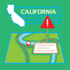
Have you ever wondered not only where traffic incidents are on the freeways, but also what's happening with them -- for example, what time the ambulance got there, if the car that broke down has a tow truck on the way, and so on? Now there's an app for that: The California Highway Patrol (CHP) meticulously logs every incident that is reported on freeways in California, and even some that aren't on freeways (maybe close to a freeway, but not necessarily on one). Anyone can retrieve that information. This app presents it in a much more readable fashion than is available from the CHP. Major Features: • View the incidents on a map • Glossary, so you can decipher what the CHP shorthand actually means. • A "Mark" button that lets you mark the locations of incidents and traffic hazards so you can more easily report them to the authorities later. FOR CALIFORNIA ONLY.
Descripción
Barcelona Gothic Quarter is SelfTour’s most unique GPS assisted walking tour of one of the world’s most beloved and beautiful cities. Barcelona is a city of art where history is combined with a contemporary, hip vibe. With turn-by turn GPS and voice guided instructions we lead you through Barcelona’s very popular Gothic Quarter’s maze of narrow streets revealing its fascinating history, wonderful shopping, culture and spectacular architecture. Put On Your Headsets And Go! We bring our show biz experience this and each tour to insure it is a fun experience. - A complete circle walk of the Gothic Quarter’s significant sights, from those of the early Roman village then called Barcino, to the Kingdom of Aragon to 19th century Catalunya. - Visit and hear about over 60 fascinating locations, including a walk along one of Europe’s most famous streets, the beautiful La Rambla. Others include the Plaza of Saint Jaume, the Royal Plaza, Gaudi’s Guell Palace, Casa Bruno Cuadros, the spectacular Boqueria Market, the charming Canaletas Fountain, Roman temple columns, the Crown Jewels of Aragon, Liceu Theater, and even where you can explore the earliest ruins under the existing city. And some legends of the city are shared. The tour is great background for a visit to Gaudi’s now famous La Sagrada Familia Basilica. - Your guides are experts who delightfully describe the locations aided by appropriate music and audio effects to dramatically bring alive historical events and characters. - For sports fans, you’ll hear about the famous Barca Futbol (soccer) team and visit their center where you can see a video experience the outrageous excitement of their games. - The descriptions have all been thoroughly researched providing accurate information. Photos of each location verify you are looking at what is being described. ### SelfTour™ is a trademark of SelfTour Audio Adventures
Descripción
This app shows over 1,660 hot or thermal springs throughout the USA. Each location displays the temperature of the hot spring, the local weather, nearest city, an Internet search of the hot spring, Flickr geotag search, and more. Easily locate the hot springs nearest you. - Hot spring locations are included with the app so it works even when offline. - Database is updated monthly, subject to user submissions. - Tapping on a hot spring shows the driving distance and time between your location and the hot spring. - Send location data directly to our Road Trip Planner app. - Import GPX files; this makes it much easier to find locations along your route - Show the route between your location and a map pin location. - NOTE: Spring locations are not guaranteed to be always at a safe temperature or open to the public. Please check with the applicable owner of the land or operator of the spring.
Descripción
No Signup. No Login. Celebrating their 14th year online, the Wise Pilgrim Guides are the go-to source of up-to-date information on the Camino de Santiago. Completely Rebuilt for 2026 New Dashboard A new layout designed to get you to the information you need, faster. Yellow X Returns The best features from our beloved geolocation toolkit are back—see exactly how far you are from the next town or the nearest albergue. Dynamic Elevation Profile Completely reimagined and interactive. Tap anywhere to see distances to points along your route. See where you are on the profile in real time. One complete elevation from start to finish, uninterrupted by page folds. Improved Maps Offline and online versions of beautiful topographical maps. More interactive, more informative, more helpful when you're standing at a fork in the path. Offline map tiles now available as an in-app purchase—individually or as a bundle. Live Wildfire Map See active wildfires across Spain and Portugal, updated daily from the EU's Copernicus fire service (EFFIS), plus this season's burnt areas along your route. A quick safety check before you set out. More Routes Now includes the alternate beginning on the Aragonés and the alternate ending on the Invierno. Smarter Updates Over-the-air updates only download what's changed. No more full app downloads eating through your data plan. Itinerary Planner Built-in planner, with the ability to import your plan from wisepilgrim.com too. Pilgrim Tips Leave tips for pilgrims following behind you, and benefit from those left before you. Accommodation Directory A full directory of albergues, camping, hotels, pensions, paradors, and casas rurales. Over 900 in total, with special attention to those that can be booked online. Stageless Guide No more "stage anxiety" or guide-created bottlenecks. Photos Photos of albergues, monuments and other points of interest along the way. Currently 900+ images and growing. Comments Albergue closed early for the season? Have a restaurant to share, or one to warn others about? Every location gives you the opportunity to leave a comment and read comments left by others. No registration necessary. Notes Jot down a note on any town, albergue, or stop on the route, or drop a pin on the map for water, viewpoints, photo spots, or places to come back to. Everything gathers on one page in order along the Camino, ready to search and export. Your notes stay private on your phone. ¡Buen Camino and thank you for your support!
Descripción
No Signup. No Login. Celebrating their 14th year online, the Wise Pilgrim Guides are the go-to source of up-to-date information on the Camino de Santiago. Completely Rebuilt for 2026 Include Coastal, Central, Variante, and the connectors that go between them. New Dashboard A new layout designed to get you to the information you need, faster. Yellow X Returns The best features from our beloved geolocation toolkit are back—see exactly how far you are from the next town or the nearest albergue. Dynamic Elevation Profile Completely reimagined and interactive. Tap anywhere to see distances to points along your route. See where you are on the profile in real time. One complete elevation from start to finish, uninterrupted by page folds. Improved Maps Offline and online versions of beautiful topographical maps. More interactive, more informative, more helpful when you're standing at a fork in the path. Offline map tiles now available as an in-app purchase—individually or as a bundle. Live Wildfire Map See active wildfires across Spain and Portugal, updated daily from the EU's Copernicus fire service (EFFIS), plus this season's burnt areas along your route. A quick safety check before you set out. More Routes Now includes the Coastal and Central routes from Lisbon. Smarter Updates Over-the-air updates only download what's changed. No more full app downloads eating through your data plan. Itinerary Planner Built-in planner, with the ability to import your plan from wisepilgrim.com too. Pilgrim Tips Leave tips for pilgrims following behind you, and benefit from those left before you. Accommodation Directory A full directory of albergues, camping, hotels, pensions, paradors, and casas rurales. Over 900 in total, with special attention to those that can be booked online. Stageless Guide No more "stage anxiety" or guide-created bottlenecks. Photos Photos of albergues, monuments and other points of interest along the way. Currently 900+ images and growing. Comments Albergue closed early for the season? Have a restaurant to share, or one to warn others about? Every location gives you the opportunity to leave a comment and read comments left by others. No registration necessary. Notes Jot down a note on any town, albergue, or stop on the route, or drop a pin on the map for water, viewpoints, photo spots, or places to come back to. Everything gathers on one page in order along the Camino, ready to search and export. Your notes stay private on your phone. ¡Buen Camino and thank you for your support!
Descripción
The app for knowing where you’re going. --- Explore over 60,000 sites across Australia --- Whether you're heading away for a weekend camping trip or planning an outback adventure, find the right places for you with WikiCamps! Search with ease using intuitive filters to access detailed information, provided and kept up to date by a community of like-minded WikiCampers. Get exclusive insights from real travellers, including authentic reviews, fee information to help your budgeting, and photos that show you the real deal—before you travel. --- Plan your journey from here to there or anywhere --- WikiCamps has the ultimate tools to plan your next journey. Use collections to create a wishlist, mark where you’ve been, or remember places you liked on previous adventures. In Trip Planner, you can build an itinerary, plot a route, gauge your fuel spend, and see every place in your adventure mapped out. --- No signal? No worries! Use offline mode --- Thanks to offline mode, you can download everything you need to explore and travel. You’ll always be in the know, wherever you go! --- New! Book and Save with WikiCamps --- Many of your favourite sites are now bookable through WikiCamps! Plus, check out how you can save money on your adventures with our travel partners. --- Why not download the ultimate travel companion today? ---
Descripción
FAAwait provides real-time access to current air traffic delays at all U.S. airports. It utilizes a data feed maintained by the FAA that tracks departure and arrival delays, ground stops, and ground delays. To access this information, an active internet connection (WiFi or cellular) is required. FAAwait does NOT provide status information for specific flights. But by monitoring airport traffic conditions, you can often anticipate delays that may impact your travel, sometimes before the airlines themselves officially update their schedules. For more information on FAAwait, refer to the links below. Note: This application is not provided or endorsed by the FAA.
Descripción
The US Federal Governments owns nearly 650 million acres of land - almost 30 percent of the land area of the United States. These are lands that are held for all Americans. US Public Lands allows you to quickly retrieve the boundaries of these properties without carrying physical maps, books, or digging deep online. Included in the app are on-device (fully works offline), individually selectable & beautifully colored map layers for most of the properties administered by the federal government: - Bureau of Land Management (BLM) - US Forest Service (FS) - National Park Service (NPS) - Army Corp of Engineers (ACOE) - US Fish & Wildlife Service - Bureau of Reclamation - Tennessee Valley Authority - Department of Defense (military bases & installations) - Other (National Laboratories, Test Sites, etc...) Key Benefits & Features - Know which US agency owns and operates the land you're on or are heading to. Use the "Layers" icon to select which agencies you want displayed to create your own custom map. (Hint, the toggles are color coded to the color each layer is displayed in.) - Links are provided to each agency's website within the app, so that you can further your research as to what land use rules apply for each public land type - such as permits, fees, activities allowed, and limits of stay. - Map layers are stored on device - no internet connection required. - Be sure to turn on the 'Basic' base map to see the US Public Land labels for each land area. This base map layer is also stored entirely on your device, and can be utilized if you do not have an internet connection or would like to conserve bandwidth. - If you have an internet connection (or have cached them before going out of signal), you can utilize the built in Apple Maps and satellite view maps as the base layer underneath the public land overlays. - A boondocker's assistant - While US Public Lands is not specifically a camp site locator and does not have a database of specific sites, by turning on the satellite view map, you can better scout out trails, roads and signs of dispersed camping locations within the boundaries of the public land resources. - Quickly toggle between 'Show' and 'Hide' via the "Map" icon to more clearly see satellite images below. - If you have GPS access on your device, click the 'Locate Me' icon to show your present location - know what type of land you're on right now! - Built in search tool locates anything on device maps supports (requires internet access) - including cities, states, zip codes, addresses and points of interest. A pin is dropped at the search location. Thank you to the Protected Area Database (PAD-US) of the U.S. Geological Survey for providing the public domain raw map data that we’ve been able to utilize to create this interactive overlayable mapping & navigation tool. We will update our maps in the future to stay in sync with improvements to this data set. Please note, the USGS PAD-US database contains the “most up-to-date aggregation of Federal lands and waters” available, but this database is still evolving and some locations may not be listed and others may not have precisely accurate boundaries. Resolution across the nation may vary. And always remember - there may be private unmapped inholdings within any public lands - so always pay attention to local signage, indications, and information. The US Public Lands app should only be used as an overview, and you should always confirm more precise details by consulting local field offices, administration websites, and other resources. Do not solely rely on this app for determining if you are on public or private land.
Descripción
As Featured On The App Store's "Best New Apps", The Washington Post, BBC, LA Times, Lifehacker, Fast Company's Co.DESIGN, and The Next Web. "A Travel App That Practically Packs Your Bags For You" Never Forget Your ______ Again! PackPoint Premium has all of PackPoint's best features - TripIt integration, Evernote sync, custom activities creation, and more! PackPoint is an intelligent packing app and packing list builder for serious travelers. PackPoint will tell you what you need to pack based on length of travel, weather at your destination, and any activities planned during your trip. Punch in the city you're traveling to, the departure date, and the number of nights you'll be staying there. PRO TIPS: - Tap and hold to re-order packing list items - Select "hide checked items" for a minimal packing list as you pack. - Check out the Customize menu within PackPoint for more features - Swipe left to remove an item from your packing list - Tap the "+" sign to change quantities for each packing list item - Check off "Repeat Basics" if you're willing to repeat wearing basics like shirts and pants - Check off "Laundry" if you will have access to laundry facilities PackPoint will build a packing list for you that takes into account: - Business or Leisure travel - Activities you plan on doing - What you need for an international trip - Warm weather clothes - Cold weather clothes - An umbrella if the forecast calls for rain Have a packing app feature request, or feedback? E-mail [email protected] or visit http://ideas.packpnt.com Like us on Facebook https://www.facebook.com/packpoint Follow us on Twitter https://twitter.com/packpnt @packpnt
Descripción
Discover the Peloponnese, Greece with the only complete travel app dedicated exclusively to this stunning region. After 10 years of exploring and guiding groups through the Peloponnese, we created this app to save you time, money and stress while traveling. Content available in multiple languages through automatic translation. With Peloponnese Guide, you will reach places that others don't even know about. From hidden beaches to mountain villages, from UNESCO archaeological sites to authentic tavernas, everything is now in your pocket. And the best part? The app costs practically nothing compared to the price of your vacation. For the cost of a coffee per day, you'll travel smarter, waste no time searching and discover much more than the average traveler. What You'll Find in the Peloponnese Guide: Exclusive Town & Village Guides: - Seaside towns, mountain villages and inland gems with photos and rich descriptions. - General overview, reasons to visit, what to do, nearby places, annual events, best season. - Essential info: how to get there, where to eat, shop or stay, plus emergency contacts. Beaches of the Peloponnese, Greece: - Discover the best sandy, pebbled, family-friendly and hidden beaches. - Clear directions and descriptions so you'll always know where to go. Activities & Attractions: - Archaeological sites, castles, monasteries, museums and local culture. - Outdoor experiences: hiking, diving, sailing and more. Practical Info for Travelers: - Car rental companies, bus, train, ferry and flight connections. - Shops and supermarkets with opening hours. - Local tips that save you time and money. Suggested Itineraries or Create Your Own: - Suggested trips from 3 to 14 nights with routes, highlights and driving times. - Or create your own itinerary with our content - you are in full control. Nearby Islands & Excursions - Explore day trips to islands close to the Peloponnese, Greece. Living in the Peloponnese Greece - Useful advice for those who dream of moving here permanently. Why Choose Peloponnese Guide? - Exclusivity: The only app in the world dedicated 100% to the Peloponnese. - Smartest Solution: Save days of searching online - everything is structured, verified and in one place. - Expertise: Created by guides who have been exploring the region for over 10 years. - Hidden Gems: Reach places other travelers don't know exist. - Flexibility: Follow our expert itineraries or design your own journey. - Best Value: The app is much cheaper than a lunch in Greece and helps you make the most of a vacation worth hundreds or thousands of euros. Download Peloponnese Guide today and explore the most authentic region of Greece like a local. Don't waste time or money - travel smarter with the only app you'll ever need in the Peloponnese, Greece!
Descripción
Pasinaudoję šia programėle Jūs sužinosite daugybę naujų ir įkvepiančių istorijų apie Lietuvos Didžiąją kunigaikštystę, Trakų miestą su pilimis, kuriose įsikūręs Trakų istorijos muziejus! Išradingas ir sumanus gidas Jus lydės visos kelionės laiku metu, nuspės klausimus, suteikdamas žinių bei dar labiau pažadins smalsumą, kviesdamas apsilankyti dar kartą. Gal nustebsite sužinoję, kad viduramžiais su Trakų vardu buvo siejamos trys pilys? Visos buvo mūrinės, visos apsuptos vandens – natūralių telkinių ir dirbtinai suformuotų perkasų. Dabar jas vadiname Senųjų Trakų, Trakų Pusiasalio ir Trakų Salos pilimis. Pažintis prasideda trečiojoje, garsiausioje ir geriausiai išlikusioje – gotikinėje Salos pilyje. Pilies sala suformuota dirbtinai – sujungus tris atskiras, atskirtas durpyno, užpelkėjusio ežero ir pakrančių vandens, saleles. Konvento tipo kunigaikščių rūmai su aukščiausiu – 33 metrų aukščio – bokštu (vadinamu donžonu) ir gynybinėmis atraminėmis sienomis, suformuojant terasą, yra dviejų aukštų, su pusrūsiais ir gynybine pastoge. Gyvenamuosius aukštus juosia medinės galerijos. Iš jų durys veda į devynias menes, kuriose gyveno kunigaikščio šeima, svita ir svečiai, ir į visą aukštą užimančią didžiąją, arba reprezentacinę, menę. Pusrūsyje po ja buvo įrengta virtuvė, priešingoje pusėje, kitame korpuso pusrūsyje, – iždinė. Iš kiemelio matomos pusrūsiuose esančios orinio šildymo pakuros, ant originalaus tinko pilyje visur randama polichrominės tapybos likučių. Trakų istorijos muziejaus ekspozicija prasideda kairiajame sparne, vadinamosiose „Vytautinėse“ menėse, kuriose, manoma, apsistodavęs Didysis kunigaikštis su žmona. Vitrinose eksponuojami archeologiniai radiniai – šachmatų figūrėlės, Venecijos stiklo šukės, daugiaspalvės glazūros kokliai – byloja, kad XV amžiuje pilis buvo puošniai ir prabangiai įrengta, joje vykdavo įvairios pramogos, šventės, įšventinimai į riterius. Arbaletų strėlių antgaliai – dažnas archeologų radinys – byloja apie intensyvias kovas. Dar daugiau įvairios istorinės ginkluotės pavyzdžių galima apžiūrėti ekspozicijos vitrinose, klausantis nuodugnaus ir informatyvaus šios programėlės pasakojimo. Visą dešiniojo sparno pirmą aukštą užimanti didžioji, arba reprezentacinė, menė – svarbiausia ir puošniausia pilies patalpa. Tai, kad Lietuvos Didžioji Kunigaikštystė XV ir XVI amžiais buvo didžiausia savo plotu Europos valstybė, įrodoma senovės kartografų sukurtais žemėlapiais, o Trakų miesto ir pilių grožis – pavaizduotas istorinėse graviūrose ir paveiksluose. Trumpai pristatoma XX amžiaus Salos pilies restauravimo istorija: vitražai, kaip ir kai kurie kiti architektūriniai sprendimai (grindų plytelių, medinių galerijų raštai), atkuriant buvo stilizuoti pagal ankstyvosios gotikos analogus. Modernėjantis Trakų istorijos muziejus kiekvienais metais skiria daug dėmesio interaktyvioms pramogoms, įvairaus pobūdžio edukacijoms, nuolat surengia įdomių parodų, renginių ar atnaujina ilgalaikes ekspozicijas. Mūsų tikslas – įdomus, gyvas, nuolat besikeičiantis muziejus. Kviečiame apsilankyti dar ne kartą. Tapkime gerais draugais!
Descripción
Learn about one of the most famous Victorian cemeteries in the world and its inhabitants. Each stop has photos and a narration by a local Savannah resident. Your fee goes directly to support the preservation efforts of this treasure by the Bonaventure Historical Society.
Descripción
Fotospot is your ultimate road trip companion! Discover over 14,000 handpicked, photo-worthy tourist attractions across all 50 U.S. states (plus D.C.). From stunning waterfalls and giant roadside donuts (and one bagel!) to quirky museums, iconic film locations, world-class street art, scenic, and historic sites, plus countless other spots featuring the wild, the wonderful, and the just plain weird. Bookable Experiences In addition to 14,000+ unique spots, we now feature over 1,800 human-curated, bookable experiences right in the app. Imagine yourself learning to surf in Venice Beach, touring iconic "The Walking Dead" locations in Atlanta, white-water rafting on the Rio Grande, exploring the covered bridges of Madison County, crafting a broom in Salem, Mass, enjoying a VIP-guided drive along Maui's Road to Hana, spotting wild horses in North Carolina, or tasting the best cheesesteaks in Philadelphia. And yes, there are ghost tours. So many ghost tours! Where I've Been Easily keep track of your travels with personalized stats. See which states you've visited, view your overall progress, and monitor how you rank in each state. Compete with friends on the leaderboard and get inspired to explore even more. Road Trip Trivia Take your trip to the next level with Road Trip Trivia! With 800+ multiple choice questions, every mile becomes a chance to test your knowledge, spark conversations, and enjoy those unexpected "a-ha!" moments. National Parks Just like you, we LOVE our National Parks. That’s why we’ve done the research and added every must-see spot to the app—from scenic viewpoints and unique hikes to hidden gems you might otherwise miss. It’s all in your pocket. Our curated National Park list includes: Arches (73 spots) Badlands (56 spots) Bryce Canyon (42 spots) Death Valley (75 spots) Glacier (52 spots) Grand Canyon (62 spots) Grand Teton (51 spots) Great Smoky Mountains (87 spots) Joshua Tree (110) Olympic (47 spots) Rocky Mountain (56 spots) Sequoia & Kings Canyon (70 spots) Yellowstone (102 spots) Yosemite (71 spots) Zion (55 spots) But Wait, There's More! Suggest new spots, add photos and comments, check in to places you visit, save attractions for later, follow your friends' adventures, and earn FREE stuff—all in one app. Leave No Trace Whether you're visiting a spot in our app or not, please explore responsibly. Take only photos, leave only footprints. Learn more at LNT.org. Happy exploring, The Fotospot Team #fotospotapp #fotospotting
Descripción
The battle of Gettysburg was the largest and deadliest single battle ever fought in the western hemisphere. Now experience it like never before with the Gettysburg Audio Tour. Follow the tour in a customized map of the Gettysburg national park auto tour as you listen to over 1 1/2 hours of narration and sound effects telling the story of the 3 day battle. With 17 audio stops, this tour provides you and your family with what you need to learn about one of the most important events in United States History. The app is easy to use. Begin at the Gettysburg visitor center. Follow the tour on the map, or use the provided list tour stops to navigate the official tour. You can even follow the tour with a free map provided at the visitor’s center. Tap play and let the tour stop audio play all the way through. When complete, the next tour stop automatically loads in the player. Drive to the next tour stop and tap play again. It’s that simple. If you need directions, a button will open Apple’s map application and provide directions from your location to the next tour stop from wherever you are. Why buy an expensive CD at the visitor center that you will have to store and never use again? The Gettysburg Audio Tour is like having a personal guide right in your car. Look no further as you have found the only thing you need to experience the Gettysburg battlefield.
Descripción
Prairie State Conservation Coalition is a non-profit organization created to assist conservation land trusts, landowners, and communities in their efforts to protect land and water resources in Illinois. This Hike App was created with the support of PSCC, the Donnelley Foundation, and the Grand Victoria Foundation to further enhance public awareness and foster community interactions with Illinois natural areas and open lands. With this App, land trust organizations in Illinois now have an outlet to provide interactive tours of their project sites. These tours are guided by GPS and conveniently available on your mobile devices. The Hike app leads you through an interpretive hike in a natural area of your choosing all across the state of Illinois! Note: Continued use of GPS running in the background can dramatically decrease battery life.
Descripción
航旅纵横,伴你出行每一程 我们是国家队:中国民航信息官方出品,民航版“12306”。 我们只提供权威、及时、精确、全面的航班、机票、机场信息。 【您想不到的功能我们有】 民航官方直销平台:来这买源头机票,0差价·0捆绑·0套路 自动导入行程:无须您手动添加,行程自动跳到碗里来 3D飞行视频:连接你在地球上飞过的每个角落 火车抢票:抢不到火车票?有票神器帮你抢 机上打牌聊天:无网也能聊天和娱乐,快试试机上模式 全球精品商城:线上点一点,免税商品送到家 【您想到的功能我们也有】 电子登机牌:无需兑换纸质登机牌,一码快捷通行 航班动态:航班动态及时晓,官方数据任您查 手机值机:随时随地在线选座位,还能选状态和留言 用车:接送机延误免费等、误机必赔偿,租车场站取还便捷、免千元押金 酒店预订:专属客服7x24小时守候,海量酒店等你来订 机场雷达:手机变雷达,查看机场上空飞机实时动向 常客卡:支持不同航空公司的常客卡添加,方便管理 【求关照】 独乐乐不如众乐乐,邀请小伙伴,一起享受航旅纵横服务 【联系我们】 邮箱:[email protected]
Descripción
Place pins on a worldwide map for each location you want to visit, then see your route. Enter trip details for each location and create a complete trip itinerary. Multiple sample files are available, including an informative Route 66 sample file. You can demo this app by downloading our free RTP Viewer app. RPT Viewer is virtually identical to this app except with RTP Viewer you can’t save your edits. Road Trip Planner does not require any subscription and respects your privacy by not collecting any of your data. MAP PINS HOLD WHAT YOU NEED. Each pin shows: - arrival date & time - departure date & time - travel time to this location - time spent at this location - name of pin (such as John’s house) - address of pin - notes and images - custom pin color and icon - URL for related information - weather reports - transport type (driving or walking) - Internet Search results - list of activities (lodging, sights to see, etc.) - choose between multiple routes (if available) - view driving distance between pins, driving time, fuel cost, travel advisories, turn-by-turn driving directions - Export pin data to your calendar. EACH PIN CAN HAVE MANY ACTIVITIES. For each activity you can record: - name of activity - activity date, time and duration - cost - phone - FAX - address - URL - email address - confirmation number - notes - picture There are two types of pins. Route Pins are used to create the route. POI Pins mark points of interest on the map. Choose between Apple Maps or OpenStreet Maps. Cache non-Apple maps to disk for offline use. See the settings and Help for more info. For air and rail routes a straight line can be displayed between pins. Add, remove or rearrange the pins in any order you wish. Routes and pins can be sent to Apple Maps. Import and export GPX data files. Each trip can be saved as a separate document. Perfect for anyone who wants to maintain a record of past trips. VIEW YOUR TRIP ON YOUR MAC with our Road Trip Planner app available from the Mac App Store. Send location data to Road Trip Planner directly from any of our location-savvy apps. THE ITINERARY HOLDS ALL OF THE DETAILS. Share it and take it with you. - print the itinerary or share it easily - includes a map image with pins and routes, activities for each Route Pin, costs for each activity, total fuel cost, total trip cost, information for Points of Interest Pins, and driving instructions. USE THE TO-DO CHECKLIST. Make sure you don’t forget anything. We respond quickly to suggestions and questions in our forum. PLEASE CONTACT US IF YOU HAVE A QUESTION OR AN ISSUE. We promise we'll respond as quickly as we can. For more info visit the Road Trip Planner web site at https://roadtripplanner.modesittsoftware.com PLEASE READ CAREFULLY BEFORE PURCHASING: The mapping and routing functionality Road Trip Planner uses is based upon Apple’s maps technology. If Apple Maps cannot find a route between map pins, then neither can Road Trip Planner. Please test the area you wish to travel using Apple’s Maps app to ensure that the area can be routed. If it cannot be routed, please submit the issue to Apple. If Apple Maps cannot perform routing in the area you wish to travel then neither can Road Trip Planner.
Descripción
Excited to take the Pacific Coast Highway from Morro Bay, CA to Monterey, CA (or vice versa) but nervous you won’t have cell coverage for most of the trip? Well, we’ve got you covered! Introducing our new offline California Route 1 Road Trip photo guide. When you have a working WiFi connection simply download our offline guide to your device and, like magic, the app will now work when you don't have an internet connection. You'll be able to check in, save attractions for later, add new photos, and - best of all - find the exact locations of all the coolest PCH spots including Morro Rock, Moonstone Beach, Hearst Castle, McWay Falls, the Bixby Creek Bridge, and the Lone Cypress (plus, all 17 spots along the 17-Mile Drive) - all without having a working cell signal! One-time payment: We don't have any upsells, in-app purchases, or subscriptions in this app, so for a simple one-time purchase, all of this can be yours for life. Plus, you'll automatically get any new future attractions we add to the app for FREE! Leave no trace: When visiting any attraction (in our app or not) please be responsible and leave it exactly how you found it. Take only photos and leave only footprints. To learn more please visit LNT.org. Happy exploring, The I Heart Travel Team
Descripción
Lace up your walking shoes and get ready to explore! Dijon: The Owl's Trail is your guide to the historic capital of Burgundy, home to nearly a thousand years of art, architecture, and culture. Discover four distinct walking tours that will introduce you to the best of this unique city. You'll discover a palace that houses a world-class art collection, towers that have silently stood guard over a changing city, and historic churches, including one that is known for its good luck charm! You'll also discover the city's rich collection of museums, including archaeological centers, art galleries, and a museum dedicated to life in one of the world's best known wine regions. If you get lost, the app will help you find your way, so you can take on the town with confidence. Enjoy all Dijon has to offer - it's more than mustard!
Descripción
Visualize your unique planetary lines on a high-precision world map, revealing the hidden connection between you and any location on Earth. -- PERSONAL MAP Interactive Global View: Zoom into any city to see your planetary influences (MC, IC, ASC, DSC lines). Daily Power Place: Receive personalized daily location recommendations based on current planetary transits. Six Life Modes: Explore optimal locations for Travel, Love, Relocation, Work, Family, and Pets. Share Your Map: Create stunning branded images of your astrocartography map with one tap. TOGETHER MODE Planning a trip or life with someone else? Together Mode harmonizes two birth charts onto one map. See both partners’ planetary lines overlaid on a single globe, with harmony scoring to highlight locations where your energies align. PLAN YOUR TRAVEL Journey mode - Map multi-city trips with astrological precision. Our transit calculator identifies optimal dates to visit each destination using real planetary movements. Add 2–5 cities and see when the stars align for every stop. Save or share an image of your trip directly from the app. A COMPANION FOR LIFE Make informed decisions about where to live, work, and travel. Understand the energy of your current location. Discover destinations where relationships can thrive. Download Maphrodite and explore the world that was meant for you. The official digital companion to Astrocartography (DK Publishing, 2025) by Clarisse Monahan. -- Terms of Use: https://www.apple.com/legal/internet-services/itunes/dev/stdeula/ Privacy Policy: https://maphrodite.com/privacy.html
Descripción
Check out more than 700 of the Lone Star State's finest dive bars, honky-tonks, diners, icehouses, dance halls, country stores, cantinas, saloons, restaurants, and more. Curated by the @texasdives community on Instagram.
Descripción
The Venice Panorama App is the only guide with which you can discover Venice from the top of St. Mark’s bell tower. The panorama which the bell tower offers is unique and exciting, with a view stretching over the whole of Venice and its lagoon. This App will help you identify all the wonders you can admire from up there, which are hidden among the rooftops to the north, east, west and south. Go up to the top of the bell tower and with our description lose yourself in the most beautiful spots in town: its palaces, its islands, its churches. You will fly over the rooftops and an unexpected Venice will open up beneath you. The Venice Panorama App proposes: - a tour of 26 listening points, with the history of the bell tower and the description of the four views to the south, west, north and east. - the MyVisit function to create your own chosen itinerary - the camera to take photos and share your experience - the images of the 4 views to identify the listening points - the “find” function to look for the listening points which interest you - over 30 minutes of audio in English
Descripción
GyPSy Guide GPS driving tour of Kauai is an excellent way to enjoy a sightseeing trip to explore the entire island. There are 280+ audio points that play automatically, featuring what to see, stories, tips and advice. All the benefits of a guided tour, the freedom to drive yourself. TOUR GUIDE FOR SCENIC DRIVES ON KAUAI If you like driving yourself when you go sightseeing, GyPSy Guide™ tour apps allow you to enjoy a guided tour experience while remaining totally independent. By driving yourself, you'll be able to get from place to place faster, see more things and not be tied to anyone else's schedule. DON'T MISS OUT ON THE BEST SIGHTS AND STORIES The tour apps use your device’s location abilities to play the commentary AUTOMATICALLY. All you have to do is drive, listen and decide which places you want to stop at. Our tour guides have created an insightful and entertaining tour of Kauai. We’ll recommend the best places to experience and some great locations that most visitors will drive by. PLAYS AUTOMATICALLY GyPSy Guide knows where you are and which direction you are heading, and plays commentary automatically about the things you are seeing, plus stories and tips and advice. EXPLORE LIKE A LOCAL It’s just like having a local friend to show you around. And that friend just happens to be a professional tour guide. GREAT VALUE The same information you would get on a bus tour or from a guide book, for just a fraction of the price. And you control the itinerary and schedule. WORKS OFFLINE No data, cellular or even wireless network connection needed while touring. Download over Wi-Fi before you tour. Anyone can use them with no need for roaming data – even visiting from another country. DRIVING TOUR ROUTE The tour has commentary everywhere on the island that you will want to explore. We recommend dividing the island into at least 2 driving days. 1) North and Eastern Kauai. This half of the island tours through the famous northern beach and resort areas of Hanalei and Princeville. The tour continues all the way to the end of the road at Ke’e Beach. Between Princeville and Lihue we’ll explore many fine beaches and the vibrant town of Kapa’a. 2) South and Western Kauai. The resort area of Poipu is home to south shore's best beaches and the island’s most famous blowhole. Drive further for the artsy town of Hanapepe. From historic Waimea, we travel up Kauai’s volcanic mountains to the superb Waimea Canyon and continue to the awe-inspiring viewpoints of Koke’e Park perched above the Na Pali Cost. There’s much more to see as we drive and GyPSy will be you very own tour guide all the way. NOTES Download the app on Wi-Fi from your network at home or use any free Wi-Fi network. Because the app is filled with audio commentary and maps, its larger than "normal" apps. Many phone/data networks may block the download because of size - so its important to download over a Wi-Fi network. ++ Continued use of GPS running in the background increases battery usage - we strongly recommend taking a cigarette style DC outlet car charger. This is much better than simply plugging into the USB port in a vehicle. ** iPad users - please note that WiFi-only iPads will not activate the commentary automatically. Any iPhone or network-capable iPad (WiFi + Cellular - whether you have a network connection or not) will work just fine. ABOUT US GyPSy Guide™ produce award winning audio tours along scenic drives around the world. Enjoyed by travelers who prefer to set their own pace and itinerary on vacation, but enjoy a fun, informative and educational guided experience. Our goal is to provide a great introduction to the region and perhaps inspire you to learn more and return. None of our apps include paid advertising or placements for benefit.
Descripción
Live traffic reports and video cameras for Tennessee including Nashville and Memphis. Save your favorite cameras for quick access. One time purchase, no subscription required. The app was updated during December 2025. KEY FEATURES: Live data from The Tennessee Department of Transportation (TDOT): - 546 traffic cameras with LIVE VIDEO covering Tennessee State. - Today screen widget to show at a glance the nearest current traffic incidents - Dark Mode throughout the app (iOS13+). - Optimised for all iPhone and iPad models. MAP VIEW - Shows current incidents and traffic cams - Each incident is color coded as well as being represented by an icon showing the incident type. - Clicking on an incident displays more detail right there on the map. - The map view can also show live traffic camera videos. LIST VIEW - Shows current incidents in order of distance from your current location (closest incidents are shown first). - Each incident is color-coded to indicate the severity of the delay. - You can quickly see the distance the incident is from you, the road name and the type of incident. - The detail view shows the description together with a map showing the location. - Full search functionality, works across both the list and map views. TRAFFIC CAM FAVORITES - Save your favorite cameras for quick access to see how clear/congested your usual routes are. TODAY WIDGET - Shows at a glance the nearest current traffic incidents without launching the app. PERSONALISE - Toggle traffic information on the map. - Toggle always show map on app launch. - Toggle construction on/off. - You can configure which incidents are displayed according to the severity of the delay caused. - Miles or KM setting. CONTACT - Email me for feature requests/bug reports etc. I would love to hear from you! Data courtesy of The Tennessee Department of Transportation (TDOT).
Descripción
Live CHP traffic reports and cameras for California. View up-to-the-minute California Highway Patrol logs. One time purchase, no subscription required. The app was updated during December 2025. KEY FEATURES: Live data from California Highway Patrol (CHP): - 1,568 traffic cameras covering California State. - Today screen widget to show at a glance the nearest current traffic incidents - Dark Mode throughout the app. - Sharing: you can easily share traffic camera images with your Twitter followers, Facebook friends or via email etc. - Optimised for all iPhone and iPad models. MAP VIEW - Shows current incidents and traffic cams. - Each incident is color coded as well as being represented by an icon showing the incident type. - Clicking on an incident displays more detail right there on the map. - The map view can also show live traffic camera images. LIST VIEW - Shows current incidents in order of distance from your current location (closest incidents are shown first). - Each incident is color-coded to indicate the severity of the delay. - You can quickly see the distance the incident is from you, the road name, the type of incident and when the incident log was updated. - The detail view shows the description and log of the incident together with a map showing the location. - Full search functionality, works across both the list and map views. TRAFFIC CAMS - Toggle show/hide the cameras on the map. - Touch a camera icon on the map to view a live camera image. TRAFFIC CAM FAVORITES - Save your favorite cameras for quick access to see how clear/congested your usual routes are. TODAY WIDGET - Shows at a glance the nearest current traffic incidents without launching the app. PERSONALISE - Toggle traffic information on the map. - Toggle auto refresh of camera images (will refresh every 10 seconds). - Toggle always show map on app launch. - Toggle roadworks on/off. - You can configure which incidents are displayed according to the severity of the delay caused. - Miles or KM setting. CHP GLOSSARY - Quick access to a full CHP glossary of terms to help you interpret traffic reports. CONTACT - Email me for feature requests/bug reports etc. I would love to hear from you!
Descripción
Discover Oahu with GyPSy Guide, the most trusted and loved app for exploring Hawaii’s island paradise. With 340+ audio points that play automatically along the scenic drives, experience the island’s top sights and hidden gems through 4 incredible tours filled with fascinating stories and stunning scenery. 1) Oahu Island Circle Drive: Experience Oahu’s highlights with a full-circle route featuring lush rainforests, coastal cliffs, and scenic lookouts. 2) Beaches & Volcanoes: Explore pristine beaches, volcanic craters, and iconic spots like Diamond Head and Hanauma Bay. 3) North Shore Loop: Discover world-famous surf beaches, the charming town of Haleiwa, and peaceful tropical valleys. 4) Pearl Harbor: Step back in time at this historic site, honoring the events of World War II and the legacy of its heroes. COMING SOON: Explore more of Oahu on foot with our new Waikiki and Honolulu walking tours—perfect for uncovering hidden gems and local stories! With GyPSy Guide, explore Oahu's stunning beaches, iconic landmarks, and rich culture. Enjoy expertly curated audio tours that reveal breathtaking coastlines, lush valleys, and historic treasures, making every moment of your journey unforgettable. Why Choose GyPSy Guide for Oahu? ‣ Your Island Insider: Immerse yourself in the aloha spirit with stories and insights from local guides who truly know Oahu—its moolelo (legends), aina (land), and hidden treasures. ‣ GPS-Triggered Audio Stories: Explore effortlessly with GPS-guided storytelling. Discover secret beaches, fascinating paniolo (cowboy) history, and local travel tips—all while you drive. ‣ Expertly Curated Routes: Navigate like a kamaaina (local)! GyPSy Guide highlights iconic landmarks, off-the-beaten-path gems, and must-see attractions to create an unforgettable Hawaiian journey. ‣ No Signal? No Problem: Enjoy stress-free travel! Our tours work offline, using GPS to guide you through Oahu’s scenic routes and remote corners. No Wi-Fi or data is needed. What to Expect: Oahu offers a perfect blend of natural beauty and cultural heritage, from iconic surf beaches and lush valleys to historic sites and breathtaking coastal drives—making every journey an unforgettable experience. GyPSy Guide: It’s Just Like Having a Tour Guide in Your Car ‣ Explore at Your Own Pace: Set your own pace with GyPSy Guide, whether exploring the vibrant streets of Honolulu, relaxing on world-famous beaches, or discovering hidden gems along the coast. ‣ Must-See Stops: Visit top attractions like Pearl Harbor, Diamond Head, and the North Shore while uncovering local secrets along the way. ‣ Top Highlights: With hours of exploration ahead, discover Oahu’s most iconic sights and uncover insider tips to make the most of your adventure. Immerse yourself in the island’s rich culture and history through engaging audio commentary that brings its stories to life. What You’ll See: Some of the highlights along the route include: ‣ Hanauma Bay ‣ Diamond Head Crater ‣ Byodo-In Temple ‣ Pali Lookout ‣ Kailua & Lanikai ‣ Laie Sea Arch ‣ North Shore Surf Spots ‣ Haleiwa Town ‣ Dole Plantation ‣ Pearl Harbor Bonus Perks: ‣ NO EXPIRY: TOURS NEVER EXPIRE—REVISIT ANYTIME. ‣ Regular Updates: Get the latest on roads and attractions. Hear the Aloha Spirit in Every Word: ‣ “GyPSy Guide transformed our Oahu trip! The audio was fun, informative, and easy to follow. We discovered so much more than we ever would on our own.” ‣ “Absolutely fantastic! Cannot recommend it enough. We came to love the narrator so much we gave him a name! Directions were far better than GPS. Thanks for helping us make our Hawaiian vacation so pleasurable. Will use this guide at other locations.” Important Info: ‣ iPad Compatibility: Use an iPad with GPS (WiFi + Cellular) for full functionality. ‣ Battery: GPS drains battery—bring a car charger.
Descripción
Traveling to San Diego? Visit the World's Largest Lemon. In Las Vegas? Visit the Glow-In-The-Dark Kiss Mini-Golf. Stopping in Chicago? Visit the Hill Street Blues Police Station. Choose from over 22,300 offbeat roadside attractions from around the US! This app lists places and things that you would not normally think of visiting. These attractions are fun, oddball, strange and sometimes normal but have a uniqueness to them. Also included with each location is the address, weather, images from a Flickr search of the location, Internet search of the attraction, URL and phone number (if they exist), and more. - Import GPX files; this makes it much easier to find offbeat attractions along your route. - Show the driving distance and time between your location and an offbeat attraction. - Show a route between your location and an offbeat attraction. - Send offbeat attraction data directly to our Road Trip Planner app, or to Apple Maps. - Ability to submit new offbeat attractions for review and inclusion in a future update.
Descripción
Having trouble booking a Global Entry interview? This app alerts you when slots open up. Appointments don't last long, so use this app to help you snag one. No login or account creation is required to use this app. 1. Download the app from the app store and open it. 2. Tap one or more nearby interview locations and enable alerts. 3. You'll receive a push notification when an interview slot is available with the constraints you set. This app does not book an appointment for you. It does not interact with your Global Entry account in any way. The sole purpose of the app is to help you book your Global Entry interview at busy locations. You are responsible for booking your interview. The app only alerts you when slots are available. Keep in mind that certain locations are heavily booked and open slots disappear quickly. Global Entry is a registered trademark of the US Department of Homeland Security. This app is not affiliated with, endorsed by or supported by any government agency or entity.
Descripción
Roadside 66 (tm) places offbeat and essential landmarks from U.S. Route 66 in the hands of road trippers. Just in time for the attraction filled 100th year anniversary of the Mother Road! • Powered by offbeat travel authority RoadsideAmerica • Jam-packed with all the thorough research and wit fans have come to expect. • Detailed maps & trip planning tools, stories, and • Beautiful photos (some by veteran Roadie photographers). • More than 1,600 points-of-interest (POIs) in Route 66 corridor — See all the popular classics! the Blue Whale, Jackrabbit Trading Post, St. Louis Arch — Quirky sights! Singing Highway, Bottle Tree Ranch, Santa Anna's Leg, road phantoms, Uranus! — Giant statues — Neon signs — Restored gas stations and motels — Folk art environments, murals, weird museums — Ruins from the Golden Age of cheap gas and pure wanderlust — Over-the-top tourist traps and photo ops! ** Backseat Know-It-All ** Our arcane knowledge booster -- starts each driving day with an illuminating factoid or two. ** Route Zealot ** For hardcore Rt. 66 veterans, a mysterious toggle reveals even more points-of-interest. ** Snappy Reports from the Roadside America Team ** Our writers talk to unique characters, from the savvy huckster to the sleepless owner, from the over-caffeinated local booster to the otherworldly artist. ** The Team That Unlocked the "Muffler Men" Mystery! ** The Roadside 66 team is led by two original Roadside America book authors, who pioneered a previously undefined tourism category (offbeat, ironic, quirky) and a unique approach to road trips. They (re-)discovered, named, and mapped “The Muffler Men,” fiberglass giants and enduring Route 66 icons. Ready to open that third eye? Room in the trunk for souvenirs? This app is your indispensable highway spirit guide.
Descripción
Discover the Big Island like a local with GyPSy Guide, your trusted companion for exploring Hawaii Volcano National Park, Akaka Falls, lush rainforests, and historic sites. Enjoy multiple routes in a single download—no need to juggle versions. With 460+ stories, drive from anywhere and let the GPS guide you seamlessly to must-see stops at your own pace. 1) Volcanoes National Park: Explore a world-famous park with lava flows, craters, and dramatic viewpoints. 2) Island Circle Route: Experience the island’s best, from the lush Hamakua Coast to Waipio Valley’s cliffs and waterfalls. 3) Kohala North Loop: Discover North Kohala’s rugged coastlines, ancient sites, and black sand beaches. 4) Kona Coast Route: Enjoy the sunny Kona Coast with snorkeling spots, ancient temples, and coffee plantations. With GyPSy Guide, explore the Big Island's diverse landscapes, hidden gems, and local culture. Enjoy expertly curated audio tours that reveal volcanic wonders, lush rainforests, and pristine beaches, making every twist of your journey unforgettable. Why Choose GyPSy Guide? • Big Island Experts: Immerse yourself in the spirit of Hawaii with stories and insights from local guides who truly know the Big Island – its legends, culture, and hidden treasures. • GPS-Triggered Audio Adventure: Discover the Big Island effortlessly. With GPS-triggered storytelling, uncover secret spots, fascinating history, and travel tips – all while you drive. • Expertly Curated Guidance: Navigate like a pro! GyPSy Guide helps you hit the must-see highlights, explore off-the-beaten-path gems, and craft an unforgettable adventure tailored just for you. • Works Offline – No Signal, No Worries: Say “aloha” to stress-free travel! Our tours work offline, using GPS to guide you even in the most remote corners of paradise. No Wi-Fi or data is needed. GyPSy Guide: It’s Just Like Having a Tour Guide in Your Car • Explore at Your Own Pace: Set your own pace with GyPSy Guide, whether exploring lava fields, hiking rainforests, or relaxing on a beach. • Must-See Stops: Our curated itineraries include top attractions like Akaka Falls and Pololu Valley, so you don't miss a thing. • Top Highlights: With hours of exploration ahead, we’ll ensure you visit the island’s top sights and offer insider tips to make the most of your trip. • Cultural Narratives: Immerse in the island's culture and history with engaging audio commentary that brings traditions to life. What You’ll See: ‣ Volcanoes National Park ‣ Akaka Falls ‣ Waipio Valley ‣ Pololu Valley ‣ Rainbow Falls ‣ Kealakekua Bay ‣ Halemaumau Crater ‣ Puuhonua o Honaunau National Historical Park (“Those Are My Ancestors”) ‣ Hamakua Coast ‣ Liliuokalani Gardens ‣ Thurston Lava Tube • Hear the Aloha Spirit in Every Word: “GyPSy Guide made our Big Island trip so much more memorable. We can't wait to use it again on our next Hawaiian adventure!” “The audio guides were informative, entertaining, and easy to follow. We learned so much about the island's history, culture, and natural wonders.” “GyPSy Guide was an absolute game-changer for our Big Island adventure. We felt like we had a local expert by our side, sharing the island's secrets and stories.” • Important Notes: Volcano National Park: Following the 2018 eruptions, parts of the park are reopening in phases. Check for current closures and access updates before visiting. Upgrade to the Hawaii Bundle and access 1,540+ audio points spanning all 4 islands: Maui (including the iconic Road to Hana), Big Island, Oahu, and Kauai. Immerse yourself in Hawaii’s rich stories, scenic drives, and breathtaking landscapes—all in one ultimate bundle. • Bonus Perks: No Expiry: Tours never expire—revisit anytime. Regular Updates: Get the latest on roads and attractions. • Important Info: iPad Compatibility: Use an iPad with GPS (WiFi + Cellular) for full functionality. Battery: GPS drains battery—bring a car charger.
Descripción
Easily find your way to/from Fire Island communities serviced by Sayville Ferry (Pines, Cherry Grove, Water Island & Sailors Haven), Bay Shore Ferry (Ocean Bay Park, Ocean Beach, Fair Harbor, Kismet, Saltaire, Seaview, Dunewood & Atlantique) and Davis Park Ferry (Davis Park & Watch Hill) from New York City. Simply choose From, To, Date, Time to select from all matching routes found between Long Island Rail Road and Sayville Ferry routes. Want a specific ferry? Just select the desired ferry time to see the routes within your time frame. Also, Ferry Only option is available by selecting the Ferry Station and the Fire Island Community. For example, to see just the Ferry Schedule to Fire Island Pines, choose Sayville to Fire Island Pines! Share your Journey (Train and Ferry schedule details) over SMS (text message) while viewing any route details using the "action" icon. Go forth and Share! Have an app feature request? Send it in! Have a complaint? Ugh! Send it in, too! See you on Fire Island! Upcoming features under development: ○ Push notifications providing a heads up as it is time to make the connection or get off the train! ○ Real-time LIRR status updates! NOTE: This app is not associated with Sayville Ferry Service, Fire Island Ferries nor MTA/LIRR. It does include and display data provided the respective transit providers in an off-line manner.
Descripción
Texas is home to over 16,000 historical markers. And now there's an app to help you find them! Features: -Onboard marker database means you can browse markers without an Internet connection. -Browse markers by geographic locations including cities and counties. -Browse markers by governing agencies; manufacturers; and topics. -Browse attractions where markers can be found including museums; cemeteries; state parks; historic districts; etc. -Uses Location Services in the background (optionally) and notifies you when you enter a different Texas county! (Continuous use of GPS may reduce battery life.) -Keep track of marker visits! -Update marker coordinates! (Device with GPS radio required) -Record marker conditions! -Includes conditions of marker where reported. -Includes text for many markers with more being added frequently. -Link marker records to existing pictures from your Photo Library! (Photos not included with app.) -Share your favorite markers via Mail, and iMessage! -Backup your user database to your computer using iTunes File Sharing. Backed up data includes: Markers you’ve checked in at; marker coordinates you’ve captured; favorite markers; flagged markers; shared markers; and markers you’ve browsed in the database. Includes: -Texas Centennial markers and monuments erected in 1936! -Old San Antonio Road markers erected by DAR and the State of Texas in 1918! -San Jacinto Battleground markers erected by DRT and the State of Texas in 1912! -Complete Texas works of Pompeo Coppini! -Selected Texas works of Waldine Tauch, Frank Teich, Elisabet Ney, and others! -Selected DAR bronze plaques! -Blue Star Memorial markers (all the ones we know about.) -New markers erected since 2012!
Descripción
Explore Maui’s stunning landscapes, vibrant culture, and hidden gems with just one easy download. Our GPS-triggered audio tour covers 8 unique routes and 465+ stories, guiding you through everything Maui offers—no expiry and no need for multiple downloads. • Road to Hana Adventures 1) Original Route – Journey the classic Road to Hana with immersive stories. 2) Return Route – Fresh tales on your drive back, offering a new perspective. 3) Loop – Experience a full-circle journey showcasing Hana’s best spots. 4) Backroad – Discover off-the-beaten-path gems on the less-traveled Hana route. 5) Haleakala Ascend to the summit for breathtaking sunrises and views of the massive volcanic crater, with stops in charming Upcountry towns like Pukalani and Makawao. 6) Iao Valley Unwind in this lush valley, home to the famous Iao Needle and peaceful hiking trails. It offers a tranquil escape. 7) West Maui Discover dramatic coastlines, historic Lahaina, and hidden beaches like Honolua Bay and DT Fleming Beach Park. 8) South Maui Relax on the sun-soaked beaches of Kihei and Wailea, or snorkel in Turtle Town before heading to the remote beauty of La Perouse Bay. • Why Choose GyPSy Guide? ‣ One Download, Full Access: Get all 8 routes in a single app—cover the entire island without juggling multiple tours. ‣ GPS-Triggered Audio: Explore effortlessly as 465+ stories play automatically, packed with local legends and insider tips. ‣ Offline Navigation: No Wi-Fi or data needed—enjoy offline freedom with seamless GPS guidance. ‣ Expert Insights: Discover Maui’s top highlights and hidden gems with advice on must-see viewpoints, side trips, and cultural stories. • Must-See Stops: ‣ Seven Sacred Pools at Oheo ‣ Wai’anapanapa State Park and Black Sand Beach ‣ Haleakala Crater and Kalahaku Overlook ‣ Iao Needle ‣ Lahaina Town and Ka’anapali Beach ‣ Makena Beach, Wailea Beach, and Molokini Crater • Experience Maui Like a Local From scenic drives to iconic landmarks, GyPSy Guide brings the entire island to life. Whether tackling the Road to Hana, hiking Haleakala, or relaxing on South Maui’s beaches, this tour is your key to unlocking Maui’s most unforgettable moments. It’s like having a personal tour guide in your car! • Important Notes: ‣ Reservations Required: Some parks like Wai’anapanapa require reservations. ‣ Road Restrictions: Some routes, like the Backroad on the Road to Hana, may have driving restrictions with rental cars—check before you go. What Our Ohana is Saying: “We downloaded Gypsy Maui and used it every day in Maui. Great information and great tips...funny too” “If you are visiting Maui, you absolutely need to download this app. The guide gives so much valuable and interesting information while driving. During the Road to Hana, the guide gives must see stops that we normally would not know about. On the drive back, the guide dives into the history of Hawaii which made the drive itself so much easier. My wife and I ran this app every single time we were on the road. It’s worth the money.” “We saw in another review, the user named the tour guide. Our family named him Toddson Dukelely (yes there is a story behind that). This app was super relevant and when plugged into the Car Play app in the rental car, he just piped in with his stories and instructions as we drove. This app definitely enhanced our trip and was very informative about the entire island and it’s history. Worth purchasing, no doubt!” Important Info: iPad Compatibility: Use an iPad with GPS (WiFi + Cellular) for full functionality. Battery: GPS drains battery—bring a car charger. No Expiry: Tours never expire—revisit anytime.
Descripción
Discover the hidden gems of Exuma, Bahamas. Whether you're a first-time visitor or a seasoned island hopper, Exuma Secrets is your ultimate companion for exploring the stunning 365-island archipelago of the Exumas. From the world-famous swimming pigs to secluded beaches and local culinary hotspots, unlock the best the Bahamas has to offer. EXPLORE WITH CONFIDENCE Browse a comprehensive directory of beaches, boat rentals, tours, restaurants, snorkeling spots, and hidden gems. Search by category or keyword to find exactly what you're looking for. View detailed information for every location including photos, reviews, contact info, social media links, and direct booking options through partners like VRBO, Airbnb, and Expedia. INTERACTIVE MAP Navigate the islands with a beautifully designed interactive map featuring color-coded pins by category. Tap any pin for a quick preview and get directions to your next adventure. PLAN YOUR PERFECT TRIP Organize your island adventure with the built-in trip planner. Create day-by-day itineraries, add points of interest as stops, and share your plans with friends and travel companions. Use the expert packing checklist pre-loaded with Exuma essentials so you never forget reef-safe sunscreen or your snorkel gear. REAL-TIME ISLAND CONDITIONS Stay informed with current weather, marine conditions including wave height, water temperature, and swell direction, plus a detailed tide schedule to help you plan boat trips and beach days perfectly. JOIN THE COMMUNITY Share your favorite moments, photos, and discoveries with fellow explorers in the community feed. Like and comment on posts to connect with the Exuma travel community. Read authentic reviews from other travelers to find the best experiences. GAMIFIED EXPLORATION Earn points and unlock exclusive badges as you visit new locations. Check in via GPS at points of interest to climb the Explorer Leaderboard. Level up from Newcomer to Explorer, Adventurer, and ultimately Legend as you discover more of the islands. Compete with other travelers for the top spot on the community leaderboard. FEATURES AT A GLANCE - Searchable directory of 100+ points of interest - Interactive map with category-colored pins - Day-by-day trip planner with sharing - GPS check-ins and gamified exploration - Community feed with photos and reviews - Real-time weather and marine conditions - Tide schedules for boaters - Packing checklist with Exuma essentials - Save favorites for quick access - Direct contact links for local businesses - Virtual tours and photo galleries - Light and dark mode support Download Exuma Secrets and start your journey to the heart of the Bahamas.
Descripción
TV Towers USA is a map of digital TV broadcasting towers in the United States and its territories plus a select number of Canadian stations. The database includes over 2000 stations and over 1000 repeaters. My users include avid RVers who roam from region to region and need to locate available TV networks, and homeowners setting up a new antenna system. Apple Watch (Series 5) users can make use of their compass with the optional in-app purchase of an embedded watch app. There is an alternate compass tab which shows the direction of stations within a 45 mile radius—given enough screen space—just look over your phone to see which way to point your antenna. Pinch to zoom into your locality, or hit the circular location button to concentrate on local stations. If more than 80 stations are in the area being viewed, a random assortment of 80 stations will be displayed. There is no "phoning home" with data, personal or not. If a data connection is available, the FCC servers will be asked for contour plot data when a tower is selected. This will show up as a blue overlay showing the calculated area over which the signal will drop off by at most 35 dBu. Basically, this is the area where an antenna not too near the ground has a chance to receive the signal; your luck will vary. Once downloaded, the data is stored for the next time you select the tower. Errors and omissions are to be expected especially for stations with low power licenses. Please e-mail the support address if you find a glaring omission or error; I'll need a call sign and a TV network.
Descripción
eCurrency is far more than an easy to use currency converter and handy calculator. It supports over 200 popular currencies; works without active internet connection and even supports custom rates. eCurrency offers rich graphical charts for all exchange rates and supports calculations with historical exchange rates, making this the perfect tool for business, overseas travel and for anyone interested in currency trading. eCurrency offers the following features: ► Easy-to-use appealing interface ► One screen for all major functionalities ► Designated keypad for fast number entry; plus a handy built-in math’s calculator ► Configures up to 8 converters; swipe through as on the iPhone‘s home screen ► Supports over 200 currencies (for a full list see: http://bit.ly/knBkeS) ► Detailed graphical charts for all exchange rates (1-week, 1-month, 3-months, 6-months, 1-year, 2-years, and 5-years) ► Automatic setting of home currency and number formatting ► Reliable functionality: No active internet connection required ► Exchange rates automatically updated on startup (Automatic update can be deactivated to avoid roaming costs) ► Supports custom exchange rate entry ► One touch reverse currency conversion ► Special ‘shake to inverse calculation’ feature ► Select and create a list of preferred currencies for fast access ==Easy to use interface== eCurrency interface is designed for ease of use. Just start the application and type in the amount you want to convert and eCurrency converts instantly. Tap on one of the flags to change the currency you want to convert to. A built-in calculator allows for math calculations. The current exchange rate and rate change compared to the previous day is conveniently displayed in the main interface. ==Favorites Support== eCurrency supports over 200 currencies. The “Favorites” functionality allows you to define the currency pairs you use as favorites. To create a new favorite go into the “Settings” and touch the “+” Button. You can swipe through all your favorites on the main calculation interface just as you swipe the pages on the iPhone’s home screen. == Charts and Historic Rates== eCurrency provides detailed historical charts for all exchange rates. Just rotate the device to landscape, to view the chart for the active currency pair. You can switch the chart display between a 1-week, 1-month, 3-month, 6-month, 1-year, 2-year or 5-year period. Tap on the chart to display the exact exchange rate tor a particular day. Tap and hold to use a specific exchange rate for historic calculations. == Exchange Rate Updates == eCurrency updates exchange rates automatically on every start-up or on demand. You can turn off automatic updates to avoid roaming costs. The conversion and calculation functionally works completely offline using the latest downloaded exchange rates; the display of historical charts requires an active internet connection. ==Rates Provider== eCurrency is not dependant on any single data-source. The application obtains its exchange rates from our self-developed Currency-Provider-engine that aggregates rates data from multiple sources to secure the reliability of exchange rate updates. == Tutorial & Support== On the first startup a short self-running demo is displayed to introduce you to the app. We appreciate any reviews or comments you may have on eCurrency in iTunes. If you have any questions please contact us directly, as we are unable to respond to your enquiries via iTunes.
Descripción
Yayoi Kusama (*1929, Matsumoto, Japan) is one of the most renowned artists of our time. The exhibition takes visitors on a fascinating journey through Kusama’s entire oeuvre. More than three hundred works will be featured. Kusama’s practice revolves around nature and its state of constant transformation, of becoming and decay, and the boundlessness of the universe, in which everything that exists eventually perishes. The polka dot pattern used by the artist to cover objects and people is as much an expression of this worldview as her Infinity Mirror Rooms. After growing up in the confines of rural, patriarchal postwar Japan, Kusama fled to New York City in the late 1950s, finding herself in the midst of the Flower Power movement and anti–Vietnam War protests. Using art as a means of activism, she hit the headlines with provocative happenings. Returning to Japan in 1973, Kusama began to work through her existential anxieties, often in visceral novels and poems. Her powerful mature work, in turn, contains vibrant, richly colored cycles of paintings.
Descripción
Because some things change when you cross the line... Compiled after over 20+ years of full time RV road-tripping across the USA, State Lines is an indispensable traveler’s guide to highly variable state laws and regulations. Currently State Lines tracks over 45 pieces of travel relevant information for each of the 50 states plus DC; including electronic device use, seat belt & child safety seats, state sales tax exemptions, gas/diesel taxes, bottle deposits, plastic shopping bag bans, time zones, towing & RV specific laws, rest area overnight parking limits, state park camping fees, default speed limits, radar detectors, highway emergency #s, alcohol sales laws & taxes, smoking bans, open container laws, pet leash laws, e-bike laws, bicycle helmet laws, motorcycle helmet laws, left turns on red, u-turns, keep right and more. State Lines is location aware, so it can automatically show you information about nearby states. The entire State Lines database is integrated into the application, so State Lines works when you are out of internet access. When you visit a new state, have you ever wondered: Is the sales tax lower over the next state line? Is the fuel tax cheaper here? Can I buy beer in the grocery stores? Can I overnight in rest areas? Is smoking allowed in restaurants? Are radar detectors legal? Can I make a left turn on red? Are helmets required? What restraints for my kids are required in this state? KEY FEATURES: + Quick Compare: You can pick up to three favorite data fields to be displayed on the main screen, making it easy to compare nearby states. + Custom Sorting: You can sort the state list alphabetically, by distance from you, and by your selected Quick Compare fields. If you’ve ever wanted to see what state has the lowest alcohol or fuel taxes, this feature makes it easy! + Custom Page Ordering: State Lines has six pages of detailed information per state. You can rearrange these pages so that your favorite pages are first. State Lines is an essential application for anyone traveling around the United States - whether by RV, car, train, bike, plane, or boat. No matter how you travel, if you’re frequently crossing state lines, you need State Lines. ****** NOTES ******* State Lines is intended to provide an at-a-glance summarized guide to rules and regulations, and it is not an exhaustive legal reference. While every effort has been made to provide quality up to date data, no warranty for accuracy of data is expressed or implied. State Lines assumes no responsibility for how you utilize the data. Keep in mind, local regulations can often override state level rules (so while a state may not have plastic bag bans, a city may - which will not be reflected in State Lines), and laws frequently change. Always verify with the proper authorities before assuming anything. Gun Laws: Please note, State Lines has not included this feature in a long time. We recommend apps like 'Legal Heat' - which is updated regularly by the experts on this very complex topic. We attempt to keep State Lines up to date annually This is a time consuming manual research process, and we appreciate your patience and understanding that things WILL get out of date. State Lines is a personal passion project that has been maintained in the App Store for over 15 years, and takes a tremendous amount of time to manually research and update. This app was first released in 2010, pre-dating the era of in-app subscriptions - so the app only generates income from new app sales. If you want
Descripción
This app shows over 2,185 Loves, Petro, Pilot, Flying J, Travel America (TA), AmBest, Road Ranger, Maverik and Sapp Brothers fueling stations in the US and Canada. Included in the description are RV facilities (RV Fuel island, RV dump, propane) as well as the street address plus interstate exits, food service, and number of truck parking places when available. Also available with each location is the weather, Internet search of the location, and if available access to the companies' web site. - Tapping on a fuel stations map pin shows the driving distance and time to the fuel station from your current location. - Send location info directly to our Road Trip Planner app. - Import GPX files; this makes it much easier to find locations along your route. - Show a route between your location and the fuel station by tapping on the route button. - Import and export your list of Favorites. - Database is updated monthly, subject to user submissions.
Descripción
Download the Herculaneum app and you will get: - useful information for your tour (times, how to get there, contacts etc.) - one audio tour for adults and one for children - the official map for touring the excavations The audio tour includes: - the tour of the Park with 63 listening points for adults for a total of approx.150 minutes of audio - the tour of the park with 44 listening points for children for a total of approx.38 minutes of audio - an interactive map - contents in Italian, English, French, German and Spanish - a fascinating interpretation of the Letter of Pliny the Younger - access to the contents in offline mode so as to save on internet traffic or in streaming if you do not wish to take up space on your phone A bit of us D’Uva is a digital interpretation lab which offers multimedia contents for the description of the cultural heritage with audio guides, video guides, multimedia totems, mobile apps and web platforms. A laboratory where we have fun, we experiment, we discuss and we try to improve daily. Our aim? To set up deeper relations between museums and visitors. Together we form a close-knit, multi-disciplinary group of developers, designers, creative talents, technology freaks, audio and video operators, architects, art historians, narrators and technicians, who love museums, churches, art towns and tourist attractions. Our projects are based on the capacity of the digital media for involving people, and they are developed so as to transform interaction into experience and to add value and emotions to the audio- and video-guided itineraries.
Descripción
No Signup. No Login. Celebrating their 14th year online, the Wise Pilgrim Guides are the go-to source of up-to-date information on the Camino de Santiago. Completely Rebuilt for 2026 Your Complete Guide to the Camino a Finisterre Continue your pilgrimage from Santiago to the "End of the World" at Cape Finisterre. 90 km from Santiago de Compostela to Finisterre through the Galician coast. Also includes the route to Muxía. Yellow X The best features from our beloved geolocation toolkit—see exactly how far you are from the next town or the nearest albergue. Dynamic Elevation Profile Completely reimagined and interactive. Tap anywhere to see distances to points along your route. See where you are on the profile in real time. One complete elevation from start to finish, uninterrupted by page folds. Improved Maps Offline and online versions of beautiful topographical maps. More interactive, more informative, more helpful when you're standing at a fork in the path. Offline map tiles now available as an in-app purchase. Live Wildfire Map See active wildfires across Spain and Portugal, updated daily from the EU's Copernicus fire service (EFFIS), plus this season's burnt areas along your route. A quick safety check before you set out. Smarter Updates Over-the-air updates only download what's changed. No more full app downloads eating through your data plan. Itinerary Planner Built-in planner, with the ability to import your plan from wisepilgrim.com too. Pilgrim Tips Leave tips for pilgrims following behind you, and benefit from those left before you. Accommodation Directory A full directory of albergues, camping, hotels, pensions, paradors, and casas rurales. With special attention to those that can be booked online. Stageless Guide No more "stage anxiety" or guide-created bottlenecks. Photos Photos of albergues, monuments and other points of interest along the way. Comments Albergue closed early for the season? Have a restaurant to share, or one to warn others about? Every location gives you the opportunity to leave a comment and read comments left by others. No registration necessary. Notes Jot down a note on any town, albergue, or stop on the route, or drop a pin on the map for water, viewpoints, photo spots, or places to come back to. Everything gathers on one page in order along the Camino, ready to search and export. Your notes stay private on your phone. ¡Buen Camino and thank you for your support!
Descripción
BorderWatcher was made in order to create a platform which informs about the car traffic at every Hungarian border crossings. The application gets the data periodically from the official website, but the information found there isn't accurate. To provide more accurate information it is necessary that you indicate how long did your border crossing take. Year after year its expanded with other countries such as (Serbia, Romania, Ukraine, Slovakia, Austria, Germany, Slovenia, Croatia, Bulgaria, North Macedonia, Montenegro, Bosnia and Herzegovina, Greece, Czech Republic, Italy, Switzerland, Turkey, Kosovo, Poland)
Descripción
Know what's happening on California highways — right now. CHPMap Pro shows real-time California Highway Patrol (CHP) incidents on a live, interactive map, so you can see collisions, hazards, road work, and closures before they slow you down. Tap any incident for the full CAD log — type, location, time, and unit updates — in clean, readable detail. Why drivers rely on CHPMap Pro: - Real-time CHP incidents, statewide - Tap any incident for full details and live updates - Fast, map-first design built for the road - Save favorites and share incidents with a tap Add the layers you want: - Traffic Cameras — live Caltrans highway camera feeds - Weather Alerts — NWS zones, color-coded by severity - EV Chargers — public charging stations - Rest Areas — Caltrans roadside stops Great for daily commuters, long-distance travelers, fleet and field teams, and anyone who wants a clearer view of the road. CHPMap Pro is not affiliated with the California Highway Patrol. Incident and map information may be delayed or incomplete — always follow official guidance and road signs. Premium layers (Traffic Cameras, Weather Alerts, EV Chargers, Rest Areas) are optional auto-renewing yearly subscriptions, each with a 7-day free trial. Payment is charged to your Apple Account at confirmation of purchase. A subscription renews automatically unless canceled at least 24 hours before the end of the current period; manage or cancel anytime in your Apple Account settings. Terms of Use (EULA): https://itsnode.com/disclosure/chpmap/terms.html Privacy Policy: https://itsnode.com/disclosure/chpmap/privacy.html
Descripción
The best audio tour of Washington DC monuments and memorials around! Why strain your eyes to see a distant statue from a tour bus, or get rushed through your favorite site? See DC the way it was meant to be seen: on foot. The National Mall's park-like setting was designed for walking. Fourteen sites are included in this tour - the White House, the Capitol, and all the monuments in between. Yes, it can be a lot to cover. So, spread it out over a couple of days, take a break for lunch, or maybe stop at one of the Smithsonians along the way. It's like having your own personal tour guide, at a fraction of the price. Two Buck Tours include maps with GPS, directions, photos, tips, interesting information about each site, and are narrated in English. No schedules, no crowds, no worries. Good for tourists and locals of all ages. Not visiting DC anytime soon? The text and photos will let you experience the city on your own.
Descripción
Tour the Most Interesting Citywide Locations of Washington DC in Your Own Car. This App Uses the SelfTour GPS "Location Aware" U-Drive App with Entertaining Narrations and Spoken Directions. An Ideal Family Experience. Now Updated and Improved! Hundreds have used this App to see the most famous sights citywide as you sit in the comfort of your car’s air-conditioning with a bag of snacks and cooler of beverages. - You’ll drive to over 150 key places like… Arlington Cemetery, Capitol Hill, Jefferson Memorial, National Cathedral, Embassy Row, the houses of John F. Kennedy, the Clintons and the Vice President, Georgetown, Ford’s Theater, Watergate, White House, the C&O Canal and the many memorials and museums along the National Mall… learning about each as you go. - For the younger family members in the backseat… this tour includes such fun places as the Volta Laboratory where Alexander Graham Bell invented the telephone, and record player, they can search for the image of Darth Vadar at the National Cathedral, see the deathbed of Abraham Lincoln, go under the giant Chinese Dragon Arch and see the Hall that looks like something right out of "Harry Potter." - Forget those expensive bus tours. Everyone in the car enjoys this tour for one App download… which is less than the price of a pizza! A Delightful Experience! Connect your smartphone or pad to your car’s audio system for the full effect. The descriptions are performed by talented voice actors in an entertaining style, underscored with dramatic music and enhanced with photos. The descriptions have been thoroughly researched providing accurate information about the history and importance of each location. It’s easy to use! The SelfTour™ GPS system automatically triggers the audio descriptions and turn-by-turn voice directions at the appropriate spots as you drive. The route is displayed on the phone, along with pictures of each site. It is recommended another in the car uses this to assist the driver along the way and to visually identify the correct building, attraction or site. You’re in control! The easy-to-use exclusive SelfTour™ system ensures an enjoyable full-circle driving tour on your own schedule, at your own pace. No waiting for others! You can start the tour at any of its locations, stop anywhere along the way and continue again. And it is a complete circle tour so you end up where you started. The GPS always shows you where you are keeping you from getting lost. There are no advertisements and an Internet connection is not needed. Just download the App and go! All this makes your personal driving tour an enjoyable adventure.” No bus tour gives you this same experience. If there’s a tour worth taking, it’s worth taking a SelfTour! Also check out the SelfTour™ Washington walking tour experience.
Descripción
** NEW ** Realtime Subway Departures powered by MTA Subway Time- just $0.99 as an in-app-add-on! BUS NYC IS THE MOST FEATURE RICH NEW YORK CITY BUS APP AVAILABLE, ENHANCED WITH MTA BUS TIME. *** Winner at the MTA AT&T App Quest Awards! *** Features: ################## * Find out when the next buses are scheduled to arrive. * With MTA Bus Time®, we can give you live departure info and bus positions for all MTA buses in New York. * **NEW** Realtime Subway departures for the 1, 2, 3, 4, 5, 6, L and S (42 St Shuttle), all for just $0.99! More realtime routes will be added as they become available. * View full bus timetables for a selected service even when you don't have an internet connection e.g. find out when the last bus is scheduled to leave. * View official MTA route maps for the Subway and the bus networks in Manhattan, Brooklyn, Queens, the Bronx & Staten Island. * Find out latest news that might affect your daily commute, as well as status updates for bus, subway, rail, bridges & tunnels. * Add stops to your favorites so you can quickly find out when your next buses are due to arrive. * View bus routes on the map and find out where they go. * Search for a location or pin point your current position on the map so you can find nearby bus stops. * Use the official MTA Journey planner to find out how to get from A to B. * Lots of information about the MTA, including fares and MetroCards, FAQs, accessibility, contact details, how to get to and from the airports and lots more. * Find out the latest news about your transport network, including improvements and innovations. * Plus: many of the features work offline! Use it whilst on the Subway, or when you have no signal. Be green! Let's try and get more people using public transport in New York City! We love to receive feedback :) Email us at [email protected] for comments or suggestions you have about the app. This app was produced by Electric Labs Ltd under licence from the Metropolitan Transportation Authority (MTA). For a full list of supported bus routes, please visit: http://www.electriclabs.com/bus-new-york-city/route-list
Descripción
The complete catalogue of every roller coaster in the world, stationary or travelling, operating standing or operated. Listed by continent, country, theme park, showman and funfair. Maps for continents and countries. There are details for every roller coaster, theme park, showman and funfair with website, link to RCDB and directions to get there. Full offline capability. Search around you with list, map and multiple filters. Search for roller coasters, theme parks, showmen and funfairs.
Descripción
Historic Philadelphia, SelfTour’s GPS assisted audio walking tour leads you with turn-by-tour directions and inspiring descriptions using your smartphone or table through America’s most historic square mile! - Walk in the footsteps of America’s founders and hear their inspiring words spoken where it actually happened. - Visit over 50 historically significant sites including the Betsy Ross House, Carpenter's Hall, Dolley Madison’s home, Benjamin Franklin’s house, his kite flying location and grave, Independence Hall, the house Christ Church, haunted mansions and Elfreth’s Alley. - Hear a recreation of the sound of the Liberty Bells as last heard in 1846. A SelfTour Exclusive! - Plus fascinating tales of the area’s historic characters and its over 259-long history. A Delightful Experience! The descriptions are performed by talented voice actors in an entertaining style, underscored with dramatic music of the period and enhanced with photos. The descriptions have been thoroughly researched providing the accurate information about the trying times and actions of America’s founders. It is an experience you will long remember for a fraction of the cost of other tours. You’re in control! The easy-to-use exclusive SelfTour system ensures an enjoyable full-circle walking tour on your own schedule, at your own pace. No waiting for others! You can join the tour at any location, stop anywhere along the way and continue again. And it is a complete circle tour so you end up where you started. The GPS always shows you where you are so you can’t get lost. There are no advertisements and an internet connection is not needed. Just download and go! For more instructions go to our website SelfTour.Guide. Here you’ll also discover more great SelfTour audio walks, and drives… and you can leave us your comments. If there’s a tour worth taking, it’s worth taking a SelfTour! Now… walk through history!
Descripción
FEATURES · Guided tours of 80+ mid-century landmarks in Palm Springs, California · Tour by location, architect, or create your own custom tour · Intimate profiles of 12 leading architects · Video access to interiors and exteriors of premier properties · New & historic images, including Julius Shulman photography · Written and narrated by top architectural historians and experts PLEASE NOTE This application contains embedded high-quality video, photo, and audio content. Because of the large size, download time may vary based on your connection speed. You will need a WiFi connection to download the app to your device. We recommend you download the app through iTunes on your computer, then sync to your mobile device to reduce download time. Depending on the model of the device, the “Checking for updates” install sequence may vary. The app will also require 1 Gb of free space on your mobile device. Without enough free space the app may not install.
Descripción
Plan your Japan trip on a budget. Works 100% offline. No subscription. Japan on a Budget (JOAB) is the Japan travel planner built for budget travelers. Browse curated Japan itineraries, remix any trip and make it yours — or build your own. No PDFs. No subscriptions. No WiFi needed. Stop spending hours on Japan trip planning. JOAB keeps it simple — no overwhelming features, no cluttered dashboards. Just your itinerary, your spots, and your budget, clean and focused. Need more detail? Just ask AI, even offline. PERFECT FOR: - First-time Japan travelers overwhelmed by planning - Budget travelers who want real cost breakdowns of must tries in Japan - Anime fans looking for pilgrimage locations - Anyone tired of paying for a static PDF that barely works on your phone 10 READY-TO-USE HAND-CURATED ITINERARIES: 1) 7 Days Tokyo + Kyoto Classic — The perfect first-timer trip covering Tokyo's energy and Kyoto's tradition 2) 5 Days Osaka Food Adventure — Eat your way through Osaka with side trips to Kobe and Nara 3) 10 Days Ultimate Japan — Tokyo, Kyoto, Osaka and Hiroshima — the full Japan experience on a budget 4) 3 Days Tokyo Anime & Culture — Akihabara, Nakano Broadway and Shimokitazawa for anime and pop culture lovers 5) 4 Days Kyoto Deep Dive — Temples, markets and hidden streets. Slow-paced and culture-focused 6) 7 Days Cherry Blossom Japan — Chase peak Sakura bloom from Tokyo to Kyoto with hanami picnics and night illuminations 7) 7 Days Autumn Leaves Japan — Fiery reds and golden temples from Nikko to Kyoto 8) 6 Days Summer Festivals Japan — Matsuri season across Osaka, Kyoto and Tokyo. Street food and yukata nights 9) 5 Days Winter Hokkaido — Snow-covered Sapporo, Otaru canals and mountain onsen. Miso ramen and soup curry 10) "Your Name" Pilgrimage — Walk in the footsteps of Taki and Mitsuha across Tokyo, Gifu and Nagano WHY JOAB? 1) 10 curated Japan travel itineraries — Tokyo, Kyoto, Osaka, Hiroshima, Hokkaido, Nara, Fukuoka, Okinawa and more. Hand-picked routes for budget travelers. 2) Remix any Japan itinerary — Copy any trip and customize every spot, day and budget. Edit anything, swap days, add your own stops. 3) Build your own Japan itinerary — Pick curated day blocks by city, vibe or activity. Mix Kyoto temples with Osaka street food. Or simply answer 4 questions and we'll build it for you. 4) Real costs for every spot — See exact budget estimates before you go. No hidden fees, no surprises. Plan your Japan trip on a budget with confidence. 5) Plan Day Route — Tap once to open all your day's spots as a multi-stop route in Apple Maps. No manual searching, no copy-pasting addresses. 6) Ask AI anything — Ask about your Japan itinerary, budget tips, or what to pack. Powered by Apple Intelligence. Works 100% offline and stays completely private. 7) Home screen widgets — See your trip countdown, today's spots and daily budget right on your iPhone home screen. Always up to date. 8) 100% offline — No WiFi, no data, no roaming charges needed. Works anywhere in Japan — including the Shinkansen and rural areas. 9) No account needed — No login, no signup, no setup. Open the app and start planning your Japan trip instantly. 10) One-time purchase — Pay once, use forever. No subscription. No ads. JOAB is built to make Japan travel planning feel simple, clear and actually enjoyable — whether you're a first-time visitor or planning your third trip.
Descripción
Raleigh Durham International Airport (RDU) serves the state capital region and the Research Triangle of North Carolina. The airport is located about 18 miles northeast of downtown Raleigh. Raleigh (RDU) Airport Info app provides: - Live arrival & departure boards with flight tracking map. - Sky Radar - Track all the flights up in the sky in real time. - Explore - Find interesting locations / topics in and around Raleigh. - Book cheap flights to top destinations from Raleigh. - Next Flight - Delayed / Cancelled flight? Find and book the next flight from RDU airport.
Descripción
Out of town and want to check on your favorite shows or if you just love British programming - this app is for you! Built from the ground up with the goal of creating a simple consolidated experience for common wealth tv lovers. FEATURES ======== • CHANNELS Consolidated list of various shows including plot summaries • REMINDERS One-click to create reminders for your shows • SEARCH Find the shows that you are interested across all the networks Download and see what everyone is talking about! Satisfying you our customer is our one priority. Share you feedback, report bug, feature request. Just email us at [email protected]
Descripción
Use the map to find inspiration where you are - or where you are going. Let user reviews and gorgeous fullscreen photos by Iceland photographers guide your way. • Includes guides to driving in Iceland, seeing the aurora, finding natural spas and much more. • Search for attractions, hotels, gas stations etc. Whatever you can think of. • Bookmark places you want to see and start driving directions when you are ready to go! • Iceland Visually even works offline (limited functionality)
Descripción
Live traffic reports and video cameras for Maryland. One time purchase, no subscription required. The app was updated during December 2025. KEY FEATURES: MAP VIEW - Shows current incidents and traffic video cams. - Each incident is color coded as well as being represented by an icon showing the incident type. - Clicking on an incident displays more detail right there on the map. - The map view can also show live traffic videos. LIST VIEW - Shows current incidents in order of distance from your current location (closest incidents are shown first). - Each incident is color-coded to indicate the severity of the delay. - You can quickly see the distance the incident is from you, the road name and the type of incident. - The detail view shows the description together with a map showing the location. - Full search functionality, works across both the list and map views. TODAY WIDGET - Shows at a glance the nearest current traffic incidents without launching the app. PERSONALISE - Toggle traffic information on the map. - Toggle always show map on app launch. - You can configure which incidents are displayed according to the severity of the delay caused. - Kilometres or Miles setting. Optimised for all iPhone and iPad models. CONTACT - Email me for feature requests/bug reports etc. I would love to hear from you! Data courtesy of the Maryland Department of Transportation.
Descripción
Tide Table Chart provides quick and easy access to high and low tide forecasts. Swipe left/right to see the tide chart of the next day or play an animation of moon phase and tide changes to get a quick overview. The app provides tide forecasts for thousands of tide stations across the world (including USA, Canada, UK, Germany, Australia, New Zealand, ...). Whether you love to surf, dive, go fishing or simply enjoy walking on beautiful ocean beaches, the app Tide Table Chart will show you the tide predictions for your favourite beach. The tide prediction information is stored on your phone so that you can use the app without internet connection. This app supports also the tide chart display on Apple Watch. DISCLAIMER - Tide data displayed by the app are based on astronomical tide predictions and do not take into account the effects of strong winds, rain, floods and other meteorological events. Do NOT use the app for navigation or any other purpose that may result in personal injury or property damage. Use it at your own risk. Features: * Display high and low tides on iPhone, iPod or Apple Watch. * Moon Phase depiction * Sunrise, Sunset, Moonrise and Moonset times * Animation of moon phase and tide changes for quick overview * Swipe left/right to see the tide chart of the next days * Thousands of tide stations across the world * including USA, Canada, UK, Germany, Australia, New Zealand... * Offline viewing capability * View tide station locations on an overview map with offline cache * Accounts for daylight savings time and different timezones
Descripción
"Travel Tools" for Hong Kong! With over 9,000 Hong Kong addresses translated into written Chinese, phonetic Cantonese, equipped with function to request for additional addresses and get feedback very quickly. If you are non-Cantonese speaking visitor or resident to Hong Kong, this app will definitely helps, especially when you need to take taxi. Features: * Pronounce addresses in Cantonese * Search, browse addresses by categories * Show flashcard for drivers * request for additional addresses translation * Quick feedback on requests * Learn Cantonese addresses by phonetic Cantonese * Bookmark addresses * Send addresses as email, whatsapp * Support offline usage * more than 9,000 addresses * Accurate translation (reviewed by Hong Kong locals) This app is designed as a platform to provide addresses translation in a collaborative way. Users are expected to enjoy comprehensive database, and able to request and contribute to the database. For whose who have tried the request function, we believed you truly understanding what this app could uniquely provide to you. You just don't have to worry about the database coverage. [ === About This App === ] - comprehensive & dynamic database - request function with quick feedback - let your iphone speak cantonese - accurate translation [ ==== Functions in details ===== ] * Address Translation This app translates address into Chinese and phonetic Cantonese. Just show the Chinese flash card to taxi drivers, it solves the language problem. * Request Additional Address Function Do not find the address you look for ? Easy, use the 'request for translation' function. Just submit your request, we are happy to add it for you very quickly ( within a day normally ) . More importantly, the updates could be retrieved by a single click by the updates button. Also, you could report error on address, and we would correct the data. * One Click Updates Whenever you start the app, it will automatically check for new address updates from our servers. Just one single click could keep your database up-to-date. * Share to email or whatsapp You could send the address to your friend by the "share to" function * Offline Usage This app could works offline except the first-time data install and the map function. [ === About Translation Request Status === ] After you made a request, you could click on the 'Request' button again to check the status. After you click the updates button, the requested address would automatically update onto your database.
Descripción
Tulum – Be Your Own Guide GPS locates and navigates you anywhere within the Maya ruins of Tulum in Quintana Roo, Mexico without using any external data. There’s no data usage for your mobile device’s automatic ability to locate satellite based cell signals, so no expensive charges apply for using the app. Created by renowned Maya archaeologist Dr. Edwin Barnhart, the Tulum app provides detailed information about virtually every feature of the site. The home page provides an interactive map of Tulum with each and every building clickable to reveal information regarding its construction, excavation history, and what was found inside. The “What Is That” function uses your gps location and allows you to point your mobile device at any structure to learn more about it. The “Take Me There” function allows you to choose any building at the site and receive guided navigation to its location. The descriptions for each building are available as text and audio files voiced by Dr. Barnhart. Photos of each structure are included, as well as drawings and photos of the features inside the temples – ones you can’t see because they are barred from tourist access. With the Tulum app, you can see the incredible murals that other visitors can’t! The Tulum app also includes: •General history of Tulum •Ed’s Tour – a recommended walking route •A complete buildings and features list •Personalizable photo and video galleries to remember your visit •Bibliographical references Whether you are planning on visiting Tulum or just want to learn more about the site, the Tulum app is an invaluable tool for anyone who wants to learn more about the ancient city. No other source of Tulum information, book or otherwise, is more complete. And thanks to wifi connections at selected restaurants in Tulum visitor’s center, you can download it data charge free right at the entrance to the ruins!
Descripción
Get comprehensive information on 20,000 travel destinations worldwide. No Internet connection is required – all the data is stored within the app, so you can access it in the most remote places and avoid expensive phone charges. Explore all the major cities, discover places off the beaten track, and learn about everything in between. Use the guide for information on history, culture, attractions, sights, hotels, bars, restaurants, nightlife, entertainment, transportation, and much more. Follow links to thousands of useful websites. Access a handy phrasebook for many languages around the world to make communication easier. Add your own notes to each location and keep a list of your favorite places for easy access. Explore locations on an offline world map. Backup and sync your favorites and notes between devices. Be sure to load it up on your iPod, iPhone, or iPad for your next travel adventure – it’s the only guide you’ll ever need. Note because this is the whole world offline, the app requires 700MB on your device. Please make sure you have enough free space before downloading. If the app doesn’t fully download, click and hold the icon to delete it then clear up some space on your device and download again.
Descripción
EXPERIENCE NEW YORK CITY in a new, futuristic way by looking into your phone’s camera to find all the most popular places of interest around you. 360 NYC is an Augmented Reality (AR) app that displays places you want to find anywhere you point the phone. HUNDREDS OF PLACES in multiple categories are available including Empire State Building, Statue of Liberty, Times Square, landmarks, historic sites, museums, parks and many others. CONTINUOUSLY GROWING database of custom selected places for your best experience in in Manhattan, Brooklyn, Queens, the Bronx, and Staten Island. HELPFUL FEATURES include a search feature to find any place in the database with many filters, toggling between miles and kilometers, selecting the search radius distance, detailed info on each place, a favorites list, navigational directions, and sharing to social media and other apps. MUST HAVE app for every visitor of New York City. 360 NYC, in addition to geolocation data, is fun and uses the most advanced technology to help you easily navigate around. All feedback is taken carefully into consideration. Please enjoy using 360 NYC!
Descripción
DroneMate is a regularly updated map of the recreational drone laws for every country in the world. The information is pulled from official sources and contacts so you know where you can fly, the rules to abide by, and the places where you should leave your drone at home. DroneMate can save you time, money, and hassle at customs as many countries (even major tourist destinations) won't let you bring a drone into the country. The map is available offline so you don’t need an Internet connection to use DroneMate when you’re traveling. *U.S. state laws are also included. *The information is pulled from official sources - there is a lot of misinformation about drone rules and laws floating online - DroneMate gives you a clear listing of the laws, rules, and places where they haven't been completely defined yet. *Shows information for specific cities, touristic sights, and other areas where drone use has special rules or restrictions. *DroneMate is updated regularly in real-time with information obtained from a number of official sources. *DroneMate has a user comment system where travelers can add their experiences droning, importing, and dealing with authorities in each specific country. The comments are useful in situations where the authorities themselves are confused or unaware of the laws, non-common situations, and other anecdotes that can help other travelers. *Users can also post questions in the comment section for other travelers or the administrator. *All comments are rated by other users, so the most useful, informative responses are highlighted on top of the others. After a 30-day free trial period a $24.99/year purchase will be applied to your iTunes account following confirmation of a Premium upgrade. Subscriptions will automatically renew unless canceled within 24-hours before the end of the current period. You can cancel anytime with your iTunes account settings. Any unused portion of a free trial will be forfeited if you purchase a subscription. For more information, see our https://foxnomad.com/dronemate-terms-use/ and https://foxnomad.com/dronemate-privacy-policy/.
Descripción
Ship's Bell is primarily an acoustic clock that sounds half-hourly or hourly time signals. Without taking the phone out of your pocket you can easily keep track of time. The principle of this bell was founded in traditional seafaring. Seafarers used the bell to keep track of their four-hourly duty watches. The first half hour is signaled by a single bell strike. Another bell strike is added every half hour, ending with eight bell strikes. To hear the bell strikes better, they are grouped into double chimes. Eight bell strikes signaled a watch change – at midnight, 4 am, 8 am, 12 pm, 4 pm and 8 pm. With just eight different signals, being repeated in six cycles during the day, you will know what time it is every half and full hour. • Ship's bell according to the seafaring tradition • Two different kinds of chimes: classic bell or a modern synthesized sound • Option to strike only once each hour • Two different chimes for hourly signals: a single beep or a triple signal counting down to the full hour • Displays the current time on a maritime 24-hour clock face • Shows Greenwich Mean Time (GMT) • Switch to quickly enable or disable the acoustic signals A new addition in version 3.0 is the Tide Clock. An additional clock hand and a tide ring can now be activated on the two dials of the glass clock (12-hour or 24-hour dial). This makes it possible to estimate the time until the next high or low tide in the style of a mechanical tide clock. The tide clock hand makes one revolution within 12 hours and 25 minutes independently of the hour clock hand and thus shows the average time between two high or low tides. The indices on the tide ring show the hours before and after a coming or past high or low tide. Dear customers, If there are any issues with this app, please send an email to our support team. We will get back to you as soon as possible!
Descripción
GREECE’S BEST is an ideal travel guide to this captivating country with its abundant and glorious beaches and many world-class cultural sights. Written by a pro-author it explores key DESTINATIONS; suggests ITINERARIES; details SIGHTS; then suggests great spots to EAT. All content (100+ points of interest/160+ pics) is original and independent; no recommendations are ads! —— *** This app is ad-free and subscription-free: the single-one-off purchase also includes free updates in the future. Published by TouchScreenTravels.com: Travel guides for the digital age. Our Touch, Your Travels. *** —— GREECE’S BEST starts with essential TRIP-PLANNING information and an overview of key REGIONS and DESTINATIONS so you can decide where to stay. A hand-crafted ITINERARIES section then offers first-timers a good way to start exploring its key city Athens, as well as recommending a few insider’s TOURS of the capital. Or, if say you’ve just want to find, say, the very best BEACHES, or are keen to explore GREEK HISTORY, you might just dive straight into info on these in the INTERESTS & ACTIVITIES section. Other categories here include ART, HIKING and KIDS & FAMILIES. Finally the app details a few good places to EAT & DRINK near many key sights and even gives you a run down of SHOPS & SHOPPING to help you find that perfect souvenir. —— APP FEATURE: TRIP ESSENTIALS Key before-you-go information, including: • Accommodation • Costs • Information & Media • Language & Etiquette *NEW* • Seasons, Festivals & Events • Transport APP FEATURE: DESTINATIONS The lowdown on all key parts of the country • Athens • Central Greece • Greek Islands • Northern Greece • Peloponnese • Thessaly APP FEATURE: ITINERARIES & TOURS Organise your time: • Athens In-A-Day • Central Greece In-A-Weekend *NEW* APP FEATURE: INTERESTS & ACTIVITIES Backgrounders and practical advice on: • Art • Beaches • Hiking • History • Kids & Families APP FEATURE: EAT, DRINK, SHOP & MORE Listings, insider tips and recommendations: • Cafés & Coffee • Restaurants • Shops & Shopping —— APP FEATURES: TECHNICAL • NAVIGATE quickly using the app's many image buttons; a global search; and internal hyperlinks. • LOCATION info (using your device's GPS). • Detailed OFFLINE MAPS and the ability to ADD YOUR OWN markers. • Save and share FAVOURITES. • One-click website LINKS. • One-click PHONE CALLS (on phones). • Easily CONTACT the author. —— CREDITS: AUTHOR: Rebecca Hall has lived in Greece for over a decade and has been a travel writer for about as long. She’s co-written guidebooks to the country and a host of articles for print and online magazines, travel websites, hotel reviews and inflight magazines. She's also published a semi-autobiographical novel “Girl Gone Greek” about her experiences in Greece and keeps her fans entertained with her website and blog lifebeyondbordersblog.com. ICON: iSAW Company@unsplash —— REVIEWS AND RATINGS Reviews and ratings are like gold dust to small developers like us, if you like the app please go back into the app store, find it and leave a review or just a rating. It really helps us. Thanks.
Descripción
Discover the charm of the Yucatan Peninsula through the first Mayan Train mobile application. Immerse yourself in a unique experience as you explore the train route, the ancient towns where the train stops, and its sections already in operation. Key features: + Tren Maya Route: Explore the fascinating journey of the Mayan Train across the picturesque peninsula. Discover the cultural and natural richness available near each station. + Emblematic Stations: Get to know the key stations along the route, each with its own history and nearby attractions. Plan your trip and discover local gems at each stop. + Interactive Map: Easily navigate through the interactive map to obtain detailed information about each operational segment. Immersive Experience: Immerse yourself in the beauty and diversity of the Yucatan Peninsula through detailed images and descriptions. Prepare for a unique adventure that combines history, culture, and modernity. Download this app and be part of this exciting journey that connects the past with the future!
Descripción
CaveMap helps you discover known cave locations around the world and guides you to them with ease. View an interactive map with both standard and hybrid views, and see your current location to find nearby caves. Tap on any cave marker to see detailed information, including coordinates, distance from your current position, and quick navigation options via Apple Maps or Google Maps. You can also share any cave location using the built-in share menu. When you launch the app for the first time, it will ask for location access so you can explore caves near you. The in-app menu lets you refresh the cave database or suggest a new cave via email. Download CaveMap now and start your underground adventure!
Descripción
Attention: after downloaded the APP, open it do donwload the media content! The Planet Pompeii APP with map, itineraries and audio guide will accompany you on your visit, making You appreciate all the ancient beauty of this unique place. Over 60 points of interest complete with text, images, reconstructions and AUDIOGUIDE. Given the breadth and wealth of attractions of Pompei, the guide provides you with an indispensable tool to optimize your experience with different types of visits: • SUGGESTED PATHS You can choose freely between many suggested itineraries: - From Porta Marina to the Forum - From the Forum to the House of the Vetti - The Theatre District - Via dell'Abbondanza - Eros Pompeii ..and more • PATHS IN TIME Three paths to visit according to the time available: - 2 hours visit - 3 hours visit - 6 hours visit • MAP Free visit geolocalised Also you can: • Know The History of ancient Pompeii • Refer to the Glossary of the Latin words most used • Have on hand all useful information related to the ruins of Pompeii Audio in 6 languages, Italian, English, Spanish, French, German and Russian. Thanks to the GPS you can freely visit the city of Pompeii ruins in all its beauty, making you drive through the streets of over 2000 years ago. The list of points can be ordered alphabetically and by distance from your position. Do not miss a single detail, visit the immortal city in the best possible way. Pompeii, the stunning place!
Descripción
This app is intended for airline passengers who wants to see precise position of airplane on moving map in-flight. It does not require Internet connection to operate and indicates following flight parameters: * Ground speed (mph or km/h) * Altitude measured by GPS (ft or m) * Barometric altitude i.e. altitude associated with air pressure inside the cabin (ft or m) if supported by iOS device * Distance from departure / to destination airports (mi or km) * Time since departure (after takeoff detected) and to destination (calculated) While offline operation is primary use case an Internet access adding weather information for selected origin/destination, access to list of flights on FlightAware web site, weather radar and more detailed online maps. Recorded track can be exported in popular GPX format for review in Google Earth or similar geo applications later on. Imperial and metric units are both supported. It is also possible to make a text notes during the flight and review them later on. Notes are injected into the exported GPX file or can be exported separately as TXT file. More and more airlines prefer not to install seatback IFE on airplanes. That's causing lack of awareness important for many passengers. This app is trying to fix it using latest technologies available on iPhones. Few additional facts: * In order to work properly app requires access to internal GPS. * Window seat is highly recommended. * It may take 30-60 seconds to get initial GPS fix. * Time since departure is most precise if app running while airplane taking off. At that time iPhone should be in airplane mode.
Descripción
Meet N Greet mini - A customisable airport welcome sign, for iPhone. Following the success of our iPad app, here's Meet N Greet for iPhone, for when you don't have an iPad with you. With a few taps you can add text or company logos to create your personalised greeting sign that fits in your pocket. The app includes themes to enable changing the appearance of your sign or customise your own combination of colors and font-styling. The main text can be adjusted for font-sizing to ensure control over your text and enhancing appearance on-screen. When in Display mode, the auto-screen lock is suspended so the sign will always remain showing and doesn't time-out with the device's screen-saver. Stand out in the airport terminal and let your clients see you from a distance. Alternatively, use Meet N Greet to get your message across in any crowded venues, such as Music Festivals, pubs, concerts, etc!
Descripción
MONTREAL’S BEST is an ideal travel guide to Canada’s liveliest city. Written by a pro-author it explores key NEIGHBOURHOODS; details SIGHTS, ACTIVITIES and ITINERARIES; then suggests great spots to EAT. All content (191 entries/246 pics) is original and independent; no recommendations are ads! ––– *** This app is ad- and subscription-free and all content works OFFLINE. The single, one-off purchase also includes free updates in the future. Published by TouchScreenTravels.com: independent digital travel guides. Our touch, your travels. *** ––– MONTREAL’S BEST starts with a TRIP ESSENTIALS section to help with planning, which includes coverage of FESTIVALS & EVENTS as well as TRANSPORT info. A rundown of all the key NEIGHBOURHOODS then helps orientate you, while an ITINERARIES section offers first-timers the ideal way to explore the city using easy-to-follow routes. Or, if you’re keen on exploring local ARCHITECTURE or ART; delving into city HISTORY; spending time OUTDOORS; or just want to find the best attractions for KIDS & FAMILIES, you might just dive straight into one of these themed sections. Finally the app details many good places to EAT, DRINK, SHOP. A rundown of key RESTAURANTS, CAFES, BARS and CLUBS, along with many THEATRES, CINEMAS and VENUES, will help ensure that perfect urban getaway. —— APP FEATURE: TRIP PLANNING Key before-you-go information, including: • Accommodation • Costs & Money • Information & Maps • Seasons, Festivals & Events • Transport APP FEATURE: NEIGHBOURHOODS Meet the key city districts: • Downtown • The Gay Village • HoMa • Mount Royal • Old Montreal • Parc Jean Drapeau • The Plateau APP FEATURE: ITINERARIES Easy-to-follow tours: • Mt Royal & Downtown In-A-Day • Old Montreal-In-A-Day APP FEATURE: INTERESTS & ACTIVITIES Backgrounders and practical advice on: • Architecture • Art • History • Kids & Families • LGBTQ+ • Outdoors • Spectator Sports APP FEATURE: LISTINGS Where best to eat, drink, shop and more: • Bars, Clubs & Nightlife • Cafés • Restaurants • Shops & Shopping • Theatres, Cinemas & Venues —— APP FEATURES: TECHNICAL • NAVIGATE quickly using the app's many image buttons; a global search; and internal hyperlinks. • LOCATION info (using your device's GPS). • Detailed OFFLINE MAPS and the ability to ADD YOUR OWN markers. • Save and share FAVOURITES. • One-click website LINKS. • One-click PHONE CALLS (on phones). • Easily CONTACT the author. —— CREDITS Author: Christian Williams has written or co-written some twenty guidebooks, a host of related articles for magazines, travel websites and UK newspapers and a good few apps. He's been eating poutine in Montreal since 2012. Icon: Emmanuel Milou@Flickr —— REVIEWS AND RATINGS Reviews and ratings are like gold dust to small developers like us. If you like the app please go back into the app store, find this app again then leave a review or even just a rating. It really helps us. Thanks.
Descripción
◆Universal App for iPhone x max /iPhone xs/iPhone xr/ iPhone X/ iPhone 8/ iPhone 8Plus/ iPhone 7/ iPhone 7Plus/ iPhone SE/ iPhone 6s/ iPhone 6s Plus/ iPhone 6/ iPhone 6 Plus/ iPhone 5/ iPhone/ iPad/ iPad Pro/ iPod. ******Best Oregon State & National Parks***** ***Easy to find Interesting Facts and Info about Park. ***Shows current location and Parks positions. ****Simple design and detailed information! ****GPS+Locations! ****Provides near by information of each Parks ****Search Parks! ~POI Search ◆ Local search Search also acts as a Guide to help user in finding the directions from one place to another via GPS enabled Map. ◆ Find list of available Restaurants, Bars, Hospitals, Drug Stores, Banks, ATM's, Shopping malls, Pizza huts, Gas Stations and Railway stations etc. ◆ Predefined & Local search searches are available. It brings your Device one step closer to a full feature GPS system. It has a database pre-populated with more than 1200 Local search categories. You can find the places you are looking for without any typing.
Descripción
App Feature *Parks & Trails *Hotels *Camping & Trails *Location Map *Safety Ficatons *Near To Search *High Quality Images *Weathe Report *Curency Converter
Descripción
St. Peter's Basilica Guide is the essential companion for every visitor to the Vatican. Whether you're planning ahead or exploring in the moment, everything you need is right in your pocket. FEATURES: - Interactive Map — Navigate St. Peter's Basilica with detailed points of interest, chapels, altars, and landmarks clearly marked. - Mass & Prayer Times — Current daily Mass times, Confession schedules, and Eucharistic Adoration hours so you never miss a service. - Papal Grottos — Explore the sacred burial place beneath the basilica. Every pope laid to rest there with images, history, and details about their pontificate. - Visitor Information — Opening hours, dress code requirements, entry rules, and practical tips to make the most of your visit. - Offline Support — Download content before your trip and use the app without an internet connection inside the basilica. - 7 Languages — Available in English, Italian, Spanish, French, German, Polish, and Portuguese. A must-have for Catholic pilgrims, tourists, and anyone visiting one of the world's most sacred and historic sites.
Descripción
"Learn Icelandic Phrases Premium" is your ultimate companion for mastering Icelandic with ease. Featuring 2287 essential phrases with standard pronunciation, this app helps you improve your speaking, listening, and comprehension skills. Best of all, you can use it entirely offline, making it perfect for both learning and travel. Why Choose the Premium Version? + Ad-Free Experience – Enjoy learning without any interruptions. + New Word Matching Game – Practice and relax with a fun word association game. + Best Version Updates – Get the latest improvements and features for the best learning experience. + 44 Languages Supported – Translate content into 44 different languages worldwide. + 58 Practical Topics – Covering everyday conversations, greetings, shopping, travel, dining, emergencies, work, and more. + Listening & Pronunciation Practice – Record and compare your speech to refine your pronunciation. + Interactive Learning Games – Engage in fun exercises to reinforce vocabulary and listening skills. + No Internet Needed – Access all content anytime, anywhere, without relying on a connection. + Perfect for All Learners – Whether you're a beginner or looking to improve fluency, this app makes learning effortless. Upgrade to the premium version today and start speaking Icelandic with confidence!
Descripción
Wisconsin State Parks offer a diverse range of outdoor experiences, from camping and hiking to swimming and exploring natural and cultural environments *State Parks & Hiking Trails *Map *Local Near Search *Beautiful Images
Descripción
Discover the ultimate tool for viewing and printing your GPX routes. Whether you're planning a road trip, learning to drive on a test route, going on a cycling adventure, or navigating through new paths, GPX Route Viewer provides an intuitive experience for visualizing and printing GPX files on your device. Key Features: Load and Visualize GPX Files: Import your GPX routes effortlessly and visualize them on a dynamic map. Supports Single Files and Zip Files Print Your Routes: Easily print your GPX routes for offline use or sharing. Saved Routes Library: Easily access, delete, or manage all your previously saved routes from a central library. User-Friendly Interface: Designed with simplicity in mind for beginners and enthusiasts alike. Who This App is For: Perfect for travelers, hikers, cyclists, driving instructors and learner drivers who need an easy-to-use tool for route viewing and planning. No more getting lost or struggling with paper maps—just load your GPX and print the route if needed. Why Choose GPX Route Viewer? Simple Interface: No unnecessary complexities—just load your GPX and view or print the route. Supports All Your Adventures: Works for walking, driving, cycling, and more. Developed with by Drive Academy Ltd: A trusted name in driving instruction industry. Take the hardwork out of Viewing GPX Route Plans—download GPX Route Viewer and experience the power of simplicity in route planning. What's New: Initial release with core GPX route loading and printing features. Privacy Policy: Your privacy is important to us. We don’t collect or share your personal data. Support: For help, contact us at [email protected]
Descripción
No Signup. No Login. Celebrating their 14th year online, the Wise Pilgrim Guides are the go-to source of up-to-date information on the Camino de Santiago. Completely Rebuilt for 2026 Your Complete Guide to the Camino del Norte The coastal route along the Bay of Biscay. 839 km from Irún to Santiago de Compostela through the northern coast of Spain. Also includes the Norte-Primitivo variant. Yellow X The best features from our beloved geolocation toolkit—see exactly how far you are from the next town or the nearest albergue. Dynamic Elevation Profile Completely reimagined and interactive. Tap anywhere to see distances to points along your route. See where you are on the profile in real time. One complete elevation from start to finish, uninterrupted by page folds. Improved Maps Offline and online versions of beautiful topographical maps. More interactive, more informative, more helpful when you're standing at a fork in the path. Offline map tiles now available as an in-app purchase. Live Wildfire Map See active wildfires across Spain and Portugal, updated daily from the EU's Copernicus fire service (EFFIS), plus this season's burnt areas along your route. A quick safety check before you set out. Smarter Updates Over-the-air updates only download what's changed. No more full app downloads eating through your data plan. Itinerary Planner Built-in planner, with the ability to import your plan from wisepilgrim.com too. Pilgrim Tips Leave tips for pilgrims following behind you, and benefit from those left before you. Accommodation Directory A full directory of albergues, camping, hotels, pensions, paradors, and casas rurales. With special attention to those that can be booked online. Stageless Guide No more "stage anxiety" or guide-created bottlenecks. Photos Photos of albergues, monuments and other points of interest along the way. Comments Albergue closed early for the season? Have a restaurant to share, or one to warn others about? Every location gives you the opportunity to leave a comment and read comments left by others. No registration necessary. Notes Jot down a note on any town, albergue, or stop on the route, or drop a pin on the map for water, viewpoints, photo spots, or places to come back to. Everything gathers on one page in order along the Camino, ready to search and export. Your notes stay private on your phone. ¡Buen Camino and thank you for your support!
Descripción
This App shows the Tour du Mont Blanc route with all its variations. On the free website TMBmap.com you can organize your self-guided TMB route: Create your personal TMB route, plan accommodations and gain insight into distances, times and altitude profiles. You can download your personal TMB route into this App and use it during your trip. You will see your current location in relation to the route map and altitude profile. Can be used with a smartphone in airplane mode!
Descripción
Over 4 million downloads! The FASTEST way possible to convert units. Just type in a unit without first selecting the category. As you type, a list of units appear. Tap a unit to select it. For most units, 1 or 2 letters is enough to find the unit you want. Automatically saves units into a Favorites list. ----- As you type, the most likely units appear. Once you have selected a unit, the other unit is automatically restricted to the category of the current unit. At any time you can browse through the complete list of units available by tapping on the buttons to the right of the input fields. Advanced features include bookmarks and an integrated calculator. With over 6,400 units, this is the only unit converter you will ever need. ----- Streamlined Interface • Search for and select units with autocomplete (as you type, a list of matching units appears). • Search faster by typing in only the unit abbreviation or first letter of each word in the unit. • "Intelligent Search" shows the most likely units first. • Automatic category selection (category is automatically set once you select a unit). • Flip Units button to switch the From and To units. • Reset button to clear all inputs and start over. • Convert to fraction. ----- Advanced Features • Built in calculator. • Save bookmarks and organize them into folders. • Equations are shown for temperature conversions. • Copy and paste to and from the clipboard. • Conversion result is shown as an easy to understand equation. • Both unit names and symbols shown. • Browse units in an alphabetically indexed list or by magnitude. • Results with up to 12 significant digits. • Automatic formatting of numbers based on your current Region Format. • Automatic formatting of extremely large or small numbers with scientific notation. ----- Over 6,400 Units In 53 Categories. • Acceleration • Angle • Area • Blood Cholesterol • Blood Glucose • Capacitance • Currency • Currency / Volume • Data • Data Rate • Density • Dynamic Viscosity • Electric Charge • Electric Current • Electric Potential • Electrical Conductance • Electrical Resistance • Energy • Force • Frequency • Fuel Economy • Illuminance • Inductance • Kinematic Viscosity • Length • Luminance • Magnetic Field Intensity • Magnetic Flux • Magnetic Flux Density • Mass • Mass / Area • Mass Flow • Mass Fraction • Mass Moment of Inertia • Mole Fraction • Numeral Systems • Pace (Speed) • Power • Pressure • Radiation - Absorbed Dose • Radiation - Equivalent Dose • Radiation Rate - Equivalent Dose • Radioactivity • Sound • Speed • Temperature • Time • Torque • Volume • Volume / Area • Volume Flow • Volume Flow / Area • Water Hardness • Weight (Mass) • Wire Gauge URL Scheme: convertanyunit://
Descripción
Visit the Opera del Duomo Museum in Pisa with the official app created by D’Uva in collaboration with the Opera della Primaziale Pisana: history, stories, fun facts, events and useful information. Download the app and you will get: useful information for your tour (times, how to get there, contacts etc.) the Museum audio tour The audio tour includes: the tour of the Museum with 55 listening points for a total of approx. 92 minutes of audio an interactive map contents in Italian, English, French, German and Spanish access to the contents in offline mode so as to save on internet traffic A bit of us D’Uva is a digital interpretation lab which offers multimedia contents for the description of the cultural heritage with audio guides, video guides, multimedia totems, mobile apps and web platforms. A laboratory where we have fun, we experiment, we discuss and we try to improve daily. Our aim? To set up deeper relations between museums and visitors. Together we form a close-knit, multi-disciplinary group of developers, designers, creative talents, technology freaks, audio and video operators, architects, art historians, narrators and technicians, who love museums, churches, art towns and tourist attractions. Our projects are based on the capacity of the digital media for involving people, and they are developed so as to transform interaction into experience and to add value and emotions to the audio- and video-guided itineraries.
Descripción
The number one GPS toolbox arrived to iOS! Displays all the GPS and sensor data you ever were curious about: position of GPS and GLONASS satellites, accuracy, speed, acceleration, altitude, bearing, pitch and roll. Find and save your locations based on coordinates or actual position and navigate to them later. Tools provided: compass with magnetic and true north, leveling tool, waypoints. You can mark or share your location using the Radar (especially useful for geocaching or quickly saving your actual position).
Descripción
Williamsburg: gentile, gracious, and the heart of American history. The city has been continuously lived and worked in for well over three centuries now! Come see how our colonists worked and played, shopped and celebrated, raised their kids and punished rule-breakers. This audio tour is about 1.5 miles long and stops at 16 historical sites. All Two Buck Tours include maps with GPS, directions, photos, interesting information about each site, and are narrated in English. No schedules, no crowds, no worries. Rain? Thirsty? Take a break and resume later. It's like having your own personal guide, at a fraction of the price. Good for tourists and locals of all ages.
Descripción
A walking guide to the murals of St. Petersburg, Florida. Mural Quest is an offline-capable map and tour app for the 175+ murals across St. Petersburg — ten years of SHINE Mural Festival walls plus commercial commissions, historic pieces, and one-off works around the city. WHAT'S INSIDE • Every mural mapped with GPS coordinates • Detailed artist bios — original writing, not lifted from press kits • Guided walking tours through the Warehouse Arts District, Central Avenue, and more • Tour compass — heads-up direction and distance to your next stop • Filter by year, category, or search by artist • Mark murals as seen or liked as you go • Offline-capable: load it once with WiFi and use it all day WHO IT'S FOR Visitors looking to see St. Pete murals. Locals trying to find murals and connect with the artists. WHAT MAKES THIS DIFFERENT The bios are written, not generated. Every artist entry is researched against the artist's own site, festival archives, and primary press. Where attribution is uncertain, we say so. The app is built and maintained by one person. NO ACCOUNTS, NO TRACKING No login. No ads. We do not collect personal data. The app uses your location only while open, and only to show your position on the map. Your location never leaves your device. QUESTIONS Email [email protected]. A person reads it. Built by Pelican Digital LLC, an independent St. Petersburg studio.
Descripción
Still a one time fee app with free updates, the longest running updated app for truck drivers does data like no one else so you can relax. Need a stop for the night with showers, laundry, TripPak, Subway and bulk DEF? This is the only app that can show exactly that to you and without service. The #1 and most complete resource for truck drivers has everything you need for a easier job. "Hands down the greatest truck driver resource available now. Seems like they thought of everything but it keeps getting better every month." -Truck Resources "Top mobile app for truckers: An all-in-one GPS-based transportation app...A highly-customizable search and filter option lets you find almost anything ahead of time." -CDL Life As seen in "Harvard Business Review" "I paid hundreds for another device and this app does a lot more and is more accurate to boot." -Dave Nelson The ultimate app for truck drivers. 100% Made in the USA, this is the only ad free, tablet ready truck stop app that is updated with driver reviews. Where are the nearest truck stops like Flying Js? Who has bulk DEF? What food options are there? Where is the next semi dealer or tank cleaning? Need a northbound Rest area? Tunnels, Runaway truck ramps and steep inclines? Providing online website truck stop information since 2003, this universal iOS trucker app is updated often with user input from both the app, websites and other brand partnerships. This app checks your location and displays all points on a map view. You can filter by type to see only what you want to see on the map and zoom out. You can also use the offline manual lookup anytime to find locations by type, state and city. Offline maps. Just scan your route ahead of time to load maps into memory. They will be there when service is not. This app puts all kinds of data at your fingertips. This is currently over 35,000 points. WHAT'S IN IT: Flying J Travel Plazas Loves Travel Stops TA Travel Center Pilot Petro Stopping Centers AM Best Pacific Pride Commercial Petro-Canada Sapp Brothers Roadys and other smaller brands Thousands of independents. Permanent Weigh stations CAT scales Bulk DEF dispensers filter Turn outs and rest areas by heading. Road Grades and Runaway truck ramps Truck washes Tank cleaning Walmart (No Parking/Ask Parking) Home Depot, Lowes Speedco, Thermo King, Utility Dealers (International, Kenworth, Mack, Peterbilt, Volvo, Western Star) TSE (Truck Stop Electrification) with Airedock, CabAire, IdleAir, and Shorepower Resources for each state on highway conditions, emergency phone numbers, access rules, restricted and hazmat routes, idling laws, rest area parking, laws for work zones, cellphones, texting, checkpoints, helmets, gun carrying and much more. Be informed and save the fines for your wallet. +3,000 chain motels that ADVERTISE truck parking. TRUCK STOP DETAILS (filters for most of these) parking spaces diesel lanes showers restaurant and food options internet laundry scales Transflo Tripak with pick up times game room DAT dump station propane Bulk DEF tire care road service service bays travel and cb stores lounge ATMs Western Union and check cashing UPS and FedEx FEATURES + GPS based NOAA weather + Driver ratings and reviews + Search for specific locations around you on a map or even satellite view. + The map automatically loads points as you scroll. + Multiple types of icons to help spot things on the map. + Advanced filters: Only want a certain brand with parking, showers, ATM, Bulk DEF, TSE and a Wendys? Filter for it! + One-touch calling for places that have a phone number listed. Call ahead on important stuff. + Turn-by-turn directions. + Provides data without internet service. + Supports a manual lookup mode Questions or requests? Email: [email protected] for a fast and personal reply.
Descripción
One time fee app. Find only campgrounds (in US and Canada) that accept tents and do it with or without internet service. Stop taking detours around RV only parks. See at a glance if a place is dispersed, tent friendly, tent only, hike-in or accepts RVs too. "When looking for a place to camp, nothing beats AllStays." -padgadget.com "No one should plan a camping trip without first checking with Allstays’ Camp & Tent." -appadvice.com "Best iPhone App for a Road Trip" -Techlicious "For those with more discerning tastes in campsites..." -NY Times See all campgrounds on the map view or look info up by type of location and by city. Includes a link for campground photos. App includes everything from BLM camping to National Parks. BUY IT ONCE and get regular free updates. -This app or the "Camp & RV" app? Although Camp and RV has a "tent" filter for this same data, you may not ever need RV stuff. This app shows only places that take tents. Even boat and hike-in ones. Camp & RV has more than 4 times the points of this app because it has both tent camps and stuff tenters may not need. The other app has RV only parks, truck stops, rest stops, RV dealers, low clearances, parking lots and much more. -CAMP & TENT HAS 2 MODES: -Map view: uses GPS and maps to plot up to 150 points at a time. Starting from your current location, you can zoom out and in or jump to anywhere in the USA and Canada. This mode shows everything. Filter the map to view only what you want: KOA, Forests, BLM, or maybe REI stores. -City lookup: View text info by state and city. Only looking for State Parks? Find them without internet service! -WHAT'S IN IT: -Over 26,000 Tent Campgrounds: (US & Canada) -KOA -Private -State Parks -National Parks -BLM -National & State Forests -Army Corps of Engineers -Military famcamps -County/City Parks -Even primitive hike-in/boat-in/rough road spots that other apps exclude. Every point has coordinates, address or directions and phone. 98% have amenities and official website links. -Expanded detail view lists all amenities. RV amenities are included because it gives you a idea of what to expect. When tent camping, you may want to find the smaller more primitive places with less RV focus. This is a good indicator. Amenities include open season, rate range, sites, water, showers, toilets/restrooms, tables, pool, playground, laundry, pet-friendly, firewood, boat launch, seasonal sites and internet access. - PLUS Outdoor Supply Stores: -Camping World -REI -Cabelas -Gander Mountain -Dicks -Bass Pro Shops -Big 5 Sporting Goods Send in your own additions, reports and app corrections from each detail view. -HOW CAN THIS APP SAVE YOU MONEY TOO? -When you find a tent camp in a park behind a store. -Find a nice forest site just 2 miles beyond the $40 spot your book lists. -Lighten your load and not buy as many books year after year. -NO WIFI? NO SERVICE? Parts of this app will always work and provide useful information. The data is stored on your phone while the app uses GPS, so constantly calling upon a website for information like other camping apps do is not necessary. This is great for improving speed when you’re in remote places. -SUPPORTED ** This app is a full time project built for campers by a camper. From http://www.allstays.com, providing camping data for over 18 years. There will be mistakes but they will be fixed on next update. This independent app does not feature or hide any place based on fees or corporate ties. Information is provided. You make the decision. Don’t take the tent out one more time without Camp & Tent. Or if you use a camper, look for our Camp & RV app. The ultimate outdoor travel app. ** Cell service is required for full GPS functionality. Internet required for maps first view and loading into memory.** Questions, comments or requests? Let me know what would make it even better for you. Email: [email protected] for a fast reply.